GridImp 2.3 |
|
|
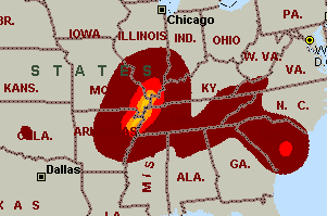
Imports gridded data into Microsoft MapPoint, to produce attractive data maps that resemble contour maps. Input data consists of a value that is defined for various (gridded) geographic coordinates. Common text output formats such as CSV are supported. Can handle imperfect data, holes, re-gridding, etc. Can be used to import such attributes as pollution data, seismic hazard, geological information, customer/population distribution,...
|