Geoitem 1.0 |
|
|
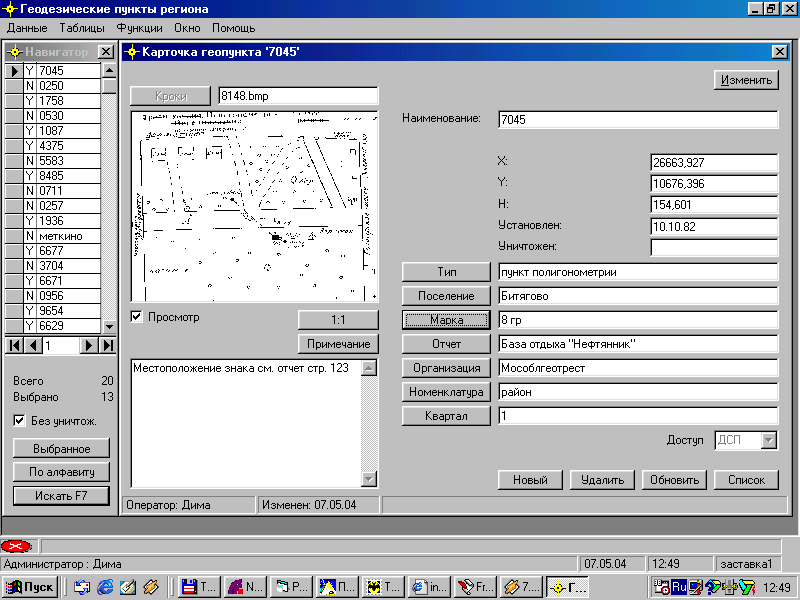
Card file of geodetic items of region (only on russian) Program "Geoitem" is intended for Managements of architecture and town-planning, Committees on land reform of cities and areas, of industrial geodetic firms and is applied to the automated account of basic geodetic items (points) of the appropriate area (city) and provides: * Conducting databases of geodetic points, with sketch and figures of the marks of items in view of conditions of a...
|