


Spatial Skills freeware
Spatial Skills
Released: July 09, 2004
|
Added: March 23, 2006 | Visits: 2.767
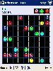 Advanced Lines for Pocket PC is an incredibly addictive color matching game with a bunch of sound effects and a graphics galore. It includes three different game types: lines, squares, and blocks. Advanced Lines is played on a 9x9-square board, which is filled with colored objects.
The aim of...
Platforms: Windows CE
Advanced Lines for Pocket PC is an incredibly addictive color matching game with a bunch of sound effects and a graphics galore. It includes three different game types: lines, squares, and blocks. Advanced Lines is played on a 9x9-square board, which is filled with colored objects.
The aim of...
Platforms: Windows CE
| License: Freeware | Size: 620 KB | Download (534): Advanced Lines PPC Download |
Added: April 24, 2013 | Visits: 605
 A package of Matlab functions for exploring spatial patterns of correlation in high resolution climate data. Cross-similarity parameters (dominant lag, max-similarity, window cross-similarity) are calculated for each pair of records and presented on maps as well as plots with an intersite...
Platforms: Matlab
A package of Matlab functions for exploring spatial patterns of correlation in high resolution climate data. Cross-similarity parameters (dominant lag, max-similarity, window cross-similarity) are calculated for each pair of records and presented on maps as well as plots with an intersite...
Platforms: Matlab
| License: Freeware | Size: 10 KB | Download (50): Spatial correlation in high resolution climate data Download |
Added: June 16, 2013 | Visits: 364
Integrates the Spatial Solr Plugin, Location and Apache Solr modules.http://www.jteam.nl/news/spatialsolr.htmlhttp://drupal.org/project/locationhttp://drupal.org/project/apachesolrProvides postal code and radius fields on the apachesolr_search page to filter and order results. Currently supports...
Platforms: PHP
| License: Freeware | Size: 10 KB | Download (45): Spatial Solr Download |
Added: August 05, 2013 | Visits: 447
This is a motley collection of useful spatial tools created by Patrick Hayes of Geomemes ResearchModules included are: * Spatial Import - Provides a shapefile parser for Feeds and Table Wizard, allowing you to import nodes or tables from a shapefile. Integrates well with Geo and OpenLayers field...
Platforms: PHP
| License: Freeware | Size: 20.48 KB | Download (40): Spatial Tools Download |
Released: April 10, 2000
|
Added: June 13, 2006 | Visits: 4.129
Memory Skills for Improving Comprehension (c) is a fully-interactive multimedia lesson that explains the human memory system and employs useful strategies for recalling difficult text. Clearly written and provocative, Memory Skills includes full-screen art, crisp sound files, and hands-on...
Platforms: Windows
| License: Freeware | Size: 3.4 MB | Download (399): Memory Skills Download |
Added: August 26, 2008 | Visits: 4.841
 Improve your Study skills is a free ebook for College and High School students to develop and improve your study skills. Includes, Doing Assignments, Taking Notes, Memorizing, and how to memorize, How to Read textbooks, How to study if you have to cram, How to write exams and prepare for tests,...
Platforms: Windows
Improve your Study skills is a free ebook for College and High School students to develop and improve your study skills. Includes, Doing Assignments, Taking Notes, Memorizing, and how to memorize, How to Read textbooks, How to study if you have to cram, How to write exams and prepare for tests,...
Platforms: Windows
| License: Freeware | Size: 614 KB | Download (427): College Study Skills Download |
Released: August 14, 2012
|
Added: August 14, 2012 | Visits: 641
 Basic computer skills & concepts in Plain English - What is WiFi and how does it work? This easy lesson helps you understand this kind of wireless and gives you a basic non-technical understanding of how it works and how you can use it
Platforms: Windows, Mac
Basic computer skills & concepts in Plain English - What is WiFi and how does it work? This easy lesson helps you understand this kind of wireless and gives you a basic non-technical understanding of how it works and how you can use it
Platforms: Windows, Mac
| License: Freeware | Size: 23.83 MB | Download (56): Basic Computer Skills & Concepts: WiFi Download |
Released: June 13, 2012
|
Added: June 13, 2012 | Visits: 594
 How to Learn Basic Computer Skills Tip #5 - What is the Best Method to Learn Basic Computer Skills. Fifth in an ongoing series of lessons that reveals valuable tips to make learning computers quicker, easier, and more fun. This lesson explains what is the best method to learn computer, based on...
Platforms: Windows, Mac
How to Learn Basic Computer Skills Tip #5 - What is the Best Method to Learn Basic Computer Skills. Fifth in an ongoing series of lessons that reveals valuable tips to make learning computers quicker, easier, and more fun. This lesson explains what is the best method to learn computer, based on...
Platforms: Windows, Mac
| License: Freeware | Size: 40.55 MB | Download (52): Learn Basic Computer Skills Tip #5 Download |
Released: December 13, 2012
|
Added: December 13, 2012 | Visits: 370
The C# RTree project aims to maintain a C# version of the RTree spatial indexing algorithm. Ported from https://sourceforge.net/projects/jsi
Platforms: Windows, Mac, Linux
| License: Freeware | Size: 17.54 KB | Download (50): C# Spatial Index (RTree) Library Download |
Released: August 19, 2012
|
Added: August 19, 2012 | Visits: 455
The Java RTree project aims to maintain an Java version of the RTree spatial indexing algorithm. See http://jsi.sourceforge.net for more information, and http://github.com/aled/jsi for latest development code.
Platforms: Windows, Mac, Linux
| License: Freeware | Size: 1.38 MB | Download (44): Java Spatial Index (RTree) Library Download |
Released: November 14, 2012
|
Added: November 14, 2012 | Visits: 515
 Spatial Data Integrator(SDI) is an ETL tool for geospatial. Based on Talend Open Studio, input, output and transform geocomponents are available. IO components read/write GIS formats(eg.PostGIS, GeoRSS). Transformers allow feature manipulation(eg.buf
Platforms: Windows, Mac, Linux
Spatial Data Integrator(SDI) is an ETL tool for geospatial. Based on Talend Open Studio, input, output and transform geocomponents are available. IO components read/write GIS formats(eg.PostGIS, GeoRSS). Transformers allow feature manipulation(eg.buf
Platforms: Windows, Mac, Linux
| License: Freeware | Size: 61.02 MB | Download (44): Spatial Data Integrator Download |
Released: July 17, 2012
|
Added: July 17, 2012 | Visits: 536
 Spatial Knowledge Base is a web based application for storing and searching of archaeological sites information. The software was written to improve access to cultural heritage information though the use of digital archiving, search technology, and GIS.
Platforms: Windows, Mac, Linux
Spatial Knowledge Base is a web based application for storing and searching of archaeological sites information. The software was written to improve access to cultural heritage information though the use of digital archiving, search technology, and GIS.
Platforms: Windows, Mac, Linux
| License: Freeware | Size: 64.03 MB | Download (53): Spatial Knowledge Base Download |
Added: September 03, 2013 | Visits: 410
The spatial point pattern test was developed as part of Martin Andresen's PhD Dissertation. The test measures the degree of similarity at the local level between two spatial point patterns and is an area-based test. The software has been written by Nick Malleson in Java and has a graphical user...
Platforms: Mac
| License: Freeware | Size: 32.55 MB | Download (38): Spatial Test Program Download |
Added: March 05, 2010 | Visits: 1.644
Score Reading Trainer helps you improve your (musical) score reading skills by practicing with random scores. It works in a very simple way, you choose the clef, the key and the accidentals you want to practice as well as thee range of notes and then, the program generates a on-screen score...
Platforms: *nix
| License: Freeware | Size: 133.12 KB | Download (100): Score Reading Trainer Download |
Added: October 23, 2010 | Visits: 725
openModeller library is a spatial distribution modelling library, providing a uniform method for modelling distribution patterns using a variety of modelling algorithms. openModeller can be used via programatic interfaces, including SOAP and SWIG-python, as well as via a user friendly desktop...
Platforms: *nix
| License: Freeware | Download (90): openModeller Download |
Released: July 15, 2012
|
Added: July 15, 2012 | Visits: 863
Depthmap is a single software platform to perform a set of spatial network analyses designed to understand social processes within the built environment. It works at a variety of scales from building through small urban to whole cities or states. At each scale, the aim of the software is to...
Platforms: Windows
| License: Freeware | Size: 3 MB | Download (430): UCL Depthmap Download |
Released: June 09, 2012
|
Added: June 09, 2012 | Visits: 382
openLISEM was specially built as an accessible and easy-to-use spatial soil erosion model.
The program can be used to assess the soil conservation measures and scientific analysis of small to medium catchments.
Platforms: Windows
| License: Freeware | Download (420): openLISEM Download |
Released: July 04, 2012
|
Added: July 04, 2012 | Visits: 616
gsdview, which is actually short for Geo-Spatial Data Viewer was built as a lightweight viewer for geo-spatial data and products.
It was written in Python and Qt4 and it is mainly intended to be a graphical front-end for the GDAL library and tools. GSDView is modular and has a simple plug-in...
Platforms: Windows
| License: Freeware | Download (418): gsdview Download |
Released: October 08, 2012
|
Added: October 08, 2012 | Visits: 406
A motocross game that focuses on pure, simple fun. Race like a mad man. Do backflips over spectacular jumps. Land perfectly, full throttle, hit the Nitro-button and off you go.
- Take advantage of the fun physics
- Play around with the 5 power-ups
- Race in 5 exotic places
- Win all 52 tracks...
Platforms: Mac
| License: Freeware | Size: 24.6 MB | Download (484): Mad Skills Motocross for Mac OS Download |
Released: September 17, 2012
|
Added: September 17, 2012 | Visits: 405
Jaspa was designed as an accessible spatial extension for relational database systems.
Jaspa implements the OpenGIS Simple Features for SQL and partially the SQL/MM standard. Currently supports PostgreSQL and H2 as the RDBMS backends.
Jaspa brings around 200 spatial functions to relational...
Platforms: Windows
| License: Freeware | Download (47): Jaspa Download |