


Satellite Maps Programs freeware
Satellite Maps Programs
Released: August 11, 2012
|
Added: August 11, 2012 | Visits: 562
 When starting Windows, a number of other programs are also started. Some are necessarily, but the autostarting mechanism is used also by programs, which spy the computer. Finally is simple possible that some unused programs are started and use system resources.
The Startup Programs Control...
When starting Windows, a number of other programs are also started. Some are necessarily, but the autostarting mechanism is used also by programs, which spy the computer. Finally is simple possible that some unused programs are started and use system resources.
The Startup Programs Control...
Platforms: Windows
| License: Freeware | Size: 653 KB | Download (408): Startup Programs Control Download |
Released: June 04, 2012
|
Added: June 04, 2012 | Visits: 470
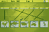 In this game there will be some country names and some maps of countries. Your task is to match the country names with the correct maps. You match them by using the mouse to draw a line to connect the dots of the country names and the maps. There are a total of 5 levels and each level will be...
Platforms: Windows
| License: Freeware | Size: 262 KB | Download (451): Mapping Maps Download |
Released: July 11, 2012
|
Added: July 11, 2012 | Visits: 558
A central database of all installable programs, descriptions, dependencies, source URLs, MD5 sums, and suggested menu listings and the software to read the database, usable by desktops and window managers to organize software and install any new software
Platforms: Windows, Mac, Linux
| License: Freeware | Size: 39.26 KB | Download (47): DLIP: Desktop List of Installed Programs Download |
Released: July 11, 2012
|
Added: July 11, 2012 | Visits: 426
 SaVi - satellite constellation visualization. Simulate Iridium, Globalstar, O3b, Sirius Radio, GPS, Galileo and other systems, modify them, or design your own. Uses Tcl/Tk and Unix libraries; 3D viewing option requires Geomview running on X Window.
Platforms: Windows, Mac, BSD, Solaris, Linux
| License: Freeware | Size: 779.5 KB | Download (48): SaVi satellite constellation visualizer Download |
Released: June 04, 2012
|
Added: June 04, 2012 | Visits: 382
tinyTiM is a small and lightweight implementation of the Topic Maps API (TMAPI). The engine is implemented in Java.
Platforms: Windows, Mac, Linux
| License: Freeware | Size: 527.06 KB | Download (43): tinyTiM - The tiny Topic Maps engine Download |
Released: July 05, 2012
|
Added: July 05, 2012 | Visits: 423
 A project by Veqryn for creating, centralizing, and hosting all open-source TripleA maps, as well as other developer resources such as artwork and map makers. If you need the actual TripleA program, go here: https://sourceforge.net/projects/triplea/
Platforms: Windows, Mac, Linux
| License: Freeware | Size: 115.09 MB | Download (43): TripleA Maps Download |
Released: August 13, 2012
|
Added: August 13, 2012 | Visits: 687
Anquet Maps for Mac is mapping, route-planning navigation software used by professional mountain guides, top mountain athletes, outdoor training centres and thousands of everyday walkers, climbers and cyclists.
With Anquet Maps for Mac you can create routes on real OS maps to print or transfer...
Platforms: Mac
| License: Freeware | Size: 4.8 MB | Download (54): Anquet Maps Download |
Added: May 10, 2013 | Visits: 453
Individuals may also give the markers titles and descriptions, as well as position the map and choose between the map, satellite, and hybrid view types.Installation - Unpack in your modules folder (usually /sites/all/modules/) and enable under Administer > Site Building > Modules. Requirements:...
Platforms: Windows, Mac, *nix, PHP, BSD Solaris
| License: Freeware | Download (54): CCK Map Download |
Added: March 30, 2013 | Visits: 433
Based on the Two line elements(TLE) - Input from the user, the program calculates the time and the date of the satellite pass. Prints out Azimuth and Elevation & plots it too.
Platforms: Matlab
| License: Freeware | Size: 153.6 KB | Download (47): GUI based Satellite Tracking System Download |
Added: April 30, 2013 | Visits: 501
The two programs computes residue curve maps for the methyl acetate and isopropyl acetate chemistries at atmospheric pressure. These calculations involve solving a complex system of differential algebraic equations (DAEs). This can be readily achieved using the built-in function of MatLab,...
Platforms: Matlab
| License: Freeware | Size: 10 KB | Download (51): Residue Curve Map for Homogeneous Reactive Quaternary Mixtures Download |
Added: June 16, 2013 | Visits: 557
SATGLOBE - This file renders a fully manipulatable satellite view of earth at a resolution of two pixels per degree, with added international political boundaries and gridlines. The imagery was obtained from NASA, and the globe was rendered using the MATLAB Mapping Toolbox.The Mapping Toolbox is...
Platforms: Matlab
| License: Freeware | Size: 460.8 KB | Download (43): SATGLOBE - Rendering Satellite Views of Earth Download |
Added: August 18, 2013 | Visits: 578
Given the orbital parameters of a satellite equipped with a steerable antenna and the locations of two ground stations whose visibility circles are overlapped (e.g. Matera and Svalbard), the model is able to compute the time spent by the steering mechanism to repoint the dowlink antenna from the...
Platforms: Matlab
| License: Freeware | Size: 40.96 KB | Download (42): Repointing Time of Satellite Antenna Download |
Added: July 28, 2013 | Visits: 571
Displays Visitor Maps with location pins, city, and country. Includes a Who's Online Sidebar to show how many users are online. Includes a Who's Online admin dashboard to view visitor details. The visitor details include: what page the visitor is on, IP address, host lookup, online time, city,...
Platforms: PHP
| License: Freeware | Size: 2.59 MB | Download (47): Visitor Maps and Who's Online Download |
Added: June 01, 2013 | Visits: 533
Your Planet Today displays a satellite map of the Earth in the sidebar of your blog. With the Google Maps integration, you can zoom in and pan around. All the satellite images used to generate the map are between 3 and 36 hours old. With this widget you can monitor global weather patterns, dust...
Platforms: PHP
| License: Freeware | Size: 10 KB | Download (41): Your Planet Today widget Download |
Added: June 06, 2013 | Visits: 511
The WP2TM plugin adds XML Topic Maps (XTM) "feed" support to WordPress blogs.WP2TM may enable the sharing and merging of knowledge across WordPress blogs. XTM exports produced by WP2TM can be merged using standard compliant topic maps software.
Platforms: PHP
| License: Freeware | Size: 10 KB | Download (45): WordPress Topic Maps Download |
Added: April 29, 2013 | Visits: 565
The Comment Geo Maps WordPress plugin allows you to turn a post or a page into a geo-based issue map. This adds value to discussions about issues that are geographically located. All you need to do is create a prompt in the form of a blog post and then people post their comments. Each comment is...
Platforms: PHP
| License: Freeware | Size: 10 KB | Download (47): Comment Geo Maps Download |
Added: June 08, 2013 | Visits: 579
The WP2TM plugin adds XML Topic Maps (XTM) "feed" support to WordPress blogs.WP2TM may enable the sharing and merging of knowledge across WordPress blogs. XTM exports produced by WP2TM can be merged using standard compliant topic maps software.installation : 1. Unzip into your...
Platforms: PHP
| License: Freeware | Size: 20.48 KB | Download (46): WordPress Topic Maps (WP2TM) Download |
Added: August 17, 2013 | Visits: 532
The Maps Management Module is an addon module for PHP-Nuke. It is a full Module for managing "maps" for any type of game.Administration Features:List of maps to edit are now in a dropdown list.Add and edit Descriptions, images, and links.Upload Images!Module Features:Page numbering.Configure how...
Platforms: PHP
| License: Freeware | Size: 51.2 KB | Download (48): Maps Management Module Download |
Added: November 12, 2013 | Visits: 425
hamfax is an application for sending and receiving facsimiles in amateur radio and for receiving public facsimile broadcasts like weather maps. Supported interfaces are sound cards and the SCS-PTCII from Special Communication Systems. The goal is developing an application which is usable for...
Platforms: *nix
| License: Freeware | Size: 122.88 KB | Download (38): hamfax Download |
Added: August 28, 2013 | Visits: 601
Diversity Maps is a data visualization tool for plant geneticists and breeders. It generates publication-quality, vector-based chromosome maps displaying differences in marker states between individuals. Features Displays haplotype similarity by color; Sorts accessions automatically to...
Platforms: *nix
| License: Freeware | Size: 4.24 MB | Download (33): Diversity Maps For Linux Download |