


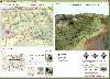
Quantum Gis freeware
Quantum Gis
Released: April 22, 2008
|
Added: April 26, 2008 | Visits: 9.510
 The free AvisMap Viewer opens most GIS/CAD and raster image file types and most ArcView, ArcExplorer, and MapInfo projects. Besides just opening and viewing files, the Viewer supports an extensive list of features including visual layer properties control, legend control, thematic mapping,...
Platforms: Windows
| License: Freeware | Size: 22.28 MB | Download (1734): AvisMap Free Viewer Download |
Added: August 07, 2008 | Visits: 2.157
 QCADesigner is a CAD tool for quantum-dot cellular automata (QCA) circuits. The powerful CAD features and simulation engines allow for rapid design, layout, and simulation of QCA circuits and systems. QCADesigner has most of the standard computer aided design features required for the advanced...
Platforms: Windows, *nix
| License: Freeware | Size: 2.6 MB | Download (1031): QCADesigner Download |
Added: August 18, 2008 | Visits: 1.357
 Genesis IV is a landscape database and graphics system particularly targeted at Professional GIS and Educational users. Create great graphics for your clients, enthuse and educate your students, or explore geographical data, GenesisIV is unique multifaceted software and much more than a simple...
Platforms: Windows
| License: Freeware | Size: 23.84 MB | Download (606): GenesisIV Download |
Added: August 12, 2008 | Visits: 952
NewCyber3D provides full source code CDs covering a wide range of topics relevant to OpenGL GIS, terrain, stereo display, image processing and visualization. Each CD includes the entire OpenGL program and demonstrations with full source codes (including library source codes), project files,...
Platforms: Windows
| License: Freeware | Download (549): NewCyber3D Download |
Released: October 01, 2012
|
Added: October 01, 2012 | Visits: 377
 An expensive GIS software is maybe not suitable for your purpose. If you are using one for analysis or simulation and feeling one of these: huge, complicated, slow and unremovable, it's time to change. Why MicroCity? Versatile: Additional to fundamental GIS functions, many unique libraries such...
Platforms: Windows
| License: Freeware | Size: 3.95 MB | Download (538): Portable MicroCity Download |
Released: August 18, 2012
|
Added: August 18, 2012 | Visits: 365
 An expensive GIS software is maybe not suitable for your purpose. If you are using one for analysis or simulation and feeling one of these: huge, complicated, slow and unremovable, it's time to change. Why MicroCity? Versatile: Additional to fundamental GIS functions, many unique libraries such...
Platforms: Windows
| License: Freeware | Size: 3 MB | Download (530): MicroCity Download |
Released: November 04, 2012
|
Added: November 04, 2012 | Visits: 1.369
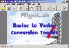 Software development kit for CAD/CAM/ GIS and graphic software developers. Converts from raster to vector and refines architect, mechanical, tech drawing, maps, math graphs, graphics for books and journals and more. ActiveX and Com Component are also available. Refines vector graphics, creates...
Platforms: Windows
| License: Freeware | Size: 2.67 MB | Download (526): Algolab Raster to Vector Conversion CAD/ Download |
Released: November 23, 2012
|
Added: November 23, 2012 | Visits: 411
 The goal of VTP is to foster the creation of tools for easily constructing any part of the real world in interactive, 3D digital form.
This goal will require a synergetic convergence of the fields of CAD, GIS, visual simulation, surveying and remote sensing. VTP gathers information and tracks...
The goal of VTP is to foster the creation of tools for easily constructing any part of the real world in interactive, 3D digital form.
This goal will require a synergetic convergence of the fields of CAD, GIS, visual simulation, surveying and remote sensing. VTP gathers information and tracks...
Platforms: Windows
| License: Freeware | Size: 1024 KB | Download (496): Virtual Terrain Project for Windows 1.1 Download |
Released: November 16, 2012
|
Added: November 16, 2012 | Visits: 489
 The goal of VTP is to foster the creation of tools for easily constructing any part of the real world in interactive, 3D digital form.
This goal will require a synergetic convergence of the fields of CAD, GIS, visual simulation, surveying and remote sensing. VTP gathers information and tracks...
The goal of VTP is to foster the creation of tools for easily constructing any part of the real world in interactive, 3D digital form.
This goal will require a synergetic convergence of the fields of CAD, GIS, visual simulation, surveying and remote sensing. VTP gathers information and tracks...
Platforms: Mac, Linux
| License: Freeware | Size: 2.2 MB | Download (492): Virtual Terrain Project for Mac OS X and Linux Download |
Released: July 14, 2012
|
Added: July 14, 2012 | Visits: 549
You are the pilot of Quantum, an Omega-class fighter patroling deep space. Its a lonely assigment. Suddenly, and predictably, you are caught in a sub-space anomaly and transported to the middle of a mysterious region of space with a black hole at its center and deadly asteroids drifting by. Youll...
Platforms: Mac
| License: Freeware | Size: 6 MB | Download (478): Quantum for Mac OS Download |
Released: November 04, 2012
|
Added: November 04, 2012 | Visits: 549
MOPlot is a handy visualization application specially designed for fast molecular orbitals plotting from the outputs of the Gaussian 03/98/94, Molcas, Gamess/US quantum chemical calculation packages. This Molecular Orbital Plotting Program will prove to be easy-to-use and very efficient.
MOPlot...
Platforms: Windows, XP
| License: Freeware | Download (478): MOPlot Download |
Released: November 04, 2012
|
Added: November 04, 2012 | Visits: 584
physicsmata is a Java-based tool that acts similar to relativistic quantum physics, especially how they form into black holes of objects that broadcast each other to others in the same set, ignoring others due to the multiply routing.
Each physicsmata is a set, an unordered group of other...
Platforms: Windows
| License: Freeware | Download (469): physicsmata Download |
Released: October 22, 2012
|
Added: October 22, 2012 | Visits: 585
IrriPro is the only software that let you design an irrigation system only by drawing the elements: now it's possible, thanks to the INDO technology (Irrigation Network Data Object) developed by Irriworks, to draw the elements of a system (such as outlets, pipes, etc) and of a terrain, not only...
Platforms: Windows
| License: Freeware | Size: 161 MB | Download (467): IrriPro Download |
Released: October 24, 2012
|
Added: October 24, 2012 | Visits: 674
 QGIS supports vector, raster, and database formats and lets you browse and create map data on your computer.
Quantum GIS (QGIS) supports many common spatial data formats (e.g. ESRI ShapeFile, geotiff). QGIS supports plugins to do things like display tracks from your GPS.
QGIS aims to be an...
QGIS supports vector, raster, and database formats and lets you browse and create map data on your computer.
Quantum GIS (QGIS) supports many common spatial data formats (e.g. ESRI ShapeFile, geotiff). QGIS supports plugins to do things like display tracks from your GPS.
QGIS aims to be an...
Platforms: Linux
| License: Freeware | Size: 1024 KB | Download (460): Quantum GIS form Linux Download |
Released: October 21, 2012
|
Added: October 21, 2012 | Visits: 741
Thuban is an interactive geographic data viewer (GIS viewer) which features methods to visualize, explore, and analyze geographic information.
Thuban is an Interactive Geographic Data Viewer with the following features:
# Vector Data Support: Shapefile, PostGIS Layer and OGR
# Raster Data...
Platforms: Linux
| License: Freeware | Size: 1.18 MB | Download (458): Thuban for Linux Download |
Released: October 11, 2012
|
Added: October 11, 2012 | Visits: 772
 QGIS supports vector, raster, and database formats and lets you browse and create map data on your computer.
Quantum GIS (QGIS) supports many common spatial data formats (e.g. ESRI ShapeFile, geotiff). QGIS supports plugins to do things like display tracks from your GPS.
QGIS aims to be an...
QGIS supports vector, raster, and database formats and lets you browse and create map data on your computer.
Quantum GIS (QGIS) supports many common spatial data formats (e.g. ESRI ShapeFile, geotiff). QGIS supports plugins to do things like display tracks from your GPS.
QGIS aims to be an...
Platforms: Windows
| License: Freeware | Size: 77.3 MB | Download (453): Quantum GIS Download |
Released: June 25, 2012
|
Added: June 25, 2012 | Visits: 868
 The free AvisMap Viewer opens most GIS/CAD and raster image file types and most ArcView, ArcExplorer, and MapInfo projects. Besides just opening and viewing files, the Viewer supports an extensive list of features including visual layer properties control, legend control, thematic mapping,...
Platforms: Windows
| License: Freeware | Size: 23.17 MB | Download (449): Free Shapefile Viewer Download |
Released: September 09, 2012
|
Added: September 09, 2012 | Visits: 475
 A Microstation GIS to allow pipeline design and management
Platforms: Windows
| License: Freeware | Size: 7.58 MB | Download (446): RiliView Download |
Released: July 24, 2012
|
Added: July 24, 2012 | Visits: 782
 QGIS supports vector, raster, and database formats and lets you browse and create map data on your computer.
Quantum GIS (QGIS) supports many common spatial data formats (e.g. ESRI ShapeFile, geotiff). QGIS supports plugins to do things like display tracks from your GPS.
QGIS aims to be an...
QGIS supports vector, raster, and database formats and lets you browse and create map data on your computer.
Quantum GIS (QGIS) supports many common spatial data formats (e.g. ESRI ShapeFile, geotiff). QGIS supports plugins to do things like display tracks from your GPS.
QGIS aims to be an...
Platforms: Mac
| License: Freeware | Size: 1024 KB | Download (440): Quantum GIS form Mac Download |
Released: August 20, 2012
|
Added: August 20, 2012 | Visits: 689
 The Ascalaph Quantum package provides interfaces to ab initio quantum mechanical packages NWChem, CP2K and PC GAMESS / Firefly. Quantum calculations are performed using the PC GAMESS program.
FEATURES:
Energy calculations :
· Energy calculation mode is controlled by selecting the basis...
The Ascalaph Quantum package provides interfaces to ab initio quantum mechanical packages NWChem, CP2K and PC GAMESS / Firefly. Quantum calculations are performed using the PC GAMESS program.
FEATURES:
Energy calculations :
· Energy calculation mode is controlled by selecting the basis...
Platforms: Windows
| License: Freeware | Size: 74.6 MB | Download (440): Ascalaph Quantum Download |