


Openstreetmap freeware
Openstreetmap
Added: June 15, 2013 | Visits: 415
 Keepright offers data consistency check routines for openstreetmap. With the project, you will never be able to lose yourself.Keepright is designed to provide a wiki-style means of creating a world-wide street map where everybody is encouraged to contribute.
Platforms: PHP
| License: Freeware | Size: 1.38 MB | Download (40): Keepright Download |
Added: September 19, 2013 | Visits: 381
Gosmore is an OpenStreetMap navigation application. It can display the map in 2D and 3D. It also provides searching and turn-by-turn routing capabilities. All the data is stored offline in it's own binary format.
Platforms: *nix
| License: Freeware | Size: 6.2 MB | Download (39): Gosmore Download |
Added: September 08, 2013 | Visits: 513
This tool provides an OpenStreetMap data parser to turn them into a nodes-edges adapted for routing applications. == INPUT FORMAT == The input is an OpenStreetMap XML file. The file can be read: * from a plain .osm file * from a bzip2 file * from a gzip file == OUTPUT FORMAT == The output can...
Platforms: *nix
| License: Freeware | Size: 61.44 KB | Download (35): Osm4routing Download |
Released: November 23, 2012
|
Added: November 23, 2012 | Visits: 258
With OpenStreetMap.org, you can export maps (for free) in XML OSM format. These maps are pretty handy - but if you want to load them onto your GPS, this free utility will allow you to easily convert the OSM files to IMG files which you can import into your Garmin GPS.
Platforms: Mac
| License: Freeware | Size: 2.5 MB | Download (511): OSMtoIMG for Mac OS Download |
Released: September 09, 2012
|
Added: September 09, 2012 | Visits: 462
 eWorld is a framework to import mapping data from providers, such as OpenStreetMap.org. eWorld is also cross-platform being capable of running on any platform that comes with Java support.
eWorld will allow you to edit it, visualize it, and enrich it with events or annotational attributes and...
eWorld is a framework to import mapping data from providers, such as OpenStreetMap.org. eWorld is also cross-platform being capable of running on any platform that comes with Java support.
eWorld will allow you to edit it, visualize it, and enrich it with events or annotational attributes and...
Platforms: Windows
| License: Freeware | Size: 26.4 MB | Download (49): eWorld Download |
Released: August 01, 2012
|
Added: August 01, 2012 | Visits: 483
 Plugin for JOSM (OpenStreetMap editor) that makes a grid of streets from only two. It traces parallels to the existing ones and make all intersections. We need it because our Country have a lot of cities with a regular design and lot of square blocks.
Platforms: Windows, Mac, Linux
| License: Freeware | Size: 3.94 KB | Download (46): Create a grid of ways plugin por JOSM Download |
Released: June 09, 2012
|
Added: June 09, 2012 | Visits: 166
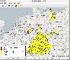 The viewer allows to show maps from a WebMapServer (OpenStreetMap). Additionally it have a plugin mechanism to integrate plugins. The primary plugin is to read CAP (Common Alerting Protocol) file and show them on the map.
Platforms: Windows, Mac, Linux
| License: Freeware | Size: 925.67 KB | Download (45): GeoMapViewer Download |
Released: August 19, 2012
|
Added: August 19, 2012 | Visits: 197
injooosm integrades OpenStreetMap in Joomla. It shows Tracks and Waypoints in a SlippyMap. Registred Users can uploads own Files.
Platforms: Windows, Mac, Linux
| License: Freeware | Size: 801.66 KB | Download (44): injooosm Download |
Released: June 13, 2012
|
Added: June 13, 2012 | Visits: 306
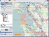
 With OSM Parser it is possible to process OpenStreetMap geodata for various purposes. For example, it can be used to extract streets or other OSM elements for user defined regions to generate a street directory.
Platforms: Windows, Mac, Linux
| License: Freeware | Size: 1.33 MB | Download (49): OSM Parser Download |
Released: June 25, 2012
|
Added: June 25, 2012 | Visits: 279
A simple and still alpha Python script to extract features out of an OpenStreetMap (OSM) file into basic Keyhole markup language (KML)
Platforms: Windows, Mac, Linux
| License: Freeware | Size: 14.71 KB | Download (63): osm2kml Download |
Released: September 17, 2012
|
Added: September 17, 2012 | Visits: 230
The goal of the OSM2PostGIS project is to develop an OpenStreetMap data processor that can import any amount of .osm XML data into a PostGIS database, and produce evaluated navigation network topologies to support routing.
Platforms: Windows, Mac, Linux
| License: Freeware | Size: 82.56 KB | Download (48): OSM2PostGIS Download |
Released: November 23, 2012
|
Added: November 23, 2012 | Visits: 452
 A cross-platform aplication to explore online free maps (OpenStreetMap). Build with python and pygame, full immersive environnement. Actually only source code, require pygame.
Platforms: Windows, Mac, Linux
| License: Freeware | Size: 510.14 KB | Download (47): pyMap Explorer Download |
Released: June 05, 2012
|
Added: June 05, 2012 | Visits: 491
 traveling-salesman is a GPS -route-planning and -navigation -system based on libosm and the OpenStreetMap.
Platforms: Windows, Mac, Linux
| License: Freeware | Size: 7.35 MB | Download (51): Traveling Salesman Download |
Added: May 15, 2013 | Visits: 322
CloudMade is a set of services for building maps and map applications that utilizes OpenStreetMap data. This project provides integration between Drupal and CloudMade.StatusThis project is very young and still getting its wings. The goal is to be a very lightweight integration point between...
Platforms: PHP
| License: Freeware | Size: 10 KB | Download (44): CloudMade Download |
Added: November 08, 2013 | Visits: 238
An SDK for imbedding interactive maps from openstreetmap.org in an iPhone application
Platforms: Mac
| License: Freeware | Size: 20.48 KB | Download (40): CercaMap Download |
Released: July 15, 2012
|
Added: July 15, 2012 | Visits: 859
Depthmap is a single software platform to perform a set of spatial network analyses designed to understand social processes within the built environment. It works at a variety of scales from building through small urban to whole cities or states. At each scale, the aim of the software is to...
Platforms: Windows
| License: Freeware | Size: 3 MB | Download (430): UCL Depthmap Download |
Released: July 19, 2012
|
Added: July 19, 2012 | Visits: 833
 Mobile Atlas Creator (formerly known as TrekBuddy Atlas Creator) is an open source (GPL) program which creates offline atlases for GPS handhelds and cell phone applications like TrekBuddy, AndNav and other Android and WindowsCE based applications.
For the full list of supported applications...
Mobile Atlas Creator (formerly known as TrekBuddy Atlas Creator) is an open source (GPL) program which creates offline atlases for GPS handhelds and cell phone applications like TrekBuddy, AndNav and other Android and WindowsCE based applications.
For the full list of supported applications...
Platforms: Windows
| License: Freeware | Size: 2 MB | Download (398): Mobile Atlas Creator Download |
Released: September 04, 2012
|
Added: September 04, 2012 | Visits: 752
 Mobile Atlas Creator (formerly known as TrekBuddy Atlas Creator) is an open source (GPL) program which creates offline atlases for GPS handhelds and cell phone applications like TrekBuddy, AndNav and other Android and WindowsCE based applications.
For the full list of supported applications...
Mobile Atlas Creator (formerly known as TrekBuddy Atlas Creator) is an open source (GPL) program which creates offline atlases for GPS handhelds and cell phone applications like TrekBuddy, AndNav and other Android and WindowsCE based applications.
For the full list of supported applications...
Platforms: Mac
| License: Freeware | Size: 1.6 MB | Download (448): Mobile Atlas Creator for Mac OS X Download |
Released: July 13, 2012
|
Added: July 13, 2012 | Visits: 218
 This software allows FlightGear (http://www.flighgear.org ) users to display their plane position and other navigational data on a moving map from the openstreetmap ( http://www.openstreetmap.org ) project.
Platforms: Windows, Mac, Linux
| License: Freeware | Size: 1.38 MB | Download (48): jMapView Download |
Released: September 15, 2012
|
Added: September 15, 2012 | Visits: 435
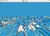 This is Osm3d - a software to display 'Open Street Map' data in 3d - for Linux and MacOS X. This software visualize the map data of the OpenStreetMap project in three dimensions. You see motorways, streets, railways, buildings and lakes, rivers or fore
Platforms: Mac, Linux
| License: Freeware | Size: 284.48 KB | Download (46): osm3d Download |