


Onslow County Spatial Data freeware
Onslow County Spatial Data
Released: November 14, 2012
|
Added: November 14, 2012 | Visits: 512
 Spatial Data Integrator(SDI) is an ETL tool for geospatial. Based on Talend Open Studio, input, output and transform geocomponents are available. IO components read/write GIS formats(eg.PostGIS, GeoRSS). Transformers allow feature manipulation(eg.buf
Platforms: Windows, Mac, Linux
| License: Freeware | Size: 61.02 MB | Download (44): Spatial Data Integrator Download |
Released: July 04, 2012
|
Added: July 04, 2012 | Visits: 615
 gsdview, which is actually short for Geo-Spatial Data Viewer was built as a lightweight viewer for geo-spatial data and products.
It was written in Python and Qt4 and it is mainly intended to be a graphical front-end for the GDAL library and tools. GSDView is modular and has a simple plug-in...
gsdview, which is actually short for Geo-Spatial Data Viewer was built as a lightweight viewer for geo-spatial data and products.
It was written in Python and Qt4 and it is mainly intended to be a graphical front-end for the GDAL library and tools. GSDView is modular and has a simple plug-in...
Platforms: Windows
| License: Freeware | Download (418): gsdview Download |
Released: August 16, 2012
|
Added: August 16, 2012 | Visits: 529
uDig is a user-friendly desktop Internet GIS, a core element in an internet aware Geographic Information System.
The application is an open source spatial data viewer / editor, that comes with a special emphasis on the OpenGIS standards for internet GIS, the Web Map Server and Web Feature Server...
Platforms: Windows
| License: Freeware | Download (439): uDig Download |
Released: October 15, 2012
|
Added: October 15, 2012 | Visits: 443
 C-squares is an easily implemented method for storage, querying and display of spatial data locations, based on a hierarchical, grid-based representation of the Earth' surface. Source code for encoding, decoding, mapping, etc. is provided via this site.
Platforms: Windows, Mac, Linux
| License: Freeware | Size: 81.58 MB | Download (53): C-squares Download |
Released: June 22, 2012
|
Added: June 22, 2012 | Visits: 378
A simple, cross-browser, OGC WMS client that may be included into any HTML page that might be enhanced by dynamic rendering of geo-spatial data.
Platforms: Windows, Mac, Linux
| License: Freeware | Size: 7.37 KB | Download (44): Inline WMS Client Download |
Released: December 24, 2012
|
Added: December 24, 2012 | Visits: 499
The remote sensing and GIS library is a set of C++ libraries and commands for the processing of spatial data (raster, vector and point cloud). Functionality is available through an XML interface, ideal for batch processing. Visit www.rsgislib.org
Platforms: Mac, BSD, Linux
| License: Freeware | Size: 1.55 MB | Download (52): RSGISLib Download |
Released: August 20, 2012
|
Added: August 20, 2012 | Visits: 246
 SpatiumCube is open source technology for the easily development of Spatial Data Infrastructures (SDIs) and services over them. It includes software, stylesheets, ontologies, and other technology elements for the development of SDIs.
Platforms: Windows, Mac, Linux
| License: Freeware | Size: 78.1 MB | Download (49): spatiumCube Download |
Added: July 26, 2013 | Visits: 422
GSDView (Geo-Spatial Data Viewer) is a lightweight viewer for geo-spatial data and products. It is written in python and Qt4 and it is mainly intended to be a graphical front-end for the GDAL library and tools. GSDView is modular and has a simple plug-in architecture.
Platforms: *nix
| License: Freeware | Size: 2.09 MB | Download (33): gsdview for Linux Download |
Added: September 25, 2006 | Visits: 6.305
 GeoBase is a high performance OEM tool for embedding GIS functions in client and server applications. GeoBase has a small memory footprint - both on the hard disk for storage and in RAM during use. Compatible with both .NET and Linux, GeoBase is designed for a rapid development cycle and low...
Platforms: Windows, Windows CE
| License: Freeware | Size: 106.11 MB | Download (513): GeoBase Download |
Released: October 24, 2012
|
Added: October 24, 2012 | Visits: 678
 QGIS supports vector, raster, and database formats and lets you browse and create map data on your computer.
Quantum GIS (QGIS) supports many common spatial data formats (e.g. ESRI ShapeFile, geotiff). QGIS supports plugins to do things like display tracks from your GPS.
QGIS aims to be an...
QGIS supports vector, raster, and database formats and lets you browse and create map data on your computer.
Quantum GIS (QGIS) supports many common spatial data formats (e.g. ESRI ShapeFile, geotiff). QGIS supports plugins to do things like display tracks from your GPS.
QGIS aims to be an...
Platforms: Linux
| License: Freeware | Size: 1024 KB | Download (460): Quantum GIS form Linux Download |
Released: July 24, 2012
|
Added: July 24, 2012 | Visits: 784
 QGIS supports vector, raster, and database formats and lets you browse and create map data on your computer.
Quantum GIS (QGIS) supports many common spatial data formats (e.g. ESRI ShapeFile, geotiff). QGIS supports plugins to do things like display tracks from your GPS.
QGIS aims to be an...
QGIS supports vector, raster, and database formats and lets you browse and create map data on your computer.
Quantum GIS (QGIS) supports many common spatial data formats (e.g. ESRI ShapeFile, geotiff). QGIS supports plugins to do things like display tracks from your GPS.
QGIS aims to be an...
Platforms: Mac
| License: Freeware | Size: 1024 KB | Download (440): Quantum GIS form Mac Download |
Released: October 11, 2012
|
Added: October 11, 2012 | Visits: 775
 QGIS supports vector, raster, and database formats and lets you browse and create map data on your computer.
Quantum GIS (QGIS) supports many common spatial data formats (e.g. ESRI ShapeFile, geotiff). QGIS supports plugins to do things like display tracks from your GPS.
QGIS aims to be an...
QGIS supports vector, raster, and database formats and lets you browse and create map data on your computer.
Quantum GIS (QGIS) supports many common spatial data formats (e.g. ESRI ShapeFile, geotiff). QGIS supports plugins to do things like display tracks from your GPS.
QGIS aims to be an...
Platforms: Windows
| License: Freeware | Size: 77.3 MB | Download (453): Quantum GIS Download |
Added: July 03, 2013 | Visits: 301
phpPgGIS is a PHP Web system to manage PostgreSQL/PostGIS. It was developed under the phpPgAdmin and the MapServer. It's simple and makes easy to manage spatial data in PostGIS.
Platforms: PHP
| License: Freeware | Size: 727.04 KB | Download (42): phpPgGIS Download |
Added: August 27, 2013 | Visits: 301
phpPgGIS is a PHP Web system to manage PostgreSQL/PostGIS. It was developed under the phpPgAdmin and the MapServer. It's simple and makes easy to manage spatial data in PostGIS.
Platforms: PHP
| License: Freeware | Size: 716.8 KB | Download (41): phpPgGIS for Scripts Download |
Released: September 17, 2021
|
Added: November 18, 2023 | Visits: 4.140
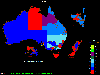 OzGIS is an extensive system for the analysis and display of geographically
referenced data. About 150 menus provide an enormous range of options for:
. importing data from databases, spreadsheets and Geographic Information
Systems (GISs) or downloaded from Census Bureaux or mapping...
OzGIS is an extensive system for the analysis and display of geographically
referenced data. About 150 menus provide an enormous range of options for:
. importing data from databases, spreadsheets and Geographic Information
Systems (GISs) or downloaded from Census Bureaux or mapping...
Platforms: Windows, Windows 8, Windows 7, Windows Server
| License: Freeware | Size: 313 KB | Download (1146): OzGIS Download |
Released: August 16, 2012
|
Added: August 16, 2012 | Visits: 478
VMMLib was specially developed as a vector and matrix math library. The library was implemented using C++ templates, thus making it very easy to integrate into other libraries and programs.
Its basic functionality includes a vector and a matrix class, with additional functionality for the...
Platforms: Windows
| License: Freeware | Download (44): VMMLib Download |
Added: May 10, 2013 | Visits: 507
Features - provides an API to help other modules display Google Maps - defines a display plugin for Views - provides some default pages containing maps of nodes and users - defines a macro language and provides an interface for building macros ("[gmap|stuff]") so that users can put maps in their...
Platforms: Windows, Mac, *nix, PHP, BSD Solaris
| License: Freeware | Download (65): GMap Module Download |
Added: May 10, 2013 | Visits: 278
phpPgGIS is a PHP Web system to manage PostgreSQL/PostGIS. It was developed under the phpPgAdmin and the MapServer. It's simple and makes easy to manage spatial data in PostGIS.
Platforms: Windows, Mac, *nix, PHP, BSD Solaris
| License: Freeware | Download (55): phpPgGIS 4.0.1-3 Download |
Added: May 10, 2013 | Visits: 498
The phpArcIMS project intends to write a set of PHP classes that allow any php developer to develope ArcIMS applications or integrate ArcIMS into any existing application. For those of you that never heard of ArcIMS: ArcIMS is an application server from ESRI that allows users to share GIS...
Platforms: Windows, Mac, *nix, PHP, BSD Solaris
| License: Freeware | Download (55): phpArcIMS Download |
Added: July 12, 2013 | Visits: 344
MapServer is an open source platform for publishing spatial data and interactive mapping applications to the web. Originally developed in the mid-1990???*a*?s at the University of Minnesota, MapServer is released under an MIT-style license, and runs on all major platforms (Windows, Linux, Mac OS...
Platforms: *nix
| License: Freeware | Size: 143.36 KB | Download (41): mapscript Download |