


Nmea freeware
Nmea
Added: March 12, 2006 | Visits: 12.989
 HS GPS is a software library (with full C source code) which provides access to a NMEA-183 compliant GPS receiver via a serial communications port, decoding NMEA sentences: $GPGGA, $GPGSA, $GPGSV, $GPGLL, $GPRMC and $GPVTG. Decoded parameters include: time, date, position, altitude, speed, course...
Platforms: Palm OS, Windows
| License: Freeware | Size: 309 KB | Download (973): HS NMEA GPS C Source Library 1.0 Download |
Added: August 08, 2008 | Visits: 2.874
HS GPS is a software library (with full C source code) which provides access to a NMEA-183 compliant GPS receiver via a serial communications port, decoding NMEA sentences: , , , , and . Decoded parameters include: time, date, position, altitude, speed, course and heading, according to standard -...
Platforms: Windows
| License: Freeware | Size: 309 KB | Download (398): HS NMEA GPS C Source Library Download |
Released: October 25, 2012
|
Added: October 25, 2012 | Visits: 625
Java API for NMEA programming. Java Parser for NMEA Streams.
Platforms: Windows, Mac, Linux
| License: Freeware | Size: 47.59 KB | Download (60): Java API for NMEA Programming. Download |
Released: June 04, 2012
|
Added: June 04, 2012 | Visits: 429
A dialect-neutral Smalltalk library which supports communication with NMEA enabled devices, such as GPS receivers. The initial specific target device will be a Magellan GPS315 receiver.
Platforms: Windows, Mac, Linux
| License: Freeware | Size: 19.78 KB | Download (49): Smalltalk NMEA GPS Serial Library Download |
Added: March 28, 2013 | Visits: 517
Reads a NMEA 0183 (National Marine Electronics Association) sentence (or string) into a Matlab structure.
Platforms: Matlab
| License: Freeware | Size: 10 KB | Download (43): NMEA 0183 Sentence Reader Download |
Added: May 26, 2006 | Visits: 4.198
This program is a demo application for BitLevelGPS software library that provides a PC-based user application with access to a NMEA-183 compliant GPS receiver via a serial communications port. It provides navigational data update once per second, decoding NMEA sentences: $GPGGA (Global...
Platforms: Windows
| License: Freeware | Size: 300 KB | Download (335): BitLevelGPS Demo Download |
Released: September 08, 2009
|
Added: September 14, 2009 | Visits: 3.871
 PhotoGPSEditor is an easy to use meta-data editor for photo (JPEG, RAW) files, plus it can match data from GPS (gpx or NMEA) files. The program is freeware, however, donations can be made to help support future development. With PhotoGPSEditor you can add location and summary details to a...
Platforms: Mac
| License: Freeware | Size: 2.39 MB | Download (1330): PhotoGPSEditor Download |
Added: April 23, 2010 | Visits: 1.414
nmeap is an extensible parser for NMEA-0183 (GPS) data, written in portable C. It has a small footprint, is portable, extensible, and I/O agnostic. It is suitable for Linux, Win32, and embedded systems. It has built in support for most useful standard NMEA sentences, and is extensible to add...
Platforms: *nix
| License: Freeware | Size: 29.7 KB | Download (145): nmeap Download |
Added: November 15, 2010 | Visits: 1.245
WIGS is both an API to talk to a GPS receiver over the serial port via the NMEA protocol supported by most GPS receivers, as well as an application that use this API. The first phase of the WIGS project is now completed as weve published the API. The second phase is to make an application to...
Platforms: *nix
| License: Freeware | Download (127): WIGS Download |
Released: July 10, 2012
|
Added: July 10, 2012 | Visits: 689
PolarCOM is an integrated NMEA 0183 marine navigation instrument data bridge and multipurpose data display. Available for Apple Mac OS X and Windows systems, it combines background server operation with high quality easy to read and fully customizable digital instrument views. PolarCOM is a...
Platforms: Mac
| License: Freeware | Size: 4.4 MB | Download (52): PolarCOM Download |
Released: December 29, 2010
|
Added: January 06, 2011 | Visits: 4.316
 OkMap is a GPS and map software that:
-Works with vectorial maps and calibrates raster maps
-Organizes paths by creating waypoints, routes and tracks
-Uploads/downloads data to/from your GPS
-Uses altitude DEM data
-Supports GPS real-time navigation
-Sends/receives vehicles position...
OkMap is a GPS and map software that:
-Works with vectorial maps and calibrates raster maps
-Organizes paths by creating waypoints, routes and tracks
-Uploads/downloads data to/from your GPS
-Uses altitude DEM data
-Supports GPS real-time navigation
-Sends/receives vehicles position...
Platforms: Windows
| License: Freeware | Size: 20.25 MB | Download (1277): OkMap Download |
Added: November 12, 2010 | Visits: 1.395
802.11b Network Discovery Tools is a gtk tool to scan for 802.11b networks using wavelan/aironet hardware and Linux wireless extensions. It includes the ability to log coordinates of found networks from a GPS device that is NMEA-compatible, and can be linked to a serial port. It currently logs...
Platforms: *nix
| License: Freeware | Size: 34.82 KB | Download (127): 802.11b Network Discovery Tools Download |
Released: January 25, 2010
|
Added: August 18, 2010 | Visits: 1.059
 Set of programs to convert GPS-tracks of *.gpx, *.mps, *.plt or *.nmea format to route files *.rt2. Software creates two route files - forward route and backward one.
Platforms: Windows
| License: Freeware | Size: 26.06 KB | Download (878): Gpx2rt2 Download |
Released: January 24, 2011
|
Added: February 17, 2011 | Visits: 2.464
 GPS log-maker. Software create *.plt track file, *.rte route file and, optionally, NMEA-log file.
The program from TL_Gate*.cab can work via COM-port or Franson GpsGate software API, but it requires installed GpsGate in any case. If GpsGate is installed the best way is to use it.
TrackLog...
GPS log-maker. Software create *.plt track file, *.rte route file and, optionally, NMEA-log file.
The program from TL_Gate*.cab can work via COM-port or Franson GpsGate software API, but it requires installed GpsGate in any case. If GpsGate is installed the best way is to use it.
TrackLog...
Platforms: Windows
| License: Freeware | Size: 91.3 KB | Download (1002): DXsoft TrackLog Download |
Released: January 20, 2012
|
Added: March 05, 2013 | Visits: 847
 A program to convert GPS-track of *.gpx, *.mps, *.plt or *.nmea format to Navitel Tracks.bin "blue line" file.
Platforms: Windows
| License: Freeware | Size: 31.64 KB | Download (623): Gpx2bin Download |
Released: September 25, 2012
|
Added: September 25, 2012 | Visits: 555
An easy to use meta-data editor for photo (JPEG, RAW) files, plus it can match data from GPS (gpx or NMEA) files. The program is freeware, however, donations can be made to help support future development.
With PhotoGPSEditor you can add location and summary details to a JPEG/RAW photo files....
Platforms: Mac
| License: Freeware | Size: 2.4 MB | Download (440): PhotoGPSEditor for Mac OS Download |
Released: September 01, 2012
|
Added: September 01, 2012 | Visits: 657
Java Marine API is a small, handy NMEA 0183 library specially designed to enable an easy access to data provided by marine instruments such as GPS, sonar or autopilot.
Also, the manipulation of data is supported. Currently the library supports 11 GPS sentence types.
Platforms: Windows
| License: Freeware | Download (49): Java Marine API Download |
Released: November 22, 2012
|
Added: November 22, 2012 | Visits: 532
 mdNavMobile is a waypoint-based GPS navigation solution for the Windows Mobile platform. It can guide you from waypoint to waypoint while keeping you informed of all relevant navigation data. All NMEA-data from a GPS is automatically logged to file so you can 'replay' a trip with variable speed....
Platforms: Windows, Pocket PC, Handheld/Mobile Other
| License: Freeware | Size: 30 KB | Download (48): mdNavMobile Download |
Released: June 11, 2012
|
Added: June 11, 2012 | Visits: 377
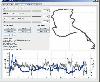 This program takes NMEA, CSV, GPR or GPX logfiles from your GPS device, manages your tracks and exports them as KML to Google Earth. Investigate altitude and speed information, measure distances and cut tracks.
Platforms: Windows, Mac, Linux
| License: Freeware | Size: 1.77 MB | Download (46): GpRoko - Track Analyzer Download |
Released: October 12, 2012
|
Added: October 12, 2012 | Visits: 627
 A software gps simulator, providing TCP/IP, UDP, http and serial port connectivity in NMEA 0183, XML or user defined output format. Usable for testing all kinds of GPS applications. Can playback pre-recorded GPS files with NMEA output.
Platforms: Windows, Mac, Linux
| License: Freeware | Size: 30.56 KB | Download (78): gpsfeed+ Download |