


Map Data freeware
Map Data
Released: May 01, 2011
|
Added: May 23, 2011 | Visits: 1.409
 Convert ESRI ShapeFiles (.SHP) geolocation data into AnyMap format to be used with AnyChart. AnyChart Flash Map Converter allows making use of a wide choice of maps with AnyChart Flash Component, a GIS visualization system that recognizes map data in AnyMap format only. AnyChart Flash Map...
Platforms: Windows
Convert ESRI ShapeFiles (.SHP) geolocation data into AnyMap format to be used with AnyChart. AnyChart Flash Map Converter allows making use of a wide choice of maps with AnyChart Flash Component, a GIS visualization system that recognizes map data in AnyMap format only. AnyChart Flash Map...
Platforms: Windows
| License: Freeware | Size: 1.62 MB | Download (130): AnyChart Flash Map Converter Download |
Added: May 10, 2013 | Visits: 529
 This structure is a kind of dictionary which allows you to map data intervals to values. You can then query the structure for a given point, and it returns the value associated to the interval which contains the point.Boundary values don't need to be an integer ; in the test unit a date-time...
Platforms: Windows, Mac, *nix, Python, BSD Solaris
This structure is a kind of dictionary which allows you to map data intervals to values. You can then query the structure for a given point, and it returns the value associated to the interval which contains the point.Boundary values don't need to be an integer ; in the test unit a date-time...
Platforms: Windows, Mac, *nix, Python, BSD Solaris
| License: Freeware | Download (54): An interval mapping data structure Download |
Added: September 17, 2013 | Visits: 457
Simple Game Map Editor is an application for editing tile map data. While it was written with video game development in mind, Simple Game Map Editor is generic enough to be useful for other purposes as well. Here are some key features of "Simple Game Map Editor": ?*A* Simple Game Map Editor is...
Platforms: Mac
| License: Freeware | Size: 430.08 KB | Download (52): Simple Game Map Editor Download |
Released: October 24, 2012
|
Added: October 24, 2012 | Visits: 681
 QGIS supports vector, raster, and database formats and lets you browse and create map data on your computer.
Quantum GIS (QGIS) supports many common spatial data formats (e.g. ESRI ShapeFile, geotiff). QGIS supports plugins to do things like display tracks from your GPS.
QGIS aims to be an...
Platforms: Linux
QGIS supports vector, raster, and database formats and lets you browse and create map data on your computer.
Quantum GIS (QGIS) supports many common spatial data formats (e.g. ESRI ShapeFile, geotiff). QGIS supports plugins to do things like display tracks from your GPS.
QGIS aims to be an...
Platforms: Linux
| License: Freeware | Size: 1024 KB | Download (460): Quantum GIS form Linux Download |
Released: July 24, 2012
|
Added: July 24, 2012 | Visits: 786
 QGIS supports vector, raster, and database formats and lets you browse and create map data on your computer.
Quantum GIS (QGIS) supports many common spatial data formats (e.g. ESRI ShapeFile, geotiff). QGIS supports plugins to do things like display tracks from your GPS.
QGIS aims to be an...
Platforms: Mac
QGIS supports vector, raster, and database formats and lets you browse and create map data on your computer.
Quantum GIS (QGIS) supports many common spatial data formats (e.g. ESRI ShapeFile, geotiff). QGIS supports plugins to do things like display tracks from your GPS.
QGIS aims to be an...
Platforms: Mac
| License: Freeware | Size: 1024 KB | Download (440): Quantum GIS form Mac Download |
Released: October 11, 2012
|
Added: October 11, 2012 | Visits: 778
 QGIS supports vector, raster, and database formats and lets you browse and create map data on your computer.
Quantum GIS (QGIS) supports many common spatial data formats (e.g. ESRI ShapeFile, geotiff). QGIS supports plugins to do things like display tracks from your GPS.
QGIS aims to be an...
Platforms: Windows
QGIS supports vector, raster, and database formats and lets you browse and create map data on your computer.
Quantum GIS (QGIS) supports many common spatial data formats (e.g. ESRI ShapeFile, geotiff). QGIS supports plugins to do things like display tracks from your GPS.
QGIS aims to be an...
Platforms: Windows
| License: Freeware | Size: 77.3 MB | Download (453): Quantum GIS Download |
Added: August 27, 2008 | Visits: 1.091
USAPhotoMaps downloads aerial photo and topo map data from Microsoft's free TerraServer Web site, saves it on your hard drive, and creates seamless maps from it. You can - Scroll and zoom, See the latitude/longitude, Add waypoints, routes, and text, Jump to any waypoint or latitude/longitude in...
Platforms: Windows
| License: Freeware | Size: 314 KB | Download (505): USAPhotoMaps Download |
Released: October 23, 2012
|
Added: October 23, 2012 | Visits: 480
expressor Studio provides game-changing ease-of-use with a drag-and-drop and wizard driven interface that enables developers to easily connect to standard data sources and targets, map data to common business names and types, and design and run complex data flow applications in minutes. It...
Platforms: Windows
| License: Freeware | Size: 1.46 MB | Download (52): expressor Studio Download |
Released: September 15, 2012
|
Added: September 15, 2012 | Visits: 438
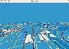 This is Osm3d - a software to display 'Open Street Map' data in 3d - for Linux and MacOS X. This software visualize the map data of the OpenStreetMap project in three dimensions. You see motorways, streets, railways, buildings and lakes, rivers or fore
Platforms: Mac, Linux
This is Osm3d - a software to display 'Open Street Map' data in 3d - for Linux and MacOS X. This software visualize the map data of the OpenStreetMap project in three dimensions. You see motorways, streets, railways, buildings and lakes, rivers or fore
Platforms: Mac, Linux
| License: Freeware | Size: 284.48 KB | Download (46): osm3d Download |
Released: December 04, 2012
|
Added: December 04, 2012 | Visits: 323
Use map data to plan hikes or explore new areas. Includes 3D maps of terrain rendered in real-time; trace trails across the terrain and get height verses distance profiles; tile together adjacent maps to create seamless map areas. Reads USGS SDTS files.
Platforms: Windows, Mac, BSD, Linux
| License: Freeware | Size: 5.23 MB | Download (61): Virtual Hiker Download |
Added: September 15, 2013 | Visits: 271
QMapControl is a Qt/Qtopia widget which enables your (mobile) applications to use map data from different sources. Maps can be enriched by custom objects which will be drawn into the map.
Platforms: *nix
| License: Freeware | Size: 3.96 MB | Download (34): QMapControl Download |
Added: June 21, 2010 | Visits: 1.472
QLandkarte can view and upload map files, track and waypoint data to your Garmin GPS receiver. Garmins MapSource software is hardly the only reason for me to boot into Windows and it does not look like Garmin ever wants to address Linux users by writing a portable piece of software. So I...
Platforms: *nix
| License: Freeware | Size: 972.8 KB | Download (116): QLandkarte Download |
Released: December 22, 2011
|
Added: January 24, 2012 | Visits: 1.473
 Land surveyors and civil engineers:
o Calculate surveys and manage points, effortlessly
o Run Copan on Windows 2K/XP/Vista/7
o Use it forever and pay nothing
o Choose quadrant bearings or N/S azimuths, and gons or DMS
o Create point files quickly and easily
o Edit...
Platforms: Windows
Land surveyors and civil engineers:
o Calculate surveys and manage points, effortlessly
o Run Copan on Windows 2K/XP/Vista/7
o Use it forever and pay nothing
o Choose quadrant bearings or N/S azimuths, and gons or DMS
o Create point files quickly and easily
o Edit...
Platforms: Windows
| License: Freeware | Size: 5.44 MB | Download (983): Copan Lite Download |
Released: September 09, 2012
|
Added: September 09, 2012 | Visits: 463
 eWorld is a framework to import mapping data from providers, such as OpenStreetMap.org. eWorld is also cross-platform being capable of running on any platform that comes with Java support.
eWorld will allow you to edit it, visualize it, and enrich it with events or annotational attributes and...
Platforms: Windows
eWorld is a framework to import mapping data from providers, such as OpenStreetMap.org. eWorld is also cross-platform being capable of running on any platform that comes with Java support.
eWorld will allow you to edit it, visualize it, and enrich it with events or annotational attributes and...
Platforms: Windows
| License: Freeware | Size: 26.4 MB | Download (49): eWorld Download |
Added: August 17, 2013 | Visits: 507
Intent: Provides a useful 1D data structure (or container) for storing an ordered heterogeneous set of elements.Motivation: MATLABdlT« R2009a provides the "containers.Map" data structure for storing an unordered heterogeneous set of elements - the Map ADT is a container that is indexed with a...
Platforms: Matlab
| License: Freeware | Size: 30.72 KB | Download (45): Data Structure: A Cell Array List Container Download |
Added: September 13, 2013 | Visits: 286
Gwybodaeth is a collection of classes and scripts aimed to help in the RDFizing of data. The modules provide an object orientated API and are designed to be easily extended and customized. Gwybodaeth's main features are: * Ability to map data from an input into RDF. * Extendible so that more...
Platforms: *nix
| License: Freeware | Size: 30.72 KB | Download (40): Gwybodaeth Download |
Released: October 24, 2005
|
Added: March 10, 2006 | Visits: 2.251
 QXchange is a profile based ETL application that can integrate data between MS Access, text and excel. It facilitates moving
of data from multiple sources and loading it into required database.
Users of QXchange are endued with easy mapping .It comprises of simple drag and drop option...
Platforms: Windows
QXchange is a profile based ETL application that can integrate data between MS Access, text and excel. It facilitates moving
of data from multiple sources and loading it into required database.
Users of QXchange are endued with easy mapping .It comprises of simple drag and drop option...
Platforms: Windows
| License: Freeware | Download (162): QXchange Download |
Added: July 16, 2010 | Visits: 748
Maccess is a program which helps to analyse data in databases. Maccess helps to analyse data in databases; it is a Web interface to an SQL server. Its main features are user friendly query creation for SQL server; selective, grouped, and crosstab queries; various outputs (XML, HTML, TXT,...
Platforms: *nix
| License: Freeware | Size: 256 KB | Download (91): Maccess Download |
Added: May 10, 2013 | Visits: 481
easyMap is a module written in PHP which allows you to display a map (or any other image for that matter) with markings superimposed on top of it.The module allows full graphical management of multiple maps, with numerous markings for each map. Markings are also arranged by categories, thus a...
Platforms: Windows, Mac, *nix, PHP, BSD Solaris
| License: Freeware | Download (61): easyMap Download |
Added: August 11, 2008 | Visits: 1.962
USA Photo Maps works to download aerial photos and topographical map data directly from the Microsoft TerraServer website, saving it to your hard drive and creating maps from there. With USA Photo Maps you can do the following:* Scroll and zoom operations.* See latitudes and longitudes.* See UGSS...
Platforms: Windows
| License: Freeware | Size: 5 KB | Download (530): USA Photo Maps Download |