


Longitude Locator freeware
Longitude Locator
Released: October 17, 2012
|
Added: October 17, 2012 | Visits: 419
 Create the GeoDatabase for the entire world. This program create the geographical location Latitude, Longitude, and Altitude (Elevation) for every city, village, region, state, county in the World. The program crawls the data from the website www.heavens-above.com which collect data from US...
Platforms: Windows
| License: Freeware | Size: 1.11 MB | Download (45): GeoMaker Download |
Released: January 17, 2013
|
Added: January 17, 2013 | Visits: 707
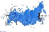 Dongsoft Interactive Russia Flash Maps for websites, interactive map applications, presentations, and more. The innovation of this fully-clickable map will revolutionize your website navigation and provide visitors with a simple and seamless method of accessing information. Using the map as a...
Platforms: Windows, Mac, Linux
| License: Freeware | Size: 156 KB | Download (51): Free Russia Flash Map Download |
Released: January 18, 2013
|
Added: January 18, 2013 | Visits: 815
 Dongsoft Interactive India Flash Maps for websites, interactive map applications, presentations, and more. The innovation of this fully-clickable map will revolutionize your website navigation and provide visitors with a simple and seamless method of accessing information. Using the map as a...
Platforms: Windows, Mac, Linux
| License: Freeware | Size: 156 KB | Download (45): Free India Flash Map Download |
Released: January 08, 2013
|
Added: January 08, 2013 | Visits: 713
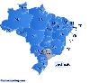 Dongsoft Interactive Brazil Flash Maps for websites, interactive map applications, presentations, and more. The innovation of this fully-clickable map will revolutionize your website navigation and provide visitors with a simple and seamless method of accessing information. Using the map as a...
Platforms: Windows, Mac, Linux
| License: Freeware | Size: 156 KB | Download (46): Free Brazil Flash Map Download |
Released: September 16, 2012
|
Added: September 16, 2012 | Visits: 499
 Suncycle is a calendar that shows you the sunrise and sunset time for a latitude / longitude and timezone. You can also configurate in the aboutscreen the winter and summer time offset. On the sunrise/set a mediafile can be activated (image and sound). By checking de systray menu item, suncycle...
Platforms: Windows
| License: Freeware | Size: 440 KB | Download (528): Suncycle Download |
Released: December 04, 2012
|
Added: December 04, 2012 | Visits: 274
A tool to help java developers define classpath references in the Eclipse IDE.Extends the statndard autocompletion and import system, to allow autoinclusion of classes that are completely missing from the current classpath.
Platforms: Windows, Mac, Linux
| License: Freeware | Size: 218.7 KB | Download (49): Class Locator for classpath building Download |
Released: October 14, 2012
|
Added: October 14, 2012 | Visits: 283
geoLucene is an extension of Lucene that allows to effectively index and search documents that contain locational information (longitude/latitude). It uses R-tree as a spacial index. See http://www.gossamer-threads.com/lists/lucene/java-dev/53378.
Platforms: Windows, Mac, Linux
| License: Freeware | Size: 607.68 KB | Download (44): GeoLucene Download |
Released: October 07, 2012
|
Added: October 07, 2012 | Visits: 462
 Written in Objective-C, the GeographicFormatter provides a Cocoa NSFormatter subclass for latitude and longitude output and input. There is also an IBPalette for integration with Interface Builder.
Platforms: Mac
| License: Freeware | Size: 532.81 KB | Download (50): GeographicFormatter Download |
Released: November 09, 2012
|
Added: November 09, 2012 | Visits: 561
Java and ColdFusion libraries to lookup country code and language from IP address. It uses a local copy of the WHOIS database to perform fast, accurate lookups of country codes. Useful for log analysis, internationalization, geolocation, etc..
Platforms: Windows, Mac, Linux
| License: Freeware | Size: 132.01 KB | Download (51): Java IP (InetAddress) Locator Download |
Released: September 18, 2012
|
Added: September 18, 2012 | Visits: 363
This library is a basic implementation from the GeoHash algorithm written in the java can be used to generate from the latitude and longitude a geohash code and reverse. For more information go to (http://en.wikipedia.org/wiki/Geohash)
Platforms: Windows, Mac, Linux
| License: Freeware | Size: 12.12 KB | Download (45): jGeohash Download |
Released: July 20, 2012
|
Added: July 20, 2012 | Visits: 400
Pysolar is a Python library for calculating the position of the sun relative to the earth as a function of latitude, longitude, and time. There is also code included for other problems related to the development of photovoltaic systems. Still in alpha.
Platforms: Windows, Mac, Linux
| License: Freeware | Size: 21.28 KB | Download (45): Pysolar Download |
Added: May 10, 2013 | Visits: 324
GeoClass helps you to handle georeferenced data (latitude and longitude values for a location). It enables the connection to databases which provide these data or you can easily create your own GeoObjects. Features are: circumference search in (relational) databases, handlers for NIMA-DB and...
Platforms: Windows, Mac, *nix, PHP, BSD Solaris
| License: Freeware | Download (60): GeoClass Download |
Added: April 25, 2013 | Visits: 418
CHyperLink provides the convenience of a static control that can be clicked to open a URL (Uniform Resource Locator) in a form or dialog. It allows linking to either ordinary URLs or email addresses. It is easy to use.The control is sub-classed from CStatic so it is compatible with MFC.Features:-...
Platforms: C and C plus plus
| License: Freeware | Size: 40.96 KB | Download (44): CHyperLink Download |
Added: May 09, 2013 | Visits: 546
Predict the azimuth and elevation of the Sun within +/- 1 degree at any geodetic latitude, longitude and altitude.Function Call: [Az El] = SolarAzEl('2008/02/18 13:10:00',60,15,0)Input List:UTC Date and Time - Use format YYYY/MM/DD hh:mm:ssLatitude - Site Latitude in degrees -90:90 -> S(-)...
Platforms: Matlab
| License: Freeware | Size: 10 KB | Download (47): Solar Azimuth and Elevation Estimation Download |
Added: August 08, 2013 | Visits: 674
ECEF2LLA - convert earth-centered earth-fixed (ECEF) cartesian coordinates to latitude, longitude, and altitude.USAGE:[lat,lon,alt] = ecef2lla(x,y,z)lat = geodetic latitude (radians)lon = longitude (radians)alt = height above WGS84 ellipsoid (m)x = ECEF X-coordinate (m)y = ECEF Y-coordinate (m)z...
Platforms: Matlab
| License: Freeware | Size: 10 KB | Download (42): Convert Cartesian (ECEF) Coordinates to lat, lon, alt Download |
Added: August 11, 2013 | Visits: 484
This algorithm will accept a Latitude, Longitude and Altitude location as well as a specific universal coordinated time. It will use this information and calculate the position of the moon in a local coordinate frame (az and alt aka az and el).Example Function Call:[Az El] = LunarAzEl('1991/05/19...
Platforms: Matlab
| License: Freeware | Size: 10 KB | Download (40): Lunar Azimuth and Altitude Estimation Algorithm Download |
Added: September 05, 2013 | Visits: 499
function alt_km=ITU_P1511(lat,long)computes altitude of a site at given lat,long coordinatesby means of bicubic interpolation using itu topo 0.5 degrees resolutionmatrix.refer to ITU-R Recommendation P 1511.INPUTSlat: latitude + = North, -=southlong: longitude, positive degrees East.Required...
Platforms: Matlab
| License: Freeware | Size: 10 KB | Download (54): Altitude in Km above sea level for a given pair of coordinates (lat,long) Download |
Added: August 26, 2013 | Visits: 618
china.mat and china.province.mat contain the longitude and latitude values that define the political boundaries of China and its provinces.Data source: http://nfgis.nsdi.gov.cnExample of its use:worldmap china;load china.mat;plotm(lat,long);
Platforms: Matlab
| License: Freeware | Size: 358.4 KB | Download (43): china.mat Download |
Added: May 06, 2013 | Visits: 500
china.mat and china.province.mat contain the longitude and latitude values that define the political boundaries of China and its provinces.Data source: http://nfgis.nsdi.gov.cnExample of its use:worldmap china;load china.mat;plotm(lat,long);
Platforms: Matlab
| License: Freeware | Size: 542.72 KB | Download (41): china.province.mat Download |
Added: May 26, 2013 | Visits: 456
DISTMATLATLON Computes distance matrix between list of coords in X and Y D = DISTMATLATLON(X,Y) for matrices X and Y, with columns [Lat Lon], returns the distance matrix where the (i,j)th entry is the distance between the i'th and j'th row of X and Y respectively. X and Y must have columns in the...
Platforms: Matlab
| License: Freeware | Size: 10 KB | Download (46): Distance Matrix Latitude Longitude Download |