


Latitude Longitude Maps freeware
Latitude Longitude Maps
Released: November 14, 2012
|
Added: November 14, 2012 | Visits: 5.013
 Professional Free Kundli software in Hindi from Astro-Vision. Ideal for Astrologers and Astrology Students. Contains both calculations as well as predictions. This free kundali software also provides you a choice of chart formats, like, North Indian, South Indian, etc. This means you can generate...
Platforms: Windows
| License: Freeware | Size: 24.21 MB | Download (1430): Free Kundli Software Download |
Released: September 08, 2009
|
Added: September 14, 2009 | Visits: 3.869
 PhotoGPSEditor is an easy to use meta-data editor for photo (JPEG, RAW) files, plus it can match data from GPS (gpx or NMEA) files. The program is freeware, however, donations can be made to help support future development. With PhotoGPSEditor you can add location and summary details to a...
Platforms: Mac
| License: Freeware | Size: 2.39 MB | Download (1330): PhotoGPSEditor Download |
Released: January 07, 2006
|
Added: July 18, 2006 | Visits: 11.416
 GeoDataSource Free Cities Edition provides geographical database of world features, cities with place names and region names. Free database of worldwide cities in text format suitable for any applications requiring a comprehensive list of cities and country code. It is a subset of the paid...
Platforms: DOS, OS/2, BeOS, Palm OS, Windows, Mac, *nix, Windows CE
| License: Freeware | Size: 25 KB | Download (1190): World Cities Database (Free Edition) Download |
Released: November 07, 2014
|
Added: November 19, 2014 | Visits: 813
 Importation/Exportation: Import/export trails to gpx file. Unlimited number of trails, and TrackPoints. Export to gpx, Excel, PDF, XPS and KML/KMZ.
Data table: Very flexible data table that allows sorting by columns, with inheritance of data, attributes, etc.
Presentation on map: View...
Importation/Exportation: Import/export trails to gpx file. Unlimited number of trails, and TrackPoints. Export to gpx, Excel, PDF, XPS and KML/KMZ.
Data table: Very flexible data table that allows sorting by columns, with inheritance of data, attributes, etc.
Presentation on map: View...
Platforms: Windows, Windows 8, Windows 7, Windows Server
| License: Freeware | Size: 27.05 MB | Download (611): ediTrail Download |
Released: November 10, 2012
|
Added: November 10, 2012 | Visits: 619
 A complex but easy to use Prayer Times Calculator that have parametric depression angles and safety margins with graphical display of sun/moon azimuth & elevation angles and trajectory. FEATURES: All timings between 1901 and 2099 by truly astronomical calculation 5 different calculation...
Platforms: Windows
| License: Freeware | Size: 451 KB | Download (567): Alperen Download |
Released: January 09, 2013
|
Added: January 09, 2013 | Visits: 660
 This utility can be used to analyze GPS log files and then generate graphs, summaries, reports and Google Earth (TM) compatible KML files. With the PRO version you can create trip reports with details such as drive time, drive distance, stop time, etc.
Platforms: Windows
| License: Freeware | Size: 648 KB | Download (540): KML Generator Download |
Released: September 16, 2012
|
Added: September 16, 2012 | Visits: 499
 Suncycle is a calendar that shows you the sunrise and sunset time for a latitude / longitude and timezone. You can also configurate in the aboutscreen the winter and summer time offset. On the sunrise/set a mediafile can be activated (image and sound). By checking de systray menu item, suncycle...
Platforms: Windows
| License: Freeware | Size: 440 KB | Download (528): Suncycle Download |
Added: August 11, 2008 | Visits: 1.953
 USA Photo Maps works to download aerial photos and topographical map data directly from the Microsoft TerraServer website, saving it to your hard drive and creating maps from there. With USA Photo Maps you can do the following:* Scroll and zoom operations.* See latitudes and longitudes.* See UGSS...
Platforms: Windows
| License: Freeware | Size: 5 KB | Download (524): USA Photo Maps Download |
Added: August 27, 2008 | Visits: 1.084
USAPhotoMaps downloads aerial photo and topo map data from Microsoft's free TerraServer Web site, saves it on your hard drive, and creates seamless maps from it. You can - Scroll and zoom, See the latitude/longitude, Add waypoints, routes, and text, Jump to any waypoint or latitude/longitude in...
Platforms: Windows
| License: Freeware | Size: 314 KB | Download (505): USAPhotoMaps Download |
Released: August 08, 2012
|
Added: August 08, 2012 | Visits: 857
 Astro-Vision LifeSign Mini is a reliable application designed for astrologers and astrology students. Contains both calculations as well as predictions. This astrology software also provides you a choice of chart formats, like, North Indian, South Indian, etc. This means you can generate Free...
Platforms: Windows
| License: Freeware | Size: 25.5 MB | Download (505): Astro-Vision LifeSign Mini Download |
Released: June 13, 2012
|
Added: June 13, 2012 | Visits: 936
 Add realistic 3D capabilities to your online Bing Maps. Bing Maps 3D brings you another step closer to knowing "what it is like out there". You can search, browse, and organize local information viewed in three dimensions, just the way it exists in the real world. This enables you to more...
Platforms: Windows
| License: Freeware | Size: 1.2 MB | Download (505): Microsoft Bing Maps 3D Download |
Released: July 20, 2012
|
Added: July 20, 2012 | Visits: 1.229
The database includes a list of more than 9,000 Post Office Box (PO Box) only ZIP codes, state and city name.
It is bundled with the ZIPCodeWorld US Gold Edition which includes 5-Digit ZIP code, city name, alias city name, state code, phone area code, city type, country name, country FIPS, time...
Platforms: Windows
| License: Freeware | Download (484): US ZIP Code Database PO Box Edition Download |
Released: August 19, 2012
|
Added: August 19, 2012 | Visits: 452
No matter if you are an experienced player, a highly-handicapped beginner, or even a golf coach, GXP3 + iGXP is a great application suite to improve your golf game. This is because GXP3 and iGXP was created by players to players. No fancy useless graphics. Just the info you need, where you want...
Platforms: Mac
| License: Freeware | Size: 20 MB | Download (482): GXP for Mac OS Download |
Released: October 22, 2012
|
Added: October 22, 2012 | Visits: 465
 Shadows is a program used to design sundials and astrolabes. It can be used by everybody without any required technical skills. Shadows will calculate everything and print the drawing according the user's preferences. Shadows is used by thousands of users around the world.
Shadows offers a...
Shadows is a program used to design sundials and astrolabes. It can be used by everybody without any required technical skills. Shadows will calculate everything and print the drawing according the user's preferences. Shadows is used by thousands of users around the world.
Shadows offers a...
Platforms: Windows
| License: Freeware | Size: 7.5 MB | Download (457): Shadows Download |
Released: June 04, 2012
|
Added: June 04, 2012 | Visits: 470
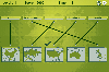 In this game there will be some country names and some maps of countries. Your task is to match the country names with the correct maps. You match them by using the mouse to draw a line to connect the dots of the country names and the maps. There are a total of 5 levels and each level will be...
Platforms: Windows
| License: Freeware | Size: 262 KB | Download (451): Mapping Maps Download |
Added: August 17, 2008 | Visits: 997
IPSearchLight is a software component used to identify the geographic location of website visitors, often within a few miles from the exact location. The process utilizes each visitor's IP address; this technique is silent and unintrusive. IPSearchLight is ideal for practical applications like...
Platforms: Windows
| License: Freeware | Size: 8.74 KB | Download (447): IPSearchLight GeoLocator for ASP.NET 2.0 Download |
Released: October 09, 2012
|
Added: October 09, 2012 | Visits: 273
Know where you took that photo! With HoudahGeo you may 'pin' photos to locations where they were taken. Just like an expensive GPS camera, HoudahGeo may store latitude, longitude, altitude and viewing direction information right within the image file - invisibly with no loss of quality. HoudahGeo...
Platforms: Mac
| License: Freeware | Size: 6.4 MB | Download (446): HoudahGeo for Mac OS Download |
Released: September 01, 2012
|
Added: September 01, 2012 | Visits: 945
A free 802.11 wireless scanner and connection manager for Mac OS X 10.6 Snow Leopard or later. This will detect access points and clients in ad-hoc mode if the SSID is being broadcasted. It can be used for wireless site surveys, wireless discovery, and to connect to wifi networks. The tool...
Platforms: Mac
| License: Freeware | Size: 768 KB | Download (428): WiFi Scanner for Mac OS Download |
Added: August 21, 2008 | Visits: 2.672
Guitar chords maps. The game won't teach your kids to play guitar, but it'll get them off the couch, away from all that ear training zombie killing, and forcing them to concentrate chord guitar, guitar scales, guitar picking, Spanish guitar chords, electric guitar chords, Spanish guitar scales,...
Platforms: Windows, Mac
| License: Freeware | Size: 30 KB | Download (405): Guitar online maps Download |
Added: January 18, 2010 | Visits: 1.447
Religion::Islam::Qibla is a Perl module that calculates the Muslim Qiblah Direction, Great Circle Distance, and Great Circle Direction. SYNOPSIS use Religion::Islam::Qibla; #create new object with default options, Destination point is Kabah Lat=21 Deg N, Long 40 Deg E my $qibla =...
Platforms: *nix
| License: Freeware | Size: 4.1 KB | Download (266): Religion::Islam::Qibla Download |