


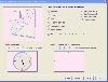
Latitude Longitude Conversion freeware
Latitude Longitude Conversion
Released: November 14, 2012
|
Added: November 14, 2012 | Visits: 5.020
 Professional Free Kundli software in Hindi from Astro-Vision. Ideal for Astrologers and Astrology Students. Contains both calculations as well as predictions. This free kundali software also provides you a choice of chart formats, like, North Indian, South Indian, etc. This means you can generate...
Platforms: Windows
| License: Freeware | Size: 24.21 MB | Download (1436): Free Kundli Software Download |
Released: September 08, 2009
|
Added: September 14, 2009 | Visits: 3.879
 PhotoGPSEditor is an easy to use meta-data editor for photo (JPEG, RAW) files, plus it can match data from GPS (gpx or NMEA) files. The program is freeware, however, donations can be made to help support future development. With PhotoGPSEditor you can add location and summary details to a...
Platforms: Mac
| License: Freeware | Size: 2.39 MB | Download (1332): PhotoGPSEditor Download |
Released: January 07, 2006
|
Added: July 18, 2006 | Visits: 11.421
 GeoDataSource Free Cities Edition provides geographical database of world features, cities with place names and region names. Free database of worldwide cities in text format suitable for any applications requiring a comprehensive list of cities and country code. It is a subset of the paid...
Platforms: DOS, OS/2, BeOS, Palm OS, Windows, Mac, *nix, Windows CE
| License: Freeware | Size: 25 KB | Download (1202): World Cities Database (Free Edition) Download |
Added: June 17, 2010 | Visits: 3.062
 FLAC is a lossless compression method for audio files. Using it, one is able to reduce the filesize and keep the same audio quality as a regular WAV file (CD quality). The FLAC format is open source, and can be read without any problem by such applications as Amarok or Kaffeine. Wav and Flac...
Platforms: *nix
| License: Freeware | Download (822): Wav and Flac conversion Download |
Released: November 07, 2014
|
Added: November 19, 2014 | Visits: 819
 Importation/Exportation: Import/export trails to gpx file. Unlimited number of trails, and TrackPoints. Export to gpx, Excel, PDF, XPS and KML/KMZ.
Data table: Very flexible data table that allows sorting by columns, with inheritance of data, attributes, etc.
Presentation on map: View...
Importation/Exportation: Import/export trails to gpx file. Unlimited number of trails, and TrackPoints. Export to gpx, Excel, PDF, XPS and KML/KMZ.
Data table: Very flexible data table that allows sorting by columns, with inheritance of data, attributes, etc.
Presentation on map: View...
Platforms: Windows, Windows 8, Windows 7, Windows Server
| License: Freeware | Size: 27.05 MB | Download (611): ediTrail Download |
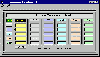
Released: November 10, 2012
|
Added: November 10, 2012 | Visits: 621
 A complex but easy to use Prayer Times Calculator that have parametric depression angles and safety margins with graphical display of sun/moon azimuth & elevation angles and trajectory. FEATURES: All timings between 1901 and 2099 by truly astronomical calculation 5 different calculation...
Platforms: Windows
| License: Freeware | Size: 451 KB | Download (567): Alperen Download |
Released: January 09, 2013
|
Added: January 09, 2013 | Visits: 667
 This utility can be used to analyze GPS log files and then generate graphs, summaries, reports and Google Earth (TM) compatible KML files. With the PRO version you can create trip reports with details such as drive time, drive distance, stop time, etc.
Platforms: Windows
| License: Freeware | Size: 648 KB | Download (540): KML Generator Download |
Released: September 16, 2012
|
Added: September 16, 2012 | Visits: 501
 Suncycle is a calendar that shows you the sunrise and sunset time for a latitude / longitude and timezone. You can also configurate in the aboutscreen the winter and summer time offset. On the sunrise/set a mediafile can be activated (image and sound). By checking de systray menu item, suncycle...
Platforms: Windows
| License: Freeware | Size: 440 KB | Download (528): Suncycle Download |
Added: August 29, 2008 | Visits: 1.901
K-Lite Video Conversion Pack 1.0 is a collection of tools to create your own totally personalized DVDs, including powerful tools and functions for conversion between formats, video editing, menu creation, integrated recording, etc
Platforms: Windows
| License: Freeware | Size: 1024 B | Download (512): K-Lite Video Conversion Pack Download |
Released: August 08, 2012
|
Added: August 08, 2012 | Visits: 862
 Astro-Vision LifeSign Mini is a reliable application designed for astrologers and astrology students. Contains both calculations as well as predictions. This astrology software also provides you a choice of chart formats, like, North Indian, South Indian, etc. This means you can generate Free...
Platforms: Windows
| License: Freeware | Size: 25.5 MB | Download (511): Astro-Vision LifeSign Mini Download |
Added: August 27, 2008 | Visits: 1.090
USAPhotoMaps downloads aerial photo and topo map data from Microsoft's free TerraServer Web site, saves it on your hard drive, and creates seamless maps from it. You can - Scroll and zoom, See the latitude/longitude, Add waypoints, routes, and text, Jump to any waypoint or latitude/longitude in...
Platforms: Windows
| License: Freeware | Size: 314 KB | Download (505): USAPhotoMaps Download |
Released: July 20, 2012
|
Added: July 20, 2012 | Visits: 1.234
The database includes a list of more than 9,000 Post Office Box (PO Box) only ZIP codes, state and city name.
It is bundled with the ZIPCodeWorld US Gold Edition which includes 5-Digit ZIP code, city name, alias city name, state code, phone area code, city type, country name, country FIPS, time...
Platforms: Windows
| License: Freeware | Download (484): US ZIP Code Database PO Box Edition Download |
Released: August 19, 2012
|
Added: August 19, 2012 | Visits: 455
No matter if you are an experienced player, a highly-handicapped beginner, or even a golf coach, GXP3 + iGXP is a great application suite to improve your golf game. This is because GXP3 and iGXP was created by players to players. No fancy useless graphics. Just the info you need, where you want...
Platforms: Mac
| License: Freeware | Size: 20 MB | Download (482): GXP for Mac OS Download |
Released: October 22, 2012
|
Added: October 22, 2012 | Visits: 469
 Shadows is a program used to design sundials and astrolabes. It can be used by everybody without any required technical skills. Shadows will calculate everything and print the drawing according the user's preferences. Shadows is used by thousands of users around the world.
Shadows offers a...
Shadows is a program used to design sundials and astrolabes. It can be used by everybody without any required technical skills. Shadows will calculate everything and print the drawing according the user's preferences. Shadows is used by thousands of users around the world.
Shadows offers a...
Platforms: Windows
| License: Freeware | Size: 7.5 MB | Download (457): Shadows Download |
Added: August 17, 2008 | Visits: 1.004
IPSearchLight is a software component used to identify the geographic location of website visitors, often within a few miles from the exact location. The process utilizes each visitor's IP address; this technique is silent and unintrusive. IPSearchLight is ideal for practical applications like...
Platforms: Windows
| License: Freeware | Size: 8.74 KB | Download (447): IPSearchLight GeoLocator for ASP.NET 2.0 Download |
Released: October 09, 2012
|
Added: October 09, 2012 | Visits: 276
Know where you took that photo! With HoudahGeo you may 'pin' photos to locations where they were taken. Just like an expensive GPS camera, HoudahGeo may store latitude, longitude, altitude and viewing direction information right within the image file - invisibly with no loss of quality. HoudahGeo...
Platforms: Mac
| License: Freeware | Size: 6.4 MB | Download (446): HoudahGeo for Mac OS Download |
Released: August 27, 2012
|
Added: August 27, 2012 | Visits: 719
Dimensional Units Conversion is a simple and useful tool built using the Python programming language that can be used to convert different measuring units.
Now you can use of this handy instrument to convert from one unit to another in no time at all.
Platforms: Windows
| License: Freeware | Download (445): Dimensional Units Conversion Download |
Released: September 01, 2012
|
Added: September 01, 2012 | Visits: 951
A free 802.11 wireless scanner and connection manager for Mac OS X 10.6 Snow Leopard or later. This will detect access points and clients in ad-hoc mode if the SSID is being broadcasted. It can be used for wireless site surveys, wireless discovery, and to connect to wifi networks. The tool...
Platforms: Mac
| License: Freeware | Size: 768 KB | Download (428): WiFi Scanner for Mac OS Download |
Released: July 10, 2012
|
Added: July 10, 2012 | Visits: 804
An Integer Conversion Application for Noobs was designed using the Java programming language to help you convert numbers to different numbering systems.
All you have to do is input the integer number you want converted, select the base system and the program will do the rest.
Platforms: Windows
| License: Freeware | Download (409): An Integer Conversion Application for Noobs Download |
Added: March 12, 2006 | Visits: 7.629
 Troy Oz Coversion Tool Converts and Computes and gives the complet breakdown of Troy ounces in Kilos, Oz, Dwt, grams, and grains. Just enter the weight and press the command button then Troy Oz Conversion Tool will do the rest. Our other related products are Gold Calculator, Gold Calculator Gold,...
Platforms: Windows
| License: Freeware | Size: 220 KB | Download (279): Troy Ounce Conversion Tool Download |