


Latitude freeware
Latitude
Added: September 07, 2010 | Visits: 1.215
 libipgeo library is written on top of the IP2LOCATION database allowing the user to do geo-targeting of IP addresses. For a given IPv4 address, libipgeo can lookup the following: Country Code Country Region City Latitude Longitude ISP NEW:libipgeo now searchs the IP2LOCATION database in...
Platforms: *nix
| License: Freeware | Size: 133.12 KB | Download (132): ipgeo Download |
Added: July 10, 2010 | Visits: 854
DateTime::Event::Sunrise is a Perl DateTime extension for computing the sunrise/sunset on a given day. SYNOPSIS use DateTime; use DateTime::Event::Sunrise; my $dt = DateTime->new( year => 2000, month => 6, day => 20, ); my $sunrise = DateTime::Event::Sunrise ->sunrise ( longitude...
Platforms: *nix
| License: Freeware | Size: 12.29 KB | Download (101): DateTime::Event::Sunrise Download |
Added: July 07, 2010 | Visits: 847
Fracplanet is an interactive tool for creating random fractal planets and terrain areas with oceans, rivers, lakes and icecaps. The results can be saved in POV-Ray format. The code is licensed under the GPL. Fracplanet project uses Qt and OpenGL. Whats New in This Release: - The main...
Platforms: *nix
| License: Freeware | Size: 68.61 KB | Download (135): Fracplanet Download |
Added: October 02, 2010 | Visits: 1.124
Itzam/C++ wraps the Itzam database engine with C++ templates for both simple and complex database classes. Itzam/C++ wrapper supports B-tree indexes with unique or duplicate keys, and includes multithreaded resource locking. Complete class documentation is embedded in the source code and...
Platforms: *nix
| License: Freeware | Size: 337.92 KB | Download (102): Itzam/C++ Download |
Added: August 07, 2010 | Visits: 869
Itzam/Java project is a pure Java reimplementation of the Itzam embedded database engine, and it is 100% interoperable with files created by Itzam/Core. Since Itzam/Core is the basis of wrappers written in languages such as C++ and Python, Itzam/Java is compatible with those language libraries...
Platforms: *nix
| License: Freeware | Size: 112.64 KB | Download (88): Itzam/Java Download |
Added: August 05, 2010 | Visits: 665
OpenGuides is a wiki-like package for maintaining a collaborative city guide. It is written in Perl and runs as a CGI program, and uses either the MySQL, PostgreSQL, or SQLite database. OpenGuides offers features over a "normal" wiki such as metadata management and a "find nearby things"...
Platforms: *nix
| License: Freeware | Size: 94.21 KB | Download (87): OpenGuides Download |
Added: July 12, 2010 | Visits: 1.303
Geo::Coordinates::OSGB is a Perl module that can convert coordinates from Lat/Long to UK Grid. A UK-specific implementation of co-ordinate conversion, following formulae from the Ordnance Survey of Great Britain (hence the name). SYNOPSIS use Geo::Coordinates::OSGB qw(ll2grid grid2ll); #...
Platforms: *nix
| License: Freeware | Size: 4.1 KB | Download (112): Geo::Coordinates::OSGB Download |
Added: January 25, 2010 | Visits: 1.305
GPS Connect is a freeware program for Mac OS X which offers connectivity to Garmin GPS receivers. The intended use is to backup waypoints from the GPS to your computer. Downloaded waypoints may be saved in a native file format or exported to a variety of other formats such as tab-delimited,...
Platforms: Mac
| License: Freeware | Size: 1.2 MB | Download (108): GPS Connect Download |
Added: January 25, 2010 | Visits: 819
Night Sky is a planetarium for Macintosh. Night Sky displays the night sky for any latitude, date and time. This includes 20,000 stars (files with up to 50,071 stars available), the Messier catalog of deep space objects, the planets out to Neptune, the Moon and Sun. Night Sky 3.3 runs on Mac OS X...
Platforms: Mac
| License: Freeware | Download (148): Night Sky Download |
Added: January 25, 2010 | Visits: 659
GPSPhotoLinker can be used to save GPS position data to a photo. The latitude and longitude recorded by your GPS unit while you were taking photos can be linked, and saved, to the photos.
Platforms: Mac
| License: Freeware | Download (126): GPSPhotoLinker Download |
Added: January 25, 2010 | Visits: 693
CoordinatesX is an application that transforms geodetic and Cartesian coordinates. It will make the conversions from Geodetic latitude, longitude and heights to planet centered Cartesian coordinates and vice versa. Works for various planetary ellipsoids, including user defined...
Platforms: Mac
| License: Freeware | Download (165): CoordinatesX Download |
Added: January 25, 2010 | Visits: 1.085
PhotoInfoEditor is an easy to use meta-data editor for photo (JPEG/RAW/Tiff) files. The program is freeware, however, donatations can be made to help support future development.With PhotoInfoEditor you can add location and summary details to a JPEG/RAW or Tiff files. Location information consists...
Platforms: Mac
| License: Freeware | Download (150): PhotoInfoEditor Download |
Added: January 25, 2010 | Visits: 902
Starry Night Widget... Whether at home or at work, keep Starry Night astronomy software at your fingertips.Faster than a shooting star, the Starry Night Widget will bring the sky for any location to your Macintosh OS X Dashboard in an instant.Set your location by zip/postal code or by latitude...
Platforms: Mac
| License: Freeware | Download (109): Starry Night Widget Download |
Released: February 15, 2011
|
Added: February 26, 2011 | Visits: 1.314
 An accurate simulation of the solar system, including all planets, major moons, all visible stars, and constellations. Multiple views and features. Home in on selected planets, or fly to distant stars quickly and easily. Support for any latitude and longitude on Earth. Includes an integrated...
Platforms: Windows
| License: Freeware | Size: 1.58 MB | Download (168): SolarMax Download |
Released: July 09, 2012
|
Added: August 14, 2012 | Visits: 1.204
 Detect and delete JPEG exif data with Easy Exif Delete, a freeware application from ConsumerSoft.
Exif data is a form of hidden metadata attached to jpeg (.jpg) images. This data can contain camera type, lens type, shutter speed and exposure, date and time, copyright information, author,...
Detect and delete JPEG exif data with Easy Exif Delete, a freeware application from ConsumerSoft.
Exif data is a form of hidden metadata attached to jpeg (.jpg) images. This data can contain camera type, lens type, shutter speed and exposure, date and time, copyright information, author,...
Platforms: Windows
| License: Freeware | Size: 884.95 KB | Download (102): Easy Exif Delete Download |
Released: October 25, 2012
|
Added: October 25, 2012 | Visits: 759
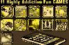 101 useful and fun apps all bundled into one nice download. You get 11 games,95 utilities which will come in handy when you least expect them.11 Games:1) Balloon Blaster,2) Soccer Champ,3) Air Traffic Dash,4) Alpha Catcher,5) Sonic Square Touch,6) iTankster,7) Hungry Animals,8) Catch A Thief,9)...
Platforms: iPhone, iPod, iTouch
| License: Freeware | Size: 70.8 MB | Download (500): 106 in 1 GameUtilities - 11 Games and 95 Utilities Download |
Released: July 14, 2012
|
Added: July 14, 2012 | Visits: 532
 GEOPoint is an easy to use satellite antenna pointing calculator, for geostationary communications satellites. It calculates the azimuth and elevation pointing angles from a given location on the earth towards a specified geostationary satellite. The program also calculates polarisation tilt...
Platforms: Windows
| License: Freeware | Size: 2.1 MB | Download (402): GEOPoint Download |
Released: October 22, 2012
|
Added: October 22, 2012 | Visits: 465
 Shadows is a program used to design sundials and astrolabes. It can be used by everybody without any required technical skills. Shadows will calculate everything and print the drawing according the user's preferences. Shadows is used by thousands of users around the world.
Shadows offers a...
Shadows is a program used to design sundials and astrolabes. It can be used by everybody without any required technical skills. Shadows will calculate everything and print the drawing according the user's preferences. Shadows is used by thousands of users around the world.
Shadows offers a...
Platforms: Windows
| License: Freeware | Size: 7.5 MB | Download (457): Shadows Download |
Released: July 17, 2012
|
Added: July 17, 2012 | Visits: 1.744
 MB Free Janam Kundali Software is an advanced birth chart calculation software based on Vedic Astrology. It tells you accurately the astronomical location of planets at the time of an individual's birth. This program gives you the natal chart in both North Indian and South Indian Styles. For the...
Platforms: Windows
| License: Freeware | Size: 2.28 MB | Download (805): MB Janam Kundali Download |
Released: November 14, 2012
|
Added: November 14, 2012 | Visits: 5.014
 Professional Free Kundli software in Hindi from Astro-Vision. Ideal for Astrologers and Astrology Students. Contains both calculations as well as predictions. This free kundali software also provides you a choice of chart formats, like, North Indian, South Indian, etc. This means you can generate...
Platforms: Windows
| License: Freeware | Size: 24.21 MB | Download (1430): Free Kundli Software Download |