


Heat Maps For Excel freeware
Heat Maps For Excel
Released: September 15, 2010
|
Added: November 23, 2010 | Visits: 1.938
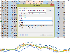
 We have invested 3 years into developing our Excel Gantt Chart templates incorporating the requirements of hundreds of customers. Whilst our solutions look simple and are easy to use, they are the most powerful, professional Gantt Chart templates available.
After years in senior Project...
Platforms: Windows, Mac
We have invested 3 years into developing our Excel Gantt Chart templates incorporating the requirements of hundreds of customers. Whilst our solutions look simple and are easy to use, they are the most powerful, professional Gantt Chart templates available.
After years in senior Project...
Platforms: Windows, Mac
| License: Freeware | Size: 466 KB | Download (297): Chartgantt Basic Demo Download |
Released: June 07, 2012
|
Added: June 07, 2012 | Visits: 679
 Includes TrueType, OpenType, PostScript and PCL fonts that support all GS1 DataBar barcodes including Omnidirectional, Limited, Stacked and Expanded types. DataBar Expanded codes in this package can encode the GTIN and may also include additional information such as coupon offer codes, expiration...
Platforms: Mac
Includes TrueType, OpenType, PostScript and PCL fonts that support all GS1 DataBar barcodes including Omnidirectional, Limited, Stacked and Expanded types. DataBar Expanded codes in this package can encode the GTIN and may also include additional information such as coupon offer codes, expiration...
Platforms: Mac
| License: Freeware | Size: 757.76 KB | Download (55): GS1 DataBar Barcode Font for Mac OS Download |
Released: November 13, 2012
|
Added: November 13, 2012 | Visits: 633
Allows printing of ECC-200 Data Matrix symbols with TrueType, PCL and PostScript fonts by using IDAutomation Vertical Interleaved Technology. Includes VB code, Java Library, ASP.NET Web Control, .NET Forms Control DLL and examples for Excel, Word, Access, Java, .NET and Crystal Reports. Hundreds...
Platforms: Mac
| License: Freeware | Size: 3.3 MB | Download (59): DataMatrix ECC200 Font and Encoder for Mac OS Download |
Released: November 23, 2012
|
Added: November 23, 2012 | Visits: 260
With OpenStreetMap.org, you can export maps (for free) in XML OSM format. These maps are pretty handy - but if you want to load them onto your GPS, this free utility will allow you to easily convert the OSM files to IMG files which you can import into your Garmin GPS.
Platforms: Mac
| License: Freeware | Size: 2.5 MB | Download (511): OSMtoIMG for Mac OS Download |
Released: July 21, 2012
|
Added: July 21, 2012 | Visits: 394
A powerful, easy-to-use modeling and prediction tool designed to support the process of knowledge extraction from data on a highly automated level. KnowledgeMiner is a data mining tool that enables anyone to use its unique form of modeling to quickly visualize new possibilities. It is an...
Platforms: Mac
| License: Freeware | Size: 4.7 MB | Download (50): KnowledgeMiner for Mac OS Download |
Released: November 06, 2012
|
Added: November 06, 2012 | Visits: 579
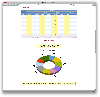
Free InfoReporter a olap & sql tool for building reports and analyzing data What you do with the ToolYou build up reports. Table reports, table & graph reports. The reports are based on local cubes, MSAS OLAP cubes or SQL relational databases or plain excel files. First of all you have to set up...
Platforms: Windows
| License: Freeware | Size: 32.88 MB | Download (46): InfoReporter Download |
Released: September 24, 2012
|
Added: September 24, 2012 | Visits: 447
Obba provides a bridge between spreadsheets and Java classes. With Obba, you can use spreadsheets as GUIs (Graphical User Interfaces) for your Java libraries. Its main features are:
* Loading of arbitrary jar or class files at runtime through a spreadsheet function.
* Instantiation of Java...
Platforms: Mac
| License: Freeware | Size: 2.4 MB | Download (55): Obba for OpenOffice Download |
Added: May 10, 2013 | Visits: 1.090
This project allows someone to track a GPS enabled cell phone using Google maps.For this project it is used a Motorola i355 cell phone on the Sprint/Nextel network. You need to have a data plan so that you can make updates to your website from the cellphone. Project includes J2ME cell phone...
Platforms: Windows, Mac, *nix, PHP, BSD Solaris
| License: Freeware | Download (81): GPS Tracker Download |
Released: December 22, 2013
|
Added: January 12, 2014 | Visits: 961
 Corrupt XLSX Salvager is designed to salvage data from corrupt Excel 2007 - 2013 'Office Open XML' XLSX extension files and convert worksheets to CSV format. XLSX files are really conventionally zipped collections of mostly XML files. The main unformatted data is contained in the sharedStrings...
Platforms: Windows, Windows 7, Windows Server
Corrupt XLSX Salvager is designed to salvage data from corrupt Excel 2007 - 2013 'Office Open XML' XLSX extension files and convert worksheets to CSV format. XLSX files are really conventionally zipped collections of mostly XML files. The main unformatted data is contained in the sharedStrings...
Platforms: Windows, Windows 7, Windows Server
| License: Freeware | Size: 7.59 MB | Download (86): Corrupt XLSX Salvager Download |
Added: September 16, 2013 | Visits: 403
Fragmentation Analyzer is a tool for analyzing MS/MS fragmentation data. Currently nine different analysis types are supported: * Spectra Visualization - visualize the MS/MS spectra with fragment ion annotation, zooming and manual de-novo-sequencing. * Intensity Box Plots - analyze intensity...
Platforms: Mac
| License: Freeware | Size: 15.27 MB | Download (34): Fragmentation Analyzer Download |
Added: August 17, 2013 | Visits: 432
django-geoportail is a Django app that adds maps and photos from the French National Geographic Institute to GeoDjango. Geodjango with the maps and photos from the French National Geographic Institute. * Installation: see INSTALL * Get involved: http://bitbucket.org/bruno/django-geoportail/...
Platforms: *nix
| License: Freeware | Size: 30.72 KB | Download (39): django-geoportail Download |
Released: December 15, 2016
|
Added: December 20, 2016 | Visits: 557
 Perform Technical Analysis in Excel with Tulip Cell, the free technical analysis add-in for Excel!
With Tulip Cell, you can quickly and easily do technical in any Excel spreadsheet. Tulip Cell is good for doing technical analysis on stock market data, Forex data, options and derivatives,...
Platforms: Windows, Windows 8, Windows 7, Windows Server
Perform Technical Analysis in Excel with Tulip Cell, the free technical analysis add-in for Excel!
With Tulip Cell, you can quickly and easily do technical in any Excel spreadsheet. Tulip Cell is good for doing technical analysis on stock market data, Forex data, options and derivatives,...
Platforms: Windows, Windows 8, Windows 7, Windows Server
| License: Freeware | Size: 447 KB | Download (50): Tulip Cell Download |
Added: August 29, 2008 | Visits: 1.649
This Excel addin performs multi-precision floating point arithmetic. Perhaps the first package that extends the standard Excel precision from 15 up to 200 significant digits. It is for Excel 97/98 and consists of a set of 50 functions for arithmetic, trigonometric, logarithm, exponential...
Platforms: Windows
| License: Freeware | Size: 130 KB | Download (213): XNUMBERS Download |
Added: August 09, 2008 | Visits: 1.606
This site provides address searching and street map facilities for the UK. We currently have street maps for Greater London and road atlas maps for the whole of mainland Britain (we're working on getting Northern Ireland). Any suggestions or comments are welcome.
Platforms: Windows
| License: Freeware | Download (554): The UK Street Map Page Download |
Added: August 30, 2008 | Visits: 708
For more advanced users! This utility is used to get information on the usage of your drive, by grouping similar extensions and showing how they are distrubuted on your hard disk. This is a completely different kind of analisis that you have seen! So you can "discover" forgotten files and then...
Platforms: Windows
| License: Freeware | Size: 389 KB | Download (448): Type Parser Download |
Added: August 25, 2008 | Visits: 2.326
Most people know of Google Maps and Yahoo Maps, two very popular Internet map and location services. This program, RoadFinder, built using Adobe Air technology, joins both services in one application so you can consult them directly from your Windows desktop.Of course you need to also have the...
Platforms: Windows
| License: Freeware | Size: 4 KB | Download (246): RoadFinder Download |
Released: September 21, 2008
|
Added: October 06, 2008 | Visits: 2.907
 SMS Plug-in for Microsoft Excel Send text and pager messages direct from Microsoft Excel. SMS plug-in for Microsoft Excel is ideal for direct sms marketing applications. Just import your data into Microsoft Excel, set up an SMS message template and we will do the rest! The SMS plug-in will add...
Platforms: Windows
SMS Plug-in for Microsoft Excel Send text and pager messages direct from Microsoft Excel. SMS plug-in for Microsoft Excel is ideal for direct sms marketing applications. Just import your data into Microsoft Excel, set up an SMS message template and we will do the rest! The SMS plug-in will add...
Platforms: Windows
| License: Freeware | Size: 1.3 MB | Download (431): Bulk SMS XL Download |
Released: May 25, 2009
|
Added: June 03, 2009 | Visits: 2.315
 myDBR is an innovative web based reporting solution for MySQL and Microsoft SQL Server with support for latest smartphones (Android, iPhone, and Symbian). myDBR reporting solution brings unparalleled speed of authoring even the most complex reports. By automating most of the work needed on...
Platforms: Windows, Mac, *nix
myDBR is an innovative web based reporting solution for MySQL and Microsoft SQL Server with support for latest smartphones (Android, iPhone, and Symbian). myDBR reporting solution brings unparalleled speed of authoring even the most complex reports. By automating most of the work needed on...
Platforms: Windows, Mac, *nix
| License: Freeware | Size: 1.45 MB | Download (189): myDBR Download |
Added: February 07, 2010 | Visits: 907
Geotrace is a geographical traceroute utility. Geotrace provide graphical view on the map. It has many geographical maps. In order to be able to use a new map with geotrace, you only need to know one thing: the longitude/latitude of the top left and bottom right corners. Most maps you will find...
Platforms: *nix
| License: Freeware | Size: 256 KB | Download (140): Geotrace Download |
Added: February 15, 2010 | Visits: 2.252
GPS Tracker project allows someone to track a GPS enabled cell phone using Google maps. For this project I used a Motorola i355 cell phone on the Sprint/Nextel network. You need to have a data plan so that you can make updates to your website from the cellphone. Please read the ReadMe.txt file...
Platforms: *nix
| License: Freeware | Download (203): GPS Tracker Download |