


Gpx Vieuwer freeware
Gpx Vieuwer
Released: June 15, 2012
|
Added: June 15, 2012 | Visits: 390
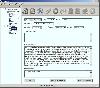 Application for geocaching or waymarking that allows you to import GPX or LOC files for editing. You can print out cheat sheets to take on the trail, export to KML or HTML, and send the data to your handheld GPS unit.
Platforms: Windows, Mac, Linux
| License: Freeware | Size: 19.78 MB | Download (52): TinyGPX Download |
Released: December 19, 2012
|
Added: December 19, 2012 | Visits: 640
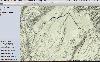
 PolarView is an efficient cross platform ENC chart planner. It supports ENC charts in S57 format (available from NOAA), raster charts in BSB format, as well as world wide standard S63 vector charts. PolarView includes Tides and Currents display, using the industry-standard TCD tide database...
Platforms: Mac
| License: Freeware | Size: 6.2 MB | Download (64): PolarView Download |
Released: October 23, 2012
|
Added: October 23, 2012 | Visits: 356
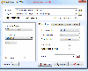
 Adze makes it easy to edit GPX files on your Mac. With intelligent editing tools, statistics calculation and integration with popular mapping tools, editing GPS data has never been more straight forward.
FEATURES
• Split, merge and d
Adze makes it easy to edit GPX files on your Mac. With intelligent editing tools, statistics calculation and integration with popular mapping tools, editing GPS data has never been more straight forward.
FEATURES
• Split, merge and d
Platforms: Mac
| License: Freeware | Size: 1.2 MB | Download (48): Adze Lite Download |
Added: August 27, 2013 | Visits: 474
GeoCosm is an Open Street Map map Viewer that allows the generation of GPX files containing waypoints. Helpfull when planning Caching tours for Geocaching. It allows the conversion of GeoCoordinates in different popular formats
Platforms: Mac
| License: Freeware | Size: 286.72 KB | Download (36): GeoCosm Download |
Added: October 08, 2013 | Visits: 461
NPGPX is a Qt-based Netscape plugin that displays GPX files (GPS eXchange) with waypoints, routes, and tracks embedded in a webpage, with optional background maps.
Platforms: *nix
| License: Freeware | Size: 81.92 KB | Download (37): NPGPX Download |
Released: November 07, 2014
|
Added: November 19, 2014 | Visits: 814
 Importation/Exportation: Import/export trails to gpx file. Unlimited number of trails, and TrackPoints. Export to gpx, Excel, PDF, XPS and KML/KMZ.
Data table: Very flexible data table that allows sorting by columns, with inheritance of data, attributes, etc.
Presentation on map: View...
Importation/Exportation: Import/export trails to gpx file. Unlimited number of trails, and TrackPoints. Export to gpx, Excel, PDF, XPS and KML/KMZ.
Data table: Very flexible data table that allows sorting by columns, with inheritance of data, attributes, etc.
Presentation on map: View...
Platforms: Windows, Windows 8, Windows 7, Windows Server
| License: Freeware | Size: 27.05 MB | Download (611): ediTrail Download |
Released: March 14, 2018
|
Added: June 20, 2018 | Visits: 797
 With Final Selection you can make the selection of your photos as you have always wanted!
- Create your selection of photos using the colors, give them a score using the stars and order them by dragging them to the position you want
- Save your projects for future revisions
- Add custom...
With Final Selection you can make the selection of your photos as you have always wanted!
- Create your selection of photos using the colors, give them a score using the stars and order them by dragging them to the position you want
- Save your projects for future revisions
- Add custom...
Platforms: Windows 8, Windows 7, Windows
| License: Freeware | Size: 11.67 MB | Download (155): Final Selection Download |
Released: April 22, 2008
|
Added: April 26, 2008 | Visits: 9.511
 The free AvisMap Viewer opens most GIS/CAD and raster image file types and most ArcView, ArcExplorer, and MapInfo projects. Besides just opening and viewing files, the Viewer supports an extensive list of features including visual layer properties control, legend control, thematic mapping,...
Platforms: Windows
| License: Freeware | Size: 22.28 MB | Download (1734): AvisMap Free Viewer Download |
Released: December 29, 2010
|
Added: January 06, 2011 | Visits: 4.315
 OkMap is a GPS and map software that:
-Works with vectorial maps and calibrates raster maps
-Organizes paths by creating waypoints, routes and tracks
-Uploads/downloads data to/from your GPS
-Uses altitude DEM data
-Supports GPS real-time navigation
-Sends/receives vehicles position...
OkMap is a GPS and map software that:
-Works with vectorial maps and calibrates raster maps
-Organizes paths by creating waypoints, routes and tracks
-Uploads/downloads data to/from your GPS
-Uses altitude DEM data
-Supports GPS real-time navigation
-Sends/receives vehicles position...
Platforms: Windows
| License: Freeware | Size: 20.25 MB | Download (1277): OkMap Download |
Added: August 31, 2008 | Visits: 3.344
GeoVisu is a visualization software for geographic data - graphic files, images and GPS. It provides real time GPS navigation (moving map - NMEA 0183 protocol or Garmin USB), displayed with diverse geographic data (MIF, GPX, NMEA, KML/KMZ, SHP, ECW, GeoTiff, MrSID). It can download waypoints,...
Platforms: Windows
| License: Freeware | Size: 1.5 MB | Download (1383): GeoVisu Download |
Added: August 19, 2010 | Visits: 1.220
GPS::Babel is a Perl interface to gpsbabel. SYNOPSIS use GPS::Babel; my $babel = GPS::Babel->new(); # Read an OZIExplorer file into a data structure my $data = $babel->read(route.ozi, ozi); # Convert a file automatically choosing input and output # format based on extension...
Platforms: *nix
| License: Freeware | Size: 10.24 KB | Download (120): GPS::Babel Download |
Added: July 11, 2010 | Visits: 1.231
GPSMap is a Java application that displays maps and shows your position with the aid of a GPS device. GPSMap project can track paths, load overlays (such as shape files), and download maps from the MapBlast and Expedia servers. Whats New in This Release: - Serial communication on Windows...
Platforms: *nix
| License: Freeware | Size: 4.4 MB | Download (152): GPSMap Download |
Added: January 15, 2010 | Visits: 1.141
Geo::Track::Log is a Perl module that represent track logs and find a location based on a track log and a date. SYNOPSIS use Geo::Track::Log; my $log = new Geo::Track::Log; # add a point to a track log. $log->addPoint( { timestamp => 2004-12-25 12:00:00, lat => 0.0, long=> 0.0, } );...
Platforms: *nix
| License: Freeware | Size: 17.41 KB | Download (100): Geo::Track::Log Download |
Added: January 25, 2010 | Visits: 648
Menu Tunes takes a direct copy of album and artist details from iTunes (from either the playlist or the iTunes Music Store (iTMS)) and finds online suppliers for the CDs. The name of the CD, the store(s) from which it is available, and the cost are all displayed in the menu. By selecting a store...
Platforms: Mac
| License: Freeware | Download (91): Tunes Menu Download |
Added: January 25, 2010 | Visits: 708
The Garmin iQue 3600 is a PalmOS 5 PDA with built-in GPS capabilities and comes with Windows software only. iQue Conduit allows you to export tracks and waypoints from the iQue to your Mac during a HotSync operation. Data is exported in the standard XML-based GPX format and can then be brought...
Platforms: Mac
| License: Freeware | Size: 115 KB | Download (102): iQue Conduit Download |
Added: January 25, 2010 | Visits: 1.085
PhotoInfoEditor is an easy to use meta-data editor for photo (JPEG/RAW/Tiff) files. The program is freeware, however, donatations can be made to help support future development.With PhotoInfoEditor you can add location and summary details to a JPEG/RAW or Tiff files. Location information consists...
Platforms: Mac
| License: Freeware | Download (150): PhotoInfoEditor Download |
Added: January 25, 2010 | Visits: 1.126
TrackRunner is a GPS-enabled exercise logbook.Coupled with a GPS receiver and using LoadMyTracks from ClueTrust to connect to your GPS device, you'll be able to log your workouts and keep track of distance, time, elevation, heart-rate etc. Activities can be organized into categories, and by...
Platforms: Mac
| License: Freeware | Download (112): TrackRunner Download |
Added: January 25, 2010 | Visits: 1.468
HoudahGPS allows you to transfer track log and waypoint data from your Garmin, Magellan or Wintec GPS devices. It connects via USB to the Garmin and Magellan devices. It interfaces with the Wintec WBT-100, WBT-101 and WBT-201 devices using Bluetooth. HoudahGPS may also be used to convert between...
Platforms: Mac
| License: Freeware | Download (122): HoudahGPS Download |
Released: November 23, 2012
|
Added: November 23, 2012 | Visits: 519
 The main purpose of this popular tool is to quickly and easily resize photos from a digital camera to a smaller size for further use (especially to share the photos on web or by email). Nevertheless, Jpeg Resampler 2010 also offers many other features such as
* convert between image formats...
The main purpose of this popular tool is to quickly and easily resize photos from a digital camera to a smaller size for further use (especially to share the photos on web or by email). Nevertheless, Jpeg Resampler 2010 also offers many other features such as
* convert between image formats...
Platforms: Windows
| License: Freeware | Size: 1.3 MB | Download (55): JPEG Resampler Download |
Released: June 25, 2012
|
Added: June 25, 2012 | Visits: 869
 The free AvisMap Viewer opens most GIS/CAD and raster image file types and most ArcView, ArcExplorer, and MapInfo projects. Besides just opening and viewing files, the Viewer supports an extensive list of features including visual layer properties control, legend control, thematic mapping,...
Platforms: Windows
| License: Freeware | Size: 23.17 MB | Download (449): Free Shapefile Viewer Download |