


Gps Waypoints freeware
Gps Waypoints
Released: August 03, 2012
|
Added: August 03, 2012 | Visits: 273
 TurboGPS is a Java application giving a comprehensive solution for GPS handling. This includes easy editing, sorting and displaying (on a map) waypoints. TurboGPS supports Garmin serial devices and WGS84/RT90 Datum.
Platforms: Windows, Mac, Linux
| License: Freeware | Size: 582.12 KB | Download (45): TurboGPS Download |
Added: August 27, 2013 | Visits: 474
 GeoCosm is an Open Street Map map Viewer that allows the generation of GPX files containing waypoints. Helpfull when planning Caching tours for Geocaching. It allows the conversion of GeoCoordinates in different popular formats
Platforms: Mac
| License: Freeware | Size: 286.72 KB | Download (36): GeoCosm Download |
Added: October 15, 2013 | Visits: 317
FlyHigh is the unique software on Linux that powers your Flytec 5020, 6015, Competino and IQ Basic from Brauniger. I am pleasured to present the next stable release of FlyHigh in version 0.8.2. This is a bugfix release. Update of pilot info, waypoints from routes are deleted on route deletion,...
Platforms: *nix
| License: Freeware | Size: 1.99 MB | Download (34): FlyHigh Download |
Added: September 19, 2013 | Visits: 352
MobileAction i-gotU Mac/Linux support igotu2gpx is a command-line utility to provide i-gotU GPS travel logger support under Linux and Mac OS X. At the moment, the following functionality is implemented: - access via serial port (Windows) or libusb (Linux) - dump of the internal flash memory -...
Platforms: *nix
| License: Freeware | Size: 235.52 KB | Download (34): igotu2gpx Download |
Added: June 19, 2013 | Visits: 348
OpenSource GPS is software for x86 PCs that allows you to acquire, track and demodulate signals from GPS satellites. OSGPS requires a Zarlink GP2021 12 channel GPS correlator chip or software receiver hardware such as the GPS1A, see www.gpscreations.
Platforms: *nix
| License: Freeware | Size: 30.57 MB | Download (37): OpenSourceGPS Download |
Released: December 03, 2014
|
Added: December 15, 2014 | Visits: 1.428
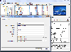
 SQL Database Studio is modern professional client for Microsoft SQL Server. It enables you to effectively work with SQL Database. SQL Database Studio contains advanced features such as database comparison, GPS visualization, table lookups, filters, dbshell extension and also features for basic...
Platforms: Windows, Windows 8, Windows 7
| License: Freeware | Size: 6.04 MB | Download (46): SQL Database Studio Download |
Added: August 25, 2006 | Visits: 3.828
 ommLog is a freeware used for record and monitor the data from serial port of PocketPC. It would be useful for record data from total station, GPS and other rs232 device connected to PDA.
Is is also useful for test the line of rs232 connected to PDA.
ommLog is a freeware used for record and monitor the data from serial port of PocketPC. It would be useful for record data from total station, GPS and other rs232 device connected to PDA.
Is is also useful for test the line of rs232 connected to PDA.
Platforms: Windows CE
| License: Freeware | Size: 65 KB | Download (1128): CommLog Download |
Released: July 04, 2011
|
Added: August 07, 2011 | Visits: 4.835
 Exif Pilot is a Free EXIF Editor that allows you to:
- View EXIF, EXIF GPS, IPTC, and XMP data.
- Edit, create EXIF, EXIF GPS and IPTC data.
- Edit some Makernote tags.
- Import/export from/to XML format.
- Import/export from/to MS Excel files.
- Import/export from/to a Text file in...
Exif Pilot is a Free EXIF Editor that allows you to:
- View EXIF, EXIF GPS, IPTC, and XMP data.
- Edit, create EXIF, EXIF GPS and IPTC data.
- Edit some Makernote tags.
- Import/export from/to XML format.
- Import/export from/to MS Excel files.
- Import/export from/to a Text file in...
Platforms: Windows
| License: Freeware | Size: 2.09 MB | Download (845): Exif Pilot Download |
Added: August 19, 2008 | Visits: 1.437
Opanda IExif is a professional browser to view the Exif/GPS/IPTC data in a digital image. Use it for reviewing and learning about the photographic technology via the EXIF data in digital images. Powerful and easy-use, a great tool for every shutterbug and photographer.
Platforms: Windows
| License: Freeware | Size: 942 KB | Download (164): Opanda IExif Download |
Added: August 18, 2008 | Visits: 1.093
GpsDiffuser is a software that diffuses real-time GPS data and can play files containing GPS data. Diffusion is done by sending sentences at format NMEA 0183 using UDP protocol. Diffused data comes either from a GPS receiver or source issuing on UDP in real time navigation mode, or from a...
Platforms: Windows
| License: Freeware | Size: 819 KB | Download (531): GpsDiffuser Download |
Added: August 27, 2008 | Visits: 1.084
USAPhotoMaps downloads aerial photo and topo map data from Microsoft's free TerraServer Web site, saves it on your hard drive, and creates seamless maps from it. You can - Scroll and zoom, See the latitude/longitude, Add waypoints, routes, and text, Jump to any waypoint or latitude/longitude in...
Platforms: Windows
| License: Freeware | Size: 314 KB | Download (505): USAPhotoMaps Download |
Added: August 04, 2008 | Visits: 2.755
This free program allows you to plan and record your trips with a GPS receiver and share your local knowledge of trails with others, you can also use the program to print topographic maps with these trails, either on a single page or, as a mosaic, on many sheets of paper. GPS Mapping Sofware...
Platforms: Windows
| License: Freeware | Size: 1024 KB | Download (626): Wissenbach Map Download |
Added: August 11, 2008 | Visits: 1.220
Exif Pilot Light allows you to view the EXIF, EXIF GPS and IPTC data.
Platforms: Windows
| License: Freeware | Size: 1.61 KB | Download (516): Exif Pilot Light Download |
Added: November 12, 2010 | Visits: 1.392
802.11b Network Discovery Tools is a gtk tool to scan for 802.11b networks using wavelan/aironet hardware and Linux wireless extensions. It includes the ability to log coordinates of found networks from a GPS device that is NMEA-compatible, and can be linked to a serial port. It currently logs...
Platforms: *nix
| License: Freeware | Size: 34.82 KB | Download (127): 802.11b Network Discovery Tools Download |
Added: July 11, 2010 | Visits: 1.231
GPSMap is a Java application that displays maps and shows your position with the aid of a GPS device. GPSMap project can track paths, load overlays (such as shape files), and download maps from the MapBlast and Expedia servers. Whats New in This Release: - Serial communication on Windows...
Platforms: *nix
| License: Freeware | Size: 4.4 MB | Download (152): GPSMap Download |
Added: April 23, 2010 | Visits: 1.414
nmeap is an extensible parser for NMEA-0183 (GPS) data, written in portable C. It has a small footprint, is portable, extensible, and I/O agnostic. It is suitable for Linux, Win32, and embedded systems. It has built in support for most useful standard NMEA sentences, and is extensible to add...
Platforms: *nix
| License: Freeware | Size: 29.7 KB | Download (145): nmeap Download |
Added: April 14, 2010 | Visits: 1.376
OpenDMTP is a protocol and framework that allows bi-directional data communications between servers and devices (clients) over the Internet and similar networks. OpenDMTP is particularly geared towards Location-based information (LBS) such as GPS, as well as temperature and other data collected...
Platforms: *nix
| License: Freeware | Size: 512 KB | Download (135): OpenDMTP Download |
Added: September 09, 2010 | Visits: 2.503
Geo::Gpx is a Perl module to create and parse GPX files. SYNOPSIS # Version 0.10 compatibility use Geo::Gpx; my $gpx = Geo::Gpx->new( @waypoints ); my $xml = $gpx->xml; # New API, generate GPX my $gpx = Geo::Gpx->new(); $gpx->waypoints(@wpt); my $xml = $gpx->xml(1.0); # Parse GPX...
Platforms: *nix
| License: Freeware | Size: 12.29 KB | Download (214): Geo::Gpx Download |
Added: January 25, 2010 | Visits: 1.033
TrailRunner is a route planning software for all kinds of long distance sports like running, biking, hiking, inline-skating, skiing and more. If you ever asked yourself how long your workout routes are and what route you should choose for this evening - then TrailRunner should be your...
Platforms: Mac
| License: Freeware | Download (123): TrailRunner Download |
Added: January 25, 2010 | Visits: 698
Mac SimpleGPS is Macintosh application designed to manage waypoints, routes and tracks on your GPSR (global positioning satellite receiver). The best use for Mac SimpleGPS is to download .LOC (waypoint location) files from GeoCaching.com and transfer them to your GPSr. It is also a great way to...
Platforms: Mac
| License: Freeware | Download (101): Mac SimpleGPS Download |