


Gis Metadata freeware
Gis Metadata
Released: April 22, 2008
|
Added: April 26, 2008 | Visits: 9.509
 The free AvisMap Viewer opens most GIS/CAD and raster image file types and most ArcView, ArcExplorer, and MapInfo projects. Besides just opening and viewing files, the Viewer supports an extensive list of features including visual layer properties control, legend control, thematic mapping,...
Platforms: Windows
| License: Freeware | Size: 22.28 MB | Download (1734): AvisMap Free Viewer Download |
Released: November 06, 2010
|
Added: November 11, 2010 | Visits: 1.067
 PDFSplit is a PDF processing utility.
Features:
-split a PDF document into pages
-PDF metadata editor
-standalone software (please check requirements)
-Adobe Acrobat or Adobe Reader not required
-can handle password protected PDF documents
-easy to use user interface
-the...
PDFSplit is a PDF processing utility.
Features:
-split a PDF document into pages
-PDF metadata editor
-standalone software (please check requirements)
-Adobe Acrobat or Adobe Reader not required
-can handle password protected PDF documents
-easy to use user interface
-the...
Platforms: Windows
| License: Freeware | Size: 31.02 MB | Download (1265): Workaholic.PDFSplit Download |
Released: June 14, 2016
|
Added: July 24, 2016 | Visits: 21.268
 Exif wMarker is a simple and user friendly tool to add a visible watermark to your images. The watermark text can be a fixed text (such as copyright or company web site), an image logo or the content of exif or iptc metadata fields. Exif wMarker allows you to batch process all images inside a...
Platforms: Windows, Windows 8, Windows 7
| License: Freeware | Size: 2.36 MB | Download (1248): Exif wMarker Download |
Added: November 04, 2006 | Visits: 4.512
 Metadata can get you into trouble!
Whenever an MS Office document is created it is complemented with such
properties as the author, corporate name, document changes, editing time
and other metadata. All this makes the private information available to a
third party that may put your company...
Metadata can get you into trouble!
Whenever an MS Office document is created it is complemented with such
properties as the author, corporate name, document changes, editing time
and other metadata. All this makes the private information available to a
third party that may put your company...
Platforms: Windows
| License: Freeware | Size: 628 KB | Download (1063): Metadata Analyzer Download |
Released: December 22, 2012
|
Added: December 22, 2012 | Visits: 546
 MusicBrainz
...is a user-maintained community music metadatabase
MusicBrainz provides a catalog of music metadata such as the artist name, the release title, and the list of tracks that appear on a release. Since 2005, users have the option to further relate each of these entities using a...
MusicBrainz
...is a user-maintained community music metadatabase
MusicBrainz provides a catalog of music metadata such as the artist name, the release title, and the list of tracks that appear on a release. Since 2005, users have the option to further relate each of these entities using a...
Platforms: Windows, Mac, Linux
| License: Freeware | Size: 15 MB | Download (932): MusicBrainz Tagger Download |
Released: July 04, 2011
|
Added: August 07, 2011 | Visits: 4.833
 Exif Pilot is a Free EXIF Editor that allows you to:
- View EXIF, EXIF GPS, IPTC, and XMP data.
- Edit, create EXIF, EXIF GPS and IPTC data.
- Edit some Makernote tags.
- Import/export from/to XML format.
- Import/export from/to MS Excel files.
- Import/export from/to a Text file in...
Exif Pilot is a Free EXIF Editor that allows you to:
- View EXIF, EXIF GPS, IPTC, and XMP data.
- Edit, create EXIF, EXIF GPS and IPTC data.
- Edit some Makernote tags.
- Import/export from/to XML format.
- Import/export from/to MS Excel files.
- Import/export from/to a Text file in...
Platforms: Windows
| License: Freeware | Size: 2.09 MB | Download (838): Exif Pilot Download |
Released: July 12, 2012
|
Added: July 12, 2012 | Visits: 1.327
 Winamp Meta Merger is designed as an accessible and handy software that allows the user to keep their Winamp Media-Library Meta-Data (like rating and play count) through file moves and renames.
Now you can use this simple application to save all your metadata.
Winamp Meta Merger is designed as an accessible and handy software that allows the user to keep their Winamp Media-Library Meta-Data (like rating and play count) through file moves and renames.
Now you can use this simple application to save all your metadata.
Platforms: Windows
| License: Freeware | Download (640): Winamp Meta Merger Download |
Added: August 18, 2008 | Visits: 1.357
 Genesis IV is a landscape database and graphics system particularly targeted at Professional GIS and Educational users. Create great graphics for your clients, enthuse and educate your students, or explore geographical data, GenesisIV is unique multifaceted software and much more than a simple...
Platforms: Windows
| License: Freeware | Size: 23.84 MB | Download (606): GenesisIV Download |
Released: November 22, 2012
|
Added: November 22, 2012 | Visits: 835
Completely free Print to PDF creator with multiple digital signing and trusted time-stamping. Easily create an Adobe PDF from any application that can print, with one click conversion from Microsoft Word and Excel. Create trusted electronic documents in professional quality - quickly and reliably...
Platforms: Windows
| License: Freeware | Size: 17.85 MB | Download (602): Software602 Print2PDF 9 Free Download |
Released: December 27, 2011
|
Added: January 03, 2012 | Visits: 1.559
 Kindlean is a cool add-on for your Kindle. It's a desktop app that allows to view and manage Kindle books and collections. Kindle allows to visualize your Kindle library, manage collections, search, sort book lists, create book ratings and edit book metadata (title, author, publisher, publish...
Platforms: Windows
| License: Freeware | Size: 5.67 MB | Download (582): Kindlean Download |
Released: June 05, 2012
|
Added: July 16, 2012 | Visits: 3.975
 InsideCAT is an automatic indexer/cataloguer program for all your PC disks (CD, DVD, BD, HD, USB, CD-Audio, folders...) with an excellent support for compressed and multimedia files. No typing needed!. It enables you to locate any file in a fast way. Never lose a file again!. A must-have if you...
Platforms: Windows
| License: Freeware | Size: 8.98 MB | Download (579): InsideCAT Lite Edition Download |
Released: June 08, 2012
|
Added: January 29, 2013 | Visits: 946
 A professional tool for digital image management to capture metadata from photos or other digitalized contents loading the extracted information into a relational database for sql specialized functions and full text image search. Kalimages PRO application has IPTC/IIM, IPTC Core and XMP support...
Platforms: Windows
| License: Freeware | Size: 4.63 MB | Download (561): Kalimages PRO Download |
Added: August 12, 2008 | Visits: 950
NewCyber3D provides full source code CDs covering a wide range of topics relevant to OpenGL GIS, terrain, stereo display, image processing and visualization. Each CD includes the entire OpenGL program and demonstrations with full source codes (including library source codes), project files,...
Platforms: Windows
| License: Freeware | Download (549): NewCyber3D Download |
Released: October 01, 2012
|
Added: October 01, 2012 | Visits: 377
 An expensive GIS software is maybe not suitable for your purpose. If you are using one for analysis or simulation and feeling one of these: huge, complicated, slow and unremovable, it's time to change. Why MicroCity? Versatile: Additional to fundamental GIS functions, many unique libraries such...
Platforms: Windows
| License: Freeware | Size: 3.95 MB | Download (538): Portable MicroCity Download |
Released: March 17, 2008
|
Added: March 19, 2008 | Visits: 2.465
 Alternate Data Streams (ADS) are pieces of info hidden as metadata on files on NTFS drives. They are not visible in Explorer and the size they take up is not reported by Windows. Recent browser hijackers started using ADS to hide their files, and very few anti-malware scanners detect this. Use...
Platforms: Windows
| License: Freeware | Size: 375.89 KB | Download (536): ADS Scanner Download |
Released: November 12, 2007
|
Added: May 10, 2008 | Visits: 1.982
 Ensure confidentiality of sensitive data by erasing files completely and securely.
Did you know that simply deleting a file in Windows does not do anything to its content? Anyone can recover the files you deleted, and get unrestricted access to your confidential information and sensitive...
Ensure confidentiality of sensitive data by erasing files completely and securely.
Did you know that simply deleting a file in Windows does not do anything to its content? Anyone can recover the files you deleted, and get unrestricted access to your confidential information and sensitive...
Platforms: Windows
| License: Freeware | Size: 360 KB | Download (536): Mareew Free Eraser Download |
Released: August 18, 2012
|
Added: August 18, 2012 | Visits: 364
 An expensive GIS software is maybe not suitable for your purpose. If you are using one for analysis or simulation and feeling one of these: huge, complicated, slow and unremovable, it's time to change. Why MicroCity? Versatile: Additional to fundamental GIS functions, many unique libraries such...
Platforms: Windows
| License: Freeware | Size: 3 MB | Download (530): MicroCity Download |
Released: November 04, 2012
|
Added: November 04, 2012 | Visits: 1.362
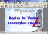 Software development kit for CAD/CAM/ GIS and graphic software developers. Converts from raster to vector and refines architect, mechanical, tech drawing, maps, math graphs, graphics for books and journals and more. ActiveX and Com Component are also available. Refines vector graphics, creates...
Platforms: Windows
| License: Freeware | Size: 2.67 MB | Download (526): Algolab Raster to Vector Conversion CAD/ Download |
Released: November 26, 2012
|
Added: November 26, 2012 | Visits: 546
Let this software and a GPS logger do the hard work of assigning precise Places metadata to your photos. Why import ungeotagged pictures into iPhoto, when its so straightforward to GPS-enable your favorite camera?
Geotagalogs sophisticated automatic geotagging technology combines locations from...
Platforms: Mac
| License: Freeware | Size: 13.8 MB | Download (498): Geotagalog for Mac OS Download |
Released: November 23, 2012
|
Added: November 23, 2012 | Visits: 408
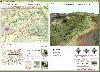
 The goal of VTP is to foster the creation of tools for easily constructing any part of the real world in interactive, 3D digital form.
This goal will require a synergetic convergence of the fields of CAD, GIS, visual simulation, surveying and remote sensing. VTP gathers information and tracks...
The goal of VTP is to foster the creation of tools for easily constructing any part of the real world in interactive, 3D digital form.
This goal will require a synergetic convergence of the fields of CAD, GIS, visual simulation, surveying and remote sensing. VTP gathers information and tracks...
Platforms: Windows
| License: Freeware | Size: 1024 KB | Download (496): Virtual Terrain Project for Windows 1.1 Download |