


Gis Examples freeware
Gis Examples
Released: August 16, 2012
|
Added: August 16, 2012 | Visits: 526
 uDig is a user-friendly desktop Internet GIS, a core element in an internet aware Geographic Information System.
The application is an open source spatial data viewer / editor, that comes with a special emphasis on the OpenGIS standards for internet GIS, the Web Map Server and Web Feature Server...
uDig is a user-friendly desktop Internet GIS, a core element in an internet aware Geographic Information System.
The application is an open source spatial data viewer / editor, that comes with a special emphasis on the OpenGIS standards for internet GIS, the Web Map Server and Web Feature Server...
Platforms: Windows
| License: Freeware | Download (439): uDig Download |
Released: August 06, 2012
|
Added: August 06, 2012 | Visits: 783
 This guide provides software, documentation, examples and VB6 source code for the integration of hand-held USB and keyboard emulation barcode scanners. Using these guidelines, hand held scanners may be easily integrated with existing or custom applications as input, automation and verification...
Platforms: Windows
| License: Freeware | Size: 30.72 KB | Download (63): USB Barcode Scanner Application Integrat Download |
Released: August 13, 2012
|
Added: August 13, 2012 | Visits: 513
DigiSigner Kit is a software development kit, which includes DigiSigner library, documentation and examples. With DigiSigner Kit you can start using DigiSigner functionality in your applications immediately.
The Demo Version of DigiSigner Kit contains the full functionality DigiSigner has to...
Platforms: Windows
| License: Freeware | Size: 4.8 MB | Download (52): DigiSigner Kit Download |
Released: November 05, 2012
|
Added: November 05, 2012 | Visits: 655
 *Dozens of hours of Online Video Help for detailed examples and explanation.*Ask for changes-done in days6 products built-in, priced for your needs.*File SyncForce*File SyncForce SourceForce*File SyncForce Powerbuilder*File SyncForce FTP*File SyncForce Pro*File SyncForce Dest Move/RenameFreeware...
Platforms: Windows
| License: Freeware | Size: 2.5 MB | Download (47): File SyncForce Pro Download |
Released: October 17, 2012
|
Added: October 17, 2012 | Visits: 860
![]() Icons-Land Company advertises exclusive set of icons - Vista Style Points of Interest Icon Set V2. The images are represented in 4 variations of colors (green, blue, red, orange) and 2 variations of backgrounds (plain and circled). Colors variety helps distinguishing the same objects on the map...
Icons-Land Company advertises exclusive set of icons - Vista Style Points of Interest Icon Set V2. The images are represented in 4 variations of colors (green, blue, red, orange) and 2 variations of backgrounds (plain and circled). Colors variety helps distinguishing the same objects on the map...
Platforms: Windows, Mac, Linux, Handheld/Mobile Other, Java
| License: Freeware | Size: 17.49 MB | Download (61): Icons-Land Vista Style POI Icon Set Download |
Released: October 01, 2012
|
Added: October 01, 2012 | Visits: 945
 Visual Graph is a standard ActiveX component for developing graphics-related applications of various industries, such as power, coal, chemical, automation monitor, simulation, graphical modeling, graphical topology analysis, vector drawing, tables, geographic information system (GIS), workflow,...
Platforms: Windows
| License: Freeware | Size: 6.66 MB | Download (68): Visual Graph ActiveX Component Download |
Released: August 14, 2012
|
Added: August 14, 2012 | Visits: 922
MSP Development System is a optimizing C compiler that includes Micro-IDE (a Windows-based Integrated Development Environment), Serial Loaders, Terminal; Complete online documentation, Project Examples. for WindowsAll
Platforms: Windows
| License: Freeware | Download (60): MSP Development System Download |
Released: September 14, 2012
|
Added: September 14, 2012 | Visits: 305
GeoPhyloBuilder was specially designed as an accessible and handy extension for ArcGIS.
GeoPhyloBuilder is a tool that allows you to build a spatiotemporal phylogeographic GIS model from a tree and a set of geographical features.
Platforms: Windows, 2K, XP, Windows Vista, 7
| License: Freeware | Download (46): GeoPhyloBuilder Download |
Released: November 09, 2012
|
Added: November 09, 2012 | Visits: 813
 MPEG-4 Player with SMR decoder and examples. Symbolic Music Representation (SMR) is integrated into MPEG-4 by 1) defining an XML format for a text based symbolic music representation, to be used for interoperability with other symbolic music representation/notation formats and as a source for the...
Platforms: Windows
| License: Freeware | Size: 19.85 MB | Download (50): MPEG-4 Player with SMR Decoder Download |
Released: October 01, 2012
|
Added: October 01, 2012 | Visits: 377
 An expensive GIS software is maybe not suitable for your purpose. If you are using one for analysis or simulation and feeling one of these: huge, complicated, slow and unremovable, it's time to change. Why MicroCity? Versatile: Additional to fundamental GIS functions, many unique libraries such...
Platforms: Windows
| License: Freeware | Size: 3.95 MB | Download (538): Portable MicroCity Download |
Released: August 18, 2012
|
Added: August 18, 2012 | Visits: 365
 An expensive GIS software is maybe not suitable for your purpose. If you are using one for analysis or simulation and feeling one of these: huge, complicated, slow and unremovable, it's time to change. Why MicroCity? Versatile: Additional to fundamental GIS functions, many unique libraries such...
Platforms: Windows
| License: Freeware | Size: 3 MB | Download (530): MicroCity Download |
Released: June 06, 2012
|
Added: June 06, 2012 | Visits: 719
 Donkey Kong is one of the earliest examples of the platform genre (it is sometimes said to be the first platform game, although it was preceded by Space Panic).Competitive video gamers and referees stress the game's high level of difficulty compared to other classic arcade games. Winning the game...
Platforms: Windows
| License: Freeware | Size: 3.36 MB | Download (54): Donkey Kong Online Download |
Released: July 17, 2012
|
Added: July 17, 2012 | Visits: 480
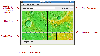 JMARS is an acronym that stands for Java Mission-planning and Analysis for Remote Sensing. It is a geospatial information system (GIS) developed by ASU's Mars Space Flight Facility to provide mission planning and data-analysis tools to NASA's orbiters, instrument team members, students of all...
Platforms: Windows, Mac, Linux
| License: Freeware | Size: 52.2 MB | Download (48): JMARS Download |
Released: December 27, 2012
|
Added: December 27, 2012 | Visits: 498
 SplitFile's goal is to split (chop) big file in smaller segments to be able to store them in floppy disks or CD (these are just examples).
The main feature if compared to other programs like this, is the ability to support very large files( up to 9,223,372,036,854,775,807 bytes = 8589934591 GB ,...
SplitFile's goal is to split (chop) big file in smaller segments to be able to store them in floppy disks or CD (these are just examples).
The main feature if compared to other programs like this, is the ability to support very large files( up to 9,223,372,036,854,775,807 bytes = 8589934591 GB ,...
Platforms: Windows, Edition 2005,Edition 2005
| License: Freeware | Size: 355 KB | Download (45): SplitFile Download |
Released: June 01, 2012
|
Added: June 01, 2012 | Visits: 438
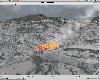
 The goal of VTP is to foster the creation of tools for easily constructing any part of the real world in interactive, 3D digital form.
This goal will require a synergetic convergence of the fields of CAD, GIS, visual simulation, surveying and remote sensing. VTP gathers information and tracks...
The goal of VTP is to foster the creation of tools for easily constructing any part of the real world in interactive, 3D digital form.
This goal will require a synergetic convergence of the fields of CAD, GIS, visual simulation, surveying and remote sensing. VTP gathers information and tracks...
Platforms: Mac, Linux
| License: Freeware | Size: 2.2 MB | Download (422): Virtual Terrain Project for Mac OS X and Linux 1.1 Download |
Released: November 23, 2012
|
Added: November 23, 2012 | Visits: 411
 The goal of VTP is to foster the creation of tools for easily constructing any part of the real world in interactive, 3D digital form.
This goal will require a synergetic convergence of the fields of CAD, GIS, visual simulation, surveying and remote sensing. VTP gathers information and tracks...
The goal of VTP is to foster the creation of tools for easily constructing any part of the real world in interactive, 3D digital form.
This goal will require a synergetic convergence of the fields of CAD, GIS, visual simulation, surveying and remote sensing. VTP gathers information and tracks...
Platforms: Windows
| License: Freeware | Size: 1024 KB | Download (496): Virtual Terrain Project for Windows 1.1 Download |
Released: July 18, 2012
|
Added: July 18, 2012 | Visits: 310
A collection of examples demonstrating the use of the Alternativa Flash 3D engine.
Platforms: Windows, Mac, Linux
| License: Freeware | Size: 1.52 MB | Download (48): Alternativa Tutorials Download |
Released: October 20, 2012
|
Added: October 20, 2012 | Visits: 590
The Open1451 Project provides a repository for implementations, examples, and applications of the IEEE 1451 Standard for a Smart Transducer Interface for Sensors and Actuators.
Platforms: Windows, Mac, BSD, Linux
| License: Freeware | Size: 277.11 KB | Download (50): An Open Implementation of IEEE 1451 Download |
Released: July 11, 2012
|
Added: July 11, 2012 | Visits: 387
Contextor is a light-weight simple-to-use Java based library to help developers and researchers working with the general concept of a resource; as examples, resources can be text resources, web resources, images and videos.
Platforms: Windows, Mac, Linux
| License: Freeware | Size: 1.18 MB | Download (48): Contextor Download |
Released: June 13, 2012
|
Added: June 13, 2012 | Visits: 406
Crossbar is a collection of example applications written for Java Server Faces (JSF) and Java Server Pages (JSP).
Platforms: Windows, Mac, Linux
| License: Freeware | Size: 2.15 MB | Download (47): Crossbar JSF Examples Download |