


Gis freeware
Gis
Released: November 03, 2015
|
Added: November 30, 2015 | Visits: 3.068
 EWD 3D is a 3D CAD program. The software contains the major CAD functions (line, arc, polyline, spline, face, 3D solid, 3D Surface). Support boolean operation, undo/redo, drag/drop, OSNAP. And have good interactive,easy to use UI.
Version EWD 3D 5.7.5 Nov.03 2015
.Fixed bug of view...
EWD 3D is a 3D CAD program. The software contains the major CAD functions (line, arc, polyline, spline, face, 3D solid, 3D Surface). Support boolean operation, undo/redo, drag/drop, OSNAP. And have good interactive,easy to use UI.
Version EWD 3D 5.7.5 Nov.03 2015
.Fixed bug of view...
Platforms: Windows, Windows 7
| License: Freeware | Size: 14.3 MB | Download (3290): EWD 3D Download |
Released: April 22, 2008
|
Added: April 26, 2008 | Visits: 9.509
 The free AvisMap Viewer opens most GIS/CAD and raster image file types and most ArcView, ArcExplorer, and MapInfo projects. Besides just opening and viewing files, the Viewer supports an extensive list of features including visual layer properties control, legend control, thematic mapping,...
Platforms: Windows
| License: Freeware | Size: 22.28 MB | Download (1734): AvisMap Free Viewer Download |
Released: September 17, 2021
|
Added: November 18, 2023 | Visits: 4.131
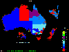 OzGIS is an extensive system for the analysis and display of geographically
referenced data. About 150 menus provide an enormous range of options for:
. importing data from databases, spreadsheets and Geographic Information
Systems (GISs) or downloaded from Census Bureaux or mapping...
OzGIS is an extensive system for the analysis and display of geographically
referenced data. About 150 menus provide an enormous range of options for:
. importing data from databases, spreadsheets and Geographic Information
Systems (GISs) or downloaded from Census Bureaux or mapping...
Platforms: Windows, Windows 8, Windows 7, Windows Server
| License: Freeware | Size: 313 KB | Download (1146): OzGIS Download |
Released: January 24, 2011
|
Added: February 17, 2011 | Visits: 2.463
 GPS log-maker. Software create *.plt track file, *.rte route file and, optionally, NMEA-log file.
The program from TL_Gate*.cab can work via COM-port or Franson GpsGate software API, but it requires installed GpsGate in any case. If GpsGate is installed the best way is to use it.
TrackLog...
GPS log-maker. Software create *.plt track file, *.rte route file and, optionally, NMEA-log file.
The program from TL_Gate*.cab can work via COM-port or Franson GpsGate software API, but it requires installed GpsGate in any case. If GpsGate is installed the best way is to use it.
TrackLog...
Platforms: Windows
| License: Freeware | Size: 91.3 KB | Download (1002): DXsoft TrackLog Download |
Released: November 11, 2005
|
Added: September 06, 2006 | Visits: 6.027
 Vector Graphics ActiveX is professional graphics solution for creating business and technical drawings and the most powerful for today. It provides 500+ methods, properties and events and is fully object oriented. Developers get full control of all objects at run time and can process graphic...
Platforms: Windows
| License: Freeware | Size: 5.93 MB | Download (765): Vector Graphics ActiveX Download |
Added: August 18, 2008 | Visits: 1.357
 Genesis IV is a landscape database and graphics system particularly targeted at Professional GIS and Educational users. Create great graphics for your clients, enthuse and educate your students, or explore geographical data, GenesisIV is unique multifaceted software and much more than a simple...
Platforms: Windows
| License: Freeware | Size: 23.84 MB | Download (606): GenesisIV Download |
Released: December 10, 2012
|
Added: December 10, 2012 | Visits: 798
 Xeus is a comprehensive solution designed for RF Engineers by RF Engineers. Xeus heightens engineering productivity by providing a PC based solution that intelligently post processes and analyzes multiple network data’s, including network configuration data, measurement recording data and drive...
Platforms: Windows
| License: Freeware | Size: 94.77 MB | Download (575): Xeus Download |
Released: July 01, 2005
|
Added: March 03, 2006 | Visits: 3.955
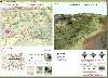
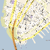
 A good travelogue often requires a map showing the destinations or route. With MapCreator you can create the maps necessary for this purpose. The map type, extract and scale are freely adjustable. The maps are of a very high quality and can be used in all media without query and cost.
Platforms: Windows
| License: Freeware | Size: 29.61 MB | Download (565): MapCreator Free Edition Download |
Added: August 12, 2008 | Visits: 950
NewCyber3D provides full source code CDs covering a wide range of topics relevant to OpenGL GIS, terrain, stereo display, image processing and visualization. Each CD includes the entire OpenGL program and demonstrations with full source codes (including library source codes), project files,...
Platforms: Windows
| License: Freeware | Download (549): NewCyber3D Download |
Released: October 01, 2012
|
Added: October 01, 2012 | Visits: 377
 An expensive GIS software is maybe not suitable for your purpose. If you are using one for analysis or simulation and feeling one of these: huge, complicated, slow and unremovable, it's time to change. Why MicroCity? Versatile: Additional to fundamental GIS functions, many unique libraries such...
Platforms: Windows
| License: Freeware | Size: 3.95 MB | Download (538): Portable MicroCity Download |
Released: October 25, 2012
|
Added: October 25, 2012 | Visits: 791
 StatPlanet Map Maker is a free program for creating highly interactive Flash maps which can be published online. A stand-alone offline version is also included. Data can be imported automatically, so new interactive maps can be created within minutes. Maps are completely customizable. Use the...
Platforms: Windows
| License: Freeware | Size: 7.4 MB | Download (534): StatPlanet Map Maker Download |
Released: August 18, 2012
|
Added: August 18, 2012 | Visits: 364
 An expensive GIS software is maybe not suitable for your purpose. If you are using one for analysis or simulation and feeling one of these: huge, complicated, slow and unremovable, it's time to change. Why MicroCity? Versatile: Additional to fundamental GIS functions, many unique libraries such...
Platforms: Windows
| License: Freeware | Size: 3 MB | Download (530): MicroCity Download |
Released: November 04, 2012
|
Added: November 04, 2012 | Visits: 1.362
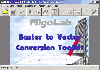 Software development kit for CAD/CAM/ GIS and graphic software developers. Converts from raster to vector and refines architect, mechanical, tech drawing, maps, math graphs, graphics for books and journals and more. ActiveX and Com Component are also available. Refines vector graphics, creates...
Platforms: Windows
| License: Freeware | Size: 2.67 MB | Download (526): Algolab Raster to Vector Conversion CAD/ Download |
Added: September 25, 2006 | Visits: 6.303
 GeoBase is a high performance OEM tool for embedding GIS functions in client and server applications. GeoBase has a small memory footprint - both on the hard disk for storage and in RAM during use. Compatible with both .NET and Linux, GeoBase is designed for a rapid development cycle and low...
Platforms: Windows, Windows CE
| License: Freeware | Size: 106.11 MB | Download (512): GeoBase Download |
Released: November 23, 2012
|
Added: November 23, 2012 | Visits: 410
 The goal of VTP is to foster the creation of tools for easily constructing any part of the real world in interactive, 3D digital form.
This goal will require a synergetic convergence of the fields of CAD, GIS, visual simulation, surveying and remote sensing. VTP gathers information and tracks...
The goal of VTP is to foster the creation of tools for easily constructing any part of the real world in interactive, 3D digital form.
This goal will require a synergetic convergence of the fields of CAD, GIS, visual simulation, surveying and remote sensing. VTP gathers information and tracks...
Platforms: Windows
| License: Freeware | Size: 1024 KB | Download (496): Virtual Terrain Project for Windows 1.1 Download |
Released: November 16, 2012
|
Added: November 16, 2012 | Visits: 488
 The goal of VTP is to foster the creation of tools for easily constructing any part of the real world in interactive, 3D digital form.
This goal will require a synergetic convergence of the fields of CAD, GIS, visual simulation, surveying and remote sensing. VTP gathers information and tracks...
The goal of VTP is to foster the creation of tools for easily constructing any part of the real world in interactive, 3D digital form.
This goal will require a synergetic convergence of the fields of CAD, GIS, visual simulation, surveying and remote sensing. VTP gathers information and tracks...
Platforms: Mac, Linux
| License: Freeware | Size: 2.2 MB | Download (492): Virtual Terrain Project for Mac OS X and Linux Download |
Released: July 25, 2012
|
Added: July 25, 2012 | Visits: 653
The GUI geo-browser for seamlessly browsing in the sea of the distributed geographical information spread over the internet (Globalbase server network). Including contents are different kind from Google Earth or the other systems. For example, old aerial photographs, old maps, archeological...
Platforms: Mac
| License: Freeware | Size: 9.8 MB | Download (468): Cosmos Globalbase Browser for Mac OS Download |
Released: October 22, 2012
|
Added: October 22, 2012 | Visits: 585
IrriPro is the only software that let you design an irrigation system only by drawing the elements: now it's possible, thanks to the INDO technology (Irrigation Network Data Object) developed by Irriworks, to draw the elements of a system (such as outlets, pipes, etc) and of a terrain, not only...
Platforms: Windows
| License: Freeware | Size: 161 MB | Download (467): IrriPro Download |
Released: October 24, 2012
|
Added: October 24, 2012 | Visits: 673
 QGIS supports vector, raster, and database formats and lets you browse and create map data on your computer.
Quantum GIS (QGIS) supports many common spatial data formats (e.g. ESRI ShapeFile, geotiff). QGIS supports plugins to do things like display tracks from your GPS.
QGIS aims to be an...
QGIS supports vector, raster, and database formats and lets you browse and create map data on your computer.
Quantum GIS (QGIS) supports many common spatial data formats (e.g. ESRI ShapeFile, geotiff). QGIS supports plugins to do things like display tracks from your GPS.
QGIS aims to be an...
Platforms: Linux
| License: Freeware | Size: 1024 KB | Download (460): Quantum GIS form Linux Download |
Released: October 21, 2012
|
Added: October 21, 2012 | Visits: 739
Thuban is an interactive geographic data viewer (GIS viewer) which features methods to visualize, explore, and analyze geographic information.
Thuban is an Interactive Geographic Data Viewer with the following features:
# Vector Data Support: Shapefile, PostGIS Layer and OGR
# Raster Data...
Platforms: Linux
| License: Freeware | Size: 1.18 MB | Download (458): Thuban for Linux Download |