


Geospatial freeware
Geospatial
Added: October 21, 2013 | Visits: 403
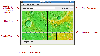
 OpenEV is a software library and application for viewing and analysing raster and vector geospatial data. OpenEV is used by private companies, universities, governments and non-profit organizations around the world. OpenEV is both: * An application for displaying and analysing geospatial data...
Platforms: *nix
| License: Freeware | Size: 24.36 MB | Download (34): OpenEV Download |
Added: June 11, 2010 | Visits: 1.004
GeoServer project connects your information to the Geospatial Web. With GeoServer, you can publish and edit data using open standards. Your information is made available in a large variety of formats as maps/images or actual geospatial data. GeoServers transactional capabilities offer robust...
Platforms: *nix
| License: Freeware | Size: 25.9 MB | Download (105): GeoServer Download |
Added: January 25, 2010 | Visits: 728
GRASS GIS, commonly referred to as GRASS (Geographic Resources Analysis Support System), is a Geographic Information System (GIS) used for geospatial data management and analysis, image processing, graphics/maps production, spatial modeling, and visualization. GRASS is currently used in academic...
Platforms: Mac
| License: Freeware | Download (116): GRASS GIS Download |
Released: June 21, 2012
|
Added: June 21, 2012 | Visits: 911
 Commonly referred to as GRASS, this is a free Geographic Information System (GIS) used for geospatial data management and analysis, image processing, graphics/maps production, spatial modeling, and visualization. GRASS is currently used in academic and commercial settings around the world, as...
Platforms: Mac
| License: Freeware | Size: 59 MB | Download (57): Grass GIS for Mac OS X Download |
Released: July 17, 2012
|
Added: July 17, 2012 | Visits: 482
 JMARS is an acronym that stands for Java Mission-planning and Analysis for Remote Sensing. It is a geospatial information system (GIS) developed by ASU's Mars Space Flight Facility to provide mission planning and data-analysis tools to NASA's orbiters, instrument team members, students of all...
Platforms: Windows, Mac, Linux
| License: Freeware | Size: 52.2 MB | Download (48): JMARS Download |
Released: December 16, 2012
|
Added: December 16, 2012 | Visits: 307
CAVOR is an engine for building apps that involve both graphic and text/numeric data. Primarily GIS is the initial focus, but consider also CAD, CASE, project management (eg PERT charts), and others. Built-in scripting, C API, also supports Tcl and Java.
Platforms: Mac, BSD, Linux
| License: Freeware | Size: 314.04 KB | Download (48): Cavor geospatial app engine Download |
Released: December 19, 2012
|
Added: December 19, 2012 | Visits: 300
 GeoKettle is a powerful, metadata-driven spatial ETL (Extract, Transform and Load) tool dedicated to the integration of different data sources for building and updating geospatial databases, data warehouses and services.
Platforms: Windows, Mac, Linux
| License: Freeware | Size: 151.84 MB | Download (46): GeoKettle Download |
Released: November 14, 2012
|
Added: November 14, 2012 | Visits: 514
 Spatial Data Integrator(SDI) is an ETL tool for geospatial. Based on Talend Open Studio, input, output and transform geocomponents are available. IO components read/write GIS formats(eg.PostGIS, GeoRSS). Transformers allow feature manipulation(eg.buf
Platforms: Windows, Mac, Linux
| License: Freeware | Size: 61.02 MB | Download (44): Spatial Data Integrator Download |
Added: September 27, 2013 | Visits: 426
GeoAlchemy is a SQLAlchemy extension that provides support for Geospatial data types at the ORM layer using SQLAlchemy. It aims to support spatial operations and relations specified by the Open Geospatial Consortium (OGC). Installation: To install type as usual: easy_install GeoAlchemy Or,...
Platforms: *nix
| License: Freeware | Size: 20.48 KB | Download (47): GeoAlchemy Download |
Added: October 07, 2013 | Visits: 222
WMS UniPortal is a unified geospatial portal which is focusing on OGC Web Services to allow users to search their interested WMS in a comprehensive WMS library efficiently. Go to http://eie.cos.gmu.edu/WMSUniPortal/ to check the operational instance
Platforms: *nix
| License: Freeware | Size: 24.83 MB | Download (33): WMS UniPortal Download |
Added: May 27, 2010 | Visits: 1.037
ferris-fnews provides a RSS news feed aggregator and archiver. ferris-fnews is an RSS news feed aggregator and archiver. It can poll RSS news feeds and make them available as a filesystem. In non technical terms libferris makes the file system and other hierarchical storage systems easier to...
Platforms: *nix
| License: Freeware | Size: 163.84 KB | Download (97): ferris-fnews Download |
Added: July 20, 2010 | Visits: 1.015
ferrisfuse is a FUSE module for mounting libferris filesystems through the Linux kernel. About libferris In non technical terms libferris makes the file system and other hierarchical storage systems easier to use. For the geeks out there, libferris is a virtual file system (VFS) that runs in...
Platforms: *nix
| License: Freeware | Size: 276.48 KB | Download (91): ferrisfuse Download |
Added: January 14, 2010 | Visits: 1.206
OGDI is the Open Geographic Datastore Interface. OGDI is an application programming interface (API) that uses a standardized access methods to work in conjunction with GIS software packages (the application) and various geospatial data products. OGDI uses a client/server architecture to...
Platforms: *nix
| License: Freeware | Size: 911.36 KB | Download (91): Open Geographic Datastore Interface Download |
Added: February 05, 2010 | Visits: 774
Geotools is an open source Java GIS toolkit for developing standards compliant solutions. GeoTools project provides an implementation of Open Geospatial Consortium (OGC) specifications as they are developed. Geotools maintains an open development process, with public collaboration on new ideas...
Platforms: *nix
| License: Freeware | Size: 26 MB | Download (113): GeoTools Download |
Added: March 09, 2010 | Visits: 589
Xj3D is a project focussed on creating a toolkit for VRML97 and X3D content written completely in Java. This toolkit may be used to the import VRML content into your custom application, or to create a fully-fledged browser. Development is financially supported through a number of institutes and...
Platforms: *nix
| License: Freeware | Size: 12 MB | Download (107): Xj3D Download |
Added: January 25, 2010 | Visits: 802
TNTmap... View maps, images, and other geodata as layers in Google Maps, Google Earth, TNTmap Open, or TNTmap Viewer from any site offering them via a Web Map Service (WMS). Web sites offering their geodata via a WMS are publishing their layers in compliance with ISO standard 19128 (see Open...
Platforms: Mac
| License: Freeware | Download (123): TNTmap Widget Download |
Released: May 29, 2012
|
Added: July 21, 2012 | Visits: 687
 Apache Solr is the popular, blazing fast open source enterprise search platform from the Apache Lucene project. Its major features include powerful full-text search, hit highlighting, faceted search, dynamic clustering, database integration, rich document (e.g., Word, PDF) handling, and...
Platforms: Windows
| License: Freeware | Size: 71.94 MB | Download (83): BitNami Apache Solr Stack Download |
Released: August 16, 2012
|
Added: August 16, 2012 | Visits: 529
uDig is a user-friendly desktop Internet GIS, a core element in an internet aware Geographic Information System.
The application is an open source spatial data viewer / editor, that comes with a special emphasis on the OpenGIS standards for internet GIS, the Web Map Server and Web Feature Server...
Platforms: Windows
| License: Freeware | Download (439): uDig Download |
Released: July 05, 2012
|
Added: July 05, 2012 | Visits: 449
View VRML and X3D 3D files. Now has improved support for Geospatial nodes, required for X3D-Earth rendering. Also has MIDI and ReWire support, to enable control by/of MIDI devices, and software such as Propellerheads Reason.
- Various bugs and code improvements; Viewpoint and ViewpointGroup...
Platforms: Mac
| License: Freeware | Size: 10.5 MB | Download (413): FreeWRL VRML/X3D Viewer for Mac OS Download |
Released: July 04, 2012
|
Added: July 04, 2012 | Visits: 352
 What is OpenEV?
OpenEV is a software library and application for viewing and analysing raster and vector geospatial data.
OpenEV is used by private companies, universities, governments and non-profit organizations around the world. OpenEV is both:
* An application for displaying and...
What is OpenEV?
OpenEV is a software library and application for viewing and analysing raster and vector geospatial data.
OpenEV is used by private companies, universities, governments and non-profit organizations around the world. OpenEV is both:
* An application for displaying and...
Platforms: Windows
| License: Freeware | Size: 13.5 MB | Download (46): OpenEV for Windows Download |