


Geological freeware
Geological
Added: September 10, 2006 | Visits: 3.270
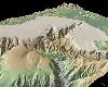
 A photo slideshow screen saver with beautiful NASA/JPL radar images of geological formations around the world. All photos are high-quality images. Other features include transition effects, black and white mode, password use, and extract photos as wallpaper, including built-in wallpaper cycling...
Platforms: Windows
A photo slideshow screen saver with beautiful NASA/JPL radar images of geological formations around the world. All photos are high-quality images. Other features include transition effects, black and white mode, password use, and extract photos as wallpaper, including built-in wallpaper cycling...
Platforms: Windows
| License: Freeware | Size: 1.73 MB | Download (170): Awesome Geology from Space Screen Saver Download |
Released: June 08, 2012
|
Added: June 08, 2012 | Visits: 373
 A collection of Dashboard Widgets generally focused on displaying information provided by the United States Geological Survey (USGS). Examples include river levels information of interest to whitewater kayakers amongst others.
Platforms: Mac
A collection of Dashboard Widgets generally focused on displaying information provided by the United States Geological Survey (USGS). Examples include river levels information of interest to whitewater kayakers amongst others.
Platforms: Mac
| License: Freeware | Size: 188.87 KB | Download (48): Water Widgets Download |
Added: August 07, 2013 | Visits: 401
Intended for 3D geological/geophysical visualisation of layered data and will eventually form part of a geophysical visualisation package.Run ThreedDemo to get an idea of how to use. INPUTS: LayerN: The number of the layer to be plotted R: a m*n*k matrix of colour/resistivity data for each layer...
Platforms: Matlab
| License: Freeware | Size: 10 KB | Download (49): Surf3D Download |
Added: January 25, 2010 | Visits: 849
Mt. St. Helens VolcanoCam Widget is more than just a simple webcam, this widget displays a half-size static image from the Mount St. Helens Volcanocam, as well as the current volcano Alert Level as assigned by the US Geological Survey. The Alert Level is not available on the volcanocam site, but...
Platforms: Mac
| License: Freeware | Download (87): Mt. St. Helens VolcanoCam Widget Download |
Added: January 25, 2010 | Visits: 601
The Whitewater Widget lets you check the flows of your favorite rivers right from your Dashboard. The widget downloads data from the USGS (United States Geological Survey) and graphs it in real time.Features:Real-time graphingSwitch between CFS and FTAdd, Edit and Delete your favorite riversmore...
Platforms: Mac
| License: Freeware | Download (101): Whitewater Widget Download |
Released: September 26, 2012
|
Added: September 26, 2012 | Visits: 538
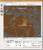
 GeoMapApp is an earth science exploration and visualization application that is continually being expanded as part of the Marine Geoscience Data System (MGDS) at the Lamont-Doherty Earth Observatory of Columbia University.
The application provides direct access to the Global Multi-Resolution...
Platforms: Windows
GeoMapApp is an earth science exploration and visualization application that is continually being expanded as part of the Marine Geoscience Data System (MGDS) at the Lamont-Doherty Earth Observatory of Columbia University.
The application provides direct access to the Global Multi-Resolution...
Platforms: Windows
| License: Freeware | Size: 9 MB | Download (446): GeoMapApp Download |
Released: October 17, 2012
|
Added: October 17, 2012 | Visits: 426
Create the GeoDatabase for the entire world. This program create the geographical location Latitude, Longitude, and Altitude (Elevation) for every city, village, region, state, county in the World. The program crawls the data from the website www.heavens-above.com which collect data from US...
Platforms: Windows
| License: Freeware | Size: 1.11 MB | Download (45): GeoMaker Download |
Released: November 20, 2012
|
Added: November 20, 2012 | Visits: 393
 GPlates is an interactive plate-tectonics visualisation program. GPlates enables interactive visualisation and manipulation of the plate-tectonic reconstructions of geological and paleo-geographic features through geological time.
Platforms: Windows, Mac, Linux
GPlates is an interactive plate-tectonics visualisation program. GPlates enables interactive visualisation and manipulation of the plate-tectonic reconstructions of geological and paleo-geographic features through geological time.
Platforms: Windows, Mac, Linux
| License: Freeware | Size: 5.51 MB | Download (50): GPlates Download |
Released: November 12, 2012
|
Added: November 12, 2012 | Visits: 390
This project provides a library written in Python for reading and eventually writing ISO8211 files. ISO8211 is a format used for various GIS systems (geographic data), including SDTS, the format used by the US Geological Survey.
Platforms: Windows, Mac, Linux
| License: Freeware | Size: 70.75 KB | Download (45): Python ISO8211 Library Download |
Released: August 06, 2012
|
Added: August 06, 2012 | Visits: 459
River Levels widget provides an easy way to monitor the amount of water flowing in your favorite streams and rivers right from your Dashboard. The River Levels widget is of particular interest to whitewater kayakers and canoeists.
Once any United States Geological Survey (USGS) stream-gauge...
Platforms: Mac
| License: Freeware | Size: 174.08 KB | Download (47): River Levels Download |
Added: May 22, 2013 | Visits: 352
Conversions of these routines into Matlab.From:http://pubs.usgs.gov/of/1995/ofr-95-0077/o...77.htmlAnderson, W.L, 1983, Fourier cosine and sine transforms using lagged convolutions in double-precision (Subprograms DLAGFO/DLAGF1): U.S. Geological Survey Open-File Report 83-320, 38 p. 026 DLAGF0/...
Platforms: Matlab
| License: Freeware | Size: 51.2 KB | Download (44): dlagf01 Download |
Added: May 30, 2013 | Visits: 488
ffA provide world leading 3D Seismic Analysis Software and Services to the oil and gas industry.ffA software extracts geological features from 3D seismic data, objectively and more rapidly than with conventional techniques to help geoscientists and engineers to make better decisions with higher...
Platforms: Matlab
| License: Freeware | Size: 10 KB | Download (49): Read and write ffA volume formats Download |
Added: April 03, 2013 | Visits: 402
This function plots sand, silt and clay fraction data on a ternary plot that is marked with the Shepard classification scheme labels from his article:Shepard, F.P., 1954, Nomenclature based on sand-silt-clay ratios: Journal Sedimentary Petrology, v. 24, p. 151-158.This function is merely a...
Platforms: Matlab
| License: Freeware | Size: 10 KB | Download (45): Shepard_Ternary_Plot Download |
Added: June 18, 2013 | Visits: 502
Dwarf Fortress is a single-player fantasy game. You can control a dwarven outpost or an adventurer in a randomly generated, persistent world. Although Dwarf Fortress is still in a work in progress, many features have already been implemented. * The world is randomly generated with distinct...
Platforms: *nix
| License: Freeware | Size: 9.85 MB | Download (39): Dwarf Fortress for Linux Download |