


Garmin Geocaching freeware
Garmin Geocaching
Released: November 23, 2012
|
Added: November 23, 2012 | Visits: 257
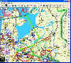
 With OpenStreetMap.org, you can export maps (for free) in XML OSM format. These maps are pretty handy - but if you want to load them onto your GPS, this free utility will allow you to easily convert the OSM files to IMG files which you can import into your Garmin GPS.
Platforms: Mac
| License: Freeware | Size: 2.5 MB | Download (511): OSMtoIMG for Mac OS Download |
Released: October 22, 2012
|
Added: October 22, 2012 | Visits: 419
An intuitive geocache management and planning tool. Manage all your Geocaches from one place. Send only the caches you want to your GPS receiver. When you're done Geocaching, download them to Geocache Manager to automatically update your finds. Import Geocaches from queries, .loc or .gpx files....
Platforms: Mac
| License: Freeware | Size: 5 MB | Download (497): Geocache Manager for Mac OS Download |
Released: September 07, 2012
|
Added: September 07, 2012 | Visits: 474
A powerful and flexible journal application that allows all levels of athletes and fitness enthusiasts to get the most from their training and racing. It allows you to easily and quickly track your training, monitor your progress, and built a history of your training. You can manually enter your...
Platforms: Mac
| License: Freeware | Size: 20 MB | Download (485): iSMARTtrain for Mac OS Download |
Released: September 21, 2012
|
Added: September 21, 2012 | Visits: 697
 PocketFMS is the Moving Map and Flight Planning tool for PC, Tablet PC, UMPC, Pocket PC and Windows CE-based Car Navigation equipment. It comprises downloadable, worldwide maps, access to a comprehensive AeroDatabase, integrated & graphical weather with 48 hours prognosis, TCAS info and...
Platforms: Windows, Pocket PC
| License: Freeware | Size: 34.55 MB | Download (65): PocketFMS Download |
Released: July 16, 2012
|
Added: July 16, 2012 | Visits: 468
 ITN Converter is both a route converter supporting many formats and a simple and efficient route planner. The converter supports routes file formats (roadbook) from many GPS or mapping software, the most popular are TomTom, Navigon, Garmin, MapPoint or MapSource. This converter can easily...
Platforms: Windows
| License: Freeware | Download (410): ITN Converter Download |
Released: July 12, 2012
|
Added: July 12, 2012 | Visits: 485
 ITN Converter is both a route converter supporting many formats and a simple and efficient route planner. The converter supports routes file formats (roadbook) from many GPS or mapping software, the most popular are TomTom, Navigon, Garmin, MapPoint or MapSource. This converter can easily...
Platforms: Windows
| License: Freeware | Download (414): ITN Converter Portable Download |
Released: November 12, 2012
|
Added: November 12, 2012 | Visits: 485
 Create and edit waypoints, tracklogs, routes, and insert scanned images of map. More than 160 GPS models recognized. Garmin, Magellan, Eagle and others
- Most complete free program for GPS devices
- Compatible with more than 160 GPS models
- Support for Garmin, Magellan and others
- Easily...
Create and edit waypoints, tracklogs, routes, and insert scanned images of map. More than 160 GPS models recognized. Garmin, Magellan, Eagle and others
- Most complete free program for GPS devices
- Compatible with more than 160 GPS models
- Support for Garmin, Magellan and others
- Easily...
Platforms: Windows
| License: Freeware | Size: 54.92 MB | Download (57): GPS TrackMaker Download |
Released: August 20, 2012
|
Added: August 20, 2012 | Visits: 697
 Free serial port monitor software lets you troubleshoot communications problems and log data from RS232, RS422, RS485 and Modbus instruments. Control the state of the PC's serial port output lines and see the state of the serial port input lines. Free technical support for life. Understands...
Platforms: Windows
| License: Freeware | Size: 10.66 MB | Download (53): ComDebug Download |
Released: January 11, 2013
|
Added: January 11, 2013 | Visits: 728
 Super GPS Store Search Helps You Find The Best Deals On GPS's Search though thousands of GPS related products with ease. Shopping Secured By Amazon.com All this in this free application, requires no install, has no adware or spyware.
Platforms: Windows
| License: Freeware | Size: 756 KB | Download (517): Super GPS Store Search Software Download |
Released: December 11, 2012
|
Added: December 11, 2012 | Visits: 288
Python script for Geocachers. Takes GPX file (eg from Geotoad), downloads waypoints to Garmin Etrex, and produces OpenOffice quick-reference document with the descriptions and hints.
Platforms: Windows, Mac, BSD, Linux
| License: Freeware | Size: 5.52 KB | Download (49): Cache and Carry Download |
Released: October 11, 2012
|
Added: October 11, 2012 | Visits: 402
EPS is a moving map project. If can use GPS units (currently GARMIN).
Platforms: Windows, Mac, Linux
| License: Freeware | Size: 1.26 MB | Download (44): EPS - The Elgaard Positioning System Download |
Released: November 05, 2012
|
Added: November 05, 2012 | Visits: 310
Java base GPS Waypoint manipulation.Provides a toolkit for managing a variety of GPS Waypoint input formats like GPX, used by ExpertGPS and GeoCaching.com, as well as conversion formats for certain GPS devices.Similar in goals to gpsbabel.
Platforms: Windows, Mac, Linux
| License: Freeware | Size: 4.58 MB | Download (43): GPS Blender Download |
Released: October 23, 2012
|
Added: October 23, 2012 | Visits: 391
Converts Google Earth KML file to a CSV file, and vice versa. This enables you to plot all custom POIs with Google Earth first before transferring them into your Garmin GPS using the POI Loader.
Platforms: Windows, Mac, BSD, Linux
| License: Freeware | Size: 273.25 KB | Download (43): KMLCSV Converter Download |
Released: August 03, 2012
|
Added: August 03, 2012 | Visits: 273
 TurboGPS is a Java application giving a comprehensive solution for GPS handling. This includes easy editing, sorting and displaying (on a map) waypoints. TurboGPS supports Garmin serial devices and WGS84/RT90 Datum.
Platforms: Windows, Mac, Linux
| License: Freeware | Size: 582.12 KB | Download (45): TurboGPS Download |
Added: May 10, 2013 | Visits: 290
These tracks are intended to be visualised on maps, plotted as distance/altitude profiles, have statistics derived from them, etc.The 'base' trackfield CCK field knows about latitude, longitude, altitude and distance.Due to the flexibility of the system, the distance/altitude pairs can be...
Platforms: Windows, Mac, *nix, PHP, BSD Solaris
| License: Freeware | Download (54): Trackfield 5.x-0.5 Download |
Added: August 22, 2013 | Visits: 432
I wrote GPS Inspector as an experiment to learn more about GPS and how it could be used within JAVA. I figured others might find it useful or interesting so I have posted the source (GPLv3) and binaries here. It uses parts of other java libraries including: World Wind Java, Gpsylon, JFreeChart,...
Platforms: Mac
| License: Freeware | Size: 6.08 MB | Download (44): Gps Inspector Download |
Added: November 23, 2013 | Visits: 575
GiPSy Flight Manager is an extension for FireFox web browser that provides: * downloading flight tracklogs from your GPS instrument and creating IGC in a very easy and intuitive way * well arranged and usable logbook of all your flights * route optimization - you can compute the best route...
Platforms: Mac
| License: Freeware | Size: 7.61 MB | Download (83): GiPSy Flight Manager Download |
Added: June 24, 2013 | Visits: 473
* Downloads ride data directly from the CycleOps PowerTap and the SRM PowerControl. * Imports ride data downloaded with other programs, including TrainingPeaks WKO+ and the manufacturers' software for the Ergomo, Garmin, Polar, PowerTap, and SRM devices. * Provides a rich set of analysis...
Platforms: Mac
| License: Freeware | Size: 11.38 MB | Download (38): Golden Cheetah Download |
Added: October 20, 2013 | Visits: 361
Over a year ago I announced that mkgmap would require Java 1.6 "soon". Well that time is now finally here and further releases will no longer work on Java 1.5 Version 1.6 has been out for nearly three years now and so most people will have it already. Indeed Sun is no longer supporting 1.5 after...
Platforms: *nix
| License: Freeware | Size: 1.98 MB | Download (45): mkgmap Download |
Released: October 01, 2014
|
Added: December 24, 2014 | Visits: 2.365
 MyRouteOnline is an easy to use route planner that that allows you to plan routes from Excel spreadsheet. Excel Add-in that uploads addresses and saves time, fuel and money by helping you map multiple locations and find the best route. Online route planning goes far beyond paper maps or a GPS...
Platforms: Windows, Windows 8, Windows 7
| License: Freeware | Size: 3.11 MB | Download (128): MyRouteOnline Excel Add-in Route Planner Download |