


Convert Gps Coordinates Map freeware
Convert Gps Coordinates Map
Added: August 08, 2013 | Visits: 674
 ECEF2LLA - convert earth-centered earth-fixed (ECEF) cartesian coordinates to latitude, longitude, and altitude.USAGE:[lat,lon,alt] = ecef2lla(x,y,z)lat = geodetic latitude (radians)lon = longitude (radians)alt = height above WGS84 ellipsoid (m)x = ECEF X-coordinate (m)y = ECEF Y-coordinate (m)z...
Platforms: Matlab
| License: Freeware | Size: 10 KB | Download (42): Convert Cartesian (ECEF) Coordinates to lat, lon, alt Download |
Added: September 11, 2013 | Visits: 510
Convert ECI (CIS, Epoch J2000.0) Coordinates to WGS 84 (CTS, ECEF) Coordinates. This function has been vectorized for speed.Example Function Call:>> [r_ECEF v_ECEF] = ECItoECEF(JD,r_ECI,v_ECI);Where:JD is the Julian Date vector [1 x N] (units are in days)r_ECI is the position vector [3 x N] (any...
Platforms: Matlab
| License: Freeware | Size: 10 KB | Download (46): Convert ECI to ECEF Coordinates Download |
Added: October 25, 2010 | Visits: 969
Geo::Coordinates::VandH is a Perl module that can convert and manipulate telco V and H coordinates. SYNOPSIS To convert V: 5498 H: 2895 to lat/long coordinates: use Geo::Coordinates::VandH; $blah=new Geo::Coordinates::VandH; ($lat,$lon) = $blah->vh2ll(5498,2895); printf...
Platforms: *nix
| License: Freeware | Size: 4.1 KB | Download (115): Geo::Coordinates::VandH Download |
Added: September 18, 2010 | Visits: 1.593
GPS::Lowrance::Trail is a Perl module to convert between GDM16 Trails and other formats. Installation: Installation is pretty standard: perl Makefile.PL make make test make install There is no test suite to speak of. One will be added in a later version. SYNOPSIS use...
Platforms: *nix
| License: Freeware | Size: 8.19 KB | Download (113): GPS::Lowrance::Trail Download |
Released: April 24, 2013
|
Added: May 12, 2013 | Visits: 2.304
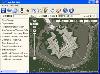 Arm Map Explorer recreates all the functionalities of Google Maps on your desktop while expanding them with new extras. Map Explorer lets you locate and view any place on the planet using dynamic interactive maps. These maps are draggable, which means there is no need for you to click and wait...
Platforms: Windows
| License: Freeware | Size: 5.46 MB | Download (197): Arm Map Explorer Download |
Released: November 17, 2009
|
Added: April 17, 2010 | Visits: 2.519
 CopanMobile for Pocket PC is a very functional and easy-to-use geomatics engineering tool for computing and managing plane surveying and mapping coordinates.
It does numerous coordinate geometry (COGO) calculations, processes and adjusts raw field survey data, computes and adjusts map...
CopanMobile for Pocket PC is a very functional and easy-to-use geomatics engineering tool for computing and managing plane surveying and mapping coordinates.
It does numerous coordinate geometry (COGO) calculations, processes and adjusts raw field survey data, computes and adjusts map...
Platforms: Pocket PC, Windows
| License: Freeware | Size: 662.68 KB | Download (1153): CopanMobile for PocketPC Download |
Released: May 01, 2011
|
Added: May 23, 2011 | Visits: 1.401
 Convert ESRI ShapeFiles (.SHP) geolocation data into AnyMap format to be used with AnyChart. AnyChart Flash Map Converter allows making use of a wide choice of maps with AnyChart Flash Component, a GIS visualization system that recognizes map data in AnyMap format only. AnyChart Flash Map...
Platforms: Windows
| License: Freeware | Size: 1.62 MB | Download (126): AnyChart Flash Map Converter Download |
Released: October 23, 2012
|
Added: October 23, 2012 | Visits: 650
GPS Utility is an easy-to-use application that provides management and manipulation of GPS information. You can use it to transfer data to/from a GPS receiver and store the data in PC files in one of several text formats.
The program converts between different map datums and many coordinate...
Platforms: Windows
| License: Freeware | Size: 1.87 MB | Download (469): GPS Utility Download |
Released: November 12, 2012
|
Added: November 12, 2012 | Visits: 485
 Create and edit waypoints, tracklogs, routes, and insert scanned images of map. More than 160 GPS models recognized. Garmin, Magellan, Eagle and others
- Most complete free program for GPS devices
- Compatible with more than 160 GPS models
- Support for Garmin, Magellan and others
- Easily...
Create and edit waypoints, tracklogs, routes, and insert scanned images of map. More than 160 GPS models recognized. Garmin, Magellan, Eagle and others
- Most complete free program for GPS devices
- Compatible with more than 160 GPS models
- Support for Garmin, Magellan and others
- Easily...
Platforms: Windows
| License: Freeware | Size: 54.92 MB | Download (57): GPS TrackMaker Download |
Added: August 20, 2013 | Visits: 514
With this plugin you can have Instant GPS Tracking for your WordPress site. (Extended version of GEOTAG plugin.). You can add coordinates to your posts and display maps with these positions. On these maps you can also display KML/KMZ files or the geotags of the images of your post. The plugin...
Platforms: PHP
| License: Freeware | Size: 10 KB | Download (52): Transportlines.com Free Fleet GPS Tracking - Geotag Download |
Added: August 13, 2013 | Visits: 615
BP Member Map allows people on a BuddyPress site to have a map of their location on their profile. It uses the Google location API to convert real-world addresses into latitude and longitude coordinates.Installation :WordPress 2.8.5 and above * Install the plugin into the bp-member-map directory,...
Platforms: PHP
| License: Freeware | Size: 10 KB | Download (56): BP Member Map Download |
Added: November 11, 2013 | Visits: 502
Bit Map Imager was developed as a companion tool to the iOS application 'Bit Map' which can use OZF2 and OZFX3 files (amongst others) to view map images on the iPhone and iPad, but is also a useful standalone tool for anyone who has any need to view or convert OZF2 or OZFX3 files on Mac OS X. It...
Platforms: Mac
| License: Freeware | Size: 645.12 KB | Download (40): Bit Map Imager Download |
Released: February 01, 2006
|
Added: November 12, 2006 | Visits: 10.965
 This program is a software to minimalizatiom logic function by karnaugh map and use bool algebra. This program can minimalize, draw, write and convert logic function. We are support some PLCs and program can convert logic function to XPRO and HYPEL programs.
Platforms: Windows
| License: Freeware | Size: 253.91 KB | Download (4140): Karnaugh map Download |
Added: August 19, 2010 | Visits: 1.220
GPS::Babel is a Perl interface to gpsbabel. SYNOPSIS use GPS::Babel; my $babel = GPS::Babel->new(); # Read an OZIExplorer file into a data structure my $data = $babel->read(route.ozi, ozi); # Convert a file automatically choosing input and output # format based on extension...
Platforms: *nix
| License: Freeware | Size: 10.24 KB | Download (120): GPS::Babel Download |
Added: January 09, 2010 | Visits: 1.040
Convert::Translit, transliterate, build_substitutes is a Perl module for string conversion among numerous character sets. SYNOPSIS use Convert::Translit; $translator = new Convert::Translit($result_chset); $translator = new Convert::Translit($orig_chset, $result_chset); $translator = new...
Platforms: *nix
| License: Freeware | Size: 79.87 KB | Download (103): Convert::Translit Download |
Added: January 06, 2010 | Visits: 976
GoooooPS is a Java MIDlet that displays a position obtained from a GPS receiver on a Google Map Tile..
Platforms: *nix
| License: Freeware | Size: 13.31 KB | Download (110): GoooooPS Download |
Added: May 13, 2010 | Visits: 1.336
GPS::Lowrance is a Perl module connect to Lowrance and Eagle GPS devices. REQUIREMENTS The following modules are required to use this module: Carp::Assert GPS::Lowrance::LSI 0.23 Parse::Binary::FixedFormat Win32::SerialPort or Device::SerialPort If you will be using the...
Platforms: *nix
| License: Freeware | Size: 22.53 KB | Download (139): GPS::Lowrance Download |
Added: March 17, 2010 | Visits: 1.178
Math::Bezier::Convert is a Perl module to convert cubic and quadratic bezier each other. SYNOPSIS use Math::Bezier::Convert; @new_cubic = divide_cubic($cx1, $cy1, $cx2, $cy2, $cx3, $cy3, $cx4, $cy4, $t); @new_quad = divide_quadratic($cx1, $cy1, $cx2, $cy2, $cx3, $cy3, $t); @quad =...
Platforms: *nix
| License: Freeware | Size: 6.14 KB | Download (99): Math::Bezier::Convert Download |
Released: December 22, 2011
|
Added: January 24, 2012 | Visits: 1.462
 Land surveyors and civil engineers:
o Calculate surveys and manage points, effortlessly
o Run Copan on Windows 2K/XP/Vista/7
o Use it forever and pay nothing
o Choose quadrant bearings or N/S azimuths, and gons or DMS
o Create point files quickly and easily
o Edit...
Land surveyors and civil engineers:
o Calculate surveys and manage points, effortlessly
o Run Copan on Windows 2K/XP/Vista/7
o Use it forever and pay nothing
o Choose quadrant bearings or N/S azimuths, and gons or DMS
o Create point files quickly and easily
o Edit...
Platforms: Windows
| License: Freeware | Size: 5.44 MB | Download (977): Copan Lite Download |
Released: May 28, 2012
|
Added: July 18, 2012 | Visits: 1.068
 RouteConverter displays, modifies, enriches and converts GPS data between over 75 formats. It works without installation under Linux, Mac OS X and Windows, automatically detects the format of a file, supports drag and drop, undo and redo, offers a map view onto the positions of routes, tracks and...
Platforms: Windows, Mac, *nix, Windows 7, Solaris,FreeBSD,OpenBSD,Java
| License: Freeware | Size: 6.61 MB | Download (162): RouteConverter Download |