


Convert Coordinates Latitude Longitude freeware
Convert Coordinates Latitude Longitude
Released: September 08, 2009
|
Added: September 14, 2009 | Visits: 3.870
 PhotoGPSEditor is an easy to use meta-data editor for photo (JPEG, RAW) files, plus it can match data from GPS (gpx or NMEA) files. The program is freeware, however, donations can be made to help support future development. With PhotoGPSEditor you can add location and summary details to a...
Platforms: Mac
| License: Freeware | Size: 2.39 MB | Download (1330): PhotoGPSEditor Download |
Added: January 18, 2010 | Visits: 1.447
 Religion::Islam::Qibla is a Perl module that calculates the Muslim Qiblah Direction, Great Circle Distance, and Great Circle Direction. SYNOPSIS use Religion::Islam::Qibla; #create new object with default options, Destination point is Kabah Lat=21 Deg N, Long 40 Deg E my $qibla =...
Platforms: *nix
| License: Freeware | Size: 4.1 KB | Download (266): Religion::Islam::Qibla Download |
Added: May 10, 2013 | Visits: 489
Future versions of Location beyond v3 will be dependent on the Geo module.InstallationUnpack in your modules folder (usually /sites/all/modules/) and enable under Administer > Site Building > Modules. Key features "location": - stores human-readable addresses ("123 Main St.") - contains...
Platforms: Windows, Mac, *nix, PHP, BSD Solaris
| License: Freeware | Download (54): location 6.x-3.0-test3 / 5.x-3.0-test3 Download |
Added: July 17, 2013 | Visits: 283
A wordpress widget that retrieve images from Panoramio API.HOW TOTo display the widget, add a custom field to a post called "panoramio". The value of panoramio should be the coordinate to the area that you want to display pictures from. The value should be formatted like this: X:YIt is also...
Platforms: PHP
| License: Freeware | Size: 10 KB | Download (47): Panoramio Images Download |
Added: May 05, 2013 | Visits: 399
This is a simple module to let users store their location on the edit account page. It uses HTML5d-deOaos geolocation API and stores latitude and longitude. How you use that data is up to other modules.
Platforms: PHP
| License: Freeware | Size: 20.48 KB | Download (46): HTML5 user geolocation Download |
Added: August 25, 2013 | Visits: 389
Geobaza is the software for identifying geolocation by IP-address, developed and supported by CN-Software Ltd. Taking a certain IP-address, Geobaza outputs its local registration data*a country and a city with geographic coordinates. Features . Includes 2,459,551 records (IP-addresses...
Platforms: *nix
| License: Freeware | Size: 10.24 KB | Download (35): GeobazaDjango Download |
Added: January 25, 2010 | Visits: 693
CoordinatesX is an application that transforms geodetic and Cartesian coordinates. It will make the conversions from Geodetic latitude, longitude and heights to planet centered Cartesian coordinates and vice versa. Works for various planetary ellipsoids, including user defined...
Platforms: Mac
| License: Freeware | Download (165): CoordinatesX Download |
Added: March 29, 2013 | Visits: 483
A collection of geodetic functions that solve a variety of problems in geodesy. Supports a wide range of common and user-defined reference ellipsoids. Most functions are vectorized. Functions include:Angle Conversions deg2rad - Degrees to radians dms2deg - Degrees,minutes,seconds to degrees...
Platforms: Matlab
| License: Freeware | Size: 40.96 KB | Download (46): Geodetic Toolbox Download |
Released: November 07, 2014
|
Added: November 19, 2014 | Visits: 814
 Importation/Exportation: Import/export trails to gpx file. Unlimited number of trails, and TrackPoints. Export to gpx, Excel, PDF, XPS and KML/KMZ.
Data table: Very flexible data table that allows sorting by columns, with inheritance of data, attributes, etc.
Presentation on map: View...
Importation/Exportation: Import/export trails to gpx file. Unlimited number of trails, and TrackPoints. Export to gpx, Excel, PDF, XPS and KML/KMZ.
Data table: Very flexible data table that allows sorting by columns, with inheritance of data, attributes, etc.
Presentation on map: View...
Platforms: Windows, Windows 8, Windows 7, Windows Server
| License: Freeware | Size: 27.05 MB | Download (611): ediTrail Download |
Released: January 07, 2006
|
Added: July 18, 2006 | Visits: 11.416
 GeoDataSource Free Cities Edition provides geographical database of world features, cities with place names and region names. Free database of worldwide cities in text format suitable for any applications requiring a comprehensive list of cities and country code. It is a subset of the paid...
Platforms: DOS, OS/2, BeOS, Palm OS, Windows, Mac, *nix, Windows CE
| License: Freeware | Size: 25 KB | Download (1196): World Cities Database (Free Edition) Download |
Released: January 08, 2006
|
Added: August 03, 2006 | Visits: 2.384
 IP2Location Desktop translates IP address to country, city, region, latitude, longitude, ZIP code, ISP and domain name using XML Web Service. Users can perform 90 queries per month using Free account. Please visit http://www.fraudlabs.com for more information.
Platforms: Windows
| License: Freeware | Size: 796 KB | Download (174): IP2Location Geolocation Web Service (Desktop Application) Download |
Added: August 27, 2008 | Visits: 1.085
USAPhotoMaps downloads aerial photo and topo map data from Microsoft's free TerraServer Web site, saves it on your hard drive, and creates seamless maps from it. You can - Scroll and zoom, See the latitude/longitude, Add waypoints, routes, and text, Jump to any waypoint or latitude/longitude in...
Platforms: Windows
| License: Freeware | Size: 314 KB | Download (505): USAPhotoMaps Download |
Added: August 17, 2008 | Visits: 997
IPSearchLight is a software component used to identify the geographic location of website visitors, often within a few miles from the exact location. The process utilizes each visitor's IP address; this technique is silent and unintrusive. IPSearchLight is ideal for practical applications like...
Platforms: Windows
| License: Freeware | Size: 8.74 KB | Download (447): IPSearchLight GeoLocator for ASP.NET 2.0 Download |
Added: January 09, 2010 | Visits: 1.134
Geo::Lookup::ByTime is a Perl module to lookup location by time. SYNOPSIS use Geo::Lookup::ByTime; $lookup = Geo::Lookup::ByTime->new( @points ); my $pt = $lookup->nearest( $tm ); Given a set of timestamped locations guess the location at a particular time. This is a useful operation...
Platforms: *nix
| License: Freeware | Size: 15.36 KB | Download (94): Geo::Lookup::ByTime Download |
Added: August 24, 2010 | Visits: 1.489
GIS::Distance::Vincenty Perl module contains Thaddeus Vincenty distance calculations. SYNOPSIS my $calc = GIS::Distance::Vincenty->new(); my $distance = $calc->distance( $lon1, $lat1 => $lon2, $lat2 ); For the benefit of the terminally obsessive (as well as the genuinely needy), Thaddeus...
Platforms: *nix
| License: Freeware | Size: 8.19 KB | Download (125): GIS::Distance::Vincenty Download |
Added: September 07, 2010 | Visits: 1.215
libipgeo library is written on top of the IP2LOCATION database allowing the user to do geo-targeting of IP addresses. For a given IPv4 address, libipgeo can lookup the following: Country Code Country Region City Latitude Longitude ISP NEW:libipgeo now searchs the IP2LOCATION database in...
Platforms: *nix
| License: Freeware | Size: 133.12 KB | Download (132): ipgeo Download |
Added: July 07, 2010 | Visits: 847
Fracplanet is an interactive tool for creating random fractal planets and terrain areas with oceans, rivers, lakes and icecaps. The results can be saved in POV-Ray format. The code is licensed under the GPL. Fracplanet project uses Qt and OpenGL. Whats New in This Release: - The main...
Platforms: *nix
| License: Freeware | Size: 68.61 KB | Download (135): Fracplanet Download |
Added: August 05, 2010 | Visits: 665
OpenGuides is a wiki-like package for maintaining a collaborative city guide. It is written in Perl and runs as a CGI program, and uses either the MySQL, PostgreSQL, or SQLite database. OpenGuides offers features over a "normal" wiki such as metadata management and a "find nearby things"...
Platforms: *nix
| License: Freeware | Size: 94.21 KB | Download (87): OpenGuides Download |
Added: January 25, 2010 | Visits: 1.304
GPS Connect is a freeware program for Mac OS X which offers connectivity to Garmin GPS receivers. The intended use is to backup waypoints from the GPS to your computer. Downloaded waypoints may be saved in a native file format or exported to a variety of other formats such as tab-delimited,...
Platforms: Mac
| License: Freeware | Size: 1.2 MB | Download (108): GPS Connect Download |
Released: October 22, 2012
|
Added: October 22, 2012 | Visits: 465
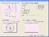 Shadows is a program used to design sundials and astrolabes. It can be used by everybody without any required technical skills. Shadows will calculate everything and print the drawing according the user's preferences. Shadows is used by thousands of users around the world.
Shadows offers a...
Shadows is a program used to design sundials and astrolabes. It can be used by everybody without any required technical skills. Shadows will calculate everything and print the drawing according the user's preferences. Shadows is used by thousands of users around the world.
Shadows offers a...
Platforms: Windows
| License: Freeware | Size: 7.5 MB | Download (457): Shadows Download |