


Aviation Handheld Gps freeware
Aviation Handheld Gps
Added: August 21, 2013 | Visits: 432
 The avdbtools package (short for aviation database tools) is a collection of software designed to assist in creating and maintaining databases for aviation applications. As of this release, avdbtools consists of a single application that converts the National Airspace Data files distributed by...
Platforms: *nix
| License: Freeware | Size: 122.88 KB | Download (37): avdbtools Download |
Added: July 03, 2013 | Visits: 736
OpenWiz is a project assist the development of open source software for the GamePark Holdings Wiz handheld machine. We will maintain public access to the kernel sources as well as providing alternate firmwares, development tools and documentation.
Platforms: *nix
| License: Freeware | Size: 68.29 MB | Download (35): OpenWiz Download |
Added: June 19, 2013 | Visits: 348
OpenSource GPS is software for x86 PCs that allows you to acquire, track and demodulate signals from GPS satellites. OSGPS requires a Zarlink GP2021 12 channel GPS correlator chip or software receiver hardware such as the GPS1A, see www.gpscreations.
Platforms: *nix
| License: Freeware | Size: 30.57 MB | Download (37): OpenSourceGPS Download |
Added: September 16, 2013 | Visits: 350
Ramdisk Rescue allows Embedded Linux to be installed to a flash card (SD, MMC or CF) using a handheld, without requiring a separate computer to format the card.
Platforms: *nix
| License: Freeware | Size: 3.54 MB | Download (44): RamdiskRescue Download |
Released: December 03, 2014
|
Added: December 15, 2014 | Visits: 1.428
 SQL Database Studio is modern professional client for Microsoft SQL Server. It enables you to effectively work with SQL Database. SQL Database Studio contains advanced features such as database comparison, GPS visualization, table lookups, filters, dbshell extension and also features for basic...
Platforms: Windows, Windows 8, Windows 7
| License: Freeware | Size: 6.04 MB | Download (46): SQL Database Studio Download |
Released: March 15, 2012
|
Added: August 23, 2014 | Visits: 8.634
 With VisualVision's EBooksWriter you can create ebooks with ease.
It's a professional all-in-one (edit, protect, pack / compile) visual environment, not just a compiler:
- you build compact self extracting ebooks with one click; also mobi and epub ebooks for handheld and smartphones, Kindle,...
With VisualVision's EBooksWriter you can create ebooks with ease.
It's a professional all-in-one (edit, protect, pack / compile) visual environment, not just a compiler:
- you build compact self extracting ebooks with one click; also mobi and epub ebooks for handheld and smartphones, Kindle,...
Platforms: Windows, Windows 7, Windows Server, Other
| License: Freeware | Size: 2.4 MB | Download (2282): eBooksWriter LITE Download |
Added: August 25, 2006 | Visits: 3.828
 ommLog is a freeware used for record and monitor the data from serial port of PocketPC. It would be useful for record data from total station, GPS and other rs232 device connected to PDA.
Is is also useful for test the line of rs232 connected to PDA.
ommLog is a freeware used for record and monitor the data from serial port of PocketPC. It would be useful for record data from total station, GPS and other rs232 device connected to PDA.
Is is also useful for test the line of rs232 connected to PDA.
Platforms: Windows CE
| License: Freeware | Size: 65 KB | Download (1128): CommLog Download |
Released: July 04, 2011
|
Added: August 07, 2011 | Visits: 4.835
 Exif Pilot is a Free EXIF Editor that allows you to:
- View EXIF, EXIF GPS, IPTC, and XMP data.
- Edit, create EXIF, EXIF GPS and IPTC data.
- Edit some Makernote tags.
- Import/export from/to XML format.
- Import/export from/to MS Excel files.
- Import/export from/to a Text file in...
Exif Pilot is a Free EXIF Editor that allows you to:
- View EXIF, EXIF GPS, IPTC, and XMP data.
- Edit, create EXIF, EXIF GPS and IPTC data.
- Edit some Makernote tags.
- Import/export from/to XML format.
- Import/export from/to MS Excel files.
- Import/export from/to a Text file in...
Platforms: Windows
| License: Freeware | Size: 2.09 MB | Download (845): Exif Pilot Download |
Added: August 14, 2008 | Visits: 1.655
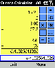 Orneta Calculator is a simple and easy to use application that acts like a standard scientific handheld calculator for Windows Mobile based Smartphone's. Just use your Smartphone when a separate handheld calculator is too much. Enjoy the simple access for quick calculation of difficult...
Platforms: Windows CE, Pocket PC
| License: Freeware | Size: 50 KB | Download (167): Orneta Calculator for Smartphone 2002 Download |
Added: September 08, 2013 | Visits: 1.130
rCalc is a scientific calculator for the GNOME desktop environment. It aims to occupy the middle ground between simple `point-and-click' calculators and full featured mathematical packages, and hopefully take some of the best of both worlds. The goal of the project has been to create a system...
Platforms: *nix
| License: Freeware | Size: 348.16 KB | Download (193): rcalc Download |
Added: August 19, 2008 | Visits: 1.437
Opanda IExif is a professional browser to view the Exif/GPS/IPTC data in a digital image. Use it for reviewing and learning about the photographic technology via the EXIF data in digital images. Powerful and easy-use, a great tool for every shutterbug and photographer.
Platforms: Windows
| License: Freeware | Size: 942 KB | Download (164): Opanda IExif Download |
Added: August 31, 2008 | Visits: 3.343
GeoVisu is a visualization software for geographic data - graphic files, images and GPS. It provides real time GPS navigation (moving map - NMEA 0183 protocol or Garmin USB), displayed with diverse geographic data (MIF, GPX, NMEA, KML/KMZ, SHP, ECW, GeoTiff, MrSID). It can download waypoints,...
Platforms: Windows
| License: Freeware | Size: 1.5 MB | Download (1383): GeoVisu Download |
Added: August 18, 2008 | Visits: 1.093
GpsDiffuser is a software that diffuses real-time GPS data and can play files containing GPS data. Diffusion is done by sending sentences at format NMEA 0183 using UDP protocol. Diffused data comes either from a GPS receiver or source issuing on UDP in real time navigation mode, or from a...
Platforms: Windows
| License: Freeware | Size: 819 KB | Download (531): GpsDiffuser Download |
Added: August 04, 2008 | Visits: 2.755
This free program allows you to plan and record your trips with a GPS receiver and share your local knowledge of trails with others, you can also use the program to print topographic maps with these trails, either on a single page or, as a mosaic, on many sheets of paper. GPS Mapping Sofware...
Platforms: Windows
| License: Freeware | Size: 1024 KB | Download (626): Wissenbach Map Download |
Added: August 11, 2008 | Visits: 1.220
Exif Pilot Light allows you to view the EXIF, EXIF GPS and IPTC data.
Platforms: Windows
| License: Freeware | Size: 1.61 KB | Download (516): Exif Pilot Light Download |
Added: August 27, 2008 | Visits: 1.249
Pro Motion is a bitmap editor and animation package, ideal for creating pixel precise animations, images or icons used in games or Flash applications especially for handheld systems like mobile phones,gameboy,PDA,Pocket PC and similar. It has a huge number of functions ranging from simple drawing...
Platforms: Windows
| License: Freeware | Size: 538 KB | Download (106): Palette Editor Plugin for Pro Motion Download |
Added: November 12, 2010 | Visits: 1.392
802.11b Network Discovery Tools is a gtk tool to scan for 802.11b networks using wavelan/aironet hardware and Linux wireless extensions. It includes the ability to log coordinates of found networks from a GPS device that is NMEA-compatible, and can be linked to a serial port. It currently logs...
Platforms: *nix
| License: Freeware | Size: 34.82 KB | Download (127): 802.11b Network Discovery Tools Download |
Added: July 11, 2010 | Visits: 1.231
GPSMap is a Java application that displays maps and shows your position with the aid of a GPS device. GPSMap project can track paths, load overlays (such as shape files), and download maps from the MapBlast and Expedia servers. Whats New in This Release: - Serial communication on Windows...
Platforms: *nix
| License: Freeware | Size: 4.4 MB | Download (152): GPSMap Download |
Added: April 23, 2010 | Visits: 1.414
nmeap is an extensible parser for NMEA-0183 (GPS) data, written in portable C. It has a small footprint, is portable, extensible, and I/O agnostic. It is suitable for Linux, Win32, and embedded systems. It has built in support for most useful standard NMEA sentences, and is extensible to add...
Platforms: *nix
| License: Freeware | Size: 29.7 KB | Download (145): nmeap Download |
Added: July 24, 2010 | Visits: 1.043
SANE comes from "Scanner Access Now Easy" and is an application programming interface (API) that provides standardized access to any raster image scanner hardware (flatbed scanner, handheld scanner, video and still cameras, framegrabbers, etc.). The SANE standard is public domain and its...
Platforms: *nix
| License: Freeware | Size: 3.15 MB | Download (150): SANE Download |