


Aerial Maps Uk freeware
Aerial Maps Uk
Added: May 22, 2010 | Visits: 1.537
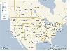
 Maps project is a topographal map and aerial photo generator and viewer. Maps allows users to generate topographical maps and aerial photographs of any region in the United States. It uses data provided by the USGS through the geoserver system. The interactive view lets you move around,...
Platforms: *nix
| License: Freeware | Size: 11.26 KB | Download (139): Maps Download |
Added: August 09, 2008 | Visits: 1.605
This site provides address searching and street map facilities for the UK. We currently have street maps for Greater London and road atlas maps for the whole of mainland Britain (we're working on getting Northern Ireland). Any suggestions or comments are welcome.
Platforms: Windows
| License: Freeware | Download (554): The UK Street Map Page Download |
Added: August 11, 2008 | Visits: 1.961
USA Photo Maps works to download aerial photos and topographical map data directly from the Microsoft TerraServer website, saving it to your hard drive and creating maps from there. With USA Photo Maps you can do the following:* Scroll and zoom operations.* See latitudes and longitudes.* See UGSS...
Platforms: Windows
| License: Freeware | Size: 5 KB | Download (530): USA Photo Maps Download |
Added: November 14, 2010 | Visits: 1.956
Crossfire Maps packages includes maps for the Crossfire MUD client. Crossfire is a multi-player graphical arcade and adventure game made for X. It has certain flavours from other games, especially Gauntlet and the rogue-like games (Nethack, Moria, Angband, and Ragnarok). Any number of players...
Platforms: *nix
| License: Freeware | Size: 21.2 MB | Download (165): Crossfire Maps Download |
Released: September 24, 2012
|
Added: September 24, 2012 | Visits: 921
This software development kit (SDK) provides the binaries and programming reference for the Bing Maps WPF Control (Beta).
When the installation completes, you can choose to open the Bing Maps WPF Control (Beta) SDK help file (BingMapsWPFControlSDK.chm).
Get Bing Maps WPF Control and give it a...
Platforms: Windows, XP, 2003, Windows Vista, 2008, 7
| License: Freeware | Download (52): Bing Maps WPF Control Download |
Released: July 17, 2012
|
Added: July 17, 2012 | Visits: 1.082
 UK STD Info is a lightweight and very simple application that allows you to search United Kingdom telephone area codes. Supports search by Area code and by City name. The interface is very simple and gives you quick access to all its features. Features: Search By city name and search by phone...
Platforms: Windows
| License: Freeware | Size: 133 KB | Download (52): UK STD Info Download |
Released: June 13, 2012
|
Added: June 13, 2012 | Visits: 940
 Add realistic 3D capabilities to your online Bing Maps. Bing Maps 3D brings you another step closer to knowing "what it is like out there". You can search, browse, and organize local information viewed in three dimensions, just the way it exists in the real world. This enables you to more...
Platforms: Windows
| License: Freeware | Size: 1.2 MB | Download (511): Microsoft Bing Maps 3D Download |
Released: August 13, 2012
|
Added: August 13, 2012 | Visits: 690
Anquet Maps for Mac is mapping, route-planning navigation software used by professional mountain guides, top mountain athletes, outdoor training centres and thousands of everyday walkers, climbers and cyclists.
With Anquet Maps for Mac you can create routes on real OS maps to print or transfer...
Platforms: Mac
| License: Freeware | Size: 4.8 MB | Download (54): Anquet Maps Download |
Added: May 10, 2013 | Visits: 876
This function will split and (optionally) validate UK postcodes.
Platforms: Windows, Mac, *nix, Python, BSD Solaris
| License: Freeware | Download (57): Parsing a UK postcode Download |
Added: May 10, 2013 | Visits: 880
This is a full list of all UK Counties (Zones) including the Channel Islands, Isle Of Man etc. Hope you find it useful.
Platforms: Windows, *nix, PHP, BSD
| License: Freeware | Download (56): All UK Zones Download |
Added: May 10, 2013 | Visits: 908
This package is intended to be a UK-Based osCommerce DEFAULT installation and NOT a "loaded" installation.This allows users to have the freedom of choosing their own contributions without additional compatibility problems.Features: - Added UK counties of England, Wales, Scotland, Northern Ireland...
Platforms: Windows, *nix, PHP, BSD
| License: Freeware | Download (51): UK-Based osCommerce Download |
Added: May 10, 2013 | Visits: 818
A list of the mainland UK counties as of June 2004, for adding to the 'Zones' table.Includes a Map for reference.
Platforms: Windows, *nix, PHP, BSD
| License: Freeware | Download (48): UK Counties Download |
Added: May 10, 2013 | Visits: 832
The standard un-altered install will create the following; 173 Zones for the UK (222) in ZONES.20 pre-filled Region Areas containing 173 Counties.(The counties can be moved around or removed via osC Admin)A different price for any of the 20 regions!!!Pre-set prices for each region, which can be...
Platforms: Windows, *nix, PHP, BSD
| License: Freeware | Download (52): UK Delivery Regions Download |
Added: May 10, 2013 | Visits: 817
A simple drop-in-and-go type module to add Royal Mail Recorded Delivery as an option for UK stores posting to UK customers.This is compatible with the 2.2 MS1 release and includes the new postal rates due to take effect on 8 May 2003.
Platforms: PHP,
| License: Freeware | Download (55): UK Recorded Delivery Download |
Added: May 10, 2013 | Visits: 774
A simple drop-in-and-go type module to add Royal Mail Special Delivery as a delivery option for UK customers.It is tested on the post-Nov 02 checkout logic and uses the correct rates as of 28 Jan 03 based on the £250 level of compensation as published on the Royal Mail website.
Platforms: Windows, *nix, PHP, BSD
| License: Freeware | Download (57): UK Special Delivery Download |
Added: April 29, 2013 | Visits: 812
This script checks that postcodes are in correct format.It is written for UK format, but could be easily adapted for other countries.
Platforms: JavaScript
| License: Freeware | Size: 20.48 KB | Download (52): UK Postcode Validation Download |
Added: August 03, 2013 | Visits: 528
Given an aerial image of a city block this program extracts all objects deemed "red". It is simple and short and should help those wanting to get a foot in image processing.
Platforms: Matlab
| License: Freeware | Size: 2.07 MB | Download (45): Extract Red Objects from Aerial Image Download |
Added: May 29, 2013 | Visits: 776
There are several plugins that can embed Google Maps into WordPress pages. However, most, if not all, of them require the user to specify the markup in a separate KML file. I found that troublesome, and hence created a plugin that allows the administrator to create a marker simply by clicking on...
Platforms: PHP
| License: Freeware | Size: 10 KB | Download (50): Organisation Maps Download |
Added: July 04, 2013 | Visits: 683
he "Yandex maps" module shows locative data using the Yandex maps API (http://api.yandex.ru/maps/).Yandex maps are the good Google Maps alternative for Russia and other eastern Europe countries.This module utilizes it's API and the main features are: * shows node locations in the blocks (using...
Platforms: PHP
| License: Freeware | Size: 20.48 KB | Download (43): Yandex maps Download |
Added: August 05, 2013 | Visits: 458
Aerial Chat a Powerful chat in php/MySQL.ldap auth available.Easy install, no flicker, kick, ban, iptracer,encrypt pwd,toplists,DHTML layers,unlimited channels ,private msg, spy mode,telescriptor,images,links,easy smiley mgmt,Jail mode,mp3,graphics effec
Platforms: *nix
| License: Freeware | Size: 512 KB | Download (41): aerial chat Download |