


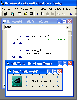
Virtual Earth Map Control Release software
Virtual Earth Map Control Release
Released: June 17, 2007
|
Added: September 20, 2007 | Visits: 2.037
 If there is a task to provide interaction between communications application and your own program (e.g. serial device emulator), there is no common solution to accomplish it. It is considered that communications applications are intended to work only with hardware serial devices connected to...
Platforms: Windows
| License: Shareware | Cost: $199.95 USD | Size: 789.87 KB | Download (133): Virtual Serial Port Control Download |
Released: December 09, 2012
|
Added: December 09, 2012 | Visits: 629
 Enjoy pleasant 3D effects as Virtual Earth takes you to outer space full of motion: rotating Earth, Clouds, as well as Shattering and reopening of your Screen is animated. The idea is to provide experience of the world outside of Earth. Fluid realistic animations and breathtaking details are the...
Platforms: Windows
| License: Shareware | Cost: $5.00 USD | Size: 3.38 MB | Download (53): Virtual Earth screensaver Download |
Added: January 25, 2010 | Visits: 1.009
This widget allows you quick and easy access to MSNNs Virtual Earth. You can do location-based searches, zoom in and out and itNs all only a Dashboard-click away.
Platforms: Mac
| License: Freeware | Download (147): Virtual Earth Widget Download |
Added: February 03, 2010 | Visits: 1.048
Net::LDAP::Control::VLV is an LDAPv3 Virtual List View control object. SYNOPSIS use Net::LDAP; use Net::LDAP::Control::VLV; use Net::LDAP::Constant qw( LDAP_CONTROL_VLVRESPONSE ); $ldap = Net::LDAP->new( "ldap.mydomain.eg" ); # Get the first 20 entries $vlv =...
Platforms: *nix
| License: Freeware | Size: 245.76 KB | Download (103): Net::LDAP::Control::VLV Download |
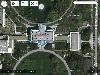
Added: August 24, 2008 | Visits: 1.749
Microsoft Virtual Earth is a fantastic program that lets you view from a bird+s eye point any part of the world thanks to the map creation technology used for local.live.com, the latest regional search and map creation site from Microsoft.With Microsoft Virtual Earth 3D you can view in full...
Platforms: Windows
| License: Freeware | Size: 4 KB | Download (228): Microsoft Virtual Earth 3D 2.0 Beta Download |
Released: July 14, 2012
|
Added: July 14, 2012 | Visits: 615
 e-OSMClient is a lightweight browser for displaing tiled maps. It was primarily designed to be used for displaying OSM rendered maps (Mapnik, Osmarender, Cycle Map,...), but it can work with any kind of tiled map servers (Virtual earth, World Wind,...). eOSMClient uses a local cache for saving...
Platforms: Windows
| License: Freeware | Size: 759 KB | Download (394): e-OSM Client Download |
Added: June 04, 2013 | Visits: 495
DRAWEARTHSHADED Draws a shaded map of the Earth DRAWEARTHSHADED Draw a map of the earth, with a realistic set of colors. This can be used as a background for any map plot you wish. It is important to note that the shapefiles "landareas" and "usastateshi" are both used in order to generate this...
Platforms: Matlab
| License: Shareware | Cost: $0.00 USD | Size: 10 KB | Download (39): Shaded Earth Map Download |
Added: September 06, 2010 | Visits: 2.172
Free Simulated Radar Client project is a framework for radar clients for virtual air traffic control networks. Free Simulated Radar Client is a framework for radar clients for virtual air traffic control networks (e.g., VATSIM and IVAO). Currently work is occuring on a radar client (an ASRC...
Platforms: *nix
| License: Freeware | Download (245): Free Simulated Radar Client Download |
Added: May 10, 2013 | Visits: 520
The plugin supports Microsoft Virtual Earth, Google Maps, and OpenStreet.InstallationUnpack and upload it to the /wp-content/plugins/ directory.Activate the plugin through the 'Plugins' menu in WordPress. Requirements: - WordPress 2.5.1 up to 2.6.3
Platforms: Windows, Mac, *nix, PHP, BSD Solaris
| License: Freeware | Download (69): UMapper Download |
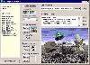
Released: November 11, 2012
|
Added: November 11, 2012 | Visits: 480
VCMap, also known as The Virtual Comparative Map was developed in order to explore the conserved synteny between Rat, Mouse and Human.
Genomes and annotations of additional species (Chicken, Cow, and Pig) were added to the database of information accessible to VCMap.
VCMap was developed with...
Platforms: Windows
| License: Freeware | Download (481): VCMap Download |
Released: October 16, 2012
|
Added: October 16, 2012 | Visits: 670
PhotoKML can be used to generate KML files that show pictures on the Google Earth map. You can either import pictures that are already geo-referenced or link your picture with a GPS track. The tool will generate a self contained kmz file that include all the icosn & thumbnails versions of the...
Platforms: Mac
| License: Freeware | Size: 235.52 KB | Download (57): PhotoKML Download |
Added: May 10, 2013 | Visits: 490
PietschSoft.VE is an ASP.NET 2.0 Virtual Earth Server Control. The goal of this control is to allow ASP.NET developers to utilize Virtual Earth mapping within their applications with out requiring any JavaScript knowledge.Feature outline: - Show map - Plot points - custom images supported -...
Platforms: Windows, ASP.NET,
| License: Freeware | Download (53): PietschSoft.VE 2.0.1a Download |
Released: April 23, 2016
|
Added: May 07, 2016 | Visits: 1.172
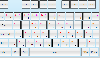 An on-screen keyboard for .NET WPF. MindFusion Virtual Keyboard is a reusable control that emulates a keyboard and enables text and shortcut input through touch, mouse or stylus events. The control works similarly to Windows Mobile embedded keyboard, letting users input text into the currently...
Platforms: Windows, Windows 7
| License: Commercial | Cost: $200.00 USD | Size: 1.66 MB | Download (58): Virtual Keyboard for WPF Download |
Released: April 23, 2016
|
Added: May 07, 2016 | Visits: 1.151
 An on-screen keyboard for .NET Windows Forms. MindFusion Virtual Keyboard is a reusable control that emulates a keyboard and enables text and shortcut input through touch, mouse or stylus events. The control works similarly to Windows Mobile embedded keyboard, letting users input text into the...
Platforms: Windows, Windows 7
| License: Commercial | Cost: $200.00 USD | Size: 1.57 MB | Download (56): Virtual Keyboard for WinForms Download |
Added: January 09, 2006 | Visits: 4.689
 The VB Image Map OCX is an ActiveX Control designed to provide your applications with the ability to display interactive images. Hotspots, or specially designated areas on your image, can be defined that will react to users' mouse events. It is easily integrated into your existing...
| License: Shareware | Cost: $49.95 USD | Size: 558 KB | Download (305): VB Image Map ActiveX Control Download |
Released: July 18, 2012
|
Added: July 18, 2012 | Visits: 794
 Create own true to scale maps, store online maps locally with Vivo techology, map editor, dataexchange with Google Earth by Copy and Paste, GPS enabled coordinates, import of free OpenStreatMap data and GPS Exchange and GPS logger data, compatible with "GPS for Google Earth", area calculation...
Platforms: Windows
| License: Shareware | Cost: $65.00 USD | Size: 6.36 MB | Download (398): Dr. Regener LandMap Vivo Download |
Released: November 04, 2015
|
Added: November 30, 2015 | Visits: 583
 Fast & Easy measure distances and areas on the ground on earth.
Map Measurement uses lines and shapes to check one or several distances and estimate sizes of different features on Earth. With Map Measurement, you can measure the length with a line or path, you can also measure areas using...
Fast & Easy measure distances and areas on the ground on earth.
Map Measurement uses lines and shapes to check one or several distances and estimate sizes of different features on Earth. With Map Measurement, you can measure the length with a line or path, you can also measure areas using...
Platforms: Windows, Windows 8, Windows 7, Windows Server
| License: Shareware | Cost: $39.00 USD | Size: 58.27 MB | Download (58): KLONK Map Measurement Download |
Released: February 23, 2012
|
Added: December 15, 2012 | Visits: 3.911
 Software developers can access various devices by utilizing the Windows API. When using an API, you gain access to a full spectrum of available features, but API programming is a very tough and time-consuming task. You have to study the documentation and you have to create all the...
Platforms: Windows
| License: Shareware | Cost: $699.00 USD | Size: 4.19 MB | Download (160): Serial Port Control Download |
Released: November 16, 2020
|
Added: March 11, 2021 | Visits: 11.930
 DarkWave Studio is a free Digital Audio Workstation (DAW) / modular virtual music studio for Windows. You can easily use the built in sequencer, bundled DarkPlug machines and third-party VST effects and VSTi instruments to create music. DarkWave Studio allows the connection of machines in an...
Platforms: Windows, Windows 8, Windows 7, Windows Server
| License: Freeware | Size: 2.13 MB | Download (1461): DarkWave Studio Download |
Added: March 01, 2010 | Visits: 1.455
GeoServer project is a full transactional Java (J2EE) implementation of the OpenGIS Consortiums Web Feature Server specification, with an integrated WMS. GeoServer is free software, available under the GPL 2.0 license. Users who would like to access and modify their geographic data over the...
Platforms: *nix
| License: Freeware | Size: 20.4 MB | Download (118): GeoServer 1.5.3 / 1.6.0 Beta Download |