


Utm software
Utm
Released: January 09, 2013
|
Added: January 09, 2013 | Visits: 574
 UTM (Universal Traffic Manager) is a professional billing system for Internet Service Providers. The core of the system, written in C++, is a smart and reliable accounting engine working directly with network equipment. It supports up to 100,000 users at a total speed of up to 3 Gbps.
All...
UTM (Universal Traffic Manager) is a professional billing system for Internet Service Providers. The core of the system, written in C++, is a smart and reliable accounting engine working directly with network equipment. It supports up to 100,000 users at a total speed of up to 3 Gbps.
All...
Platforms: Linux
| License: Demo | Cost: $700.00 USD | Size: 16.8 MB | Download (47): UTM for Linux 5.1.10-016 Download |
Released: March 19, 2015
|
Added: April 24, 2015 | Visits: 3.325
 UserGate Proxy & Firewall is a UTM (Unified Threat Management) class solution for sharing and monitoring employees' access to the local and Internet resources, for filtering FTP and HTTP traffic, as well as for administrating the network in your Company. UserGate provides complex LAN security due...
Platforms: Windows, Windows 8, Windows 7, Windows Server
| License: Shareware | Cost: $194.00 USD | Size: 77.99 MB | Download (218): UserGate Proxy & Firewall Download |
Released: December 31, 2019
|
Added: January 08, 2020 | Visits: 1.272
 Geodata International - World-wide database of countries with georeferenced towns, municipalities, postal codes and administrative units with WGS84 and UTM coordinates and elevations for geocoding, proximity search, navigation, distance calculation. Often is it necessarily, for an address...
Platforms: Windows, Mac, *nix, Windows 8, Windows 7, iOS, Android, iPhone,iPad
| License: Data Only | Cost: $165.00 USD | Size: 2.4 MB | Download (114): Geodata International Download |
Released: April 21, 2014
|
Added: July 16, 2014 | Visits: 989
 Geodata International - World-wide database of countries with georeferenced towns, municipalities, postal codes and administrative units with WGS84 and UTM coordinates and elevations for geocoding, proximity search, navigation, distance calculation. Often is it necessarily, for an address...
Platforms: Windows, Mac, *nix, DOS, Windows 8, Windows Phone, Windows 7, Windows Server, Android, Handheld, OS/2, BlackBerry,Palm,Java
| License: Demo | Cost: $205.00 USD | Size: 785.78 KB | Download (91): Geodaten International Download |
Added: August 14, 2008 | Visits: 1.754
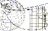 CoordTrans converts geographic positions between different coordinate systems.Convert between UTM and WGS84.Convert between UTM and NAD27 / NAD83.And more... grids from 17 countries supported. Convert geographic coordinates (latitude / longitude) between different datums.
Platforms: Windows
| License: Shareware | Cost: $19.95 USD | Size: 669 KB | Download (744): CoordTrans Download |
Released: November 20, 2015
|
Added: April 20, 2016 | Visits: 3.087
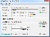 The Eye4Software Coordinate Calculator is an easy to use tool to perform map or GPS coordinate conversions. The software can be used to transform a single coordinate or a batch of coordinates read from a comma separated, database or ESRI shapefiles. The software is shipped with a MS Access...
Platforms: Windows, Windows 7
| License: Shareware | Cost: $119.00 USD | Size: 8.96 MB | Download (249): Eye4Software Coordinate Calculator Download |
Released: July 21, 2010
|
Added: September 25, 2010 | Visits: 1.351
 Toolkit to add GPS and coordinate conversion functionality to your software and scripts (GPS API). All NMEA0183 protocol versions are supported and can be filtered by NMEA sentence type and talker ID. Garmin USB PVT support. Information on GPS status can also be retrieved: GPS fix quality,...
Platforms: Windows
| License: Shareware | Cost: $99.00 USD | Size: 2.2 MB | Download (125): Eye4Software GPS API Download |
Released: September 14, 2011
|
Added: October 03, 2011 | Visits: 1.712
 For the implementation of the INSPIRE directive all so far in Germany available geo references with Gauss-Krueger / DHDN coordinates now must be converted to UTM / ETRS89 coordinates for future use. BetaDLL supports the development of geodetic software on various platforms for this...
Platforms: Windows, Mac, *nix, Windows CE, Pocket PC, iPhone,iPod,Palm,Handheld/Mobile Other,Java
| License: Shareware | Cost: $685.00 USD | Size: 1.04 MB | Download (854): BetaDLL Download |
Released: November 24, 2012
|
Added: November 24, 2012 | Visits: 624
 For the implementation of the INSPIRE directive all so far in Germany available geo references with Gauss-Krueger / DHDN coordinates now must be converted to UTM / ETRS89 coordinates for future use. BetaDLL supports the development of geodetic software on various platforms for this...
Platforms: Windows, Mac, Unix, Linux
| License: Freeware | Size: 1024 KB | Download (53): BetaDLL (English) Download |
Released: July 11, 2012
|
Added: July 11, 2012 | Visits: 552
GeographicLib is a small, handy set of C++ classes specially designed to help you convert between geographic, UTM, UPS, MGRS, geocentric, and local cartesian coordinates, for geoid calculations, and for computing geodesic.
The emphasis is on returning accurate results with errors close to...
Platforms: Windows
| License: Freeware | Download (49): GeographicLib Download |
Added: August 18, 2013 | Visits: 520
A collection of utilities for translating GPS coordinates to related coordinate systems (Earth Centere Fixed, Topocentric, UTM) with auxiliary routins for horizon computation and ray ellipsoid intercepts.
Platforms: Matlab
| License: Freeware | Size: 1.28 MB | Download (57): GPS Coordinate Transformations Download |
Added: April 06, 2013 | Visits: 381
Creates a file in kmz format that can be opened into Google Earth.GEplot uses the same syntax as the traditional plot function but requires Latitude and Longitude (WGS84) instead of x and y.Examples:GEplot('my_track',Lat,Lon);GEplot('my_track',Lat,Lon,'o-r','MarkerSize',10,'LineWidth',3)Colors...
Platforms: Matlab
| License: Freeware | Size: 30.72 KB | Download (45): GEplot Download |
Added: August 23, 2013 | Visits: 335
vtysh is a cli config tools used for the fw,utm,nac device to config the base information it come from the zebra vtysh,but i simplify it.
Platforms: *nix
| License: Freeware | Size: 112.64 KB | Download (32): vtysh Download |
Released: November 07, 2014
|
Added: November 19, 2014 | Visits: 819
 Importation/Exportation: Import/export trails to gpx file. Unlimited number of trails, and TrackPoints. Export to gpx, Excel, PDF, XPS and KML/KMZ.
Data table: Very flexible data table that allows sorting by columns, with inheritance of data, attributes, etc.
Presentation on map: View...
Importation/Exportation: Import/export trails to gpx file. Unlimited number of trails, and TrackPoints. Export to gpx, Excel, PDF, XPS and KML/KMZ.
Data table: Very flexible data table that allows sorting by columns, with inheritance of data, attributes, etc.
Presentation on map: View...
Platforms: Windows, Windows 8, Windows 7, Windows Server
| License: Freeware | Size: 27.05 MB | Download (611): ediTrail Download |
Added: April 09, 2006 | Visits: 4.385
 AllTrans can be used for world wide professional coordinate transformations between international and national coordinate systems with or without geodetic datum change.
Transformations between State-Plane-Coordinates (NAD83, NAD27, Transverse Mercator, Lambert, Soldner-Cassini, Mercator, EOV,...
AllTrans can be used for world wide professional coordinate transformations between international and national coordinate systems with or without geodetic datum change.
Transformations between State-Plane-Coordinates (NAD83, NAD27, Transverse Mercator, Lambert, Soldner-Cassini, Mercator, EOV,...
Platforms: Windows
| License: Demo | Cost: $99.00 USD | Size: 4.41 MB | Download (470): AllTrans Download |
Released: July 13, 2017
|
Added: August 30, 2017 | Visits: 4.508
 TRANSDAT geosoftware executes coordinate transformations and geodetic datum shifts between many coordinate and reference systems of America, Australasia, Europe, Germany special and world-wide, with high precision and high speed: 1.The current and historical coordinate and reference systems of...
Platforms: Windows, Windows 8, Windows 7, Windows Server
| License: Shareware | Cost: $170.00 USD | Size: 4.43 MB | Download (325): TRANSDAT Download |
Added: March 03, 2006 | Visits: 3.058
 Geodata of the European and International countries with municipalities and postal codes. Georeferences as UTM- and geographic coordinates (WGS84, ETRS89). Suitable for branch searches, periphery searches and distance computations. These countries are available: Albania, Andorra, Belgium, Bosnia,...
Platforms: DOS, OS/2, BeOS, Palm OS, Windows, Mac, *nix, Windows CE
| License: Shareware | Cost: $195.00 USD | Size: 229 KB | Download (133): Geo data Europe and International Download |
Released: December 30, 2019
|
Added: January 08, 2020 | Visits: 3.971
 SEVENPAR is a tool for the calculation of highly exact transformation parameters for the Spatial Helmert and Molodensky Transformation, which make possible precise coordinate transformations from one reference system into another. The determined transformation parameters can be entered directly...
Platforms: Windows, Windows 8, Windows 7, Windows Server
| License: Shareware | Cost: $145.00 USD | Size: 2.78 MB | Download (194): SEVENPAR Download |
Released: December 30, 2019
|
Added: January 08, 2020 | Visits: 3.834
 ORTWIN is a program for the state-wide inquiry of the localities, postal codes and telephone selections in Germany. It finds postal zip codes, telephone pre selections, coordinates and ground level elevations. The program determines municipal codes, local center points, car license codes,...
Platforms: Windows, Windows 8, Windows 7, Windows Server
| License: Shareware | Cost: $120.00 USD | Size: 4.88 MB | Download (174): ORTWIN Download |
Released: December 30, 2019
|
Added: January 08, 2020 | Visits: 3.184
 TOPOWIN is a state-wide register of the German Topographic Cartographies, the German Basic Cartography and of localities with geo references in different coordinate systems. It is also a topographic information system. In the division of planning and execution of economical and scientific...
Platforms: Windows, Windows 8, Windows 7, Windows Server
| License: Shareware | Cost: $125.00 USD | Size: 4.56 MB | Download (271): TOPOWIN Download |