


Usb Gps Receiver software
Usb Gps Receiver
Added: March 23, 2006 | Visits: 3.565
 ZylNMEAGenerator is a Delphi component that transforms position data in NMEA format.
You can generate complex NMEA sentences from simple data inputs. The sentences are recognized by any NMEA compatible mapping software. In this way with this component you can simulate a gps receiver also. You...
ZylNMEAGenerator is a Delphi component that transforms position data in NMEA format.
You can generate complex NMEA sentences from simple data inputs. The sentences are recognized by any NMEA compatible mapping software. In this way with this component you can simulate a gps receiver also. You...
Platforms: Windows
| License: Shareware | Cost: $59.99 USD | Size: 619 KB | Download (142): ZylNMEAGenerator Download |
Released: March 18, 2008
|
Added: March 21, 2008 | Visits: 7.602
 Vectir is a PC remote control application that lets you control popular media players such as Winamp, iTunes and Windows Media Player with a Bluetooth enabled mobile phone or infrared (IR) remote control. Other features include mouse pointer control, master volume adjust and remote PC shutdown....
Platforms: Windows
| License: Freeware | Size: 1.53 MB | Download (2031): Vectir Download |
Added: August 18, 2008 | Visits: 1.093
 GpsDiffuser is a software that diffuses real-time GPS data and can play files containing GPS data. Diffusion is done by sending sentences at format NMEA 0183 using UDP protocol. Diffused data comes either from a GPS receiver or source issuing on UDP in real time navigation mode, or from a...
Platforms: Windows
| License: Freeware | Size: 819 KB | Download (531): GpsDiffuser Download |
Added: November 12, 2010 | Visits: 1.393
802.11b Network Discovery Tools is a gtk tool to scan for 802.11b networks using wavelan/aironet hardware and Linux wireless extensions. It includes the ability to log coordinates of found networks from a GPS device that is NMEA-compatible, and can be linked to a serial port. It currently logs...
Platforms: *nix
| License: Freeware | Size: 34.82 KB | Download (127): 802.11b Network Discovery Tools Download |
Added: January 25, 2010 | Visits: 874
Terrabrowser is an internet browser for satellite photos and topographical maps which are obtained from the Microsoft Terra Server. The map data is provided by the U.S. Geological Survey (USGS) and therefore only covers the United States at this time (although expansion to other map servers may...
Platforms: Mac
| License: Shareware | Cost: $0.00 USD | Download (98): Terrabrowser Download |
Released: June 09, 2012
|
Added: June 09, 2012 | Visits: 338
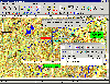 OziExplorer is interactive, it allows you to work, on your computer screen, with digital maps that you have purchased or scanned yourself. By using these maps OziExplorer allows you to plan your trip by creating waypoints, routes and tracks on screen and upload these to your GPS.
With...
OziExplorer is interactive, it allows you to work, on your computer screen, with digital maps that you have purchased or scanned yourself. By using these maps OziExplorer allows you to plan your trip by creating waypoints, routes and tracks on screen and upload these to your GPS.
With...
Platforms: Windows
| License: Shareware | Cost: $95.00 USD | Size: 7 MB | Download (431): OziExplorer Download |
Released: December 23, 2012
|
Added: December 23, 2012 | Visits: 408
PhotoLinker provides an unprecedented level of map, GPS track and photo tag interactivity, making photo annotation a compelling project and not a dreadful chore.
Key features include:
* A completely customizable metadata editor to facilitate a streamlined and efficient workflow. PhotoLinker...
Platforms: Mac
| License: Demo | Cost: $49.95 USD | Size: 13.6 MB | Download (56): PhotoLinker Download |
Released: September 11, 2003
|
Added: February 14, 2006 | Visits: 5.551
 Serial Splitter is an advanced Win32 application, based on Windows NT kernel drivers technology. It allows you to share real serial port between several applications so way, that all application will receive same data from real serial port simultaneously. It is achieved by creating virtual serial...
Platforms: Windows
| License: Shareware | Cost: $111.95 USD | Size: 1.35 MB | Download (1095): Serial Splitter Download |
Released: June 12, 2008
|
Added: June 19, 2008 | Visits: 3.331
 Comm Operator PPC is a powerful RS232 device emulator on Pocket PC.It supports communication with both serial port, include rs232, rs422, rs485 and TCP & UDP based protocol.It works with Wifi, Ethernet and Bluetooth besides normal serial port.It supports data in Text, Decimal as well as Hex...
Platforms: Pocket PC, Windows
| License: Shareware | Cost: $49.99 USD | Size: 131.72 KB | Download (428): Comm Operator PPC Download |
Added: August 19, 2008 | Visits: 648
 With PixGPS it's easy to track the exact positioin where you took your photos. You need a GPS Receiver. Download the photos and the track file from the GPS. PixGPS will calculate the position of each photo and insert this in the EXIF data of each photo. You can also see the location on a map...
Platforms: Windows
| License: Shareware | Cost: $19.95 USD | Size: 1.45 MB | Download (467): PixGPS Download |
Released: October 22, 2012
|
Added: October 22, 2012 | Visits: 419
An intuitive geocache management and planning tool. Manage all your Geocaches from one place. Send only the caches you want to your GPS receiver. When you're done Geocaching, download them to Geocache Manager to automatically update your finds. Import Geocaches from queries, .loc or .gpx files....
Platforms: Mac
| License: Freeware | Size: 5 MB | Download (497): Geocache Manager for Mac OS Download |
Released: September 06, 2012
|
Added: September 06, 2012 | Visits: 1.098
 Vectir is a PC remote control application that lets you control applications such as Winamp, iTunes, Windows Media Player and PowerPoint with a Bluetooth enabled mobile phone or infrared (IR) remote control. Other features include remote desktop, mouse pointer control, keyboard control, master...
Platforms: Windows
| License: Shareware | Cost: $14.95 USD | Size: 10.96 MB | Download (420): Vectir WiFi and Bluetooth Remote Control Download |
Released: September 23, 2012
|
Added: September 23, 2012 | Visits: 649
 Vectir is an audio visual (AV) management application that lets you remotely control popular media or MP3 players such as Winamp, iTunes and Windows Media Player. It can also control other features of your operating system such as moving the mouse pointer, adjusting the master sound volume and...
Platforms: Windows
| License: Shareware | Cost: $19.95 USD | Size: 9 MB | Download (405): Vectir - AV manager Download |
Released: September 12, 2012
|
Added: September 12, 2012 | Visits: 636
 Vectir is a PC remote control application that lets you control applications such as Winamp, iTunes, Windows Media Player and PowerPoint with a Bluetooth enabled mobile phone or infrared (IR) remote control. Other features include remote desktop, mouse pointer control, keyboard control, master...
Platforms: Windows
| License: Shareware | Cost: $19.95 USD | Size: 9.51 MB | Download (53): Vectir - IR and Bluetooth Remote Control Download |
Released: June 12, 2012
|
Added: June 12, 2012 | Visits: 415
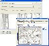
![]() Trip Tracker is a position tracking client-server system. A real time tracking environment can be set up with a GPS receiver and a tracking server. The map client can show the map position of the GPS client in real time.
Trip Tracker is a position tracking client-server system. A real time tracking environment can be set up with a GPS receiver and a tracking server. The map client can show the map position of the GPS client in real time.
Platforms: Windows, Mac, Linux
| License: Freeware | Size: 195.85 KB | Download (43): Trip Tracker Download |
Released: July 21, 2012
|
Added: July 21, 2012 | Visits: 447
Geocache Manager is an intuitive geocache management and planning tool. Manage all your Geocaches from one place. Send only the caches you want to your GPS receiver. When you’re done Geocaching, download them to Geocache Manager to automatically update your finds.
Import Geocaches from...
Platforms: Mac
| License: Shareware | Cost: $19.95 USD | Size: 6.1 MB | Download (44): Geocache Manager Download |
Added: April 19, 2013 | Visits: 550
Using this script, you can generate a set of data regarding Sun Azimuth Positions at various instants of time for any location on Earth. This data can be used in many applications, like, in determination of orientation of any plane's azimuth from True North.The syntax is 'sun_azimuth_data' (no...
Platforms: Matlab
| License: Freeware | Size: 20.48 KB | Download (40): Sun Azimuth Data Download |
Added: October 28, 2013 | Visits: 382
The following is a short description of RoadMap. More information is available in the documentation distributed with RoadMap. RoadMap is an open source (GPL) program that provides a car navigation for Linux, UNIX and now Windows CE (a.k.a. PocketPC) and the iPhone/iPod. RoadMap displays a map...
Platforms: *nix
| License: Freeware | Size: 225.28 KB | Download (41): RoadMap Download |
Released: July 21, 2010
|
Added: September 25, 2010 | Visits: 1.346
 Toolkit to add GPS and coordinate conversion functionality to your software and scripts (GPS API). All NMEA0183 protocol versions are supported and can be filtered by NMEA sentence type and talker ID. Garmin USB PVT support. Information on GPS status can also be retrieved: GPS fix quality,...
Platforms: Windows
| License: Shareware | Cost: $99.00 USD | Size: 2.2 MB | Download (121): Eye4Software GPS API Download |
Added: August 22, 2013 | Visits: 558
USB-IR-Boy is an LIRC compatible home brew USB Infrared (IR) receiver based on the Motorola (Freescale) MC68HC908 microcontroller. The project includes electronic schematics, MCU code, and a lircd compatible kernel module.
Platforms: *nix
| License: Freeware | Size: 51.2 KB | Download (36): USB-IR-Boy Download |