


Toyota Gps software
Toyota Gps
Released: July 13, 2017
|
Added: August 30, 2017 | Visits: 4.504
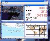
 TRANSDAT geosoftware executes coordinate transformations and geodetic datum shifts between many coordinate and reference systems of America, Australasia, Europe, Germany special and world-wide, with high precision and high speed: 1.The current and historical coordinate and reference systems of...
Platforms: Windows, Windows 8, Windows 7, Windows Server
| License: Shareware | Cost: $170.00 USD | Size: 4.43 MB | Download (319): TRANSDAT Download |
Added: January 09, 2006 | Visits: 3.140
 - you can show a current GPS data (Speed, Direction, Longitude, Latitude, Time, Date, Height);
- you can open any of scanned maps (in a "bmp" or "dib" format);
- you can calibrate the scanned maps yourself by two calibration points only (left-top and right-bottom);
- calibrations are stored...
- you can show a current GPS data (Speed, Direction, Longitude, Latitude, Time, Date, Height);
- you can open any of scanned maps (in a "bmp" or "dib" format);
- you can calibrate the scanned maps yourself by two calibration points only (left-top and right-bottom);
- calibrations are stored...
Platforms: Windows
| License: Demo | Cost: $9.50 USD | Size: 3.58 MB | Download (537): VIGps Download |
Released: May 12, 2010
|
Added: June 03, 2010 | Visits: 1.844
 Exif Pilot Pro is EXIF aditor that allows you to:
- View EXIF, EXIF GPS and IPTC data.
- Edit some Makernote tags.
- Edit, create EXIF, EXIF GPS and IPTC data.
- Import/export from/to XML format.
- Import/export from/to MS Excel files.
- Import/export from/to a text file in CSV...
Exif Pilot Pro is EXIF aditor that allows you to:
- View EXIF, EXIF GPS and IPTC data.
- Edit some Makernote tags.
- Edit, create EXIF, EXIF GPS and IPTC data.
- Import/export from/to XML format.
- Import/export from/to MS Excel files.
- Import/export from/to a text file in CSV...
Platforms: Windows
| License: Shareware | Cost: $39.95 USD | Size: 2.43 MB | Download (661): Exif Pilot Pro Download |
Released: December 29, 2010
|
Added: January 06, 2011 | Visits: 4.311
 OkMap is a GPS and map software that:
-Works with vectorial maps and calibrates raster maps
-Organizes paths by creating waypoints, routes and tracks
-Uploads/downloads data to/from your GPS
-Uses altitude DEM data
-Supports GPS real-time navigation
-Sends/receives vehicles position...
OkMap is a GPS and map software that:
-Works with vectorial maps and calibrates raster maps
-Organizes paths by creating waypoints, routes and tracks
-Uploads/downloads data to/from your GPS
-Uses altitude DEM data
-Supports GPS real-time navigation
-Sends/receives vehicles position...
Platforms: Windows
| License: Freeware | Size: 20.25 MB | Download (1271): OkMap Download |
Released: February 14, 2009
|
Added: February 16, 2009 | Visits: 1.122
 Toolkit to add GPS functionality to software. All NMEA0183 protocol versions are supported, all NMEA 0183 can be filtered by NMEA type and talker ID. Values can be outputed using different output formats and units. Information on GPS status can also be retrieved: GPS fix quality, Satellites used...
Platforms: Windows
| License: Shareware | Cost: $99.00 USD | Size: 373.22 KB | Download (141): Eye4Gps Download |
Released: April 02, 2009
|
Added: April 07, 2009 | Visits: 2.193
 This component helps you to manipulate EXIF, IPTC and GPS information in JPEG and TIFF images plus known RAW formats (Canon CRW, Adobe DNG, Canon CR2, Fujifilm RAF, Minolta MRW, Nikon NEF, Pentax PEF, Sony ARW and Sony SR2). You can Change/Read/Write ALL EXIF or IPTC fields in JPEG images. The...
Platforms: Windows
| License: Shareware | Cost: $49.95 USD | Size: 1.39 MB | Download (266): AiS EXIF Info ActiveX Download |
Released: March 18, 2009
|
Added: March 25, 2009 | Visits: 2.684
 This anti-theft software is a thief's worst nightmare! RecoveryCop software silently alerts you to where your device is. But that's only the beginning. Listen to surroundings, sound an alarm, record SMS and more!
RecoveryCop is the next generation of smartphone and Pocket PC anti-theft...
This anti-theft software is a thief's worst nightmare! RecoveryCop software silently alerts you to where your device is. But that's only the beginning. Listen to surroundings, sound an alarm, record SMS and more!
RecoveryCop is the next generation of smartphone and Pocket PC anti-theft...
Platforms: Pocket PC, Windows, Handheld/Mobile Other
| License: Shareware | Cost: $29.97 USD | Size: 705.04 KB | Download (542): RecoveryCop Download |
Released: July 21, 2009
|
Added: July 27, 2009 | Visits: 1.626
 The ScreenSafe application installs on the drivers laptop and will disable the monitor and keyboard while in motion, eliminating driver distraction. The ScreenSafe application is completely customizable allowing the Fleet Manager complete control over when to disable the monitor. ScreenSafe...
Platforms: Windows
| License: Shareware | Cost: $159.00 USD | Size: 5.68 MB | Download (95): ScreenSafe Download |
Released: January 08, 2014
|
Added: September 09, 2014 | Visits: 1.765
 HsGpsDll is a Windows Dynamic Link Library which provides access to any NMEA-183 compliant GPS receiver via a serial communications port. HsGpsDll is designed for use from Visual C, C Sharp .NET, Visual Basic or other programming languages. HsGpsDll allows a user application to easily read from a...
Platforms: Windows, Windows 8, Windows 7
| License: Shareware | Cost: $160.00 USD | Size: 1.41 MB | Download (155): HS GPSDLL Library Download |
Released: September 08, 2009
|
Added: September 14, 2009 | Visits: 3.865
 PhotoGPSEditor is an easy to use meta-data editor for photo (JPEG, RAW) files, plus it can match data from GPS (gpx or NMEA) files. The program is freeware, however, donations can be made to help support future development. With PhotoGPSEditor you can add location and summary details to a...
Platforms: Mac
| License: Freeware | Size: 2.39 MB | Download (1328): PhotoGPSEditor Download |
Released: May 25, 2018
|
Added: June 25, 2018 | Visits: 3.601
 HoudahGeo is a photo geocoding and geotagging tool for Mac. Use HoudahGeo to attach GPS coordinates and location names to your photos.
HoudahGeo writes EXIF and XMP geotags to JPEG and RAW image files. This creates a permanent record of where a photo was taken. Just like a GPS-enabled camera....
HoudahGeo is a photo geocoding and geotagging tool for Mac. Use HoudahGeo to attach GPS coordinates and location names to your photos.
HoudahGeo writes EXIF and XMP geotags to JPEG and RAW image files. This creates a permanent record of where a photo was taken. Just like a GPS-enabled camera....
Platforms: Mac
| License: Demo | Cost: $39.00 USD | Size: 22.87 MB | Download (837): HoudahGeo Download |
Released: November 20, 2015
|
Added: April 20, 2016 | Visits: 3.082
 The Eye4Software Coordinate Calculator is an easy to use tool to perform map or GPS coordinate conversions. The software can be used to transform a single coordinate or a batch of coordinates read from a comma separated, database or ESRI shapefiles. The software is shipped with a MS Access...
Platforms: Windows, Windows 7
| License: Shareware | Cost: $119.00 USD | Size: 8.96 MB | Download (243): Eye4Software Coordinate Calculator Download |
Released: October 18, 2009
|
Added: December 19, 2009 | Visits: 1.427
 Automatic Geo/GPS location track utility for most parts of the World. Lets you know your and your friends geographic location at all times. Maps are downloaded on a per demand basis. All GPS information is stored to a database and can be readily retrieved based on a given date and time range....
Platforms: Windows, Pocket PC
| License: Shareware | Cost: $15.00 USD | Size: 2.41 MB | Download (156): GeoWatch Download |
Released: December 21, 2009
|
Added: January 08, 2010 | Visits: 2.284
 Resco Photo Manager is a favorite Windows Mobile image viewing program with features far beyond standards of the classic built-in viewer. Users gain functions of complete image management in a modern looking and easy to handle application. Since the last version, the application suffered lots of...
Platforms: Pocket PC, Windows, Other,Handheld/Mobile Other
| License: Shareware | Cost: $24.95 USD | Size: 2.06 MB | Download (130): Resco Photo Manager Download |
Released: January 14, 2010
|
Added: January 16, 2010 | Visits: 3.953
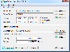
![]() The Picmeta Photo Tracker automatically geotags photos based on track information from any GPS device (.gpx files). It directly writes GPS EXIF data to .jpg, .tif, .crw, .dng, .nef, .pef, .jp2 formats. For other formats such as .cr2 it creates XMP sidecar files. The EXIFcare technology ensures...
The Picmeta Photo Tracker automatically geotags photos based on track information from any GPS device (.gpx files). It directly writes GPS EXIF data to .jpg, .tif, .crw, .dng, .nef, .pef, .jp2 formats. For other formats such as .cr2 it creates XMP sidecar files. The EXIFcare technology ensures...
Platforms: Windows
| License: Freeware | Size: 2.18 MB | Download (186): Picmeta Photo Tracker Download |
Added: September 04, 2010 | Visits: 1.263
 kGpsImageTag reads gps data from a text file and correlates it with the photos in the same folder. Use Correlate data to correlate gps data with images. If an image does not have a gps entry, it is extrapolated. Use Hide/Show to hide/show all lines that do not correspond to an image.....
Platforms: *nix
| License: Freeware | Size: 409.6 KB | Download (97): kGpsImageTag Download |
Added: October 27, 2010 | Visits: 1.059
DateTime::Precise can perform common time and date operations with additional GPS operations. SYNOPSIS use DateTime::Precise; use DateTime::Precise qw(:TimeVars); # Constructors and ways to set time. $t1 = DateTime::Precise->new; $t2 = DateTime::Precise->new(1998. 4. 3 12:13:44.054);...
Platforms: *nix
| License: Freeware | Size: 34.82 KB | Download (89): DateTime::Precise Download |
Added: October 25, 2010 | Visits: 1.220
GMap is a Map editor for GPS maps that runs on linux. This project is a work in progress. GMap reads various formats and writes .mp polish map format files suitable for compiling using the cgpsmapper compiler. I also have some notes relating to the use of GPS tools on Linux and the use of...
Platforms: *nix
| License: Shareware | Cost: $0.00 USD | Size: 952.32 KB | Download (197): GMap 0.0.4 Download |
Added: March 10, 2010 | Visits: 1.221
Geo::Spline is a Perl module to calculate geographic locations between GPS fixes. SYNOPSIS use Geo::Spline; my $p0={time=>1160449100.67, #seconds lat=>39.197807, #degrees lon=>-77.263510, #degrees speed=>31.124, #m/s heading=>144.8300}; #degrees clockwise from North my...
Platforms: *nix
| License: Freeware | Size: 20.48 KB | Download (141): Geo::Spline Download |
Added: June 21, 2010 | Visits: 1.463
QLandkarte can view and upload map files, track and waypoint data to your Garmin GPS receiver. Garmins MapSource software is hardly the only reason for me to boot into Windows and it does not look like Garmin ever wants to address Linux users by writing a portable piece of software. So I...
Platforms: *nix
| License: Freeware | Size: 972.8 KB | Download (116): QLandkarte Download |