


Topography software
Topography
Released: September 26, 2012
|
Added: September 26, 2012 | Visits: 533
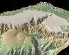 GeoMapApp is an earth science exploration and visualization application that is continually being expanded as part of the Marine Geoscience Data System (MGDS) at the Lamont-Doherty Earth Observatory of Columbia University.
The application provides direct access to the Global Multi-Resolution...
GeoMapApp is an earth science exploration and visualization application that is continually being expanded as part of the Marine Geoscience Data System (MGDS) at the Lamont-Doherty Earth Observatory of Columbia University.
The application provides direct access to the Global Multi-Resolution...
Platforms: Windows
| License: Freeware | Size: 9 MB | Download (446): GeoMapApp Download |
Released: July 14, 2012
|
Added: July 14, 2012 | Visits: 531
 GEOPoint is an easy to use satellite antenna pointing calculator, for geostationary communications satellites. It calculates the azimuth and elevation pointing angles from a given location on the earth towards a specified geostationary satellite. The program also calculates polarisation tilt...
Platforms: Windows
| License: Freeware | Size: 2.1 MB | Download (402): GEOPoint Download |
Released: July 03, 2012
|
Added: July 03, 2012 | Visits: 599
 A volume of data with map names, map numbers, corner coordinates and completing data of all official topographic maps of the Federal Republic of Germany. TK25: Data base table with data of the maps on a scale 1:25000. TK50: Table with data of the maps on a scale 1:50000. TK100: Table with data of...
Platforms: All
| License: Freeware | Size: 51.2 KB | Download (46): Geodaten German Topo Download |
Released: July 17, 2012
|
Added: July 17, 2012 | Visits: 477
 JMARS is an acronym that stands for Java Mission-planning and Analysis for Remote Sensing. It is a geospatial information system (GIS) developed by ASU's Mars Space Flight Facility to provide mission planning and data-analysis tools to NASA's orbiters, instrument team members, students of all...
Platforms: Windows, Mac, Linux
| License: Freeware | Size: 52.2 MB | Download (48): JMARS Download |
Released: November 03, 2015
|
Added: December 23, 2015 | Visits: 1.190
 10-Strike Network Diagram is a powerful network diagrammer and mapper for the quick creation of visual local-area network maps and diagrams, and exporting them to Microsoft Visio, or saving as charts, vector, or raster images.
The program will scan your managed switches via SNMP and discover the...
10-Strike Network Diagram is a powerful network diagrammer and mapper for the quick creation of visual local-area network maps and diagrams, and exporting them to Microsoft Visio, or saving as charts, vector, or raster images.
The program will scan your managed switches via SNMP and discover the...
Platforms: Windows, Windows 8, Windows 7, Windows Server
| License: Shareware | Cost: $149.95 USD | Size: 5.33 MB | Download (94): 10-Strike Network Diagram Download |
Added: May 10, 2013 | Visits: 813
 World Wind lets you zoom from satellite altitude into any place on Earth. Leveraging Landsat satellite imagery and Shuttle Radar Topography Mission data, World Wind lets you experience Earth terrain in visually rich 3D, just as if you were really there. Virtually visit any place in the world....
Platforms: Windows, C/C++,
| License: Freeware | Download (74): World Wind Download |
Added: June 15, 2013 | Visits: 744
This script can read AFM image data directly from files stored with Nanoscope 6 software(download openNANO5.m to read Nanoscope 5 files). This version can only read two channels and assumes that the first channel is the topography image and the second channel the error/vertical deflection or...
Platforms: Matlab
| License: Freeware | Size: 10 KB | Download (49): Open Nanoscope 6 AFM images Download |
Added: August 07, 2013 | Visits: 396
Intended for 3D geological/geophysical visualisation of layered data and will eventually form part of a geophysical visualisation package.Run ThreedDemo to get an idea of how to use. INPUTS: LayerN: The number of the layer to be plotted R: a m*n*k matrix of colour/resistivity data for each layer...
Platforms: Matlab
| License: Freeware | Size: 10 KB | Download (49): Surf3D Download |
Added: September 05, 2013 | Visits: 499
function alt_km=ITU_P1511(lat,long)computes altitude of a site at given lat,long coordinatesby means of bicubic interpolation using itu topo 0.5 degrees resolutionmatrix.refer to ITU-R Recommendation P 1511.INPUTSlat: latitude + = North, -=southlong: longitude, positive degrees East.Required...
Platforms: Matlab
| License: Freeware | Size: 10 KB | Download (54): Altitude in Km above sea level for a given pair of coordinates (lat,long) Download |
Added: August 13, 2013 | Visits: 399
This file includes two m-files. The ASWERS12345 calculates GRS80 free air anomalies,Eigen-CG03C and model of remaining topography reduction,empirical and analytic covariance functions,normal gravity (GRS67,GRS80) using Somigliana formula. The other one fftstokes.m is a geoid computation using...
Platforms: Matlab
| License: Freeware | Size: 2.04 MB | Download (39): Intoduction to the gravity field of earth Download |
Added: July 11, 2013 | Visits: 294
function map=mkpj(n,scheme)% MKPJ Returns a perceptually improved Jet colormap% MKPJ (N,SCHEME) returns an Nx3 colormap.% usage: map=mkpj(n,scheme);%% JUSTIFICATION: rainbow, or spectrum color schemes are considered a poor% choice for scientific data display by many in the scientific community%...
Platforms: Matlab
| License: Shareware | Cost: $0.00 USD | Size: 2.78 MB | Download (48): MKPJ - perceptually improved Jet colormap Download |
Added: April 10, 2013 | Visits: 335
slice.m does not allow non-monotonic matrices or NaN values.However, a 3D volume may often meet these limitations. For example, a 3D grid may be constructed first by 2D interpolations of scattered Z values to xy grids (such as topography at different depths), and then a 3D interpolation of data...
Platforms: Matlab
| License: Shareware | Cost: $0.00 USD | Size: 10 KB | Download (43): smartSlice and iGSlice Download |
Added: May 16, 2013 | Visits: 723
This script can read AFM image data directly from files stored with Nanoscope 5 software(download openNANO6.m to read Nanoscope 6 files). This version can only read two channels and assumes that the first channel is the topography image and the second channel the error/vertical deflection or...
Platforms: PHP
| License: Freeware | Size: 10 KB | Download (41): Open Nanoscope 5 AFM images Download |
Added: July 01, 2013 | Visits: 378
HEALPix is an acronym for Hierarchical Equal Area isoLatitude Pixelization of a sphere. As suggested in the name, this pixelization produces a subdivision of a spherical surface in which each pixel covers the same surface area as every other pixel. The figure below shows the partitioning of a...
Platforms: Mac
| License: Freeware | Size: 27.7 MB | Download (34): HEALPix Download |
Released: November 07, 2014
|
Added: November 19, 2014 | Visits: 813
 Importation/Exportation: Import/export trails to gpx file. Unlimited number of trails, and TrackPoints. Export to gpx, Excel, PDF, XPS and KML/KMZ.
Data table: Very flexible data table that allows sorting by columns, with inheritance of data, attributes, etc.
Presentation on map: View...
Importation/Exportation: Import/export trails to gpx file. Unlimited number of trails, and TrackPoints. Export to gpx, Excel, PDF, XPS and KML/KMZ.
Data table: Very flexible data table that allows sorting by columns, with inheritance of data, attributes, etc.
Presentation on map: View...
Platforms: Windows, Windows 8, Windows 7, Windows Server
| License: Freeware | Size: 27.05 MB | Download (611): ediTrail Download |
Released: July 09, 2023
|
Added: August 06, 2023 | Visits: 164
 Simple, powerful and inexpensive CAD software for surveying. You can do triangulation, isolines, color-filled contour maps, sections, intersections, volume and much more. You can process hundreds of thousands of points or triangles, even on less powerful PCs.
Through its own CAD system...
Simple, powerful and inexpensive CAD software for surveying. You can do triangulation, isolines, color-filled contour maps, sections, intersections, volume and much more. You can process hundreds of thousands of points or triangles, even on less powerful PCs.
Through its own CAD system...
Platforms: Windows, Windows 8, Windows 7, Windows Server
| License: Shareware | Cost: $125.00 USD | Size: 2.48 MB | Download (15): RTOPO Hydrology Download |
Released: January 06, 2024
|
Added: January 16, 2024 | Visits: 119
 AutoLISP source code can be run on AutoCAD or IntelliCAD (Bricscad, ProgeCAD, Cadopia, etc.), on any number of computers. They are:
- "Triangulation" will generate triangular 3DFACE entities, on the convex hull of the set of points,
- "Load XYZ and 4D files"; file types: x y z color, x y z...
AutoLISP source code can be run on AutoCAD or IntelliCAD (Bricscad, ProgeCAD, Cadopia, etc.), on any number of computers. They are:
- "Triangulation" will generate triangular 3DFACE entities, on the convex hull of the set of points,
- "Load XYZ and 4D files"; file types: x y z color, x y z...
Platforms: Windows, Windows 8, Windows 7, Windows Server
| License: Shareware | Cost: $100.00 USD | Size: 1.12 MB | Download (33): AutoLisp Source Download |