


Topo Maps Usa software
Topo Maps Usa
Released: March 01, 2010
|
Added: April 22, 2010 | Visits: 2.512
 Mapyx Quo is an intuitive, easy to learn and, surprisingly simple-to-use digital mapping program which enables you to connect your GPS to your PC and manage all your waypoints, routes and tracks. View information such as elevation, distance, speed, ETA and many more. Quo supports numerous...
Platforms: Windows, Windows CE
| License: Freeware | Size: 44.95 MB | Download (7377): Mapyx Quo Download |
Released: January 12, 2014
|
Added: September 18, 2014 | Visits: 782
 Maps Downloader For Google Map is a smart tool which can help you download tile satellite images from google map fastly and stably.It can stitch tile images into one big seamless image:Software can stitch tile images into one big seamless image such as GeoTIFF and GeoJPEG. But if the exported...
Platforms: Windows, Windows 7, Windows Server
| License: Shareware | Cost: $49.95 USD | Size: 4.71 MB | Download (1239): Maps Dwonloader For Google Map Download |
Released: August 11, 2014
|
Added: October 09, 2014 | Visits: 1.052
 Maps Downloader For Google Satellite is a smart tool which can help you download tile satellite images from google map fastly and stably.It can stitch tile images into one big seamless image:Software can stitch tile images into one big seamless image such as GeoTIFF and GeoJPEG. But if the...
Platforms: Windows, Windows 7, Windows Server
| License: Shareware | Cost: $49.95 USD | Size: 4.74 MB | Download (1236): Maps Downloader For Google Satellite |
Released: July 23, 2014
|
Added: September 23, 2014 | Visits: 896
 Maps Downloader For Yahoo Map is a smart tool which can help you download tile satellite images from google map fastly and stably.It can stitch tile images into one big seamless image:Software can stitch tile images into one big seamless image such as GeoTIFF and GeoJPEG. But if the exported...
Platforms: Windows, Windows 7, Windows Server
| License: Shareware | Cost: $49.95 USD | Size: 4.84 MB | Download (1233): Maps Downloader For Yahoo Map |
Released: January 13, 2014
|
Added: October 09, 2014 | Visits: 837
 Maps Downloader For Google Terrain is a smart tool which can help you download tile satellite images from google map fastly and stably.It can stitch tile images into one big seamless image:Software can stitch tile images into one big seamless image such as GeoTIFF and GeoJPEG. But if the...
Platforms: Windows, Windows 7, Windows Server
| License: Shareware | Cost: $49.95 USD | Size: 4.72 MB | Download (1232): Maps Downloader For Google Terrain |
Released: February 02, 2014
|
Added: September 23, 2014 | Visits: 1.101
 Maps Downloader For Bing Map is a smart tool which can help you download tile satellite images from google map fastly and stably.It can stitch tile images into one big seamless image:Software can stitch tile images into one big seamless image such as GeoTIFF and GeoJPEG. But if the exported...
Platforms: Windows, Windows 7, Windows Server
| License: Shareware | Cost: $49.95 USD | Size: 7.12 MB | Download (1231): Maps Downloader For Bing Map |
Released: July 21, 2011
|
Added: August 10, 2011 | Visits: 2.411
 Interactive Zoomable Map of United States with Clickable Cities for Web and Intranet sites.
Variants of using a map locator:
- Real-Estate websites
- Travel websites
- Quick access to contact organization data, having affiliated network
With this fully-clickable map you will be able...
Interactive Zoomable Map of United States with Clickable Cities for Web and Intranet sites.
Variants of using a map locator:
- Real-Estate websites
- Travel websites
- Quick access to contact organization data, having affiliated network
With this fully-clickable map you will be able...
Platforms: Windows, Mac
| License: Demo | Cost: $149.00 USD | Size: 288 KB | Download (1190): Zoom Map of USA Download |
Released: August 08, 2019
|
Added: September 09, 2019 | Visits: 2.898
 AnyMap JS Maps is an advanced JavaScript/HTML5 mapping library which makes you able to easily create interactive maps that look great on any device including PCs, Macs, iPhones, iPads, Android devices and others - on any platform and in any browser.
AnyMap JS is perfect for interactive...
AnyMap JS Maps is an advanced JavaScript/HTML5 mapping library which makes you able to easily create interactive maps that look great on any device including PCs, Macs, iPhones, iPads, Android devices and others - on any platform and in any browser.
AnyMap JS is perfect for interactive...
Platforms: Windows, Mac, *nix, Windows 8, Windows 7, Windows Server, iOS, Android, iPhone,iPad
| License: Shareware | Cost: $49.00 USD | Size: 17.81 MB | Download (1022): AnyMap JS Maps Download |
Released: July 14, 2010
|
Added: July 17, 2010 | Visits: 1.713
 An interactive Flash USA map with all the features you need for your web site or project. This is the ideal solution for dealer maps, real-estate listings, or visualizing state statistics. Nearly every aspect of the map is customizable. However, unlike competing products, our map is very simple...
Platforms: Not Applicable
| License: Freeware | Size: 93.75 KB | Download (902): Flash USA Map Download |
Released: September 10, 2004
|
Added: May 07, 2006 | Visits: 5.684
 Keno Expert USA is a professional and powerful tool designed to calculate combinations for Keno Games. It is the ultimate software you have to try to improve your chances of winning.
Keno Expert USA can inevitably restrict the range of numbers and make you take advantage of the good occasions...
Keno Expert USA is a professional and powerful tool designed to calculate combinations for Keno Games. It is the ultimate software you have to try to improve your chances of winning.
Keno Expert USA can inevitably restrict the range of numbers and make you take advantage of the good occasions...
Platforms: Windows
| License: Shareware | Cost: $50.00 USD | Size: 11.94 MB | Download (714): Keno Expert USA Download |
Released: September 03, 2008
|
Added: September 06, 2008 | Visits: 4.225
 Finally a program that will automatically handicap all USA horse races for you, every single race, everyday! With the help of advanced algorithms based on neural networks this revolutionary software will give recommendations for USA horse racing (thoroughbreds)!
If you want to make a living at...
Finally a program that will automatically handicap all USA horse races for you, every single race, everyday! With the help of advanced algorithms based on neural networks this revolutionary software will give recommendations for USA horse racing (thoroughbreds)!
If you want to make a living at...
Platforms: Windows
| License: Shareware | Cost: $99.95 USD | Size: 18.86 MB | Download (629): Horse Racing Predictor USA Download |
Released: September 25, 2008
|
Added: September 29, 2008 | Visits: 2.363
 Dongsoft Interactive Flash Maps for websites, interactive map applications, presentations, and more.
The innovation of this fully-clickable map will revolutionize your website navigation and provide visitors with a simple and seamless method of accessing information. Using the map as a central...
Dongsoft Interactive Flash Maps for websites, interactive map applications, presentations, and more.
The innovation of this fully-clickable map will revolutionize your website navigation and provide visitors with a simple and seamless method of accessing information. Using the map as a central...
Platforms: Windows, Windows Vista
| License: Shareware | Cost: $39.95 USD | Size: 148.44 KB | Download (583): USA Flash Map Download |
Added: August 27, 2008 | Visits: 1.010
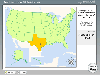 Know Your USA is a software application developed to help users expand their knowledge of USA geography. Each geographic feature of the USA is covered in detail including regions, states, state capitals, major cities, rivers, mountains and lakes. Know Your USA is great software for learning all...
Platforms: Windows
| License: Shareware | Cost: $24.95 USD | Size: 15.5 KB | Download (549): Know Your USA Download |
Released: January 16, 2013
|
Added: January 16, 2013 | Visits: 779
 Route Planner Usa - Simple and easy to use application that calculates the distance and fuel consumption for a given route. The application is very easy to use because of the simple user interface that delivers just the necessary information to calculate and display the stats. Route Planner Usa.
Platforms: Windows
| License: Freeware | Size: 7 KB | Download (539): Route Planner Usa Download |
Added: August 18, 2008 | Visits: 1.349
 Allows you to connect your hand held Global Positioning System (GPS) unit to your computer, download your waypoints, and plot them in AutoCAD or export them in .dxf Also plots the points on free public domain Aerial photos and topo maps. Works on most Garmin and Magellan GPS units, and AutoCAD...
Platforms: Windows
| License: Shareware | Cost: $345.00 USD | Size: 9.9 MB | Download (537): GPS2CAD Download |
Added: August 11, 2008 | Visits: 1.953
USA Photo Maps works to download aerial photos and topographical map data directly from the Microsoft TerraServer website, saving it to your hard drive and creating maps from there. With USA Photo Maps you can do the following:* Scroll and zoom operations.* See latitudes and longitudes.* See UGSS...
Platforms: Windows
| License: Freeware | Size: 5 KB | Download (524): USA Photo Maps Download |
Released: October 16, 2012
|
Added: October 16, 2012 | Visits: 1.009
 USA Real Estate Map Pro is a premium class software for mapping: real estate properties, contact listings, offices and other geo spatial data. Interactive Real Estate map is rather simple to integrate with database listings: both to specify the states and counties that should be active on map,...
Platforms: Windows, Mac, OS/2, Unix, Linux, MS-DOS, AS/400
| License: Shareware | Cost: $399.00 USD | Size: 10.42 MB | Download (516): USA Real Estate Map Pro Download |
Released: August 22, 2012
|
Added: August 22, 2012 | Visits: 369
With yalips maps you get 4 products in 1. You are more productive, more creative and perform better on your job when using visual software tools. With the resulting visualizations you can communicate more effectively and convincingly to your collegues, your boss, your customer or the chairman of...
Platforms: Windows
| License: Shareware | Cost: $80.00 USD | Size: 29.65 MB | Download (512): yalips maps Download |
Released: June 13, 2012
|
Added: June 13, 2012 | Visits: 936
 Add realistic 3D capabilities to your online Bing Maps. Bing Maps 3D brings you another step closer to knowing "what it is like out there". You can search, browse, and organize local information viewed in three dimensions, just the way it exists in the real world. This enables you to more...
Platforms: Windows
| License: Freeware | Size: 1.2 MB | Download (505): Microsoft Bing Maps 3D Download |
Added: August 27, 2008 | Visits: 1.084
USAPhotoMaps downloads aerial photo and topo map data from Microsoft's free TerraServer Web site, saves it on your hard drive, and creates seamless maps from it. You can - Scroll and zoom, See the latitude/longitude, Add waypoints, routes, and text, Jump to any waypoint or latitude/longitude in...
Platforms: Windows
| License: Freeware | Size: 314 KB | Download (505): USAPhotoMaps Download |