


Terrain software
Terrain
Released: December 04, 2006
|
Added: June 23, 2010 | Visits: 2.258
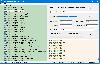
 Visual Terrain Maker is a simple 3D-Modeling program allows visually create landscapes (maps) for games and other purposes. Works in XP/NT/2k. The program can export to Direct X file format(*.x). The program is not critical to the video adapters and drivers. Suitable for DarkBasic (Professional)...
Platforms: Windows
| License: Freeware | Size: 321.22 KB | Download (329): Visual Terrain Maker Download |
Added: April 04, 2013 | Visits: 696
 This program uses the Delaunay triangulation of a set of 2d points to generate a set of triangles that will make for a good terrain.Notice how there are more triangles on the bottom than at the top. This means it can offer more terrain detail close to the viewer and less further away once the...
Platforms: C and C plus plus
| License: Freeware | Size: 10 KB | Download (68): Terrain Generator Download |
Added: July 08, 2013 | Visits: 605
UltimaX Terrain Texture Generator will take a height map, lower altitude map, and a higher altitude map and blend them.It will output a rough map thats used for CLOD terrain engine, a shade map, a blend map, and a shaded blend map.
Platforms: C and C plus plus
| License: Freeware | Size: 706.56 KB | Download (54): UltimaX Terrain Texture Generator Download |
Released: January 13, 2014
|
Added: October 09, 2014 | Visits: 841
 Maps Downloader For Google Terrain is a smart tool which can help you download tile satellite images from google map fastly and stably.It can stitch tile images into one big seamless image:Software can stitch tile images into one big seamless image such as GeoTIFF and GeoJPEG. But if the...
Platforms: Windows, Windows 7, Windows Server
| License: Shareware | Cost: $49.95 USD | Size: 4.72 MB | Download (1234): Maps Downloader For Google Terrain |
Released: December 10, 2023
|
Added: December 26, 2023 | Visits: 50
 Google Maps Terrain Downloader is a tool that can automatically download the google terrain maps images to your PC. It can download the small tiles and save them to your hard disk. After downloading, you can view the maps offline by its tool Maps Viewer, or you can combine the small images into...
Platforms: Windows 8, Windows 7, Windows
| License: Shareware | Cost: $29.99 USD | Size: 305.27 MB | Download (9): Google Maps Terrain Downloader |
Released: July 22, 2012
|
Added: July 22, 2012 | Visits: 445
 Overview of Purpose: T.Ed is a complete solution for making huge outdoor worlds: The technique behind designing and using terrain objects can be a minefield of choices, as there are so many different ways of doing it! T.Ed is designed primarily for games programmers and 3D artists to make those...
Platforms: Windows
| License: Shareware | Cost: $0.00 USD | Size: 7.63 MB | Download (383): T.Ed Pro Terrain & World Editor Download |
Released: June 16, 2012
|
Added: June 16, 2012 | Visits: 546
A cross-platform terrain rendering engine that uses advanced techniques such as dynamic tessellation to render complex landscapes at high frame rates. Suitable for use in games, engineering, simulation, etc.
Platforms: Windows, Mac, Linux
| License: Freeware | Size: 124.71 KB | Download (52): Demeter Terrain Engine Download |
Added: May 17, 2013 | Visits: 322
The Name of Game is Warless Terrain as there is no war between two teams. Hence, at any point of time all the coins/pegs are intact. The objective of game is to swap the coins/pegs to occupy opponentsd-deOao terrain. The coins/pegs can be moved or jumped (only one step) to adjacent vacant place...
Platforms: Matlab
| License: Shareware | Cost: $0.00 USD | Size: 122.88 KB | Download (48): Warless Terrain Download |
Added: July 24, 2013 | Visits: 366
This creates a random heightfield with the fault algorithm. It takes a somewhat lengthy time to finish increasing a lot with the resolution and number of blocks of the finished file. It saves it as a jpeg file. The fault algorithm is where the computer makes a random ax+by=c line and everything...
Platforms: Mac
| License: Shareware | Cost: $0.00 USD | Size: 10.24 KB | Download (44): Random Terrain Generator Download |
Released: January 05, 2002
|
Added: March 18, 2006 | Visits: 3.060
 The 'X' in Digital 'X' Model represents 'T' in terrain model, 'G' in ground or geological model.
Rockmates Digital 'X' Model I ( DXM I ) creates contours isopachytes from a triangular mesh. Contours can be labelled, and printed. Lists of coordinates in text files can be read, triangulated and...
The 'X' in Digital 'X' Model represents 'T' in terrain model, 'G' in ground or geological model.
Rockmates Digital 'X' Model I ( DXM I ) creates contours isopachytes from a triangular mesh. Contours can be labelled, and printed. Lists of coordinates in text files can be read, triangulated and...
Platforms: Windows
| License: Shareware | Cost: $86.00 USD | Size: 364 KB | Download (487): DXM Download |
Added: May 02, 2010 | Visits: 1.359
WorldForge::Mercator is primarily aimed at terrain for multiplayer online games and forms one of the WorldForge core libraries. It is intended to be used as a terrain library on the client, while a subset of features are useful on the server. Mercator is designed in such a way that individual...
Platforms: *nix
| License: Freeware | Size: 78.85 KB | Download (103): WorldForge::Mercator Download |
Released: August 05, 2011
|
Added: August 29, 2011 | Visits: 932
 In FastTerrain you are able to create, edit and visualize in 3D space digital terrain models. The program includes functionalities for break-lines and holes insertion as well as volume calculations and contours lines creation. With FastTerrain you can estimate excavation volumes by using digital...
Platforms: Windows
| License: Shareware | Cost: $171.56 USD | Size: 30.35 MB | Download (1542): FastTerrain Download |
Released: October 27, 2012
|
Added: October 27, 2012 | Visits: 551
MySatellite can download and combine every Google Maps tile (road map, terrain or satellite) between two chosen Earth coordinates into one big image. Then, for example, that map can be printed out for your own use.
Platforms: Mac
| License: Shareware | Cost: $10.00 USD | Size: 102.4 KB | Download (58): MySatellite Download |
Released: May 20, 2013
|
Added: July 11, 2013 | Visits: 719
![]() Spriteworks3D is the next generation 3D sprite/object library and includes a variety of 3D objects including rooms, terrain, scenes and props which can be incorporated into PC, Java, Flash or multimedia games and also used in 3D world environments, VRML and virtual reality settings. The objects...
Spriteworks3D is the next generation 3D sprite/object library and includes a variety of 3D objects including rooms, terrain, scenes and props which can be incorporated into PC, Java, Flash or multimedia games and also used in 3D world environments, VRML and virtual reality settings. The objects...
Platforms: Windows, *nix, Other
| License: Demo | Cost: $14.95 USD | Size: 2.09 MB | Download (65): Spriteworks3D Download |
Added: April 28, 2013 | Visits: 582
Superviewshed will calculate LOS of a referenced terrain matrices given observer and target altitudes. In addition, the standard minimum height observable of the terrain will be output. Runs approximately 16 times faster than viewshed.
Platforms: Matlab
| License: Freeware | Size: 10 KB | Download (48): superviewshed : Optimized LOS and Minimum Height Observable Tool Download |
Added: July 01, 2013 | Visits: 399
Digital elevation models can be considered just like an intensity images. Regardless of working with digital evevation models or digital images, they can be considered as a 2.5 dimensional surface, in which the row, column and grey level values represent the x, y and z respectively, using...
Platforms: Matlab
| License: Shareware | Cost: $0.00 USD | Size: 20.48 KB | Download (45): Image and Terrain Modeling using Incremental Delaunay Triangulation Download |
Added: September 17, 2013 | Visits: 423
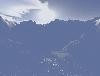
TerraVisionTM is an Open Source distributed, interactive terrain visualization system developed by SRI International. It allows users to navigate, in real time, through a 3-D graphical representation of a real landscape created from elevation data and aerial images of that landscape. There are...
Platforms: *nix
| License: Freeware | Size: 1.6 MB | Download (41): TerraVision Download |
Added: August 12, 2008 | Visits: 952
NewCyber3D provides full source code CDs covering a wide range of topics relevant to OpenGL GIS, terrain, stereo display, image processing and visualization. Each CD includes the entire OpenGL program and demonstrations with full source codes (including library source codes), project files,...
Platforms: Windows
| License: Freeware | Download (549): NewCyber3D Download |
Added: August 20, 2008 | Visits: 1.651
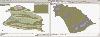
With this FREE AutoCAD add-on you can create terrain sectionsfrom geodetic points(heights) in the drawing. You can alsospecify position of pipe(cable, road, ...) or set auxiliarymarks in the section. Text settings, scale in X,Y axis, height of the referenceplane and type of the terrain section...
Platforms: Windows
| License: Freeware | Size: 69 KB | Download (705): TerrainSectionsPro2X Download |
Released: September 27, 2009
|
Added: October 01, 2009 | Visits: 2.200
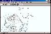
 There is not any professional program on internet like this and you can get it without any effort. I think this could be a handicap because it's dificult to believe, but it's true; try it and you'll be surprised.
It's not only a program to calculate a delaunay triangulation but you can input...
There is not any professional program on internet like this and you can get it without any effort. I think this could be a handicap because it's dificult to believe, but it's true; try it and you'll be surprised.
It's not only a program to calculate a delaunay triangulation but you can input...
Platforms: Windows
| License: Freeware | Size: 12.28 MB | Download (307): LanDTM Download |