


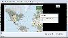
Street Map Germany software
Street Map Germany
Added: August 09, 2008 | Visits: 1.603
 This site provides address searching and street map facilities for the UK. We currently have street maps for Greater London and road atlas maps for the whole of mainland Britain (we're working on getting Northern Ireland). Any suggestions or comments are welcome.
Platforms: Windows
| License: Freeware | Download (554): The UK Street Map Page Download |
Added: August 27, 2013 | Visits: 474
GeoCosm is an Open Street Map map Viewer that allows the generation of GPX files containing waypoints. Helpfull when planning Caching tours for Geocaching. It allows the conversion of GeoCoordinates in different popular formats
Platforms: Mac
| License: Freeware | Size: 286.72 KB | Download (36): GeoCosm Download |
Released: July 01, 2013
|
Added: June 17, 2014 | Visits: 652
 Automapki application brings web mapping and commonly available satellite imagery to AutoCAD / ZWCAD / BricsCAD base DWG editors. It allows to display your project and working area on top of your favourite web mapping source, either Open Street Map, Map Quest, Open Aerial, or any user defined WMS...
Platforms: Windows, Windows 7
| License: Shareware | Cost: $50.00 USD | Size: 102.39 MB | Download (59): Automapki Download |
Released: September 15, 2012
|
Added: September 15, 2012 | Visits: 434
 This is Osm3d - a software to display 'Open Street Map' data in 3d - for Linux and MacOS X. This software visualize the map data of the OpenStreetMap project in three dimensions. You see motorways, streets, railways, buildings and lakes, rivers or fore
Platforms: Mac, Linux
| License: Freeware | Size: 284.48 KB | Download (46): osm3d Download |
Released: April 24, 2013
|
Added: May 12, 2013 | Visits: 2.308
 Arm Map Explorer recreates all the functionalities of Google Maps on your desktop while expanding them with new extras. Map Explorer lets you locate and view any place on the planet using dynamic interactive maps. These maps are draggable, which means there is no need for you to click and wait...
Platforms: Windows
| License: Freeware | Size: 5.46 MB | Download (197): Arm Map Explorer Download |
Released: July 14, 2012
|
Added: July 14, 2012 | Visits: 611
 e-OSMClient is a lightweight browser for displaing tiled maps. It was primarily designed to be used for displaying OSM rendered maps (Mapnik, Osmarender, Cycle Map,...), but it can work with any kind of tiled map servers (Virtual earth, World Wind,...). eOSMClient uses a local cache for saving...
Platforms: Windows
| License: Freeware | Size: 759 KB | Download (394): e-OSM Client Download |
Released: July 24, 2012
|
Added: July 24, 2012 | Visits: 511
Set multiple points for complex driving routes or complex area shapes. The trip adviser tool provides driving distance and duration information between the first and last routes, with intermediate points as "pit stops" between the two endpoints. Overlay street map view with a satellite view of...
Platforms: Not Applicable
| License: Commercial | Cost: $5.00 USD | Size: 31 KB | Download (51): MapTools Download |
Added: June 15, 2013 | Visits: 413
Keepright offers data consistency check routines for openstreetmap. With the project, you will never be able to lose yourself.Keepright is designed to provide a wiki-style means of creating a world-wide street map where everybody is encouraged to contribute.
Platforms: PHP
| License: Freeware | Size: 1.38 MB | Download (40): Keepright Download |
Released: December 17, 2012
|
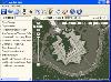
Added: December 17, 2012 | Visits: 780
 Marble is a Virtual Globe and World Atlas that you can use to learn more about Earth: You can pan and zoom around and you can look up places and roads. A mouse click on a place label will provide the respective Wikipedia article. Of course it's also possible to measure distances between locations...
Platforms: Windows
| License: Freeware | Size: 16.5 MB | Download (683): Portable Marble Download |
Added: July 06, 2013 | Visits: 296
This is a Python port of the Osmium (http://wiki.openstreetmap.org/wiki/Osmium) library, which provides a fast and flexible toolkit for working with Open Street Map data. Currently only a small subset of the Osmium toolkit is implement. You can read and write OSM files in different formats and...
Platforms: *nix
| License: Shareware | Cost: $0.00 USD | Size: 194.56 KB | Download (39): osmium Download |
Added: October 20, 2013 | Visits: 363
Over a year ago I announced that mkgmap would require Java 1.6 "soon". Well that time is now finally here and further releases will no longer work on Java 1.5 Version 1.6 has been out for nearly three years now and so most people will have it already. Indeed Sun is no longer supporting 1.5 after...
Platforms: *nix
| License: Freeware | Size: 1.98 MB | Download (45): mkgmap Download |
Released: November 22, 2015
|
Added: December 05, 2015 | Visits: 605
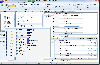 Modern ribbon-based data manipulation tool for Microsoft SQL Server
Main features:
Quick database browser.
Query designer with data preview, design SELECT, UPDATE, DELETE, INSERT commands. Support for WHERE (NOT) EXISTS and OUTER/CROSS APPLY join operators.
SQL profiler - trace SQL server...
Modern ribbon-based data manipulation tool for Microsoft SQL Server
Main features:
Quick database browser.
Query designer with data preview, design SELECT, UPDATE, DELETE, INSERT commands. Support for WHERE (NOT) EXISTS and OUTER/CROSS APPLY join operators.
SQL profiler - trace SQL server...
Platforms: Windows 8, Windows 7
| License: Shareware | Cost: $59.00 USD | Size: 6.4 MB | Download (78): DbMouse PRO Download |
Released: January 13, 2008
|
Added: January 17, 2009 | Visits: 2.548
 Germany Flash Map Locator for websites, presentations and more. Easy adjustment.
Variants of using a map locator:
- Real-Estate websites
- Quick access to contact organization data, having affiliated network in Germany
With this fully-clickable map you will be able to improve navigation...
Germany Flash Map Locator for websites, presentations and more. Easy adjustment.
Variants of using a map locator:
- Real-Estate websites
- Quick access to contact organization data, having affiliated network in Germany
With this fully-clickable map you will be able to improve navigation...
Platforms: Windows, Mac
| License: Demo | Cost: $69.00 USD | Size: 150 KB | Download (125): Germany Map Locator Download |
Released: August 29, 2008
|
Added: September 12, 2008 | Visits: 2.581
 Map Export is a GIS developer oriented tool for downloading and exporting background image.
For a long time, as a GIS developer, Its well known that to find perfect background images is a suffering and painful task. But since the growing up of Google Map, things have been changed. Google Map...
Map Export is a GIS developer oriented tool for downloading and exporting background image.
For a long time, as a GIS developer, Its well known that to find perfect background images is a suffering and painful task. But since the growing up of Google Map, things have been changed. Google Map...
Platforms: Windows
| License: Shareware | Cost: $499.95 USD | Size: 2.35 MB | Download (172): Map Export Download |
Added: June 24, 2013 | Visits: 536
Profile Map enables arbitrary profile fields to be mapped to a fixed data model in the $user object so that third-party modules can easily access the profile data. The module provides callbacks when the mapped profile fields are changed, for example, to require a form to be resubmitted on an...
Platforms: PHP
| License: Freeware | Size: 10 KB | Download (46): Profile Map Download |
Released: January 30, 2006
|
Added: November 06, 2006 | Visits: 4.049
 Map Suite Geocode USA is a powerful and feature-rich .NET geocoding engine that comes complete with a highly optimized dataset encompassing the entire United States. Map Suite Geocode USA features a fast, user-friendly .NET interface that enables C# and VB.NET software developers to take a United...
Platforms: Windows
| License: Demo | Cost: $2394.00 USD | Size: 341.13 KB | Download (165): Map Suite Geocode USA Download |
Released: August 29, 2008
|
Added: September 04, 2008 | Visits: 3.643
 Map View is a professional map browser. Both satellite imagery and maps online can be viewed through it. With the cache technology, it improve the user experience of viewing map. And more, the map can be viewed even when the computer is offline. It's a multi-window application, different places...
Platforms: Windows
| License: Shareware | Cost: $29.95 USD | Size: 1.91 MB | Download (274): Map View Download |
Released: September 02, 2012
|
Added: September 02, 2012 | Visits: 488
 The Map View SDK is available as a stand alone Developer kit. The Map View SDK offers a Direct DLL method to draw multi-type maps by region within your application. The satellite maps and the street maps will be easily used as background maps within your application such as GIS. The Map View SDK...
Platforms: Windows
| License: Shareware | Cost: $999.95 USD | Size: 1.12 MB | Download (45): Map View SDK Download |
Released: November 01, 2012
|
Added: November 01, 2012 | Visits: 439
 Interactive Deutschlandkarte for websites with wysiwyg editor tool. Easy adjustment. Variants of using a map locator: - Real-Estate websites - Quick access to contact organization data, having affiliated network in USA With this fully-clickable map you will be able to improve navigation and...
Platforms: Windows, Mac
| License: Demo | Cost: $99.00 USD | Size: 336 KB | Download (46): Click-and-Drag Map of Germany Download |
Released: October 25, 2012
|
Added: October 25, 2012 | Visits: 475
About 93 Photo Street
A photo map displays your images arranged by location instead of by time. With 93 Photo Street you can create gorgeous photo maps for the web without learning HTML or a complicated graphics program.
- Download free maps of any US city and county
- Or use your own map images...
Platforms: Mac
| License: Shareware | Cost: $0.00 USD | Size: 3.7 MB | Download (52): 93 Photo Street 1.2 Download |