


National Geographic Geography Terms software
National Geographic Geography Terms
Released: June 03, 2012
|
Added: June 03, 2012 | Visits: 480
 A web based Geographic Metadata Catalog for data description and discovery. It implements international standards (e.g. ISO19115/19139, Z39.50, CSW 2.0, OGC). It originates from the United Nations and is used by many governments as geoportal software
Platforms: Windows, Mac, Linux
| License: Freeware | Size: 201.06 MB | Download (47): GeoNetwork - Geographic Metadata Catalog Download |
Released: September 02, 2012
|
Added: September 02, 2012 | Visits: 647
 Take a three-dimensional journey through 28 of the United States National Parks. This 3D presentation of the beauty and natural wonder of Photographed in both 2D and 3D, these 800 pictures portray the best that the U.S. Park System has to offer. From Arizona's Grand Canyon to Hawaii's Volcanoes,...
Platforms: Mac
| License: Freeware | Size: 338 MB | Download (54): 3D National Parks Download |
Added: August 05, 2013 | Visits: 354
Wanting to acquire analog data from a National Instruments USB multifunction device using my Mac, I wrote this set of functions to allow "on demand" acquisition from multiple analog input channels. The routines provide analog input only, and assume that you are using only one device on your...
Platforms: Matlab
| License: Shareware | Cost: $0.00 USD | Size: 40.96 KB | Download (42): Mac OS X Data Aquisition with National Instruments device Download |
Added: July 28, 2013 | Visits: 656
Highlights search terms using jQuery when referer is a Google, Yahoo or Lycos search engine or within WordPress generated search results. This plugin is a light weight, low resource demanding and very simple fusion between How to Highlight Search Terms with jQuery - theme hack by Thaya Kareeson...
Platforms: PHP
| License: Freeware | Size: 20.48 KB | Download (48): Highlight Search Terms Download |
Added: May 06, 2013 | Visits: 486
Analyze a post and outputs the most frequent terms. This plugin is heavily based on Rob Marsh's Similar Posts plugin from which is a stripped down version for my personal purposes. Useful to have a list of related terms different from the categories.Installation : 1. Upload Post_Terms_List.php to...
Platforms: PHP
| License: Freeware | Size: 10 KB | Download (41): Post Terms List Download |
Added: May 08, 2013 | Visits: 459
This plugin will automatically links to terms in your content to that term's page. Can be used for tags, categories and custom taxonomies. Based on Chen Ju's Automatic Tag Links.The plugin will only match full words, so if you have a term called "World" and use the word "worldwide" it will link...
Platforms: PHP
| License: Freeware | Size: 20.48 KB | Download (39): Terms to Links Download |
Added: June 04, 2013 | Visits: 418
This module generates a block of related terms on the taxonomy overview pages.Terms are displayed as a tagcloud.Terms are related to each other if they appear on the same node. The more nodes they appear on together, the bigger they will be displayed in the cloud.How can you get involved? * Help...
Platforms: PHP
| License: Freeware | Size: 10 KB | Download (46): Related terms Download |
Added: April 29, 2013 | Visits: 442
Top Terms is a lightweight module designed to find popular terms on a site. These can be displayed as a simple block or used by other modules.Popularity is measured by summing page hits for each article tagged with a term. It collects these results on a scheduled basis and caches them for better...
Platforms: PHP
| License: Freeware | Size: 10 KB | Download (39): Top Terms Download |
Added: August 29, 2013 | Visits: 626
The Book Auto Terms (BATS) module automatically assigns terms to book pages based on the selected parent of the book page. Used in combination with the Book and Taxonomy Access Control modules, the BATS module allows a site administrator to automatically assign who can view and edit new content...
Platforms: PHP
| License: Freeware | Size: 10 KB | Download (46): Book Auto Terms Download |
Added: August 21, 2013 | Visits: 630
The Web Curator Tool (WCT) is an open-source workflow management application for selective web archiving. It is designed for use in libraries and other collecting organisations, and supports collection by non-technical users while still allowing complete control of the web harvesting process. It...
Platforms: *nix
| License: Freeware | Size: 138.63 MB | Download (37): Web Curator Tool Download |
Released: March 06, 2004
|
Added: November 05, 2006 | Visits: 6.099
 Quickly and easily create professional outline-map worksheets for lessons in geography, history, social studies, and current events.
See exactly what your maps will look like as you design them with the WYSIWYG interface. Zoom and pan to select a map area from high quality and detailed world...
Quickly and easily create professional outline-map worksheets for lessons in geography, history, social studies, and current events.
See exactly what your maps will look like as you design them with the WYSIWYG interface. Zoom and pan to select a map area from high quality and detailed world...
Platforms: Windows
| License: Demo | Cost: $34.95 USD | Size: 6.28 MB | Download (173): Map Worksheet Factory Download |
Added: June 25, 2006 | Visits: 2.276
termBlaster provides a way to swap between multiple search engines and search terms with just a click, and along with features like the Search Basket, the Search Bar, an Internal Browser, and Browser Integration termBlaster will make your searches as simple as possible.
Originally designed to...
Platforms: Windows
| License: Freeware | Size: 800 KB | Download (112): termBlsater Download |
Added: June 01, 2006 | Visits: 6.440
 This interactive software blends learning with entertainment as it teaches U.S. geography in a colorful, feature-rich environment. Consisting of 14 separate puzzles, Map Puzzle U.S.A. has been meticulously designed to teach kids to name and identify the 50 U.S. states along with their capitals...
Platforms: Windows
| License: Shareware | Cost: $17.99 USD | Size: 24.73 MB | Download (248): Map Puzzle U.S.A. Download |
Released: December 30, 2019
|
Added: January 08, 2020 | Visits: 3.179
 TOPOWIN is a state-wide register of the German Topographic Cartographies, the German Basic Cartography and of localities with geo references in different coordinate systems. It is also a topographic information system. In the division of planning and execution of economical and scientific...
Platforms: Windows, Windows 8, Windows 7, Windows Server
| License: Shareware | Cost: $125.00 USD | Size: 4.56 MB | Download (271): TOPOWIN Download |
Released: November 09, 2006
|
Added: November 14, 2006 | Visits: 4.286
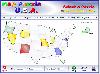
 Geo World is a handy application for finding out detailed information about any country in the world. One of its advantages is that you can find the country you were looking for by Internet Country Code, Capital and etc. Also it's supplied with more than 530 images which represent flags and maps...
Platforms: Windows
| License: Shareware | Cost: $25.00 USD | Size: 6.24 MB | Download (318): Geo World Download |
Released: January 02, 2007
|
Added: January 06, 2007 | Visits: 2.635
 Imports gridded data into Microsoft MapPoint, to produce attractive data maps that resemble contour maps.
Input data consists of a value that is defined for various (gridded) geographic coordinates. Common text output formats such as CSV are supported.
Can handle imperfect data, holes,...
Imports gridded data into Microsoft MapPoint, to produce attractive data maps that resemble contour maps.
Input data consists of a value that is defined for various (gridded) geographic coordinates. Common text output formats such as CSV are supported.
Can handle imperfect data, holes,...
Platforms: Windows
| License: Shareware | Cost: $75.00 USD | Size: 2.16 MB | Download (899): GridImp Download |
Released: November 29, 2006
|
Added: February 05, 2007 | Visits: 3.970
 IPSearchLight for ASP.NET gives you real-time feedback on the geographic location of website visitors by their IP address alone. The technology is completely unintrusive, yet can often track a person's location to a few miles radius on the planet.
Some potential uses:
- Localization of...
IPSearchLight for ASP.NET gives you real-time feedback on the geographic location of website visitors by their IP address alone. The technology is completely unintrusive, yet can often track a person's location to a few miles radius on the planet.
Some potential uses:
- Localization of...
Platforms: Windows
| License: Shareware | Cost: $199.00 USD | Size: 8.53 MB | Download (142): IPSearchLight GeoLocator for ASP.NET Download |
Added: August 27, 2008 | Visits: 1.010
 Know Your USA is a software application developed to help users expand their knowledge of USA geography. Each geographic feature of the USA is covered in detail including regions, states, state capitals, major cities, rivers, mountains and lakes. Know Your USA is great software for learning all...
Platforms: Windows
| License: Shareware | Cost: $24.95 USD | Size: 15.5 KB | Download (549): Know Your USA Download |
Added: August 22, 2008 | Visits: 1.351
Want to brush up on the names and locations of the 50 or so countries of modern Africa? This program from the Family Games Web Center will help you. African Geography Tutor presents a scrolling map of Africa along with a list of countries. As your mouse pointer passes over the map, the country...
Platforms: Windows
| License: Freeware | Size: 508 KB | Download (122): African Geography Tutor Download |
Added: August 29, 2008 | Visits: 2.402
Want to brush up on the names and locations of the 48 contiguous states of the USA? This program from the Family Games Web Center will help you. United States Geography Tutor presents a scrolling map of the USA along with a list of states. As your mouse pointer passes over the map, the state...
Platforms: Windows
| License: Freeware | Size: 500 KB | Download (110): United States Geography Tutor Download |