


Msn Satellite Virtual Earth software
Msn Satellite Virtual Earth
Released: December 09, 2012
|
Added: December 09, 2012 | Visits: 628
 Enjoy pleasant 3D effects as Virtual Earth takes you to outer space full of motion: rotating Earth, Clouds, as well as Shattering and reopening of your Screen is animated. The idea is to provide experience of the world outside of Earth. Fluid realistic animations and breathtaking details are the...
Platforms: Windows
| License: Shareware | Cost: $5.00 USD | Size: 3.38 MB | Download (53): Virtual Earth screensaver Download |
Added: January 25, 2010 | Visits: 1.007
This widget allows you quick and easy access to MSNNs Virtual Earth. You can do location-based searches, zoom in and out and itNs all only a Dashboard-click away.
Platforms: Mac
| License: Freeware | Download (147): Virtual Earth Widget Download |
Added: August 24, 2008 | Visits: 1.746
Microsoft Virtual Earth is a fantastic program that lets you view from a bird+s eye point any part of the world thanks to the map creation technology used for local.live.com, the latest regional search and map creation site from Microsoft.With Microsoft Virtual Earth 3D you can view in full...
Platforms: Windows
| License: Freeware | Size: 4 KB | Download (228): Microsoft Virtual Earth 3D 2.0 Beta Download |
Released: July 14, 2012
|
Added: July 14, 2012 | Visits: 611
 e-OSMClient is a lightweight browser for displaing tiled maps. It was primarily designed to be used for displaying OSM rendered maps (Mapnik, Osmarender, Cycle Map,...), but it can work with any kind of tiled map servers (Virtual earth, World Wind,...). eOSMClient uses a local cache for saving...
Platforms: Windows
| License: Freeware | Size: 759 KB | Download (394): e-OSM Client Download |
Added: May 10, 2013 | Visits: 517
The plugin supports Microsoft Virtual Earth, Google Maps, and OpenStreet.InstallationUnpack and upload it to the /wp-content/plugins/ directory.Activate the plugin through the 'Plugins' menu in WordPress. Requirements: - WordPress 2.5.1 up to 2.6.3
Platforms: Windows, Mac, *nix, PHP, BSD Solaris
| License: Freeware | Download (69): UMapper Download |
Released: July 18, 2012
|
Added: July 18, 2012 | Visits: 791
 Create own true to scale maps, store online maps locally with Vivo techology, map editor, dataexchange with Google Earth by Copy and Paste, GPS enabled coordinates, import of free OpenStreatMap data and GPS Exchange and GPS logger data, compatible with "GPS for Google Earth", area calculation...
Platforms: Windows
| License: Shareware | Cost: $65.00 USD | Size: 6.36 MB | Download (398): Dr. Regener LandMap Vivo Download |
Released: March 31, 2010
|
Added: April 24, 2010 | Visits: 1.924
 BotPlatform is the exclusive certified platform of Windows Live Messenger (MSN) robots, supporting Yahoo! Messenger, Google Talk and other IM services, with more than 70,000 individual developers all over the world.
The SDK is easy to distribute, develop, debug and deploy. Developers can...
BotPlatform is the exclusive certified platform of Windows Live Messenger (MSN) robots, supporting Yahoo! Messenger, Google Talk and other IM services, with more than 70,000 individual developers all over the world.
The SDK is easy to distribute, develop, debug and deploy. Developers can...
Platforms: Java
| License: Freeware | Size: 1.17 MB | Download (2736): BotPlatform SDK JAVA Download |
Released: March 31, 2010
|
Added: April 24, 2010 | Visits: 1.282
 BotPlatform is the exclusive certified platform of Windows Live Messenger (MSN) robots, supporting Yahoo! Messenger, Google Talk and other IM services, with more than 70,000 individual developers all over the world.
The SDK is easy to distribute, develop, debug and deploy. Developers can...
BotPlatform is the exclusive certified platform of Windows Live Messenger (MSN) robots, supporting Yahoo! Messenger, Google Talk and other IM services, with more than 70,000 individual developers all over the world.
The SDK is easy to distribute, develop, debug and deploy. Developers can...
Platforms: Windows
| License: Freeware | Size: 1.25 MB | Download (108): BotPlatform SDK COM Download |
Added: October 27, 2013 | Visits: 807
OpenGTS??a*zNz ("Open GPS Tracking System") is the first available open source project designed specifically to provide web-based GPS tracking services for a "fleet" of vehicles. To date, OpenGTS??a*zNz has been downloaded and put to use in over 90 countries around the world to track many 1000's...
Platforms: Mac
| License: Freeware | Size: 3.97 MB | Download (44): OpenGTS Download |
Released: May 15, 2013
|
Added: May 18, 2013 | Visits: 4.992
 PG Real Estate - a turnkey solution to build a Real Estate Web Site. It is a perfect solution for a Real Estate Portal (property lease, rent and sale marketplace), Independent Realtors or Real Estate Agencies. The script allows managing site members, content and settings from administration...
Platforms: Windows, *nix
| License: Shareware | Cost: $399.00 USD | Size: 166 KB | Download (246): PG Real Estate Solution Download |
Added: March 01, 2010 | Visits: 1.453
GeoServer project is a full transactional Java (J2EE) implementation of the OpenGIS Consortiums Web Feature Server specification, with an integrated WMS. GeoServer is free software, available under the GPL 2.0 license. Users who would like to access and modify their geographic data over the...
Platforms: *nix
| License: Freeware | Size: 20.4 MB | Download (118): GeoServer 1.5.3 / 1.6.0 Beta Download |
Released: November 10, 2012
|
Added: November 10, 2012 | Visits: 648
 With World Wind Java SDK, developers can embed World Wind technology in their own applications. World Wind Java SDK contains all the necessary files to get you started in implementing World Wind technology in your projects.
Platforms: Windows
| License: Freeware | Size: 24.69 MB | Download (49): World Wind Java SDK Download |
Released: June 13, 2012
|
Added: June 13, 2012 | Visits: 937
 Add realistic 3D capabilities to your online Bing Maps. Bing Maps 3D brings you another step closer to knowing "what it is like out there". You can search, browse, and organize local information viewed in three dimensions, just the way it exists in the real world. This enables you to more...
Platforms: Windows
| License: Freeware | Size: 1.2 MB | Download (511): Microsoft Bing Maps 3D Download |
Added: May 10, 2013 | Visits: 490
PietschSoft.VE is an ASP.NET 2.0 Virtual Earth Server Control. The goal of this control is to allow ASP.NET developers to utilize Virtual Earth mapping within their applications with out requiring any JavaScript knowledge.Feature outline: - Show map - Plot points - custom images supported -...
Platforms: Windows, ASP.NET,
| License: Freeware | Download (53): PietschSoft.VE 2.0.1a Download |
Added: June 27, 2013 | Visits: 501
This module delivers support for the Mapstraction javascript library, which provides an abstraction layer for the various map providers including Google, Yahoo!, and MapQuest. It allows you to quickly display maps on your site from multiple providers and switch between providers without worrying...
Platforms: PHP
| License: Freeware | Size: 10 KB | Download (52): Mapstraction Download |
Released: July 18, 2012
|
Added: July 18, 2012 | Visits: 541
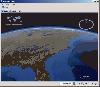
Satellite earth is a software for viewing satellite and aerial imagery of the Earth.Satellite Earth allows you to enjoy virtual travel around the world, look up local information and plan trips, exploring multimedia content and share information about your trips.Explore towns, cities and terrain...
Platforms: Windows
| License: Freeware | Size: 584 KB | Download (47): Satellite Earth Download |
Released: August 23, 2012
|
Added: August 23, 2012 | Visits: 626
The Virtual Moon Atlas Pro allows you to explore and analyze the sophisticated natural satellite known as the Moon.
A complex but easy to use software and a 3D image database.
Platforms: Windows
| License: Freeware | Download (451): Virtual Moon Atlas Download |
Added: September 09, 2013 | Visits: 785
This book presents a set of techniques useful in the construction of Low Earth Orbit (LEO) satellite communication systems, including the use of the Doppler shifts to aid communications.For a complete book description and ordering information, please visit...
Platforms: Matlab
| License: Freeware | Size: 430.08 KB | Download (52): Doppler Applications in LEO Satellite Communication Systems Download |
Added: June 16, 2013 | Visits: 559
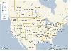
SATGLOBE - This file renders a fully manipulatable satellite view of earth at a resolution of two pixels per degree, with added international political boundaries and gridlines. The imagery was obtained from NASA, and the globe was rendered using the MATLAB Mapping Toolbox.The Mapping Toolbox is...
Platforms: Matlab
| License: Freeware | Size: 460.8 KB | Download (43): SATGLOBE - Rendering Satellite Views of Earth Download |
Added: October 21, 2013 | Visits: 412
The Geostationary Earth Orbit Satellite Model is a simple angular velocity model that uses Java3D for a realistic visualization of satellites in geostationary orbits. Students can view and explore the behavior of geostationary orbits, non-geostationary orbits, and non-physical orbits. This model...
Platforms: Mac
| License: Shareware | Cost: $0.00 USD | Size: 2.07 MB | Download (36): Geostationary Earth Orbit Satellite Model Download |