


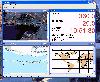
Mio Gps Data software
Mio Gps Data
Released: April 09, 2010
|
Added: July 05, 2010 | Visits: 3.474
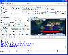 The Tro GPS Simulator provides a complete suite for all your GPS simulating needs and more. The Tro GPS Simulator uses the international standardized protocol NMEA-0183 for GPS data exchange. It can simulataneously send and recieve data.Furthermore it provides several input methods for GPS...
Platforms: Windows
| License: Demo | Cost: $99.00 USD | Size: 5.73 MB | Download (884): Tro GPS Simulator Download |
Released: September 02, 2012
|
Added: September 02, 2012 | Visits: 638
 Develop precise, efficient, and reliable GPS software in record time with this multithreaded component for desktop and mobile devices, including PocketPC, Windows CE, Tablet PC, Smartphone and now Windows Mobile! Over fifty classes in one lightweight assembly give you unparalleled features while...
Platforms: Windows, Pocket PC, Handheld/Mobile Other
| License: Shareware | Cost: $279.00 USD | Size: 10.34 MB | Download (51): GPS.NET Download |
Added: August 12, 2008 | Visits: 1.499
 GPS library VB (.NET) toolkit reads and decodes standard GPS NMEA 183 sentences from the RS232 serial port as well as computes great circle distances and bearings. Runs as a background thread unattended. Works with Bluetooth and USB. The most current GPS data is always available on demand....
Platforms: Windows
| License: Shareware | Cost: $105.00 USD | Size: 303 KB | Download (109): MarshallSoft GPS Component for VB Download |
Released: December 29, 2010
|
Added: January 06, 2011 | Visits: 4.315
 OkMap is a GPS and map software that:
-Works with vectorial maps and calibrates raster maps
-Organizes paths by creating waypoints, routes and tracks
-Uploads/downloads data to/from your GPS
-Uses altitude DEM data
-Supports GPS real-time navigation
-Sends/receives vehicles position...
OkMap is a GPS and map software that:
-Works with vectorial maps and calibrates raster maps
-Organizes paths by creating waypoints, routes and tracks
-Uploads/downloads data to/from your GPS
-Uses altitude DEM data
-Supports GPS real-time navigation
-Sends/receives vehicles position...
Platforms: Windows
| License: Freeware | Size: 20.25 MB | Download (1277): OkMap Download |
Added: March 23, 2013 | Visits: 436
The purpose of E-Collaboration for GPS/DGPS is to provide a GIS collaboration environment for the world over Internet, in which people can share and assess their measured GPS data.
Platforms: PHP
| License: Shareware | Cost: $0.00 USD | Size: 491.52 KB | Download (40): E-Collaboration for GPS/DGPS Download |
Added: June 26, 2013 | Visits: 406
The JavaGPS package enables Java applications to talk to attached GPS devices that conform to the NMEA0183 protocol. JavaGPS has the following key features: Auto-detection of attached GPS device Recording and playback of GPS data Supports raw GPS logs and has an optimised log file format....
Platforms: *nix
| License: Freeware | Size: 522.24 KB | Download (34): JavaGPS - access GPS devices from Java Download |
Added: October 14, 2006 | Visits: 5.923
 Opanda PowerExif is a professional tool to edit Exif data in images. As the best assistant to edit & modify images information for photographers, image pickers, PowerExif allows to edit & modify all Exif data freely. Not only you could manage and record photographic data and GPS data of images,...
Platforms: Windows
| License: Shareware | Cost: $89.99 USD | Size: 1.2 MB | Download (665): Opanda PowerExif Editor Download |
Added: January 09, 2006 | Visits: 3.142
 - you can show a current GPS data (Speed, Direction, Longitude, Latitude, Time, Date, Height);
- you can open any of scanned maps (in a "bmp" or "dib" format);
- you can calibrate the scanned maps yourself by two calibration points only (left-top and right-bottom);
- calibrations are stored...
- you can show a current GPS data (Speed, Direction, Longitude, Latitude, Time, Date, Height);
- you can open any of scanned maps (in a "bmp" or "dib" format);
- you can calibrate the scanned maps yourself by two calibration points only (left-top and right-bottom);
- calibrations are stored...
Platforms: Windows
| License: Demo | Cost: $9.50 USD | Size: 3.58 MB | Download (537): VIGps Download |
Released: April 02, 2009
|
Added: April 07, 2009 | Visits: 2.197
 This component helps you to manipulate EXIF, IPTC and GPS information in JPEG and TIFF images plus known RAW formats (Canon CRW, Adobe DNG, Canon CR2, Fujifilm RAF, Minolta MRW, Nikon NEF, Pentax PEF, Sony ARW and Sony SR2). You can Change/Read/Write ALL EXIF or IPTC fields in JPEG images. The...
Platforms: Windows
| License: Shareware | Cost: $49.95 USD | Size: 1.39 MB | Download (266): AiS EXIF Info ActiveX Download |
Released: May 25, 2018
|
Added: June 25, 2018 | Visits: 3.605
 HoudahGeo is a photo geocoding and geotagging tool for Mac. Use HoudahGeo to attach GPS coordinates and location names to your photos.
HoudahGeo writes EXIF and XMP geotags to JPEG and RAW image files. This creates a permanent record of where a photo was taken. Just like a GPS-enabled camera....
HoudahGeo is a photo geocoding and geotagging tool for Mac. Use HoudahGeo to attach GPS coordinates and location names to your photos.
HoudahGeo writes EXIF and XMP geotags to JPEG and RAW image files. This creates a permanent record of where a photo was taken. Just like a GPS-enabled camera....
Platforms: Mac
| License: Demo | Cost: $39.00 USD | Size: 22.87 MB | Download (837): HoudahGeo Download |
Released: October 18, 2009
|
Added: December 19, 2009 | Visits: 1.427
 Automatic Geo/GPS location track utility for most parts of the World. Lets you know your and your friends geographic location at all times. Maps are downloaded on a per demand basis. All GPS information is stored to a database and can be readily retrieved based on a given date and time range....
Platforms: Windows, Pocket PC
| License: Shareware | Cost: $15.00 USD | Size: 2.41 MB | Download (156): GeoWatch Download |
Added: January 25, 2010 | Visits: 752
GPSd is an open-source GPS daemon, which allows you to share data from a single GPS source with multiple applications on one or even many computers. Not only can it reproduce raw GPS data to an (effectively) unlimited number of clients, but it can also provide fully parsed, on-demand GPS...
Platforms: Mac
| License: Freeware | Size: 500 KB | Download (122): gpsdX Download |
Released: August 23, 2012
|
Added: August 23, 2012 | Visits: 567
ExpertGPS is the ultimate mapping software for Garmin, Magellan, and Lowrance GPS owners. ExpertGPS displays your waypoints, routes, and tracks on USGS topo maps and aerial photos.
Using the powerful mapping tools in ExpertGPS, you can draw your route directly on a map, search for nearby...
Platforms: Windows
| License: Shareware | Cost: $74.95 USD | Size: 9.1 MB | Download (441): ExpertGPS Download |
Released: November 22, 2015
|
Added: December 05, 2015 | Visits: 603
 Modern ribbon-based data manipulation tool for Microsoft SQL Server
Main features:
Quick database browser.
Query designer with data preview, design SELECT, UPDATE, DELETE, INSERT commands. Support for WHERE (NOT) EXISTS and OUTER/CROSS APPLY join operators.
SQL profiler - trace SQL server...
Modern ribbon-based data manipulation tool for Microsoft SQL Server
Main features:
Quick database browser.
Query designer with data preview, design SELECT, UPDATE, DELETE, INSERT commands. Support for WHERE (NOT) EXISTS and OUTER/CROSS APPLY join operators.
SQL profiler - trace SQL server...
Platforms: Windows 8, Windows 7
| License: Shareware | Cost: $59.00 USD | Size: 6.4 MB | Download (78): DbMouse PRO Download |
Released: June 05, 2017
|
Added: August 02, 2017 | Visits: 321
 CP Splitter is a software tool that can split a TCP or UDP data stream into two or three identical data streams, so more than one application can simultaneously process the incoming data. For example, you can send NMEA 0183 data to a navigation application and simultaneously log the data using...
Platforms: Windows, Windows 7, Windows Server
| License: Shareware | Cost: $50.00 USD | Size: 3.09 MB | Download (39): TCP Splitter Download |
Added: January 25, 2010 | Visits: 752
RouteBuddy is a GPS mapping application for OS X. All the essential functions of your GPS device are supported; all you need is a Mac, a GPS, and of course RouteBuddy.Supports USGlobalSat DevicesSupports Garmin USB DevicesSupports NMEA CommunicationTransfer Waypoints, Routes and TracksHere are...
Platforms: Mac
| License: Demo | Cost: $0.00 USD | Download (113): RouteBuddy Download |
Added: April 22, 2013 | Visits: 196
Quickly reads in high-data rate data from *.sn1, *.sn2, *.mp1, *.mp2, *.iod and *.ion (UNAVCO COMPACT) files produced from dual-frequency gps data. The data is graphically represented with imagesc. The functionality is similar to TEQCPLOT. However, no graphical functions rely on toolboxes the...
Platforms: Matlab
| License: Shareware | Cost: $0.00 USD | Size: 10 KB | Download (44): TEQCFV Download |
Added: October 16, 2013 | Visits: 363
BT747 is a MTK GPS data logger device control software. Due to similarity this SW written with a iBlue 747 device should work with the following devices: ??? i-Blue 747 ??? i-Blue 757 ??? Qstarz BT-Q1000 ??? i.Trek Z1 It also works for the following devices that have a slightly different log...
Platforms: *nix
| License: Freeware | Size: 2.6 MB | Download (39): BT747 Download |
Added: August 20, 2008 | Visits: 974
Copiks PhotoMapper helps you organize your photos by adding geographic information to the EXIF - data of the image called geotagging.The information can be inserted manually or using GPS data that you can import to the program.The location, photo thumbnails and GPS polygons can be exported...
Platforms: Windows
| License: Freeware | Size: 4 KB | Download (119): Copiks PhotoMapper Download |
Released: August 29, 2009
|
Added: September 08, 2009 | Visits: 2.416
 Private Coach is the most complete Personal Training Software available. It provides custom training and nutrition advice through the unique "TrainerAssistance" feature. The included Nutrition Manager allows for calorie budgeting and tracking of key nutrients. Many health- and fitness related...
Platforms: Windows
| License: Shareware | Cost: $44.95 USD | Size: 130.98 MB | Download (480): Private Coach Download |