


Marine Navigation Maps software
Marine Navigation Maps
Released: November 11, 2012
|
Added: November 11, 2012 | Visits: 668
 A very affordable solution for the boater that wants to take the Mac aboard for real-time display of position on full color marine raster format BSB and Softcharts. Plug your GPS into your Mac and watch as your boat moves along in real-time, plotting a track behind the boat and logging your...
Platforms: Mac
| License: Commercial | Cost: $59.99 USD | Size: 6.6 MB | Download (55): GPSNavX Marine Navigation Download |
Released: July 10, 2012
|
Added: July 10, 2012 | Visits: 693
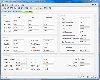
PolarCOM is an integrated NMEA 0183 marine navigation instrument data bridge and multipurpose data display. Available for Apple Mac OS X and Windows systems, it combines background server operation with high quality easy to read and fully customizable digital instrument views. PolarCOM is a...
Platforms: Mac
| License: Freeware | Size: 4.4 MB | Download (52): PolarCOM Download |
Released: September 20, 2010
|
Added: September 25, 2010 | Visits: 2.251
 Maritime Software - Draft Survey, Lashing and Route calculations for Merchant Navy. User-friendly Draft Survey, Lashing Calculations and Route Planning software for Ships' Officers and Marine Surveyors. Mariners Office is easily operated using either Keyboard or Mouse. It complies with the latest...
Platforms: Windows, Other
| License: Shareware | Cost: $199.95 USD | Size: 2.18 MB | Download (159): MarinersOffice Download |
Released: December 22, 2012
|
Added: December 22, 2012 | Visits: 464
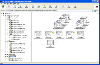 PowerMapper allows information architects, usability analysts and web developers to create graphical site maps with one click, providing site visualization and simple navigation. Maps show thumbnails of web pages and can be tailored using 11 different styles then printed or copied into another...
Platforms: Windows
| License: Shareware | Cost: $349.00 USD | Size: 1.31 MB | Download (488): PowerMapper Professional Download |
Released: August 18, 2012
|
Added: August 18, 2012 | Visits: 334
 PowerMapper allows information architects, usability analysts and web developers to create graphical site maps with one click, providing site visualization and simple navigation. Maps show thumbnails of web pages and can be tailored using 7 different styles then printed or copied into another...
Platforms: Windows
| License: Shareware | Cost: $149.00 USD | Size: 1.31 MB | Download (49): PowerMapper Standard Download |
Released: March 15, 2008
|
Added: April 30, 2008 | Visits: 4.644
 With MobiumGPS , your Windows Mobile device is turned into an advanced Mobile Navigation System with turn-by-turn voice announcements and detailed driving directions. You can search over 15 million point of interests (POIs) - places like hotels, restaurants, shopping malls and other tourist...
Platforms: Windows
| License: Demo | Cost: $9.95 USD | Size: 806.13 KB | Download (1554): Mobium GPS Navigation System Download |
Released: July 17, 2012
|
Added: July 17, 2012 | Visits: 689
 Draft Survey and Lashing calculations Marine Software Bundle is a user-friendly Draught Survey calculation program for Ships' Officers and Marine Surveyors. It is easily operated using either Keyboard or Mouse. Marine Software Bundle complies with the latest UN ECE standards for Draught Surveying...
Platforms: Windows
| License: Shareware | Cost: $199.95 USD | Size: 7.59 MB | Download (57): Marine Software Bundle Download |
Released: August 13, 2012
|
Added: August 13, 2012 | Visits: 689
Anquet Maps for Mac is mapping, route-planning navigation software used by professional mountain guides, top mountain athletes, outdoor training centres and thousands of everyday walkers, climbers and cyclists.
With Anquet Maps for Mac you can create routes on real OS maps to print or transfer...
Platforms: Mac
| License: Freeware | Size: 4.8 MB | Download (54): Anquet Maps Download |
Added: June 07, 2006 | Visits: 3.068
 Interactive France departments flash maps. With this fully-clickable map you will be able to improve navigation and provide visitors with better and quicker access to information as well as improve the way you present the information. The map can be used "as is" however it is also easily...
Platforms: Windows
| License: Demo | Cost: $24.90 USD | Size: 310 KB | Download (469): Flash Maps France Departments Download |
Released: January 01, 2006
|
Added: November 11, 2006 | Visits: 7.521
 Download this amazing 3D screensaver and liven up your desktop with brand new 3D Marine Aquarium. Turn your PC into a wonderful 3D sea aquarium! Watch the incredible sea life of dolphins, sharks and orcas and hear the sounds of life below the sea! Download new fishes and aquarium backgrounds from...
Platforms: Windows
| License: Freeware | Size: 4.04 MB | Download (453): Crawler 3D Marine Aquarium Screensaver Download |
Released: May 16, 2008
|
Added: May 20, 2008 | Visits: 4.009
 Let this awesome 3D screensaver take you on an unforgettable diving adventure to the heart of the sea. Explore the fascinating beauty of the underwater world with a vibrant coral reef, colorful sponges and gently swaying plants. Fancy little clownfish, vigorous seahorses, cheerful sea turtles and...
Platforms: Windows
| License: Shareware | Cost: $19.95 USD | Size: 15 MB | Download (357): Marine Life 3D Screensaver Download |
Added: August 19, 2008 | Visits: 3.673
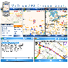
 Fugawi Global Navigator and Fugawi Marine ENC are the ideal PC software tool for route planning, GPS programming, and real-time GPS navigation on land, sea and in the air. With Fugawi Global Navigator you can navigate in real time using the widest variety of digital maps, such as NOAA RNC,...
Platforms: Windows
| License: Demo | Cost: $119.95 USD | Size: 40.05 MB | Download (1120): Fugawi Global Navigator Download |
Released: May 15, 2011
|
Added: November 12, 2012 | Visits: 1.709
![]() If your application has more than one window - and that is most probably the case - and relies on multiple input forms and report pages, smooth and fast navigation becomes one of the key factors determining the value of your application for clients. Few things irritate people more than complete...
If your application has more than one window - and that is most probably the case - and relies on multiple input forms and report pages, smooth and fast navigation becomes one of the key factors determining the value of your application for clients. Few things irritate people more than complete...
Platforms: OS/2, Windows, Mac, *nix, Windows CE, Pocket PC, Other,Android,BlackBerry,iPhone,iPod,iTouch,Palm,Palm OS 6.0,Handheld/Mobile Other,Java
| License: Demo | Cost: $49.95 USD | Size: 2.01 MB | Download (203): Navigation Toolbar Icons Download |
Added: November 14, 2010 | Visits: 1.956
Crossfire Maps packages includes maps for the Crossfire MUD client. Crossfire is a multi-player graphical arcade and adventure game made for X. It has certain flavours from other games, especially Gauntlet and the rogue-like games (Nethack, Moria, Angband, and Ragnarok). Any number of players...
Platforms: *nix
| License: Freeware | Size: 21.2 MB | Download (165): Crossfire Maps Download |
Added: May 22, 2010 | Visits: 1.537
Maps project is a topographal map and aerial photo generator and viewer. Maps allows users to generate topographical maps and aerial photographs of any region in the United States. It uses data provided by the USGS through the geoserver system. The interactive view lets you move around,...
Platforms: *nix
| License: Freeware | Size: 11.26 KB | Download (139): Maps Download |
Added: January 25, 2010 | Visits: 1.654
Software for their all-in-one car navigation system with software, maps, GPS and car mount.
Platforms: Mac
| License: Shareware | Cost: $0.00 USD | Download (399): TomTom GO Download |
Released: January 12, 2012
|
Added: February 04, 2012 | Visits: 1.498
 Bubble maps software does scatter plot and circle charts in Excel, useful for advanced business analysis.
Excel provides the ability to draw bubble maps and scatter plots, but they are less refined than a bubble map you can make with the Smart Bubble Charts software. In Excel: (1) Chart...
Bubble maps software does scatter plot and circle charts in Excel, useful for advanced business analysis.
Excel provides the ability to draw bubble maps and scatter plots, but they are less refined than a bubble map you can make with the Smart Bubble Charts software. In Excel: (1) Chart...
Platforms: Windows
| License: Shareware | Cost: $54.65 USD | Size: 16.32 MB | Download (126): Bubble Maps Software Download |
Released: July 12, 2012
|
Added: July 12, 2012 | Visits: 602
Create Flash Button Navigation Bars with ease. Use custom Fonts, MP3 Sounds, Text Color, Button Color Tinting, Text Position/Alignment, Horizontal or Vertical Navigation. Output direct to any web pages, direct to MS Frontpage (with included FrontPage Addin), MS PowerPoint (with included...
Platforms: Windows
| License: Shareware | Cost: $24.95 USD | Size: 3.82 MB | Download (386): InstantFX SE Navigation Maker Download |
Released: September 01, 2012
|
Added: September 01, 2012 | Visits: 660
Java Marine API is a small, handy NMEA 0183 library specially designed to enable an easy access to data provided by marine instruments such as GPS, sonar or autopilot.
Also, the manipulation of data is supported. Currently the library supports 11 GPS sentence types.
Platforms: Windows
| License: Freeware | Download (49): Java Marine API Download |
Released: September 24, 2012
|
Added: September 24, 2012 | Visits: 921
This software development kit (SDK) provides the binaries and programming reference for the Bing Maps WPF Control (Beta).
When the installation completes, you can choose to open the Bing Maps WPF Control (Beta) SDK help file (BingMapsWPFControlSDK.chm).
Get Bing Maps WPF Control and give it a...
Platforms: Windows, XP, 2003, Windows Vista, 2008, 7
| License: Freeware | Download (52): Bing Maps WPF Control Download |