


Map Coordinates For Cities software
Map Coordinates For Cities
Added: August 30, 2008 | Visits: 1.868
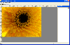 Create image maps for your website with this easy-to-use tool from Multimedia Australia. Simply select the image you want to use, choose a shape, then visually draw the image map regions. The image map coordinates can be copied to the clipboard for insertion into your favourite text editor.
Platforms: Windows
| License: Shareware | Cost: $24.95 USD | Size: 456 KB | Download (146): Imagination Image Map Editor Download |
Released: January 13, 2008
|
Added: January 17, 2009 | Visits: 2.546
 Germany Flash Map Locator for websites, presentations and more. Easy adjustment.
Variants of using a map locator:
- Real-Estate websites
- Quick access to contact organization data, having affiliated network in Germany
With this fully-clickable map you will be able to improve navigation...
Germany Flash Map Locator for websites, presentations and more. Easy adjustment.
Variants of using a map locator:
- Real-Estate websites
- Quick access to contact organization data, having affiliated network in Germany
With this fully-clickable map you will be able to improve navigation...
Platforms: Windows, Mac
| License: Demo | Cost: $69.00 USD | Size: 150 KB | Download (125): Germany Map Locator Download |
Released: May 20, 2009
|
Added: May 27, 2009 | Visits: 2.904
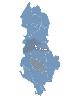 Albania Flash Map Locator for websites, presentations and more. Easy adjustment.
Variants of using a map locator:
- Real-Estate websites
- Quick access to contact organization data, having affiliated network in Albania
With this fully-clickable map you will be able to improve navigation...
Albania Flash Map Locator for websites, presentations and more. Easy adjustment.
Variants of using a map locator:
- Real-Estate websites
- Quick access to contact organization data, having affiliated network in Albania
With this fully-clickable map you will be able to improve navigation...
Platforms: Windows, Mac
| License: Demo | Cost: $69.00 USD | Size: 152 KB | Download (507): Albania Map Locator Download |
Released: May 20, 2009
|
Added: May 30, 2009 | Visits: 2.218
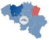 Belgium Interactive Map Locator for websites, presentations and more. Easy adjustment.
Variants of using a map locator:
- Real-Estate websites
- Quick access to contact organization data, having affiliated network in Belgium
With this fully-clickable map you will be able to improve...
Belgium Interactive Map Locator for websites, presentations and more. Easy adjustment.
Variants of using a map locator:
- Real-Estate websites
- Quick access to contact organization data, having affiliated network in Belgium
With this fully-clickable map you will be able to improve...
Platforms: Windows, Mac
| License: Demo | Cost: $69.00 USD | Size: 168 KB | Download (261): Belgium Map Locator Download |
Released: May 20, 2009
|
Added: June 02, 2009 | Visits: 2.371
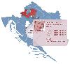 Croatia Interactive Map Locator for websites, presentations and more. Easy adjustment.
Variants of using a map locator:
- Real-Estate websites
- Quick access to contact organization data, having affiliated network in Croatia
With this fully-clickable map you will be able to improve...
Croatia Interactive Map Locator for websites, presentations and more. Easy adjustment.
Variants of using a map locator:
- Real-Estate websites
- Quick access to contact organization data, having affiliated network in Croatia
With this fully-clickable map you will be able to improve...
Platforms: Windows, Mac
| License: Demo | Cost: $69.00 USD | Size: 151 KB | Download (324): Croatia Map Locator Download |
Released: May 20, 2009
|
Added: June 06, 2009 | Visits: 2.236
 Czech Republic Interactive Map Locator for websites, presentations and more. Easy adjustment.
Variants of using a map locator:
- Real-Estate websites
- Quick access to contact organization data, having affiliated network in Czech Republic
With this fully-clickable map you will be able...
Czech Republic Interactive Map Locator for websites, presentations and more. Easy adjustment.
Variants of using a map locator:
- Real-Estate websites
- Quick access to contact organization data, having affiliated network in Czech Republic
With this fully-clickable map you will be able...
Platforms: Windows, Mac
| License: Demo | Cost: $69.00 USD | Size: 159 KB | Download (215): Czech Republic Map Locator Download |
Released: May 20, 2009
|
Added: June 09, 2009 | Visits: 1.952
 Denmark Interactive Map Locator for websites, presentations and more. Easy adjustment.
Variants of using a map locator:
- Real-Estate websites
- Quick access to contact organization data, having affiliated network in Denmark
With this fully-clickable map you will be able to improve...
Denmark Interactive Map Locator for websites, presentations and more. Easy adjustment.
Variants of using a map locator:
- Real-Estate websites
- Quick access to contact organization data, having affiliated network in Denmark
With this fully-clickable map you will be able to improve...
Platforms: Windows, Mac
| License: Demo | Cost: $69.00 USD | Size: 168 KB | Download (356): Denmark Map Locator Download |
Released: May 20, 2009
|
Added: June 11, 2009 | Visits: 2.082
 Estonia Interactive Map Locator for websites, presentations and more. Easy adjustment.
Variants of using a map locator:
- Real-Estate websites
- Quick access to contact organization data, having affiliated network in Estonia
With this fully-clickable map you will be able to improve...
Estonia Interactive Map Locator for websites, presentations and more. Easy adjustment.
Variants of using a map locator:
- Real-Estate websites
- Quick access to contact organization data, having affiliated network in Estonia
With this fully-clickable map you will be able to improve...
Platforms: Windows, Mac
| License: Demo | Cost: $69.00 USD | Size: 166 KB | Download (323): Estonia Map Locator Download |
Released: May 20, 2009
|
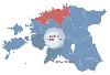
Added: June 17, 2009 | Visits: 2.197
 Finland Interactive Map Locator for websites, presentations and more. Easy adjustment.
Variants of using a map locator:
- Real-Estate websites
- Quick access to contact organization data, having affiliated network in Finland
With this fully-clickable map you will be able to improve...
Finland Interactive Map Locator for websites, presentations and more. Easy adjustment.
Variants of using a map locator:
- Real-Estate websites
- Quick access to contact organization data, having affiliated network in Finland
With this fully-clickable map you will be able to improve...
Platforms: Windows, Mac
| License: Demo | Cost: $69.00 USD | Size: 165 KB | Download (317): Finland Map Locator Download |
Released: May 25, 2018
|
Added: June 25, 2018 | Visits: 3.605
 HoudahGeo is a photo geocoding and geotagging tool for Mac. Use HoudahGeo to attach GPS coordinates and location names to your photos.
HoudahGeo writes EXIF and XMP geotags to JPEG and RAW image files. This creates a permanent record of where a photo was taken. Just like a GPS-enabled camera....
HoudahGeo is a photo geocoding and geotagging tool for Mac. Use HoudahGeo to attach GPS coordinates and location names to your photos.
HoudahGeo writes EXIF and XMP geotags to JPEG and RAW image files. This creates a permanent record of where a photo was taken. Just like a GPS-enabled camera....
Platforms: Mac
| License: Demo | Cost: $39.00 USD | Size: 22.87 MB | Download (837): HoudahGeo Download |
Added: April 14, 2010 | Visits: 1.420
 GIFgraph::Map can generate HTML map text. SYNOPSIS use GIFgraph::Map; $map = new GIFgraph::Map($gr_object); $map->set(key1 => value1, key2 => value2 ...); $HTML_map = $map->imagemap($gr_file, @data); Is a perl5 module to generate HTML map text for following graph objects GIFgraph::pie,...
Platforms: *nix
| License: Freeware | Size: 9.22 KB | Download (152): GIFgraph::Map Download |
Released: September 16, 2012
|
Added: September 16, 2012 | Visits: 595
 InnerSoft CAD is a add-on for AutoCAD. This group of tools will allows you to: Export to a Excel Sheet the values of Area/Length property or coordinates for various AutoCAD entities. Import from a Excel Sheet the vertex coordinates for a set of 2D polylines or 3D polylines (you can choose between...
Platforms: Windows, Other
| License: Shareware | Cost: $70.00 USD | Size: 1.97 MB | Download (444): InnerSoft CAD for AutoCAD 2007 Download |
Released: November 20, 2012
|
Added: November 20, 2012 | Visits: 557
 PalmaryClock Wireless Edition s not just an improved clock, it is a technological breakthrough. Your Palm can now be not only a powerful organizer but a real-time assistant in your business! Nowadays it is very important to have the latest reliable information, and with the help of PalmaryClock...
Platforms: Palm OS 4.0, Palm OS 5.0, Palm OS 6.0
| License: Shareware | Cost: $19.95 USD | Size: 1.48 MB | Download (48): PalmaryClock Wireless Edition for Treo Download |
Added: July 14, 2013 | Visits: 499
Function that convert geographic coordinates to North azimuthal equal-area map with 25 kmresolution pixel (EASE-Grid projection or NL). That projection is used mainly in remote sensing and cover the northern hemisphere.If you want to know the corresponding pixel in the EASE-Grid projection to a...
Platforms: Matlab
| License: Freeware | Size: 10 KB | Download (47): geo2easeGrid Download |
Added: June 21, 2013 | Visits: 645
This plugin creates custom post type with geo locations for back end data entering, Google Maps Api v3 is used to display geo posts onto a map with clickable markers overlay, geo posts html content then can be displayed in a popup window. Without any change this tool can be used to build a store...
Platforms: PHP
| License: Freeware | Size: 20.48 KB | Download (44): CleanCodeNZ Geo Posts Plugin Download |
Added: October 05, 2013 | Visits: 745
This app makes it easy to display a map for given address in django templates. No API keys, manual geocoding, html/js copy-pasting or django model changes is needed. Installation pip install geopy pip install django-easy-maps Then add 'easy_maps' to INSTALLED_APPS and run ./manage.py syncdb...
Platforms: *nix
| License: Freeware | Size: 10.24 KB | Download (50): django-easy-maps Download |
Added: January 09, 2006 | Visits: 4.682
 The VB Image Map OCX is an ActiveX Control designed to provide your applications with the ability to display interactive images. Hotspots, or specially designated areas on your image, can be defined that will react to users' mouse events. It is easily integrated into your existing...
| License: Shareware | Cost: $49.95 USD | Size: 558 KB | Download (305): VB Image Map ActiveX Control Download |
Released: February 07, 2012
|
Added: February 26, 2012 | Visits: 1.135
 Free standalone software DataPult Desktop creates heat maps from your data quickly and efficiently.
Key features:
Direct data import from MS Excel with one click.
The ability to create animated maps of data over several years.
Interactive maps and diagrams.
39 map...
Free standalone software DataPult Desktop creates heat maps from your data quickly and efficiently.
Key features:
Direct data import from MS Excel with one click.
The ability to create animated maps of data over several years.
Interactive maps and diagrams.
39 map...
Platforms: Windows
| License: Freeware | Size: 20.96 MB | Download (95): DataPult Desktop Download |
Released: September 04, 2012
|
Added: September 04, 2012 | Visits: 749
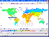
 Mobile Atlas Creator (formerly known as TrekBuddy Atlas Creator) is an open source (GPL) program which creates offline atlases for GPS handhelds and cell phone applications like TrekBuddy, AndNav and other Android and WindowsCE based applications.
For the full list of supported applications...
Mobile Atlas Creator (formerly known as TrekBuddy Atlas Creator) is an open source (GPL) program which creates offline atlases for GPS handhelds and cell phone applications like TrekBuddy, AndNav and other Android and WindowsCE based applications.
For the full list of supported applications...
Platforms: Mac
| License: Freeware | Size: 1.6 MB | Download (448): Mobile Atlas Creator for Mac OS X Download |
Released: September 19, 2012
|
Added: September 19, 2012 | Visits: 549
 InnerSoft CAD is a add-on for AutoCAD. This group of tools will allows you to: Export to a Excel Sheet the values of Area/Length property or coordinates for various AutoCAD entities. Import from a Excel Sheet the vertex coordinates for a set of 2D polylines or 3D polylines (you can choose between...
Platforms: Windows
| License: Demo | Cost: $70.00 USD | Size: 987 KB | Download (51): InnerSoft CAD for AutoCAD 2010 Download |