


Magellan Gps Maps software
Magellan Gps Maps
Added: May 22, 2010 | Visits: 1.532
 Maps project is a topographal map and aerial photo generator and viewer. Maps allows users to generate topographical maps and aerial photographs of any region in the United States. It uses data provided by the USGS through the geoserver system. The interactive view lets you move around,...
Platforms: *nix
| License: Freeware | Size: 11.26 KB | Download (139): Maps Download |
Added: May 13, 2010 | Visits: 1.337
GPS::Lowrance is a Perl module connect to Lowrance and Eagle GPS devices. REQUIREMENTS The following modules are required to use this module: Carp::Assert GPS::Lowrance::LSI 0.23 Parse::Binary::FixedFormat Win32::SerialPort or Device::SerialPort If you will be using the...
Platforms: *nix
| License: Freeware | Size: 22.53 KB | Download (139): GPS::Lowrance Download |
Added: September 18, 2010 | Visits: 1.593
GPS::Lowrance::Trail is a Perl module to convert between GDM16 Trails and other formats. Installation: Installation is pretty standard: perl Makefile.PL make make test make install There is no test suite to speak of. One will be added in a later version. SYNOPSIS use...
Platforms: *nix
| License: Freeware | Size: 8.19 KB | Download (113): GPS::Lowrance::Trail Download |
Added: January 25, 2010 | Visits: 874
Terrabrowser is an internet browser for satellite photos and topographical maps which are obtained from the Microsoft Terra Server. The map data is provided by the U.S. Geological Survey (USGS) and therefore only covers the United States at this time (although expansion to other map servers may...
Platforms: Mac
| License: Shareware | Cost: $0.00 USD | Download (98): Terrabrowser Download |
Added: January 25, 2010 | Visits: 1.304
GPS Connect is a freeware program for Mac OS X which offers connectivity to Garmin GPS receivers. The intended use is to backup waypoints from the GPS to your computer. Downloaded waypoints may be saved in a native file format or exported to a variety of other formats such as tab-delimited,...
Platforms: Mac
| License: Freeware | Size: 1.2 MB | Download (108): GPS Connect Download |
Added: January 25, 2010 | Visits: 945
GPSNavX is the solution for the boater that wants to take the Macintosh aboard for real-time display of position on full color marine Softcharts and BSB raster charts.Just plug your GPS into your Macintosh and watch as your boat moves along in real-time, plotting a track behind the boat and...
Platforms: Mac
| License: Shareware | Cost: $0.00 USD | Download (155): GPSNavX Download |
Added: January 25, 2010 | Visits: 1.398
GPSUtility displays GPS data including speed, bearing, position and satellite information.
Platforms: Mac
| License: Freeware | Download (148): GPSUtility Download |
Added: January 25, 2010 | Visits: 849
MacENC is the professional solution for the mariner that wants to take the Mac aboard for real-time display of position on the vector format S-57/S-63 ENCs (Electronic Navigational Charts) AND raster format BSB and Softcharts. Plug your GPS into your Mac and watch as your vessel moves along in...
Platforms: Mac
| License: Demo | Cost: $0.00 USD | Download (134): MacENC Download |
Released: April 09, 2010
|
Added: July 05, 2010 | Visits: 3.474
 The Tro GPS Simulator provides a complete suite for all your GPS simulating needs and more. The Tro GPS Simulator uses the international standardized protocol NMEA-0183 for GPS data exchange. It can simulataneously send and recieve data.Furthermore it provides several input methods for GPS...
Platforms: Windows
| License: Demo | Cost: $99.00 USD | Size: 5.73 MB | Download (884): Tro GPS Simulator Download |
Released: July 21, 2010
|
Added: September 25, 2010 | Visits: 1.346
 Toolkit to add GPS and coordinate conversion functionality to your software and scripts (GPS API). All NMEA0183 protocol versions are supported and can be filtered by NMEA sentence type and talker ID. Garmin USB PVT support. Information on GPS status can also be retrieved: GPS fix quality,...
Platforms: Windows
| License: Shareware | Cost: $99.00 USD | Size: 2.2 MB | Download (121): Eye4Software GPS API Download |
Released: January 12, 2012
|
Added: February 04, 2012 | Visits: 1.492
 Bubble maps software does scatter plot and circle charts in Excel, useful for advanced business analysis.
Excel provides the ability to draw bubble maps and scatter plots, but they are less refined than a bubble map you can make with the Smart Bubble Charts software. In Excel: (1) Chart...
Bubble maps software does scatter plot and circle charts in Excel, useful for advanced business analysis.
Excel provides the ability to draw bubble maps and scatter plots, but they are less refined than a bubble map you can make with the Smart Bubble Charts software. In Excel: (1) Chart...
Platforms: Windows
| License: Shareware | Cost: $54.65 USD | Size: 16.32 MB | Download (126): Bubble Maps Software Download |
Released: February 09, 2014
|
Added: March 16, 2014 | Visits: 1.889
 The Vutog GPS Simulator provides a complete suite for all your GPS simulation needs and more. It is designed to assist in developing, testing and debugging GPS Applications and equipment working with the NMEA-0183 protocol. It can be used for testing navigation applications and equipments indoor...
Platforms: Windows, Windows 7
| License: Shareware | Cost: $149.00 USD | Size: 5.75 MB | Download (164): Vutog GPS Simulator Download |
Released: October 23, 2012
|
Added: October 23, 2012 | Visits: 650
GPS Utility is an easy-to-use application that provides management and manipulation of GPS information. You can use it to transfer data to/from a GPS receiver and store the data in PC files in one of several text formats.
The program converts between different map datums and many coordinate...
Platforms: Windows
| License: Freeware | Size: 1.87 MB | Download (469): GPS Utility Download |
Released: June 03, 2012
|
Added: June 03, 2012 | Visits: 723
The Genome Positioning System (GPS) is a software tool to study protein-DNA interaction using ChIP-Seq data. GPS builds a probabilistic mixture model to predict the most likely positions of binding events at single-base resolution.
GPS is a Java software, so it runs on multiple platforms,...
Platforms: Windows
| License: Freeware | Download (430): GPS Download |
Released: November 10, 2012
|
Added: November 10, 2012 | Visits: 705
 Have a GPS and a laptop? Use this to find your way. Make patterns or a trail to share with others. When the application starts, you may pick your area of operations - be it North America, South America, Europe and Asia, or Australia. Your quadrant is determined by where you are in relation to the...
Platforms: Windows
| License: Freeware | Size: 4.56 MB | Download (503): LAS GPS Monitor LT Download |
Released: June 09, 2012
|
Added: June 09, 2012 | Visits: 338
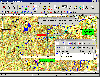 OziExplorer is interactive, it allows you to work, on your computer screen, with digital maps that you have purchased or scanned yourself. By using these maps OziExplorer allows you to plan your trip by creating waypoints, routes and tracks on screen and upload these to your GPS.
With...
OziExplorer is interactive, it allows you to work, on your computer screen, with digital maps that you have purchased or scanned yourself. By using these maps OziExplorer allows you to plan your trip by creating waypoints, routes and tracks on screen and upload these to your GPS.
With...
Platforms: Windows
| License: Shareware | Cost: $95.00 USD | Size: 7 MB | Download (431): OziExplorer Download |
Released: September 02, 2012
|
Added: September 02, 2012 | Visits: 638
Develop precise, efficient, and reliable GPS software in record time with this multithreaded component for desktop and mobile devices, including PocketPC, Windows CE, Tablet PC, Smartphone and now Windows Mobile! Over fifty classes in one lightweight assembly give you unparalleled features while...
Platforms: Windows, Pocket PC, Handheld/Mobile Other
| License: Shareware | Cost: $279.00 USD | Size: 10.34 MB | Download (51): GPS.NET Download |
Released: November 18, 2012
|
Added: November 18, 2012 | Visits: 617
 The simulator provides a complete suite for all your GPS simulating needs. You can: * Replay your GPS logfiles * Multiplex your GPS receivers * Transform your GPS receiver interface * Bridge a remote GPS receiver
Platforms: Windows
| License: Shareware | Cost: $99.00 USD | Size: 4.89 MB | Download (54): GPS-Simulator Download |
Released: September 24, 2012
|
Added: September 24, 2012 | Visits: 917
This software development kit (SDK) provides the binaries and programming reference for the Bing Maps WPF Control (Beta).
When the installation completes, you can choose to open the Bing Maps WPF Control (Beta) SDK help file (BingMapsWPFControlSDK.chm).
Get Bing Maps WPF Control and give it a...
Platforms: Windows, XP, 2003, Windows Vista, 2008, 7
| License: Freeware | Download (52): Bing Maps WPF Control Download |
Released: June 17, 2012
|
Added: June 17, 2012 | Visits: 864
![]() GPS Tracker Data Logger acts as the server and allows you to collect data from an unlimited number of various GPS trackers simultaneously. The obtained data is processed, uniformed and written to a log file or a database. Also, the program has a set of interfaces so other applications can get...
GPS Tracker Data Logger acts as the server and allows you to collect data from an unlimited number of various GPS trackers simultaneously. The obtained data is processed, uniformed and written to a log file or a database. Also, the program has a set of interfaces so other applications can get...
Platforms: Windows
| License: Shareware | Cost: $100.00 USD | Size: 11.83 MB | Download (64): GPS Tracker Data Logger Download |