


Magellan Gps software
Magellan Gps
Released: November 20, 2015
|
Added: April 20, 2016 | Visits: 3.083
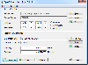 The Eye4Software Coordinate Calculator is an easy to use tool to perform map or GPS coordinate conversions. The software can be used to transform a single coordinate or a batch of coordinates read from a comma separated, database or ESRI shapefiles. The software is shipped with a MS Access...
Platforms: Windows, Windows 7
| License: Shareware | Cost: $119.00 USD | Size: 8.96 MB | Download (249): Eye4Software Coordinate Calculator Download |
Added: July 10, 2010 | Visits: 1.475
 GPS::PRN is a package for PRN - Object ID conversions. SYNOPSIS use GPS::PRN; my $obj = GPS::PRN->new(); print "PRN: ", $obj->prn_oid(22231), "n"; print "OID: ", $obj->oid_prn(1), "n"; This module maps GPS PRN number to Satellite OID and vice versa. Object Identification Number (OID)...
Platforms: *nix
| License: Freeware | Size: 4.1 KB | Download (230): GPS::PRN Download |
Added: August 14, 2008 | Visits: 1.836
GPS (Global Positioning System) receivers tell you where you are anywhere on the planet! The Global Positioning System (GPS) is a collection of 24 earth-orbiting satellites and these satellites allow any person who owns a GPS receiver to determine his or her precise longitude, latitude and...
Platforms: ALL
| License: Freeware | Download (223): How a GPS Receiver Works Download |
Released: November 02, 2010
|
Added: November 12, 2010 | Visits: 1.457
 GLIM is mobile instant messenger application for Nokia mobile phones under Symbian OS. Now supports phones only with 3rd edition.
GLIM supports Jabber/GTalk and ICQ protocols. You can use several logins simultaneously. In registered version it may be used for several protocols at same time....
GLIM is mobile instant messenger application for Nokia mobile phones under Symbian OS. Now supports phones only with 3rd edition.
GLIM supports Jabber/GTalk and ICQ protocols. You can use several logins simultaneously. In registered version it may be used for several protocols at same time....
Platforms: Symbian
| License: Shareware | Cost: $10.00 USD | Size: 198.82 KB | Download (211): GLIM Download |
Added: May 10, 2013 | Visits: 3.395
Magellan is a powerful CMS (content management system) designed for Ampoliros. It is one of the most commonly used Ampoliros modules and serves as a Web gateway platform for many other Ampoliros modules. Magellan is able to handle sites of all sizes, from standard institutional sites to very...
Platforms: Windows, Mac, *nix, PHP, BSD Solaris
| License: Freeware | Download (206): Magellan Download |
Added: January 15, 2006 | Visits: 4.092
 GPS Software - Download waypoints and routes from Garmin GPS. Upload waypoints and routes to Garmin GPS. Excel and Text files supported! This software is very easy to use!
Platforms: Windows
| License: Shareware | Cost: $29.95 USD | Size: 1.29 MB | Download (203): Frontbase GPS Download |
Added: February 15, 2010 | Visits: 2.243
GPS Tracker project allows someone to track a GPS enabled cell phone using Google maps. For this project I used a Motorola i355 cell phone on the Sprint/Nextel network. You need to have a data plan so that you can make updates to your website from the cellphone. Please read the ReadMe.txt file...
Platforms: *nix
| License: Freeware | Download (203): GPS Tracker Download |
Added: October 25, 2010 | Visits: 1.221
GMap is a Map editor for GPS maps that runs on linux. This project is a work in progress. GMap reads various formats and writes .mp polish map format files suitable for compiling using the cgpsmapper compiler. I also have some notes relating to the use of GPS tools on Linux and the use of...
Platforms: *nix
| License: Shareware | Cost: $0.00 USD | Size: 952.32 KB | Download (203): GMap 0.0.4 Download |
Released: January 14, 2010
|
Added: January 16, 2010 | Visits: 3.960
![]() The Picmeta Photo Tracker automatically geotags photos based on track information from any GPS device (.gpx files). It directly writes GPS EXIF data to .jpg, .tif, .crw, .dng, .nef, .pef, .jp2 formats. For other formats such as .cr2 it creates XMP sidecar files. The EXIFcare technology ensures...
The Picmeta Photo Tracker automatically geotags photos based on track information from any GPS device (.gpx files). It directly writes GPS EXIF data to .jpg, .tif, .crw, .dng, .nef, .pef, .jp2 formats. For other formats such as .cr2 it creates XMP sidecar files. The EXIFcare technology ensures...
Platforms: Windows
| License: Freeware | Size: 2.18 MB | Download (192): Picmeta Photo Tracker Download |
Added: August 11, 2006 | Visits: 3.337
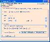
GPS Express provides a feature rich interface to serial NMEA-0183 protocol data and works with most NMEA-0183 devices, including GPS Receivers. GPS Express is available in three versions (Standard, Professional, Graphical). STANDARD displays the title, value, and units for each parameter....
Platforms: Windows
| License: Shareware | Cost: $65.00 USD | Size: 2.1 MB | Download (169): GPS Express Standard Edition Download |
Released: September 14, 2010
|
Added: November 20, 2010 | Visits: 1.683
 EXIF Farm Pro- EXIF/ IPTC/ XMP data viewer, EXIF/ IPTC/ EXIF GPS data editor and creator in Windows Explorer. Being integrated in the operating system, the program gives an access to Exif information in most of applications. EXIF Farm Pro allows editing and creation of EXIF/IPTC data for batches...
Platforms: Windows
| License: Shareware | Cost: $29.95 USD | Size: 4.78 MB | Download (165): Exif Farm Pro Download |
Released: February 09, 2014
|
Added: March 16, 2014 | Visits: 1.890
 The Vutog GPS Simulator provides a complete suite for all your GPS simulation needs and more. It is designed to assist in developing, testing and debugging GPS Applications and equipment working with the NMEA-0183 protocol. It can be used for testing navigation applications and equipments indoor...
Platforms: Windows, Windows 7
| License: Shareware | Cost: $149.00 USD | Size: 5.75 MB | Download (164): Vutog GPS Simulator Download |
Released: May 28, 2012
|
Added: July 18, 2012 | Visits: 1.069
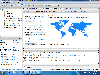
 RouteConverter displays, modifies, enriches and converts GPS data between over 75 formats. It works without installation under Linux, Mac OS X and Windows, automatically detects the format of a file, supports drag and drop, undo and redo, offers a map view onto the positions of routes, tracks and...
Platforms: Windows, Mac, *nix, Windows 7, Solaris,FreeBSD,OpenBSD,Java
| License: Freeware | Size: 6.61 MB | Download (162): RouteConverter Download |
Released: October 18, 2009
|
Added: December 19, 2009 | Visits: 1.430
 Automatic Geo/GPS location track utility for most parts of the World. Lets you know your and your friends geographic location at all times. Maps are downloaded on a per demand basis. All GPS information is stored to a database and can be readily retrieved based on a given date and time range....
Platforms: Windows, Pocket PC
| License: Shareware | Cost: $15.00 USD | Size: 2.41 MB | Download (156): GeoWatch Download |
Added: January 25, 2010 | Visits: 945
GPSNavX is the solution for the boater that wants to take the Macintosh aboard for real-time display of position on full color marine Softcharts and BSB raster charts.Just plug your GPS into your Macintosh and watch as your boat moves along in real-time, plotting a track behind the boat and...
Platforms: Mac
| License: Shareware | Cost: $0.00 USD | Download (155): GPSNavX Download |
Released: January 08, 2014
|
Added: September 09, 2014 | Visits: 1.766
 HsGpsDll is a Windows Dynamic Link Library which provides access to any NMEA-183 compliant GPS receiver via a serial communications port. HsGpsDll is designed for use from Visual C, C Sharp .NET, Visual Basic or other programming languages. HsGpsDll allows a user application to easily read from a...
Platforms: Windows, Windows 8, Windows 7
| License: Shareware | Cost: $160.00 USD | Size: 1.41 MB | Download (155): HS GPSDLL Library Download |
Added: January 25, 2010 | Visits: 1.398
GPSUtility displays GPS data including speed, bearing, position and satellite information.
Platforms: Mac
| License: Freeware | Download (148): GPSUtility Download |
Added: August 25, 2008 | Visits: 1.544
 Magellan Explorer makes it easy to manage your files. Use the built-in high-speed FTP client, work directly with popular archive formats including ZIP, RAR, ACE and UNIX formats, and view pictures. All within a single, easy-to-use, attractive package. Whether you prefer the dual window layout of...
Platforms: Windows
| License: Shareware | Cost: $39.95 USD | Size: 4.24 MB | Download (142): Magellan Explorer Download |
Released: February 14, 2009
|
Added: February 16, 2009 | Visits: 1.125
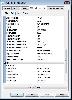
 Toolkit to add GPS functionality to software. All NMEA0183 protocol versions are supported, all NMEA 0183 can be filtered by NMEA type and talker ID. Values can be outputed using different output formats and units. Information on GPS status can also be retrieved: GPS fix quality, Satellites used...
Platforms: Windows
| License: Shareware | Cost: $99.00 USD | Size: 373.22 KB | Download (141): Eye4Gps Download |
Added: March 10, 2010 | Visits: 1.221
Geo::Spline is a Perl module to calculate geographic locations between GPS fixes. SYNOPSIS use Geo::Spline; my $p0={time=>1160449100.67, #seconds lat=>39.197807, #degrees lon=>-77.263510, #degrees speed=>31.124, #m/s heading=>144.8300}; #degrees clockwise from North my...
Platforms: *nix
| License: Freeware | Size: 20.48 KB | Download (141): Geo::Spline Download |