


Longitude And Latitude Maps software
Longitude And Latitude Maps
Released: January 10, 2005
|
Added: August 08, 2006 | Visits: 3.776
 IP2Location IP-COUNTRY-REGION-CITY-LATITUDE-LONGITUDE-ZIPCODE-ISP-DOMAIN is commericial lookup database that 1. Provide Location Aware Content (language, currency, etc.) 2. Redirect based on country; 3. Digital rights management; 4. Prevent password sharing and abuse of service; 5. Reduce credit...
Platforms: DOS, OS/2, Windows, Mac, *nix, Palm OS, Windows CE
| License: Shareware | Cost: $799.00 USD | Size: 200 KB | Download (481): IP2Location IP-COUNTRY-REGION-CITY-LATITUDE-LONGITUDE-ZIPCODE-ISP-DOMAIN Database Download |
Released: June 13, 2012
|
Added: June 13, 2012 | Visits: 724
 View maps of Earth and other planets with PrettyMap! See current day and night regions, learn geography by taking the quiz, enjoy 3D elevation surfaces, measure distances between locations and create your own maps with special places! PrettyMap lets you view vector and raster maps and images...
Platforms: Windows, Pocket PC
| License: Shareware | Cost: $19.95 USD | Size: 4.02 MB | Download (56): PrettyMap - World Atlas and Maps, GPS Download |
Released: December 25, 2012
|
Added: December 25, 2012 | Visits: 659
 This is a comprehensive database of world city names with latitude and longitude for all the cities and places of each of the continent's every country and region. This enormous collection has some 2.79 million cities and places of the planet earth. The size of the package is 43 megabyte zip file...
| License: Commercial | Cost: $59.00 USD | Size: 41.34 MB | Download (69): World City Names, Latitude & Longitude Download |
Released: April 21, 2008
|
Added: February 04, 2009 | Visits: 1.481
 FusionMaps v3 helps you create animated, interactive and data-driven Flash Maps for your dynamic web applications. Using FusionMaps, you can display geographical data distributed by category, regions or entities. Ideal usage examples are statistical display of data, flight routes, office...
Platforms: Windows, Mac, *nix
| License: Shareware | Cost: $199.00 USD | Size: 26.77 MB | Download (144): FusionMaps Download |
Added: May 22, 2010 | Visits: 1.532
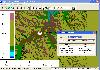
 Maps project is a topographal map and aerial photo generator and viewer. Maps allows users to generate topographical maps and aerial photographs of any region in the United States. It uses data provided by the USGS through the geoserver system. The interactive view lets you move around,...
Platforms: *nix
| License: Freeware | Size: 11.26 KB | Download (139): Maps Download |
Added: March 03, 2006 | Visits: 3.055
 Geodata of the European and International countries with municipalities and postal codes. Georeferences as UTM- and geographic coordinates (WGS84, ETRS89). Suitable for branch searches, periphery searches and distance computations. These countries are available: Albania, Andorra, Belgium, Bosnia,...
Platforms: DOS, OS/2, BeOS, Palm OS, Windows, Mac, *nix, Windows CE
| License: Shareware | Cost: $195.00 USD | Size: 229 KB | Download (133): Geo data Europe and International Download |
Added: August 11, 2008 | Visits: 1.954
USA Photo Maps works to download aerial photos and topographical map data directly from the Microsoft TerraServer website, saving it to your hard drive and creating maps from there. With USA Photo Maps you can do the following:* Scroll and zoom operations.* See latitudes and longitudes.* See UGSS...
Platforms: Windows
| License: Freeware | Size: 5 KB | Download (524): USA Photo Maps Download |
Released: November 01, 2011
|
Added: November 30, 2011 | Visits: 1.138
 Global Mapper is more than just a utility; it has built in functionality for distance and area calculations, raster blending, feathering, spectral analysis and contrast adjustment, elevation querying, line of sight calculations, cut-and-fill volume calculations, as well as advanced capabilities...
Platforms: Windows, Other
| License: Shareware | Cost: $399.00 USD | Size: 11.24 MB | Download (110): Create Better Maps with Global Mapper 13 Download |
Released: August 13, 2012
|
Added: August 13, 2012 | Visits: 687
Anquet Maps for Mac is mapping, route-planning navigation software used by professional mountain guides, top mountain athletes, outdoor training centres and thousands of everyday walkers, climbers and cyclists.
With Anquet Maps for Mac you can create routes on real OS maps to print or transfer...
Platforms: Mac
| License: Freeware | Size: 4.8 MB | Download (54): Anquet Maps Download |
Added: June 15, 2013 | Visits: 183
A block listing the last ten unique visitors based on IP, is included.It queries the IPInfoDB API to retrieve various pieces of information based upon an IP address. The originating city, state, and country are all captured, as well as latitude and longitude.Installation:Unpack in your modules...
Platforms: PHP
| License: Freeware | Size: 10 KB | Download (46): Visitor Info Download |
Added: August 30, 2013 | Visits: 415
Gmap_geo provides a Google Map location picker widget for Geo point fields and a Google Maps-based output formatter for point, line, and polygon fields.HOWEVER: Gmap_geo was written for an earlier iteration of the Geo module. It has not been updated to use recent Geo API changes. If you are...
Platforms: PHP
| License: Freeware | Size: 10 KB | Download (43): GMap + Geo Download |
Added: October 26, 2013 | Visits: 383
Cartographica allows you to use your Mac to explore and refine data, create beautiful maps, export information for the web using Google Maps and Google Earth (via our KML Export capabilities). Merge data from several sources. Get local data from your government in CSV Latitude and Longitude (or...
Platforms: Mac
| License: Shareware | Cost: $495.00 USD | Size: 45.76 MB | Download (41): Cartographica Download |
Released: September 05, 2010
|
Added: September 17, 2010 | Visits: 3.745
 PolyMap is a desktop mapping program that lets you use your own data to customize the maps supplied with the program. Use the built-in spreadsheet to enter data or paste it from other Windows applications. Alternatively, you can use the import feature to bring in data from external spreadsheets,...
Platforms: Windows
| License: Shareware | Cost: $89.95 USD | Size: 7.37 MB | Download (712): Polymap Download |
Released: June 27, 2008
|
Added: July 05, 2008 | Visits: 1.377
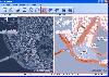 OMapView is a professional map browser. Both satellite imagery and maps online can be viewed through it. With the cache technology, it improve the user experience of viewing map. And more, the map can be viewed even when the computer is offline. It's a multi-window application, different places...
Platforms: Windows
| License: Shareware | Cost: $29.95 USD | Size: 1.75 MB | Download (131): OMapView Download |
Released: August 29, 2008
|
Added: September 04, 2008 | Visits: 3.643
 Map View is a professional map browser. Both satellite imagery and maps online can be viewed through it. With the cache technology, it improve the user experience of viewing map. And more, the map can be viewed even when the computer is offline. It's a multi-window application, different places...
Platforms: Windows
| License: Shareware | Cost: $29.95 USD | Size: 1.91 MB | Download (274): Map View Download |
Added: July 11, 2010 | Visits: 1.231
GPSMap is a Java application that displays maps and shows your position with the aid of a GPS device. GPSMap project can track paths, load overlays (such as shape files), and download maps from the MapBlast and Expedia servers. Whats New in This Release: - Serial communication on Windows...
Platforms: *nix
| License: Freeware | Size: 4.4 MB | Download (152): GPSMap Download |
Released: April 26, 2014
|
Added: May 06, 2014 | Visits: 1.446
 Risk Management software solution tools, fully-featured and comprehensive. One single file contains everything and stays local: no information goes in the cloud! The license is perpetual.
Made by experienced risk practitioners and designed for any organization, for everyone to use: it is...
Risk Management software solution tools, fully-featured and comprehensive. One single file contains everything and stays local: no information goes in the cloud! The license is perpetual.
Made by experienced risk practitioners and designed for any organization, for everyone to use: it is...
Platforms: Windows, Windows 8, Windows 7
| License: Shareware | Cost: $77.00 USD | Size: 7.46 MB | Download (149): Risk Management Software PRO Edition Download |
Released: October 22, 2012
|
Added: October 22, 2012 | Visits: 465
 Shadows is a program used to design sundials and astrolabes. It can be used by everybody without any required technical skills. Shadows will calculate everything and print the drawing according the user's preferences. Shadows is used by thousands of users around the world.
Shadows offers a...
Shadows is a program used to design sundials and astrolabes. It can be used by everybody without any required technical skills. Shadows will calculate everything and print the drawing according the user's preferences. Shadows is used by thousands of users around the world.
Shadows offers a...
Platforms: Windows
| License: Freeware | Size: 7.5 MB | Download (457): Shadows Download |
Released: November 01, 2012
|
Added: November 01, 2012 | Visits: 482
 The Capturix GPS SDK is a ActiveX OCX Control that provide Visual Basic Developers the interface between GPS receivers and their applications. This is a very simple control with a simple configuration methods and very easy to implement. It provides direct support to MapQuest website and creates...
Platforms: Windows
| License: Shareware | Cost: $39.00 USD | Size: 1.02 MB | Download (55): Capturix GPS SDK Download |
Released: August 15, 2012
|
Added: August 15, 2012 | Visits: 876
Geodata of the European and International countries offers you municipalities and postal codes. Georeferences as UTM- and geographic coordinates (WGS84, ETRS89). Suitable for branch searches, periphery searches and distance computations.
International Geo Data with geo referenced localities and...
Platforms: Windows
| License: Freeware | Download (54): Geo Data International Admin (English) Download |