


Longitude And Latitude Maps software
Longitude And Latitude Maps
Added: August 26, 2013 | Visits: 617
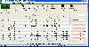
 china.mat and china.province.mat contain the longitude and latitude values that define the political boundaries of China and its provinces.Data source: http://nfgis.nsdi.gov.cnExample of its use:worldmap china;load china.mat;plotm(lat,long);
Platforms: Matlab
| License: Freeware | Size: 358.4 KB | Download (43): china.mat Download |
Added: May 06, 2013 | Visits: 500
china.mat and china.province.mat contain the longitude and latitude values that define the political boundaries of China and its provinces.Data source: http://nfgis.nsdi.gov.cnExample of its use:worldmap china;load china.mat;plotm(lat,long);
Platforms: Matlab
| License: Freeware | Size: 542.72 KB | Download (41): china.province.mat Download |
Added: July 08, 2013 | Visits: 303
This is an implementation of part of Kanan & Cottrell (2010), which extracts dense features from color images which can then be used for object or face classification. In our experiments they perform quite well, generally about as well as SIFT descriptors, if not better, on a variety of popular...
Platforms: Matlab
| License: Shareware | Cost: $0.00 USD | Size: 6.74 MB | Download (43): Image Descriptors / Features and Saliency Maps Download |
Added: August 22, 2013 | Visits: 392
This plugin is meant to be used by other developers and to be used together with themes and other plugins. Many themes and plugins use WordPress meta data table to store longitude and latitude co-ordinates for posts. While this works fine the meta data table cannot be indexed very well....
Platforms: PHP
| License: Freeware | Size: 10 KB | Download (51): Geo Data Store Download |
Released: January 30, 2006
|
Added: November 06, 2006 | Visits: 4.047
 Map Suite Geocode USA is a powerful and feature-rich .NET geocoding engine that comes complete with a highly optimized dataset encompassing the entire United States. Map Suite Geocode USA features a fast, user-friendly .NET interface that enables C# and VB.NET software developers to take a United...
Platforms: Windows
| License: Demo | Cost: $2394.00 USD | Size: 341.13 KB | Download (165): Map Suite Geocode USA Download |
Released: February 16, 2008
|
Added: February 21, 2008 | Visits: 31.476
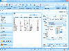
 MB Free Janam Kundali Software is an advanced birth chart calculation software based on Vedic Astrology. It tells you accurately the astronomical location of planets at the time of an individual's birth. This program gives you the natal chart in both North Indian and South Indian Styles. For the...
Platforms: Windows
| License: Freeware | Size: 1.56 MB | Download (10567): MB Free Janam Kundali Download |
Added: August 18, 2008 | Visits: 1.349
 Allows you to connect your hand held Global Positioning System (GPS) unit to your computer, download your waypoints, and plot them in AutoCAD or export them in .dxf Also plots the points on free public domain Aerial photos and topo maps. Works on most Garmin and Magellan GPS units, and AutoCAD...
Platforms: Windows
| License: Shareware | Cost: $345.00 USD | Size: 9.9 MB | Download (543): GPS2CAD Download |
Released: December 29, 2010
|
Added: January 06, 2011 | Visits: 4.315
 OkMap is a GPS and map software that:
-Works with vectorial maps and calibrates raster maps
-Organizes paths by creating waypoints, routes and tracks
-Uploads/downloads data to/from your GPS
-Uses altitude DEM data
-Supports GPS real-time navigation
-Sends/receives vehicles position...
OkMap is a GPS and map software that:
-Works with vectorial maps and calibrates raster maps
-Organizes paths by creating waypoints, routes and tracks
-Uploads/downloads data to/from your GPS
-Uses altitude DEM data
-Supports GPS real-time navigation
-Sends/receives vehicles position...
Platforms: Windows
| License: Freeware | Size: 20.25 MB | Download (1277): OkMap Download |
Added: August 25, 2008 | Visits: 1.008
Mini Map Sidebar 0.1.4.8 is a new add-on for Mozilla Firefox which lets you browse simultaneously on the Internet and Google Maps. You can do this much quicker, and locate any geographic point you+ve found on a website you+ve entered.
Platforms: Windows
| License: Freeware | Size: 1024 B | Download (128): Mini Map Sidebar Download |
Added: August 25, 2008 | Visits: 2.313
Most people know of Google Maps and Yahoo Maps, two very popular Internet map and location services. This program, RoadFinder, built using Adobe Air technology, joins both services in one application so you can consult them directly from your Windows desktop.Of course you need to also have the...
Platforms: Windows
| License: Freeware | Size: 4 KB | Download (246): RoadFinder Download |
Added: August 04, 2008 | Visits: 1.026
GeoDataSource Cities Database Gold Edition contains 2.9+ million entries with city names in original language and English, feature type classifications, country names in FIPS and ISO, regions, sub-regions, state or First-Order Administrative Division, county or Second-Order Administrative...
Platforms: OS/2, Windows, Palm OS, Windows CE, Pocket PC
| License: Shareware | Cost: $1.05 USD | Size: 164 KB | Download (109): GeoDataSource World Cities Database (Gold Edition) May Download |
Added: October 02, 2010 | Visits: 1.124
Itzam/C++ wraps the Itzam database engine with C++ templates for both simple and complex database classes. Itzam/C++ wrapper supports B-tree indexes with unique or duplicate keys, and includes multithreaded resource locking. Complete class documentation is embedded in the source code and...
Platforms: *nix
| License: Freeware | Size: 337.92 KB | Download (102): Itzam/C++ Download |
Added: August 07, 2010 | Visits: 869
Itzam/Java project is a pure Java reimplementation of the Itzam embedded database engine, and it is 100% interoperable with files created by Itzam/Core. Since Itzam/Core is the basis of wrappers written in languages such as C++ and Python, Itzam/Java is compatible with those language libraries...
Platforms: *nix
| License: Freeware | Size: 112.64 KB | Download (87): Itzam/Java Download |
Released: November 29, 2013
|
Added: December 07, 2013 | Visits: 3.710
 CRM-Express Standard Edition is a low-cost high quality CRM program. CRM-Express can manage your marketing, customers. Features include SMS abilities, Email Client, Calendar, Address Book, My work day, News Feeds, Meeting Planner, Company Library, Journal. CRM-Express Standard Edition is a...
Platforms: Windows, Windows 7, Windows Server, Other
| License: Shareware | Cost: $20.00 USD | Size: 44.73 MB | Download (1024): CRM-Express Standard Download |
Released: July 18, 2010
|
Added: November 22, 2010 | Visits: 2.913
 Bible Max has over 100 Bibles, 250000 references, 100000 commentaries, maps & pictures. A free tool that uses an artificial intelligence search engine, mutli-search modes, verse and topics guides and live maps. Create sermons, record custom verse lists and unlimited bookmarks. Export verses, maps...
Platforms: Windows
| License: Freeware | Size: 28.11 MB | Download (291): Bible Max Download |
Released: July 09, 2012
|
Added: August 14, 2012 | Visits: 1.203
 Detect and delete JPEG exif data with Easy Exif Delete, a freeware application from ConsumerSoft.
Exif data is a form of hidden metadata attached to jpeg (.jpg) images. This data can contain camera type, lens type, shutter speed and exposure, date and time, copyright information, author,...
Detect and delete JPEG exif data with Easy Exif Delete, a freeware application from ConsumerSoft.
Exif data is a form of hidden metadata attached to jpeg (.jpg) images. This data can contain camera type, lens type, shutter speed and exposure, date and time, copyright information, author,...
Platforms: Windows
| License: Freeware | Size: 884.95 KB | Download (102): Easy Exif Delete Download |
Released: October 04, 2012
|
Added: October 04, 2012 | Visits: 425
Strudel is a graphical utility designed to help you visualize genetic and physical maps of genomes for comparative purposes.
The application aims to let the user examine their data at a variety of different levels of resolution, from entire maps to individual markers, and explore syntenic...
Platforms: Windows, Windows Vista, 7
| License: Freeware | Download (450): Strudel Download |
Released: October 13, 2012
|
Added: October 13, 2012 | Visits: 417
Allows you to install and manage maps on your Garmin GPS device.
Platforms: Mac
| License: Freeware | Size: 40 MB | Download (49): MapInstall for Mac OS Download |
Released: August 01, 2012
|
Added: August 01, 2012 | Visits: 483
Easy to use HDR software, that creates HDR photos and tone maps them in a single step. An intuitive design makes it simple to choose from our 4 different tone mapping techniques.
Even if youre not into HDR photography, HDRtist is a great tool to have for dramatizing dull photos, livening dark...
Platforms: Mac
| License: Freeware | Size: 5.4 MB | Download (446): HDRtist for Mac OS Download |
Released: December 17, 2012
|
Added: December 17, 2012 | Visits: 369
 HidroSIG is a GIS that supports raster and vectorial maps with modules oriented to the hydrological analysis, time series, remote sensing and more. It has been made 100% in java using VisAD for data visualization and using MySQL to storage all data.
Platforms: Windows, Mac, Linux
| License: Freeware | Size: 151.22 MB | Download (48): HidroSIG Download |