


Longitude software
Longitude
Released: September 11, 2012
|
Added: September 11, 2012 | Visits: 555
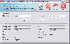
 The database includes total of 17 data fields which consists of:
ZIP Code, Classification, Primary Record, City, City Alias Name, City Type, Mailing Name, State, State FIPS, Latitude, Longitude, Elevation, Area Code, County Name, County FIPS, Time Zone & Day Light Saving.
The complete database...
The database includes total of 17 data fields which consists of:
ZIP Code, Classification, Primary Record, City, City Alias Name, City Type, Mailing Name, State, State FIPS, Latitude, Longitude, Elevation, Area Code, County Name, County FIPS, Time Zone & Day Light Saving.
The complete database...
Platforms: Windows, Mac, Palm,OS
| License: Demo | Cost: $25.95 USD | Size: 1.19 MB | Download (408): IGEOCODE US ZIP Codes Premium Edition Download |
Released: August 12, 2012
|
Added: August 12, 2012 | Visits: 697
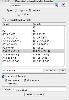
 The database includes total of 49 data fields which consists of:
ZIP Code, Classification, Primary Record, City, City Alias Name, City Type, Mailing Name, State, State FIPS, Latitude, Longitude, Elevation, Area Code, County Name, County FIPS, Time Zone, Day Light Saving, MSA, MSA Name, PMSA, PMSA...
The database includes total of 49 data fields which consists of:
ZIP Code, Classification, Primary Record, City, City Alias Name, City Type, Mailing Name, State, State FIPS, Latitude, Longitude, Elevation, Area Code, County Name, County FIPS, Time Zone, Day Light Saving, MSA, MSA Name, PMSA, PMSA...
Platforms: Windows, Mac, Palm,OS
| License: Demo | Cost: $45.95 USD | Size: 3.01 MB | Download (397): IGEOCODE US ZIP Codes Gold Edition Download |
Released: July 12, 2012
|
Added: July 12, 2012 | Visits: 671
 FaceBook @Desktop is a light-weight client that sits in your system tray, like any other messenger software, and will alert you as soon as some new activity happens in your Facebook stream. The alerts are presented as unobtrusive pop-ups on the desktop that automatically fade after some time. You...
Platforms: Windows
| License: Commercial | Cost: $1.00 USD | Size: 622 KB | Download (51): Facebook @Desktop Download |
Released: September 20, 2012
|
Added: September 20, 2012 | Visits: 474
 IP2Location Desktop translates IP address to country, city, region, latitude, longitude, ZIP code, ISP and domain name using XML Web Service. Users can perform 90 queries per month using Free account. Please visit homepage for more information.
Platforms: Windows
| License: Shareware | Cost: $0.00 USD | Size: 796 KB | Download (60): IP2Location Geolocation Application Download |
Released: October 14, 2012
|
Added: October 14, 2012 | Visits: 283
geoLucene is an extension of Lucene that allows to effectively index and search documents that contain locational information (longitude/latitude). It uses R-tree as a spacial index. See http://www.gossamer-threads.com/lists/lucene/java-dev/53378.
Platforms: Windows, Mac, Linux
| License: Freeware | Size: 607.68 KB | Download (44): GeoLucene Download |
Released: October 07, 2012
|
Added: October 07, 2012 | Visits: 462
 Written in Objective-C, the GeographicFormatter provides a Cocoa NSFormatter subclass for latitude and longitude output and input. There is also an IBPalette for integration with Interface Builder.
Platforms: Mac
| License: Freeware | Size: 532.81 KB | Download (50): GeographicFormatter Download |
Released: September 18, 2012
|
Added: September 18, 2012 | Visits: 363
This library is a basic implementation from the GeoHash algorithm written in the java can be used to generate from the latitude and longitude a geohash code and reverse. For more information go to (http://en.wikipedia.org/wiki/Geohash)
Platforms: Windows, Mac, Linux
| License: Freeware | Size: 12.12 KB | Download (45): jGeohash Download |
Released: July 20, 2012
|
Added: July 20, 2012 | Visits: 401
Pysolar is a Python library for calculating the position of the sun relative to the earth as a function of latitude, longitude, and time. There is also code included for other problems related to the development of photovoltaic systems. Still in alpha.
Platforms: Windows, Mac, Linux
| License: Freeware | Size: 21.28 KB | Download (45): Pysolar Download |
Added: May 10, 2013 | Visits: 324
GeoClass helps you to handle georeferenced data (latitude and longitude values for a location). It enables the connection to databases which provide these data or you can easily create your own GeoObjects. Features are: circumference search in (relational) databases, handlers for NIMA-DB and...
Platforms: Windows, Mac, *nix, PHP, BSD Solaris
| License: Freeware | Download (60): GeoClass Download |
Added: May 09, 2013 | Visits: 546
Predict the azimuth and elevation of the Sun within +/- 1 degree at any geodetic latitude, longitude and altitude.Function Call: [Az El] = SolarAzEl('2008/02/18 13:10:00',60,15,0)Input List:UTC Date and Time - Use format YYYY/MM/DD hh:mm:ssLatitude - Site Latitude in degrees -90:90 -> S(-)...
Platforms: Matlab
| License: Freeware | Size: 10 KB | Download (47): Solar Azimuth and Elevation Estimation Download |
Added: August 08, 2013 | Visits: 674
ECEF2LLA - convert earth-centered earth-fixed (ECEF) cartesian coordinates to latitude, longitude, and altitude.USAGE:[lat,lon,alt] = ecef2lla(x,y,z)lat = geodetic latitude (radians)lon = longitude (radians)alt = height above WGS84 ellipsoid (m)x = ECEF X-coordinate (m)y = ECEF Y-coordinate (m)z...
Platforms: Matlab
| License: Freeware | Size: 10 KB | Download (42): Convert Cartesian (ECEF) Coordinates to lat, lon, alt Download |
Added: August 11, 2013 | Visits: 484
This algorithm will accept a Latitude, Longitude and Altitude location as well as a specific universal coordinated time. It will use this information and calculate the position of the moon in a local coordinate frame (az and alt aka az and el).Example Function Call:[Az El] = LunarAzEl('1991/05/19...
Platforms: Matlab
| License: Freeware | Size: 10 KB | Download (40): Lunar Azimuth and Altitude Estimation Algorithm Download |
Added: September 05, 2013 | Visits: 500
function alt_km=ITU_P1511(lat,long)computes altitude of a site at given lat,long coordinatesby means of bicubic interpolation using itu topo 0.5 degrees resolutionmatrix.refer to ITU-R Recommendation P 1511.INPUTSlat: latitude + = North, -=southlong: longitude, positive degrees East.Required...
Platforms: Matlab
| License: Freeware | Size: 10 KB | Download (54): Altitude in Km above sea level for a given pair of coordinates (lat,long) Download |
Added: August 26, 2013 | Visits: 620
china.mat and china.province.mat contain the longitude and latitude values that define the political boundaries of China and its provinces.Data source: http://nfgis.nsdi.gov.cnExample of its use:worldmap china;load china.mat;plotm(lat,long);
Platforms: Matlab
| License: Freeware | Size: 358.4 KB | Download (43): china.mat Download |
Added: May 06, 2013 | Visits: 500
china.mat and china.province.mat contain the longitude and latitude values that define the political boundaries of China and its provinces.Data source: http://nfgis.nsdi.gov.cnExample of its use:worldmap china;load china.mat;plotm(lat,long);
Platforms: Matlab
| License: Freeware | Size: 542.72 KB | Download (41): china.province.mat Download |
Added: June 25, 2013 | Visits: 284
If carefully built, a sundial is perfectly capable of keeping accurate time. The problem is that you need a different sundial for every combination of latitude, longitude, and day of the year. Fortunately MATLABdlT« can make this a manageable problem. By turning this procedure around, you can...
Platforms: Matlab
| License: Shareware | Cost: $0.00 USD | Size: 20.48 KB | Download (39): Building Sundials Download |
Added: May 26, 2013 | Visits: 456
DISTMATLATLON Computes distance matrix between list of coords in X and Y D = DISTMATLATLON(X,Y) for matrices X and Y, with columns [Lat Lon], returns the distance matrix where the (i,j)th entry is the distance between the i'th and j'th row of X and Y respectively. X and Y must have columns in the...
Platforms: Matlab
| License: Freeware | Size: 10 KB | Download (46): Distance Matrix Latitude Longitude Download |
Added: April 23, 2013 | Visits: 316
Takes in a point cloud in xyz format, and then converts that into a MATLAB-style grid with a latitude vector, longitude vector, glat/glon grid (made using meshgrid), and a z (altitude) matrix. It then saves these into a specified output .mat file.
Platforms: Matlab
| License: Shareware | Cost: $0.00 USD | Size: 10 KB | Download (43): pcloud2grid Download |
Added: August 22, 2013 | Visits: 398
This program calculates the distance between two locations (latitude and longitude) using the Haversine formula. The Haversine formula gives the shortest distance between two points over the earth's surface, ignoring elevation, hills, etc...The program accepts two inputs that can be locations...
Platforms: Matlab
| License: Shareware | Cost: $0.00 USD | Size: 10 KB | Download (43): Distance calculation using Haversine formula Download |
Added: June 17, 2013 | Visits: 390
Convert Right Ascension/Declination angles in degrees to Altitude/Azimuth in degrees for an Alt/Az telescope mount.Input: RA - Right Ascension in degrees Dec - Declination in degrees Latidute - Observer's Latitude (Negative for South) in degrees Longitude - Observer's Longiture (Negative for...
Platforms: Matlab
| License: Shareware | Cost: $0.00 USD | Size: 10 KB | Download (45): Conversion from Right Ascension/Declination to Altitude/Azimuth in Matlab Download |