


Latitude Longitude Address software
Latitude Longitude Address
Released: January 07, 2006
|
Added: July 19, 2006 | Visits: 2.306
 GeoDataSource Cities Database Premium Edition contains 2.9+ million entries with city names in original language and English, feature type classifications, country names in FIPS and ISO, regions, sub-regions, state or First-Order Administrative Division and county or Second-Order Administrative...
Platforms: DOS, OS/2, BeOS, Palm OS, Windows, Mac, *nix, Windows CE
| License: Shareware | Cost: $749.95 USD | Size: 99 KB | Download (117): GeoDataSource World Cities Database (Premium Edition) Download |
Added: August 14, 2008 | Visits: 1.748
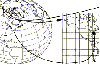 CoordTrans converts geographic positions between different coordinate systems.Convert between UTM and WGS84.Convert between UTM and NAD27 / NAD83.And more... grids from 17 countries supported. Convert geographic coordinates (latitude / longitude) between different datums.
Platforms: Windows
| License: Shareware | Cost: $19.95 USD | Size: 669 KB | Download (738): CoordTrans Download |
Added: August 04, 2008 | Visits: 764
 ZylGPSReceiver.NET is an event driven .NET component that communicates with a GPS receiver. It returns latitude, longitude, altitude, speed, heading and many other useful parameters of the current position and the parameters of the satellites in view.
Platforms: Windows
| License: Shareware | Cost: $129.99 USD | Size: 186 KB | Download (92): ZylGPSReceiver.NET Download |
Added: August 27, 2008 | Visits: 1.084
 USAPhotoMaps downloads aerial photo and topo map data from Microsoft's free TerraServer Web site, saves it on your hard drive, and creates seamless maps from it. You can - Scroll and zoom, See the latitude/longitude, Add waypoints, routes, and text, Jump to any waypoint or latitude/longitude in...
Platforms: Windows
| License: Freeware | Size: 314 KB | Download (505): USAPhotoMaps Download |
Added: August 25, 2008 | Visits: 1.217
Canadian postal codes database one month subscription service. The database includes Postal code, city name, province name, phone area code, timezone, latitude, longitude and street name in Canada. The complete database contains over 780,000 precise records. Immediate download available in...
Platforms: DOS, OS/2, Windows, Mac, *nix, Palm OS, Windows CE
| License: Shareware | Cost: $249.95 USD | Size: 26 KB | Download (93): Canadian Postal Code Database (Gold Edition) May Download |
Added: August 14, 2008 | Visits: 1.102
North American area codes database one month subscription service. Complete telecommunications database targeted specifically toward disseminating all valid NPA/NXX combinations in the North American Numbering Plan. It covers all active North American NPA/NXX assignments including the United...
Platforms: DOS, OS/2, Windows, Mac, *nix, Palm OS, Windows CE
| License: Shareware | Cost: $299.95 USD | Size: 25 KB | Download (94): North American Area Code Database (Gold Edition) April - June Download |
Added: August 02, 2008 | Visits: 1.173
North American area codes database one month subscription service. Complete telecommunications database targeted specifically toward disseminating all valid NPA/NXX combinations in the North American Numbering Plan. It covers all active North American NPA/NXX assignments including the United...
Platforms: DOS, OS/2, Windows, Mac, *nix, Palm OS, Windows CE
| License: Shareware | Cost: $149.95 USD | Size: 25 KB | Download (99): North American Area Code Database (Premium Edition) April - June Download |
Added: August 23, 2008 | Visits: 1.315
United States ZIP codes database one month subscription service. The database includes ZIP code, city name, alias city name, state code, phone area code, city type, county name, country FIPS, time zone, day light saving flag, latitude, longitude, county elevation, MSA, PMSA and Census 2000 data...
Platforms: DOS, OS/2, Windows, Mac, *nix, Palm OS, Windows CE
| License: Shareware | Cost: $59.95 USD | Size: 27 KB | Download (95): United States ZIP Code Database (Gold Edition) May Download |
Added: August 21, 2008 | Visits: 1.095
United States ZIP codes database one month subscription service. The database includes ZIP code, city name, alias city name, state code, phone area code, city type, county name, country FIPS, time zone, day light saving flag, latitude, longitude and county elevation. The complete database...
Platforms: DOS, OS/2, Windows, Mac, *nix, Palm OS, Windows CE
| License: Shareware | Cost: $39.95 USD | Size: 27 KB | Download (94): United States ZIP Code Database (Premium Edition) May Download |
Released: April 21, 2008
|
Added: February 04, 2009 | Visits: 1.480
 FusionMaps v3 helps you create animated, interactive and data-driven Flash Maps for your dynamic web applications. Using FusionMaps, you can display geographical data distributed by category, regions or entities. Ideal usage examples are statistical display of data, flight routes, office...
Platforms: Windows, Mac, *nix
| License: Shareware | Cost: $199.00 USD | Size: 26.77 MB | Download (144): FusionMaps Download |
Added: January 09, 2010 | Visits: 1.133
Geo::Lookup::ByTime is a Perl module to lookup location by time. SYNOPSIS use Geo::Lookup::ByTime; $lookup = Geo::Lookup::ByTime->new( @points ); my $pt = $lookup->nearest( $tm ); Given a set of timestamped locations guess the location at a particular time. This is a useful operation...
Platforms: *nix
| License: Freeware | Size: 15.36 KB | Download (93): Geo::Lookup::ByTime Download |
Added: August 24, 2010 | Visits: 1.487
GIS::Distance::Vincenty Perl module contains Thaddeus Vincenty distance calculations. SYNOPSIS my $calc = GIS::Distance::Vincenty->new(); my $distance = $calc->distance( $lon1, $lat1 => $lon2, $lat2 ); For the benefit of the terminally obsessive (as well as the genuinely needy), Thaddeus...
Platforms: *nix
| License: Freeware | Size: 8.19 KB | Download (125): GIS::Distance::Vincenty Download |
Added: July 07, 2010 | Visits: 846
Fracplanet is an interactive tool for creating random fractal planets and terrain areas with oceans, rivers, lakes and icecaps. The results can be saved in POV-Ray format. The code is licensed under the GPL. Fracplanet project uses Qt and OpenGL. Whats New in This Release: - The main...
Platforms: *nix
| License: Freeware | Size: 68.61 KB | Download (135): Fracplanet Download |
Added: August 05, 2010 | Visits: 664
OpenGuides is a wiki-like package for maintaining a collaborative city guide. It is written in Perl and runs as a CGI program, and uses either the MySQL, PostgreSQL, or SQLite database. OpenGuides offers features over a "normal" wiki such as metadata management and a "find nearby things"...
Platforms: *nix
| License: Freeware | Size: 94.21 KB | Download (87): OpenGuides Download |
Added: January 25, 2010 | Visits: 1.303
GPS Connect is a freeware program for Mac OS X which offers connectivity to Garmin GPS receivers. The intended use is to backup waypoints from the GPS to your computer. Downloaded waypoints may be saved in a native file format or exported to a variety of other formats such as tab-delimited,...
Platforms: Mac
| License: Freeware | Size: 1.2 MB | Download (108): GPS Connect Download |
Added: January 25, 2010 | Visits: 693
CoordinatesX is an application that transforms geodetic and Cartesian coordinates. It will make the conversions from Geodetic latitude, longitude and heights to planet centered Cartesian coordinates and vice versa. Works for various planetary ellipsoids, including user defined...
Platforms: Mac
| License: Freeware | Download (159): CoordinatesX Download |
Added: January 25, 2010 | Visits: 807
3D Weather & Globe allows you to view weather patterns all over the world, with real-time cloud cover and a 7-day forecast.An astronaut's-eye-view of the EarthMountains, rivers, lakes, and desertsReal-time weather and cloud cover7-day forecast including wind and humidityDay/night line changing...
Platforms: Mac
| License: Shareware | Cost: $0.00 USD | Download (113): 3D Weather & Globe Atlas Download |
Released: October 22, 2012
|
Added: October 22, 2012 | Visits: 464
 Shadows is a program used to design sundials and astrolabes. It can be used by everybody without any required technical skills. Shadows will calculate everything and print the drawing according the user's preferences. Shadows is used by thousands of users around the world.
Shadows offers a...
Shadows is a program used to design sundials and astrolabes. It can be used by everybody without any required technical skills. Shadows will calculate everything and print the drawing according the user's preferences. Shadows is used by thousands of users around the world.
Shadows offers a...
Platforms: Windows
| License: Freeware | Size: 7.5 MB | Download (457): Shadows Download |
Released: July 20, 2012
|
Added: July 20, 2012 | Visits: 514
With GeopIPTC you will be able to read the IPTC city information in pictures and get the corresponding coordinates to your photos from several free services and embed this into the pictures in standard tags in a very professional way. You will also create sets of pictures with all the metadata...
Platforms: Windows
| License: Shareware | Cost: $104.55 USD | Size: 7.32 MB | Download (382): GeoIPTC Download |
Released: October 06, 2012
|
Added: October 06, 2012 | Visits: 507
With GeoIPTC you will be able to read the IPTC city information in pictures and get the corresponding coordinates to your photos from several free services and embed this into the pictures in standard tags in a very professional way. You will also create sets of pictures with all the metadata...
Platforms: Windows
| License: Shareware | Cost: $112.00 USD | Size: 7.32 MB | Download (455): GeoIPTC Geolocalisation de Photos Download |