


Lat Long software
Lat Long
Added: September 05, 2013 | Visits: 504
 function alt_km=ITU_P1511(lat,long)computes altitude of a site at given lat,long coordinatesby means of bicubic interpolation using itu topo 0.5 degrees resolutionmatrix.refer to ITU-R Recommendation P 1511.INPUTSlat: latitude + = North, -=southlong: longitude, positive degrees East.Required...
Platforms: Matlab
| License: Freeware | Size: 10 KB | Download (54): Altitude in Km above sea level for a given pair of coordinates (lat,long) Download |
Added: August 08, 2008 | Visits: 1.215
Dubbed "The 'Swiss Army Knife' of world clocks" with unlimited configurable clocks, each with it's own time zone, configurable Daylight Saving Time, Lat Long, and description in a 12 or 24 hour analog/digital user configurable display, that minimizes to the system tray; 2D/3D World...
Platforms: Windows
| License: Freeware | Size: 2.31 MB | Download (89): World time Download |
Added: July 12, 2010 | Visits: 1.309
Geo::Coordinates::OSGB is a Perl module that can convert coordinates from Lat/Long to UK Grid. A UK-specific implementation of co-ordinate conversion, following formulae from the Ordnance Survey of Great Britain (hence the name). SYNOPSIS use Geo::Coordinates::OSGB qw(ll2grid grid2ll); #...
Platforms: *nix
| License: Freeware | Size: 4.1 KB | Download (113): Geo::Coordinates::OSGB Download |
Added: May 10, 2013 | Visits: 493
The location to search near must be given as a lat/long pair or postcode (if Location module is enabled).Paths in cck_maps (where a map has more than one marker) are determined with an algorithm that finds the two closest points first, which form the first part of the path, then progressively...
Platforms: Windows, Mac, *nix, PHP, BSD Solaris
| License: Freeware | Download (58): Map Search 5.x-1.x-dev Download |
Added: June 20, 2013 | Visits: 361
Makes a geoTiff using gdal_translate with the supplied top left and bottom right lat long in WGS84. Can be used in contunction with getTile to save tiles as GeoTiffs
Platforms: Matlab
| License: Freeware | Size: 10 KB | Download (46): makeGeoTiff Download |
Added: August 30, 2013 | Visits: 392
Convert decimal degrees (lat,long) to Swiss 1903+ grid (x,y) in metres
Platforms: Matlab
| License: Shareware | Cost: $0.00 USD | Size: 10 KB | Download (44): Degrees to CH1903+ Download |
Added: April 08, 2006 | Visits: 4.258
 Watch Sun & Moon passing across your desktop. Observe the Sun and the Moon like you can see them in the sky. When the Sun/Moon rises, you will notice that a small icon of the Sun/Moon rises on the left side of your taskbar, exactly where you've got the 'start' button. And it sails through your...
Platforms: Windows
| License: Shareware | Cost: $5.00 USD | Size: 649 KB | Download (582): Sun & Moon on Screen Download |
Added: October 25, 2010 | Visits: 973
Geo::Coordinates::VandH is a Perl module that can convert and manipulate telco V and H coordinates. SYNOPSIS To convert V: 5498 H: 2895 to lat/long coordinates: use Geo::Coordinates::VandH; $blah=new Geo::Coordinates::VandH; ($lat,$lon) = $blah->vh2ll(5498,2895); printf...
Platforms: *nix
| License: Freeware | Size: 4.1 KB | Download (115): Geo::Coordinates::VandH Download |
Released: October 23, 2012
|
Added: October 23, 2012 | Visits: 655
GPS Utility is an easy-to-use application that provides management and manipulation of GPS information. You can use it to transfer data to/from a GPS receiver and store the data in PC files in one of several text formats.
The program converts between different map datums and many coordinate...
Platforms: Windows
| License: Freeware | Size: 1.87 MB | Download (469): GPS Utility Download |
Released: July 18, 2012
|
Added: July 18, 2012 | Visits: 384
TiVec is a data processing program that enables the user to process Tiger Line files from the Census Bureau and convert them to MID/MIF or SHP/DBF files for use with major GIS and mapping suites. At the same time, it allows the user to select Lat/Long or Lambert projections, separate Tiger...
Platforms: Windows
| License: Shareware | Cost: $119.00 USD | Size: 1.12 MB | Download (404): TiVec Download |
Added: May 10, 2013 | Visits: 495
Future versions of Location beyond v3 will be dependent on the Geo module.InstallationUnpack in your modules folder (usually /sites/all/modules/) and enable under Administer > Site Building > Modules. Key features "location": - stores human-readable addresses ("123 Main St.") - contains...
Platforms: Windows, Mac, *nix, PHP, BSD Solaris
| License: Freeware | Download (54): location 6.x-3.0-test3 / 5.x-3.0-test3 Download |
Added: March 29, 2013 | Visits: 488
A collection of geodetic functions that solve a variety of problems in geodesy. Supports a wide range of common and user-defined reference ellipsoids. Most functions are vectorized. Functions include:Angle Conversions deg2rad - Degrees to radians dms2deg - Degrees,minutes,seconds to degrees...
Platforms: Matlab
| License: Freeware | Size: 40.96 KB | Download (46): Geodetic Toolbox Download |
Added: August 26, 2013 | Visits: 623
china.mat and china.province.mat contain the longitude and latitude values that define the political boundaries of China and its provinces.Data source: http://nfgis.nsdi.gov.cnExample of its use:worldmap china;load china.mat;plotm(lat,long);
Platforms: Matlab
| License: Freeware | Size: 358.4 KB | Download (43): china.mat Download |
Added: May 06, 2013 | Visits: 505
china.mat and china.province.mat contain the longitude and latitude values that define the political boundaries of China and its provinces.Data source: http://nfgis.nsdi.gov.cnExample of its use:worldmap china;load china.mat;plotm(lat,long);
Platforms: Matlab
| License: Freeware | Size: 542.72 KB | Download (41): china.province.mat Download |
Added: August 06, 2013 | Visits: 378
The routine parses a TLE file and extracts informations from a selected satellite.It then calls the SGP4 propagator, converts the orbit in the ECI reference into Earth Centered Earth Fixed and also into Lat Long Heigth.This subroutine includes an example of the ENVISAT satellite in which the...
Platforms: Matlab
| License: Freeware | Size: 143.36 KB | Download (50): SAT_ORBIT Script Download |
Added: July 10, 2013 | Visits: 334
A module to provide a common interface for geoparsing services such as Yahoo!'s Placemaker and various CCK fields.Geoparsing?Geoparsing is the process by which structured geographic locations and their identifiers (eg placenames, lat-long coordinates) are extracted from unstructured content, such...
Platforms: PHP
| License: Freeware | Size: 10 KB | Download (51): Geoparser Download |
Released: December 04, 2016
|
Added: December 06, 2016 | Visits: 421
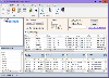 ATS Call Data Record analyzer can import and analyze CDR/Tower CDR Data from any service provider in India or Other Country and Its generates a comprehensive report of frequency statistics including service provider details and subscriber details (SDR)* of CDR Numbers. ATS CDR Analyzer Supported...
Platforms: Windows, Windows 8, Windows 7
| License: Shareware | Cost: $349.00 USD | Size: 6.97 MB | Download (55): ATS CDR Analyzer Download |
Released: January 14, 2017
|
Added: January 16, 2017 | Visits: 820
 ATS Mobile CDR Analysis is Smart Solution for Mobile Call Records investigation. Smart way of investigation, reduce time consumption and provide results in short time by using ATS CDR Analysis Software. Through this you will analyze call records, and get various types of desired reports in few...
Platforms: Windows
| License: Shareware | Cost: $40.00 USD | Size: 6.05 MB | Download (53): Mobile CDR Analysis Download |
Released: January 22, 2017
|
Added: January 23, 2017 | Visits: 726
 CDR Analysis & Investigation is Smart Solution for Call Records investigation. Smart way of investigation, reduce time consumption and provide results in short time by using ATS CDR Analysis Software. Through this you will analyze call records, and get various types of desired reports in few...
Platforms: Windows, Windows 8, Windows 7, Windows Server
| License: Shareware | Cost: $399.00 USD | Size: 6.05 MB | Download (60): CDR Analysis & Investigation Download |
Released: February 17, 2017
|
Added: February 19, 2017 | Visits: 712
 CDR Analysis is Smart Mobile data Analysis Solutions for Call Records. Easy to trace calls record & reduce time consumption and provide results in short time by using CDR Analysis Software. You will analyze call records, and get various types of desired reports in few minutes. CDR Analysis...
Platforms: Windows, Windows 8, Windows 7, Windows Server
| License: Shareware | Cost: $249.00 USD | Size: 6.05 MB | Download (43): CDR Analysis Download |