


Handheld Gps Units software
Handheld Gps Units
Added: January 25, 2010 | Visits: 853
 GPSy is a sophisticated Macintosh GPS communications and GIS mapping program. GPSy connects your Macintosh to a broad range of Global Positioning System (GPS) navigational units and has advanced mapping, logging, and data transfer features. GPSy has extensive support for USGS DRG topo maps,...
Platforms: Mac
| License: Demo | Cost: $0.00 USD | Download (104): GPSy Download |
Released: July 05, 2012
|
Added: July 05, 2012 | Visits: 572
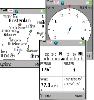
 " The most accurate and handly Altimeter is here. It gives you the altitude wherever you are. Simply start the app and altitude will appear in a second, No setup required. You can also adjust Altitude in Feet or Meter as per your requirement. Special feature saved your Max climb rate value.
...
" The most accurate and handly Altimeter is here. It gives you the altitude wherever you are. Simply start the app and altitude will appear in a second, No setup required. You can also adjust Altitude in Feet or Meter as per your requirement. Special feature saved your Max climb rate value.
...
Platforms: iPhone, iPod
| License: Shareware | Cost: $0.99 USD | Download (465): Altimeter Digital GPS + Map Viewer + Cam Download |
Released: October 05, 2012
|
Added: October 05, 2012 | Visits: 657
ClockWatch Star Sync tracks up to twelve GPS satellites simultaneously, acquiring precise time, distributing it to client computers and synchronizing them to +/- 0.01 second.
Deploying Star Sync units in different local networks around the globe maintains time synchronization across your...
Platforms: Windows
| License: Freeware | Download (52): ClockWatch Star Sync Download |
Released: August 26, 2012
|
Added: August 26, 2012 | Visits: 608
The Garmin Phase Output protocol gives software developers the ability to upload and download data from Garmin devices. The Garmin Phase Output plug-in for GPS.NET makes working with Garmin devices easy by handing all of the complicated device communications for you. Upload and download...
Platforms: Windows
| License: Shareware | Cost: $39.00 USD | Size: 4.64 MB | Download (47): Garmin Phase Output Plug-In for GPS.NET Download |
Released: November 12, 2012
|
Added: November 12, 2012 | Visits: 485
 Create and edit waypoints, tracklogs, routes, and insert scanned images of map. More than 160 GPS models recognized. Garmin, Magellan, Eagle and others
- Most complete free program for GPS devices
- Compatible with more than 160 GPS models
- Support for Garmin, Magellan and others
- Easily...
Create and edit waypoints, tracklogs, routes, and insert scanned images of map. More than 160 GPS models recognized. Garmin, Magellan, Eagle and others
- Most complete free program for GPS devices
- Compatible with more than 160 GPS models
- Support for Garmin, Magellan and others
- Easily...
Platforms: Windows
| License: Freeware | Size: 54.92 MB | Download (57): GPS TrackMaker Download |
Released: June 13, 2012
|
Added: June 13, 2012 | Visits: 724
 View maps of Earth and other planets with PrettyMap! See current day and night regions, learn geography by taking the quiz, enjoy 3D elevation surfaces, measure distances between locations and create your own maps with special places! PrettyMap lets you view vector and raster maps and images...
Platforms: Windows, Pocket PC
| License: Shareware | Cost: $19.95 USD | Size: 4.02 MB | Download (56): PrettyMap - World Atlas and Maps, GPS Download |
Released: June 07, 2012
|
Added: June 07, 2012 | Visits: 469
 Gpi2Gps converts Waypoints from Garmin GPI file format (i.e. Garmin POI Loader) to Google Earth (KMZ) or GPS compatible format (GPX) in a few steps. With GPI to GPs converter you are able to transform from GPI to GPs. Download your waypoints from your GPS or Palm PDAs and save it in .GPI format...
Platforms: Windows
| License: Demo | Cost: $20.00 USD | Size: 635 KB | Download (68): GPI to GPs converter Download |
Released: September 21, 2012
|
Added: September 21, 2012 | Visits: 427
 GPS/J is a console for all Bluetooth-enabled GPS receivers (now with 20000 European towns and cities!), a mobile navigation tool for cellular phone owners and the most affordable and convenient way to use location services.
It is a J2ME application for JSR82-compliant devices, which means...
GPS/J is a console for all Bluetooth-enabled GPS receivers (now with 20000 European towns and cities!), a mobile navigation tool for cellular phone owners and the most affordable and convenient way to use location services.
It is a J2ME application for JSR82-compliant devices, which means...
| License: Demo | Cost: $0.00 USD | Size: 281 KB | Download (48): GPS/J Download |
Released: September 20, 2012
|
Added: September 20, 2012 | Visits: 469
In an ideal world, you could create a Microsoft Word document on your desktop computer, put it on your Handheld PC, edit and format it on the road, and then send it back to the office as a .DOC file, with content and all formatting still intact.
This is what Handheld PC users expect from their...
Platforms: Windows
| License: Demo | Cost: $69.95 USD | Size: 17.75 MB | Download (404): TextMaker for Handheld PCs Download |
Released: August 25, 2012
|
Added: August 25, 2012 | Visits: 626
 GPS Mapping Software for Windows, Loading topographic maps, realtime navigation, track recording, manage GPS devices and more. The software can be used with various map formats including: GeoTiff, BSB Nautical Charts, AutoCad DXF files, ESRI Shapefiles. Using calibration you can also use scanned...
Platforms: Windows
| License: Shareware | Cost: $149.00 USD | Size: 11.13 MB | Download (48): Eye4Software GPS Mapping Studio Download |
Released: October 23, 2012
|
Added: October 23, 2012 | Visits: 566
 Use GPS without GPS receiver! Try this advanced GPS device simulator (virtual GPS receiver). It can be used for development purposes or for testing GPS software before buying. Generates NMEA messages from different data inputs (map or file). Generated NMEA data can be used by mapping or other GPS...
Platforms: Windows
| License: Shareware | Cost: $39.99 USD | Size: 800 KB | Download (534): Avangardo GPS generator PRO Download |
Released: August 17, 2012
|
Added: August 17, 2012 | Visits: 542
 Bored with alarms firing in the wrong place? GPS-Action will fire reminder exactly when you reach the target place, no sooner and no later! Depending on your geographical location GPS-Action will fire alarm, open the application, change profile, launch the website, open a document or a certain...
Platforms: Symbian
| License: Shareware | Cost: $9.99 USD | Size: 466 KB | Download (508): GPS-Action Download |
Released: December 22, 2012
|
Added: December 22, 2012 | Visits: 467
 Run.GPS Trainer UV is the perfect tool to take along doing all sorts of sports like running, skiing, hiking, and many more. Run.GPS Trainer UV is compatible with most PocketPCs and Smartphones (requires Windows Mobile 2003 Pocket PC, Windows Mobile 5 or Windows Mobile 6). Recording *...
Platforms: Windows, Pocket PC
| License: Shareware | Cost: $33.99 USD | Size: 6.29 MB | Download (600): Run.GPS Trainer UV Download |
Released: July 18, 2012
|
Added: July 18, 2012 | Visits: 385
Java program for computations with values expressed in terms of physical or other units. Supports complicated mathematical expressions and user-defined functions. Invoked from scripts, line command, as GUI, or as applet. Extensive units data base.
Platforms: Windows, Mac, Linux
| License: Freeware | Size: 322.92 KB | Download (45): Computing with units Download |
Released: November 05, 2012
|
Added: November 05, 2012 | Visits: 308
Java base GPS Waypoint manipulation.Provides a toolkit for managing a variety of GPS Waypoint input formats like GPX, used by ExpertGPS and GeoCaching.com, as well as conversion formats for certain GPS devices.Similar in goals to gpsbabel.
Platforms: Windows, Mac, Linux
| License: Freeware | Size: 4.58 MB | Download (43): GPS Blender Download |
Released: July 11, 2012
|
Added: July 11, 2012 | Visits: 575
 Preparation of GPS routes and analysis of GPS logs in the context of outdoor sports (biking, skiing, trecking, gliding, geocaching, mountaineering). Our hope is to have a multi platform, multi GPS file and map format software.
Platforms: Windows, Mac, BSD, Linux
| License: Freeware | Size: 6.18 MB | Download (50): Le Petit Poucet gps software Download |
Released: June 18, 2012
|
Added: June 18, 2012 | Visits: 629
OpenGTS (Open Source GPS Tracking System) is a full featured web-based GPS tracking system for your fleet of vehicles. It supports OpenLayers and other map providers, detail/summary Reporting, and various GPS tracking devices.
Platforms: Windows, Mac, BSD, Linux
| License: Freeware | Size: 4.27 MB | Download (46): Open GPS Tracking System Download |
Released: June 04, 2012
|
Added: June 04, 2012 | Visits: 428
A dialect-neutral Smalltalk library which supports communication with NMEA enabled devices, such as GPS receivers. The initial specific target device will be a Magellan GPS315 receiver.
Platforms: Windows, Mac, Linux
| License: Freeware | Size: 19.78 KB | Download (49): Smalltalk NMEA GPS Serial Library Download |
Released: July 04, 2012
|
Added: July 04, 2012 | Visits: 539
 Viking is a free/open source program to manage GPS data. You can import, plot and create tracks and waypoints, show OSM, Terraserver, Bing Aerial and other maps, geotag images, see real-time GPS position, get geocaches, control items, etc. It is written in C & the GTK+2 toolkit.
Platforms: Windows, Mac, BSD, Linux
| License: Freeware | Size: 1.01 MB | Download (46): Viking GPS data editor and analyzer Download |
Released: June 13, 2012
|
Added: June 13, 2012 | Visits: 591
Yama - Yet Another Map ApplicationShows GPS map on PC and handheld devices
Platforms: Windows, Mac, Linux
| License: Freeware | Size: 984.19 KB | Download (44): Yet Another Map Application Download |