


Gpx software
Gpx
Released: September 25, 2012
|
Added: September 25, 2012 | Visits: 555
 An easy to use meta-data editor for photo (JPEG, RAW) files, plus it can match data from GPS (gpx or NMEA) files. The program is freeware, however, donations can be made to help support future development.
With PhotoGPSEditor you can add location and summary details to a JPEG/RAW photo files....
An easy to use meta-data editor for photo (JPEG, RAW) files, plus it can match data from GPS (gpx or NMEA) files. The program is freeware, however, donations can be made to help support future development.
With PhotoGPSEditor you can add location and summary details to a JPEG/RAW photo files....
Platforms: Mac
| License: Freeware | Size: 2.4 MB | Download (440): PhotoGPSEditor for Mac OS Download |
Released: August 21, 2012
|
Added: August 21, 2012 | Visits: 598
Tool to extract data from a GlobalSat DG-100 GPS data logger and store the data in GPX format. It also can send configuration data to the device, delete stored data and switch the device to GPS-mouse mode.
Platforms: Windows, Mac, Linux
| License: Freeware | Size: 20.22 KB | Download (45): DG100 Util Download |
Released: June 11, 2012
|
Added: June 11, 2012 | Visits: 377
 This program takes NMEA, CSV, GPR or GPX logfiles from your GPS device, manages your tracks and exports them as KML to Google Earth. Investigate altitude and speed information, measure distances and cut tracks.
Platforms: Windows, Mac, Linux
| License: Freeware | Size: 1.77 MB | Download (46): GpRoko - Track Analyzer Download |
Released: June 19, 2012
|
Added: June 19, 2012 | Visits: 196
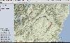
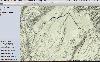
 A program for cropping GPX track files. The GUI plots the GPX track (latitude vs longitude) and lets the user remove GPS points from the beginning and end of the track respectively. There is also a built-in Command Line Interface.
Platforms: Windows, Mac, Linux
| License: Freeware | Size: 72.29 KB | Download (45): GPXTrackCropper Download |
Released: August 05, 2012
|
Added: August 05, 2012 | Visits: 156
 A library written in Java to manipulate GPX files. Also contained is a GUI program to visualize GPX files and the effects of manipulating them.
Platforms: Windows, Mac, Linux
| License: Freeware | Size: 87.7 KB | Download (44): JGPXtool Download |
Released: September 16, 2012
|
Added: September 16, 2012 | Visits: 352
The suite of Python-based shell tools for geocoding images from GPS logs (GPX)
Platforms: Windows, Mac, Linux
| License: Freeware | Size: 31.02 KB | Download (44): pygeotag Download |
Released: June 15, 2012
|
Added: June 15, 2012 | Visits: 390
 Application for geocaching or waymarking that allows you to import GPX or LOC files for editing. You can print out cheat sheets to take on the trail, export to KML or HTML, and send the data to your handheld GPS unit.
Platforms: Windows, Mac, Linux
| License: Freeware | Size: 19.78 MB | Download (52): TinyGPX Download |
Released: December 19, 2012
|
Added: December 19, 2012 | Visits: 640
PolarView is an efficient cross platform ENC chart planner. It supports ENC charts in S57 format (available from NOAA), raster charts in BSB format, as well as world wide standard S63 vector charts. PolarView includes Tides and Currents display, using the industry-standard TCD tide database...
Platforms: Mac
| License: Freeware | Size: 6.2 MB | Download (64): PolarView Download |
Released: October 10, 2012
|
Added: October 10, 2012 | Visits: 291
Manager for gpx-files containing geocaches
Manage your downloaded pocket-files from geocaching.com.
Import multiple GPX-files at the same time. Each GPX-file will be imported it's own folder.
You can easily add folders and organise your geocaches with drag and drop. Each cache has only one...
Platforms: Mac
| License: Commercial | Cost: $14.99 USD | Size: 2.1 MB | Download (56): iCaching Download |
Released: July 22, 2012
|
Added: July 22, 2012 | Visits: 236
 Adze makes it easy to edit GPX files on your Mac. With intelligent editing tools, statistics calculation and integration with popular mapping tools, editing GPS data has never been more straight forward.
FEATURES
• Split, merge and d
Adze makes it easy to edit GPX files on your Mac. With intelligent editing tools, statistics calculation and integration with popular mapping tools, editing GPS data has never been more straight forward.
FEATURES
• Split, merge and d
Platforms: Mac
| License: Shareware | Cost: $19.99 USD | Size: 2.6 MB | Download (49): Adze Download |
Released: October 23, 2012
|
Added: October 23, 2012 | Visits: 356
 Adze makes it easy to edit GPX files on your Mac. With intelligent editing tools, statistics calculation and integration with popular mapping tools, editing GPS data has never been more straight forward.
FEATURES
• Split, merge and d
Adze makes it easy to edit GPX files on your Mac. With intelligent editing tools, statistics calculation and integration with popular mapping tools, editing GPS data has never been more straight forward.
FEATURES
• Split, merge and d
Platforms: Mac
| License: Freeware | Size: 1.2 MB | Download (48): Adze Lite Download |
Added: June 03, 2013 | Visits: 322
The WordPress plugin extends the WordPress XML-RPC protocol to enable the belonging Android application to create posts and to attach and update GPX files.The Android application will periodically turn on the GPS of your device and acquire and record your position. You can make waypoints on...
Platforms: PHP
| License: Shareware | Cost: $0.00 USD | Size: 20.48 KB | Download (45): BackPackTrack for Android Download |
Added: October 01, 2013 | Visits: 303
gpxflash is a GPX-File Parser that parses GPX-Files, shows the contained GPS-Tracks on a Google Map using the Google Maps Flash-API and draws Height-Profiles of the Tracks. (See Features page in the wiki).
Platforms: Mac
| License: Shareware | Cost: $0.00 USD | Size: 471.04 KB | Download (42): GPXFlash Download |
Added: August 27, 2013 | Visits: 474
GeoCosm is an Open Street Map map Viewer that allows the generation of GPX files containing waypoints. Helpfull when planning Caching tours for Geocaching. It allows the conversion of GeoCoordinates in different popular formats
Platforms: Mac
| License: Freeware | Size: 286.72 KB | Download (36): GeoCosm Download |
Added: December 02, 2013 | Visits: 260
HikeGen*takes a GPX file as input, and generates an HTML page with a Google Map and a profile chart.
Platforms: Mac
| License: Shareware | Cost: $0.00 USD | Size: 2.23 MB | Download (38): HikeGen Download |
Added: October 08, 2013 | Visits: 461
NPGPX is a Qt-based Netscape plugin that displays GPX files (GPS eXchange) with waypoints, routes, and tracks embedded in a webpage, with optional background maps.
Platforms: *nix
| License: Freeware | Size: 81.92 KB | Download (37): NPGPX Download |
Released: November 07, 2014
|
Added: November 19, 2014 | Visits: 813
 Importation/Exportation: Import/export trails to gpx file. Unlimited number of trails, and TrackPoints. Export to gpx, Excel, PDF, XPS and KML/KMZ.
Data table: Very flexible data table that allows sorting by columns, with inheritance of data, attributes, etc.
Presentation on map: View...
Importation/Exportation: Import/export trails to gpx file. Unlimited number of trails, and TrackPoints. Export to gpx, Excel, PDF, XPS and KML/KMZ.
Data table: Very flexible data table that allows sorting by columns, with inheritance of data, attributes, etc.
Presentation on map: View...
Platforms: Windows, Windows 8, Windows 7, Windows Server
| License: Freeware | Size: 27.05 MB | Download (611): ediTrail Download |
Released: March 14, 2018
|
Added: June 20, 2018 | Visits: 796
 With Final Selection you can make the selection of your photos as you have always wanted!
- Create your selection of photos using the colors, give them a score using the stars and order them by dragging them to the position you want
- Save your projects for future revisions
- Add custom...
With Final Selection you can make the selection of your photos as you have always wanted!
- Create your selection of photos using the colors, give them a score using the stars and order them by dragging them to the position you want
- Save your projects for future revisions
- Add custom...
Platforms: Windows 8, Windows 7, Windows
| License: Freeware | Size: 11.67 MB | Download (155): Final Selection Download |
Released: March 29, 2020
|
Added: April 06, 2020 | Visits: 1.129
TRANSDATpro can prove a helpful tool for professionals, providing them with the possibility to perform coordinate transformations fast and easy by use of the coordinate reference systems of their choice.
TRANSDATpro performs Coordinate Transformations fast and with high accuracy. The coordinate...
Platforms: Windows, Windows 8, Windows 7, Windows Server
| License: Shareware | Cost: $270.00 USD | Size: 5.19 MB | Download (131): TRANSDATpro Download |
Released: January 11, 2024
|
Added: February 10, 2024 | Visits: 143
 iWhere iPhone Location Changer is a great location changer for iOS device. 4 modes such one-stop mode, multi-stop mode, and joystick mode help you simulate GPS location routes. You can customize the route and speed, allowing you to play geo-based games such as Pokmon Go, Monster Hunter Now...
Platforms: Windows, Windows 8, Windows 7, Windows Server
| License: Shareware | Cost: $49.99 USD | Size: 1.92 MB | Download (106): iWhere iPhone Location Changer Windows Download |