


Gps Position software
Gps Position
Released: July 09, 2012
|
Added: July 09, 2012 | Visits: 535
 Automatically extract from a geotagged image’s metadata, and then visually imprint (stamp), the GPS position, location description, altitude, date, date and time, or any combination of these or any other file metadata, onto a photo with no loss in image quality. It is a lossless JPEG process...
Platforms: Windows
| License: Freeware | Size: 11.9 MB | Download (406): GPStamper Download |
Added: January 25, 2010 | Visits: 659
 GPSPhotoLinker can be used to save GPS position data to a photo. The latitude and longitude recorded by your GPS unit while you were taking photos can be linked, and saved, to the photos.
Platforms: Mac
| License: Freeware | Download (126): GPSPhotoLinker Download |
Added: January 25, 2010 | Visits: 649
GPS-to-Google Earth, or gps2ge, is a utility to monitor your GPS position and track in Google Earth.Features:Tilts, tracks and zooms to follow your position in real timeYour choice of fix icon (aeroplane, car, or generic position marker)Icon changes to warn of loss of GPS fixFollow your track...
Platforms: Mac
| License: Freeware | Download (120): gps2geX Download |
Released: June 09, 2012
|
Added: June 09, 2012 | Visits: 338
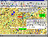 OziExplorer is interactive, it allows you to work, on your computer screen, with digital maps that you have purchased or scanned yourself. By using these maps OziExplorer allows you to plan your trip by creating waypoints, routes and tracks on screen and upload these to your GPS.
With...
OziExplorer is interactive, it allows you to work, on your computer screen, with digital maps that you have purchased or scanned yourself. By using these maps OziExplorer allows you to plan your trip by creating waypoints, routes and tracks on screen and upload these to your GPS.
With...
Platforms: Windows
| License: Shareware | Cost: $95.00 USD | Size: 7 MB | Download (431): OziExplorer Download |
Released: November 07, 2012
|
Added: November 07, 2012 | Visits: 616
 With this tool you can add GPS coordinates to vCards - electronic business cards - that you have previously exported from e. g. Microsoft Outlook. Therefore the tool uses the address data contained within the vCards and adds the exact GPS position on that basis to the vCard. This way you can use...
Platforms: Windows
| License: Freeware | Size: 1.47 MB | Download (503): GPS to vCard Download |
Released: July 21, 2010
|
Added: September 25, 2010 | Visits: 1.349
 Toolkit to add GPS and coordinate conversion functionality to your software and scripts (GPS API). All NMEA0183 protocol versions are supported and can be filtered by NMEA sentence type and talker ID. Garmin USB PVT support. Information on GPS status can also be retrieved: GPS fix quality,...
Platforms: Windows
| License: Shareware | Cost: $99.00 USD | Size: 2.2 MB | Download (121): Eye4Software GPS API Download |
Released: September 18, 2012
|
Added: September 18, 2012 | Visits: 463
 DRAGSENS Geo Software is used for the exact position estimation of a towed body, sensor, camera, array or net, dragged behind a ship, aircraft or vehicle. The software allows a real-time estimation of the position of a dragged sensor based on the location of a GPS-receiver. The sensor thereby can...
Platforms: Windows
| License: Shareware | Cost: $825.00 USD | Size: 1.7 MB | Download (405): DRAGSENS Download |
Released: July 04, 2012
|
Added: July 04, 2012 | Visits: 539
 Viking is a free/open source program to manage GPS data. You can import, plot and create tracks and waypoints, show OSM, Terraserver, Bing Aerial and other maps, geotag images, see real-time GPS position, get geocaches, control items, etc. It is written in C & the GTK+2 toolkit.
Platforms: Windows, Mac, BSD, Linux
| License: Freeware | Size: 1.01 MB | Download (46): Viking GPS data editor and analyzer Download |
Released: January 08, 2014
|
Added: September 09, 2014 | Visits: 1.767
 HsGpsDll is a Windows Dynamic Link Library which provides access to any NMEA-183 compliant GPS receiver via a serial communications port. HsGpsDll is designed for use from Visual C, C Sharp .NET, Visual Basic or other programming languages. HsGpsDll allows a user application to easily read from a...
Platforms: Windows, Windows 8, Windows 7
| License: Shareware | Cost: $160.00 USD | Size: 1.41 MB | Download (155): HS GPSDLL Library Download |
Released: December 21, 2009
|
Added: January 08, 2010 | Visits: 2.286
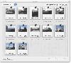
 Resco Photo Manager is a favorite Windows Mobile image viewing program with features far beyond standards of the classic built-in viewer. Users gain functions of complete image management in a modern looking and easy to handle application. Since the last version, the application suffered lots of...
Platforms: Pocket PC, Windows, Other,Handheld/Mobile Other
| License: Shareware | Cost: $24.95 USD | Size: 2.06 MB | Download (134): Resco Photo Manager Download |
Released: April 27, 2010
|
Added: May 15, 2010 | Visits: 1.586
 Resco Photo Manager Professional is a favorite Windows Mobile image management program with enhanced functionality for professional photographers or journalists. The extra tools include Histogram, editing of IPTC tags, possibility to upload images straight to an FTP server, and especially support...
Platforms: Pocket PC, Windows, Handheld/Mobile Other
| License: Shareware | Cost: $69.95 USD | Size: 2.24 MB | Download (105): Resco Photo Manager Professional Download |
Added: November 11, 2013 | Visits: 481
Viking is a free/open source program to manage GPS data. You can import and plot tracks and waypoints, show OpenStreetMap and/or Terraserver maps under it, download geocaches for an area on the map, make new tracks and waypoints, see real-time GPS position, etc.
Platforms: Mac
| License: Freeware | Size: 993.28 KB | Download (39): Viking Download |
Released: September 23, 2012
|
Added: September 23, 2012 | Visits: 345
 If you're already using the Google Latitude service on your mobile phone or you want to start using it, Latipics will allow you to geotag your pictures based on where you were at the time the picture was taken!
With its very simple, clean interface you will be able to log into your Google...
If you're already using the Google Latitude service on your mobile phone or you want to start using it, Latipics will allow you to geotag your pictures based on where you were at the time the picture was taken!
With its very simple, clean interface you will be able to log into your Google...
Platforms: Mac
| License: Shareware | Cost: $3.99 USD | Size: 2.6 MB | Download (454): Latipics for Mac Download |
Released: November 16, 2012
|
Added: November 16, 2012 | Visits: 424
 If you're already using the Google Latitude service on your mobile phone or you want to start using it, Latipics will allow you to geotag your pictures based on where you were at the time the picture was taken!
With its very simple, clean interface you will be able to log into your Google...
If you're already using the Google Latitude service on your mobile phone or you want to start using it, Latipics will allow you to geotag your pictures based on where you were at the time the picture was taken!
With its very simple, clean interface you will be able to log into your Google...
Platforms: Windows
| License: Freeware | Size: 3 MB | Download (479): Latipics Download |
Added: October 28, 2013 | Visits: 383
The following is a short description of RoadMap. More information is available in the documentation distributed with RoadMap. RoadMap is an open source (GPL) program that provides a car navigation for Linux, UNIX and now Windows CE (a.k.a. PocketPC) and the iPhone/iPod. RoadMap displays a map...
Platforms: *nix
| License: Freeware | Size: 225.28 KB | Download (41): RoadMap Download |
Added: March 24, 2010 | Visits: 1.183
GPS::SpaceTrack is a package for calculating the position of GPS satellites. SYNOPSIS use GPS::SpaceTrack; my $obj=GPS::SpaceTrack->new(filename=>"gps.tle"); print join("t", qw{Count PRN ELEV Azim SNR USED}), "n"; foreach ($obj->getsatellitelist({lat=>38.870997, lon=>-77.05596})) { print...
Platforms: *nix
| License: Freeware | Size: 52.22 KB | Download (117): GPS::SpaceTrack Download |
Added: January 05, 2006 | Visits: 3.131
 NavTools GPS is a small and easy to use application to connect your PC or laptop to an existing GPS (NMEA 0183 serial connection) installation. Position cata will automatically be displayed and logged on your screen, and voyage data can be exchanged and shared with the NavTools Route voyage...
Platforms: Windows
| License: Shareware | Cost: $25.00 USD | Size: 1.5 MB | Download (255): NavTools GPS Download |
Added: January 06, 2010 | Visits: 976
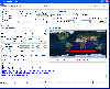
GoooooPS is a Java MIDlet that displays a position obtained from a GPS receiver on a Google Map Tile..
Platforms: *nix
| License: Freeware | Size: 13.31 KB | Download (110): GoooooPS Download |
Released: April 09, 2010
|
Added: July 05, 2010 | Visits: 3.476
 The Tro GPS Simulator provides a complete suite for all your GPS simulating needs and more. The Tro GPS Simulator uses the international standardized protocol NMEA-0183 for GPS data exchange. It can simulataneously send and recieve data.Furthermore it provides several input methods for GPS...
Platforms: Windows
| License: Demo | Cost: $99.00 USD | Size: 5.73 MB | Download (884): Tro GPS Simulator Download |
Released: October 23, 2012
|
Added: October 23, 2012 | Visits: 651
GPS Utility is an easy-to-use application that provides management and manipulation of GPS information. You can use it to transfer data to/from a GPS receiver and store the data in PC files in one of several text formats.
The program converts between different map datums and many coordinate...
Platforms: Windows
| License: Freeware | Size: 1.87 MB | Download (469): GPS Utility Download |