


Gps Navigation Software
Gps Navigation Software
Released: March 15, 2008
|
Added: April 30, 2008 | Visits: 4.644
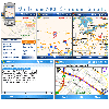 With MobiumGPS , your Windows Mobile device is turned into an advanced Mobile Navigation System with turn-by-turn voice announcements and detailed driving directions. You can search over 15 million point of interests (POIs) - places like hotels, restaurants, shopping malls and other tourist...
Platforms: Windows
| License: Demo | Cost: $9.95 USD | Size: 806.13 KB | Download (1554): Mobium GPS Navigation System Download |
Added: April 11, 2013 | Visits: 743
 In the past several years compact radio navigation receivers have proliferated in the civilian market place, generally under the name of GPS or Global Positioning System. Appearing as handheld units or built into cars, mobile phones, and airplanes, these commercial applications originated from a...
Platforms: Matlab
| License: Freeware | Size: 1.04 MB | Download (45): GPS Navigation Toolbox GNT Download |
Released: August 25, 2012
|
Added: August 25, 2012 | Visits: 631
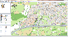 GPS Mapping Software for Windows, Loading topographic maps, realtime navigation, track recording, manage GPS devices and more. The software can be used with various map formats including: GeoTiff, BSB Nautical Charts, AutoCad DXF files, ESRI Shapefiles. Using calibration you can also use scanned...
Platforms: Windows
| License: Shareware | Cost: $149.00 USD | Size: 11.13 MB | Download (48): Eye4Software GPS Mapping Studio Download |
Released: October 08, 2012
|
Added: October 08, 2012 | Visits: 580
 Virtual GPS is a GPS simulator software. You can use it to simulate a GPS receiver unit connected to your system. It's ideal when you need GPS input, but you have no signal or for development purposes. It supports various NMEA sentences, so it can be used with any GPS mapping software. You can...
Platforms: Windows, Other
| License: Shareware | Cost: $39.99 USD | Size: 946 KB | Download (74): Virtual GPS Download |
Released: July 11, 2012
|
Added: July 11, 2012 | Visits: 822
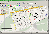
![]() Wialon GPS Tracking is an application characterized by its ease of use, reliability, usability, and high operational speed. The general features of the system include fuel consumption monitoring, editable template-base reports, SMS or e-mail alerts and notifications and controllable routes with...
Wialon GPS Tracking is an application characterized by its ease of use, reliability, usability, and high operational speed. The general features of the system include fuel consumption monitoring, editable template-base reports, SMS or e-mail alerts and notifications and controllable routes with...
Platforms: Windows
| License: Demo | Cost: $0.00 USD | Size: 6.45 MB | Download (505): Wialon GPS Tracking Download |
Added: September 05, 2013 | Visits: 432
CapCode is a navigation software for sailors for cruising or regatta. - Reads NMEA 183 data (instruments, GPS, AIS). Implements computation of the VMG , tracing on RNC charts (ENC ongoing). Display the polar on the chart, future position of the ship. Features . Acquire NMEA messages from...
Platforms: *nix
| License: Freeware | Size: 32.29 MB | Download (33): CapCode-software suite for sailors Download |
Added: August 19, 2008 | Visits: 3.673
 Fugawi Global Navigator and Fugawi Marine ENC are the ideal PC software tool for route planning, GPS programming, and real-time GPS navigation on land, sea and in the air. With Fugawi Global Navigator you can navigate in real time using the widest variety of digital maps, such as NOAA RNC,...
Platforms: Windows
| License: Demo | Cost: $119.95 USD | Size: 40.05 MB | Download (1120): Fugawi Global Navigator Download |
Released: August 25, 2012
|
Added: August 25, 2012 | Visits: 594
VirtualGPS - is a free, small utility, which fully emulates GPS receiver and returns your location (by using cellular towers and wifi hotspots). Location accuracy is about 50-500m. TUTORIAL 1. Run VirtualGPS, wait less than 1 minute until GPS: ON (or OFF in bad case) will be shown. 2. Run...
Platforms: Windows, Mac, Palm OS 1.0, Palm OS 2.0, Palm OS 2.1, Palm OS 3.0, Palm OS 3.1, Palm OS 3.2
| License: Freeware | Size: 195 KB | Download (529): VirtualGPS Download |
Released: November 22, 2012
|
Added: November 22, 2012 | Visits: 538
 mdNavMobile is a waypoint-based GPS navigation solution for the Windows Mobile platform. It can guide you from waypoint to waypoint while keeping you informed of all relevant navigation data. All NMEA-data from a GPS is automatically logged to file so you can 'replay' a trip with variable speed....
Platforms: Windows, Pocket PC, Handheld/Mobile Other
| License: Freeware | Size: 30 KB | Download (48): mdNavMobile Download |
Released: July 10, 2012
|
Added: July 10, 2012 | Visits: 693
PolarCOM is an integrated NMEA 0183 marine navigation instrument data bridge and multipurpose data display. Available for Apple Mac OS X and Windows systems, it combines background server operation with high quality easy to read and fully customizable digital instrument views. PolarCOM is a...
Platforms: Mac
| License: Freeware | Size: 4.4 MB | Download (52): PolarCOM Download |
Released: November 20, 2008
|
Added: April 27, 2010 | Visits: 6.055
 This is the only application on the market for playback of video, audio and photo content that supports all TomTom integrated portable GPS navigation devices: GO, GO 300, GO 500, GO 700, ONE, ONE New Edition, One XL, G0 520, G0 720, G0 520T, G0 720T, GO 920, GO 530/730/930, Rider, Rider New...
Platforms: Windows
| License: Demo | Cost: $0.00 USD | Size: 28.63 MB | Download (974): Media Center for TomTom Download |
Added: June 19, 2013 | Visits: 352
OpenSource GPS is software for x86 PCs that allows you to acquire, track and demodulate signals from GPS satellites. OSGPS requires a Zarlink GP2021 12 channel GPS correlator chip or software receiver hardware such as the GPS1A, see www.gpscreations.
Platforms: *nix
| License: Freeware | Size: 30.57 MB | Download (38): OpenSourceGPS Download |
Released: August 13, 2012
|
Added: August 13, 2012 | Visits: 690
Anquet Maps for Mac is mapping, route-planning navigation software used by professional mountain guides, top mountain athletes, outdoor training centres and thousands of everyday walkers, climbers and cyclists.
With Anquet Maps for Mac you can create routes on real OS maps to print or transfer...
Platforms: Mac
| License: Freeware | Size: 4.8 MB | Download (54): Anquet Maps Download |
Released: April 09, 2010
|
Added: July 05, 2010 | Visits: 3.481
 The Tro GPS Simulator provides a complete suite for all your GPS simulating needs and more. The Tro GPS Simulator uses the international standardized protocol NMEA-0183 for GPS data exchange. It can simulataneously send and recieve data.Furthermore it provides several input methods for GPS...
Platforms: Windows
| License: Demo | Cost: $99.00 USD | Size: 5.73 MB | Download (884): Tro GPS Simulator Download |
Released: July 21, 2010
|
Added: September 25, 2010 | Visits: 1.353
 Toolkit to add GPS and coordinate conversion functionality to your software and scripts (GPS API). All NMEA0183 protocol versions are supported and can be filtered by NMEA sentence type and talker ID. Garmin USB PVT support. Information on GPS status can also be retrieved: GPS fix quality,...
Platforms: Windows
| License: Shareware | Cost: $99.00 USD | Size: 2.2 MB | Download (125): Eye4Software GPS API Download |
Added: January 25, 2010 | Visits: 1.655
Software for their all-in-one car navigation system with software, maps, GPS and car mount.
Platforms: Mac
| License: Shareware | Cost: $0.00 USD | Download (399): TomTom GO Download |
Added: January 05, 2006 | Visits: 3.134
 NavTools GPS is a small and easy to use application to connect your PC or laptop to an existing GPS (NMEA 0183 serial connection) installation. Position cata will automatically be displayed and logged on your screen, and voyage data can be exchanged and shared with the NavTools Route voyage...
Platforms: Windows
| License: Shareware | Cost: $25.00 USD | Size: 1.5 MB | Download (255): NavTools GPS Download |
Released: July 17, 2012
|
Added: July 17, 2012 | Visits: 689
 Draft Survey and Lashing calculations Marine Software Bundle is a user-friendly Draught Survey calculation program for Ships' Officers and Marine Surveyors. It is easily operated using either Keyboard or Mouse. Marine Software Bundle complies with the latest UN ECE standards for Draught Surveying...
Platforms: Windows
| License: Shareware | Cost: $199.95 USD | Size: 7.59 MB | Download (57): Marine Software Bundle Download |
Released: August 24, 2012
|
Added: August 24, 2012 | Visits: 555
 The GPSMapEdit software was designed for visual authoring of GPS-maps in various proprietary cartographic formats. GPSMapEdit will help you work with Garmin MapSource, Polish format (input files for cGPSmapper.exe), ALAN Map 500/600, Holux, Navitel Navigator (Pocket PC navigation software).
Platforms: Windows
| License: Demo | Cost: $65.00 USD | Size: 2.4 MB | Download (54): GPSMapEdit Portable Download |
Released: June 20, 2012
|
Added: June 20, 2012 | Visits: 540
 The GPSMapEdit software was designed for visual authoring of GPS-maps in various proprietary cartographic formats. GPSMapEdit will help you work with Garmin MapSource, Polish format (input files for cGPSmapper.exe), ALAN Map 500/600, Holux, Navitel Navigator (Pocket PC navigation software).
Platforms: Windows
| License: Demo | Cost: $65.00 USD | Size: 2.4 MB | Download (51): GPSMapEdit Download |